


Kirchberg - Schaflberg

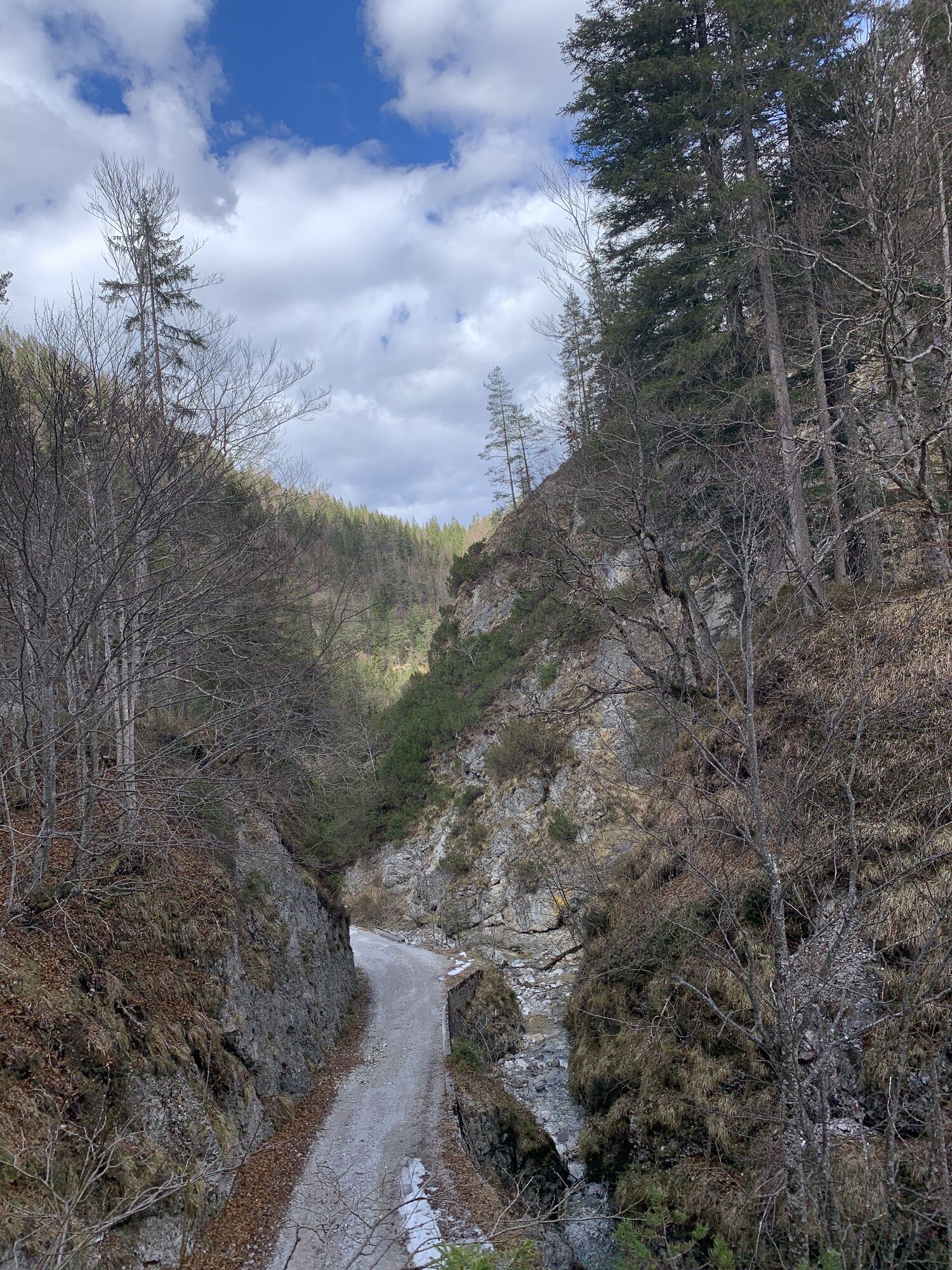
Vom Parkplatz Weißbach geht's rechts hinein in die Weissbachschlucht, dem Forstweg weiter folgen bis Kohlstatt-Leitstallen - weiter geradeaus in Richtung Raineralm und Breitaualmen. Über einen herrlichen...
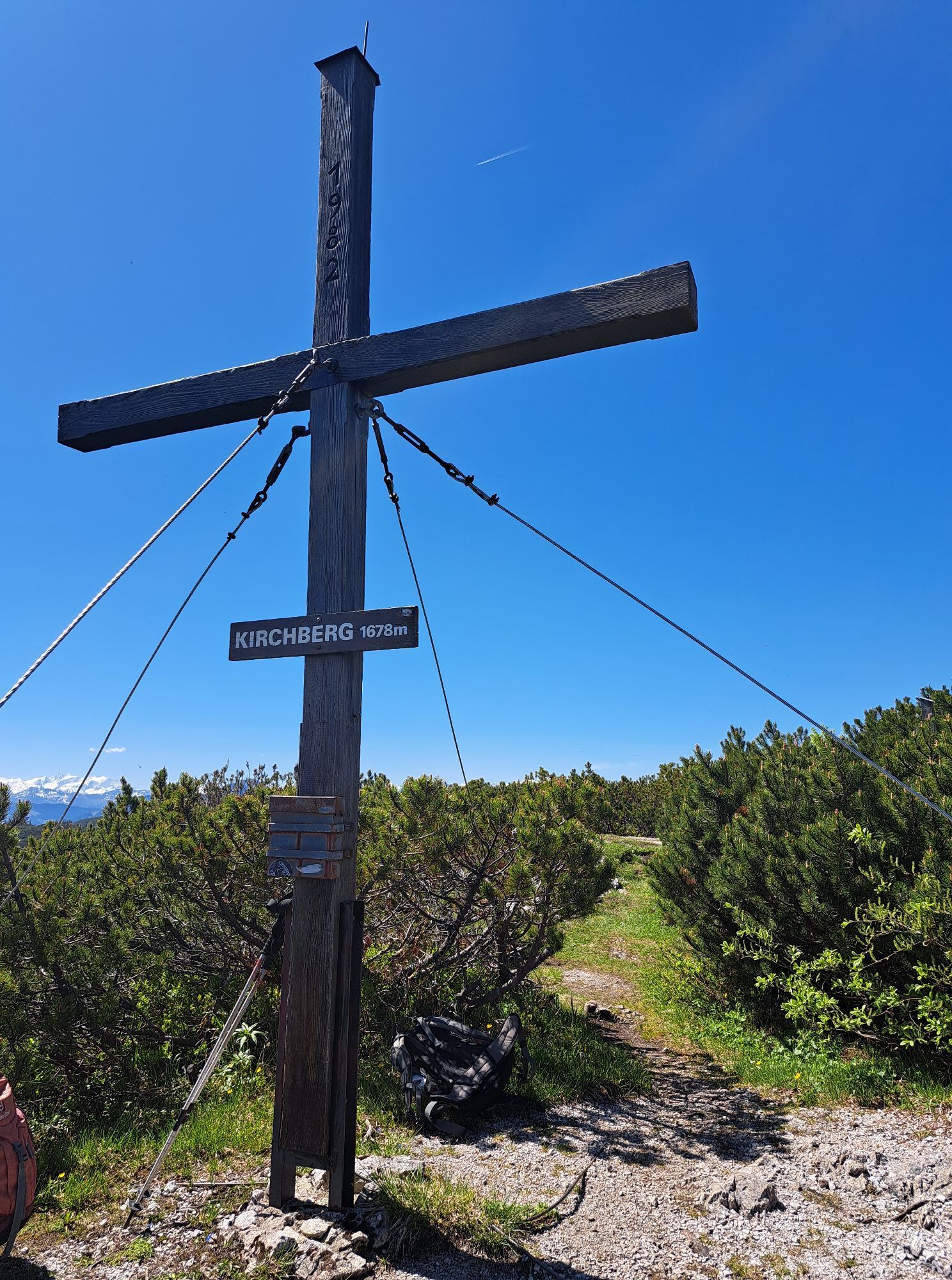
Vom Parkplatz Weißbach geht's rechts hinein in die Weissbachschlucht, dem Forstweg weiter folgen bis Kohlstatt-Leitstallen - weiter geradeaus in Richtung Raineralm und Breitaualmen. Über einen herrlichen Almweg geht's auf den Kirchberg auf 1.678m.
Zum Schaflberg auf 1.597m geht's bergab, hier den Wegweisern zur Rechensau Alm folgen. Bei den *Rechen
sau Höfen* links den Asphaltweg hoch zur Rechensaukapelle.
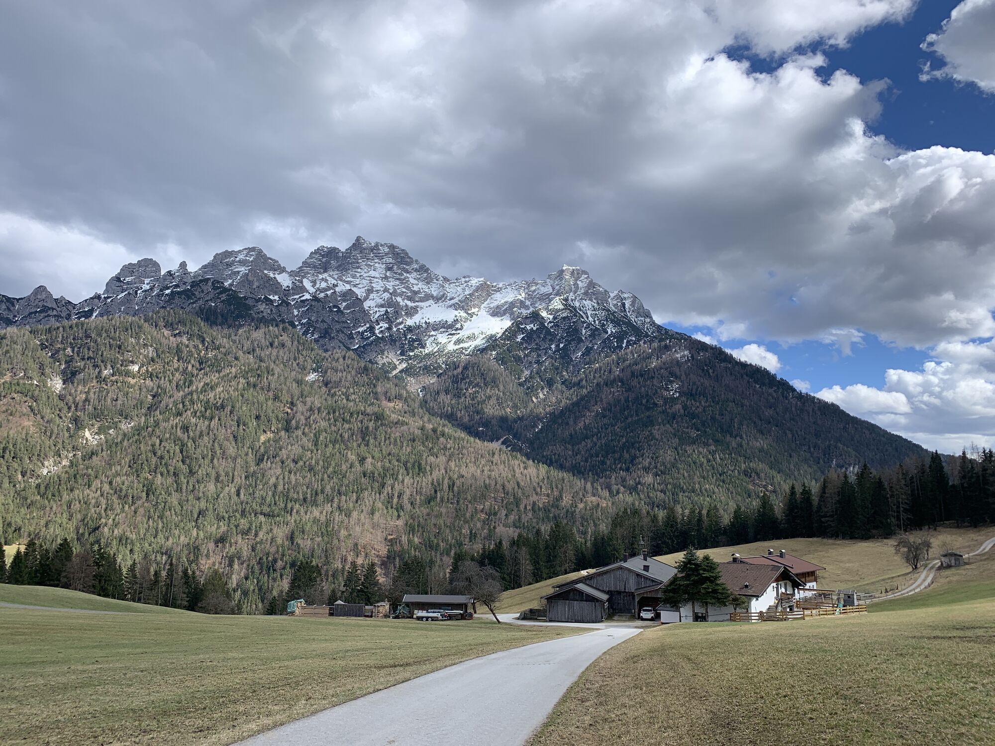
Nicht mehr weit ist es zur Einkehrmöglichkeit beim Alpengasthof Oberweissbach.
Zurück zum Ausgangspunkt entweder über die Rodelbahn (Schotter) oder die Asphaltstraße.
Ausgangspunkt ist der Parkplatz von St. Adolari. Hier beginnt der Weg in Richtung Rechensauhöfe, dann nimmt man den "Pillersee Weiterwanderweg" (Wegmarkierung 4) über Rechensau-Alm zum Schafelberg (1.597m) und weiter über Kirchberg (1.678m), Breitaualmen retour zur verfallenen Leitstallenalm (nur mehr Ruine!), dann rechts zur Rechensaukapelle. Ab hier mündet der Weg nach kurzer Wanderung wieder in den Aufstiegsweg.


Variante 2: An der "Kreuzung Talsenalm" über den Grünsattel zu Kohlstatt-Leitstallen - zusätzliche Gehzeit ca. 10 Minuten.
Variante 3: Rückweg über St. Adolari (Einkehrmöglichkeit), dem Radweg entlang zum Augangspunkt - zusätzliche Zeit ca. 30 Minuten.
Alpengasthof Oberweißbach
Tourismusverband PillerseeTal
Oui
Oui
Von Waidring in Richtung St. Ulrich am Pillersee, kostenlose Parkmöglichkeit beim Parkplatz Weißbach.
Parcours populaires à proximité
-
4,7
Kirchdorf: Zur geheimnisvollen Teufelsgasse
moyenRandonnée 7,90 km -
4,2
Erpfendorf: Griesbachklamm
moyenRandonnée 10 km -
4,8
Atemberaubende Aussicht auf dem Dürrnbachhorn
moyenRandonnée 8,44 km -
4,7
Loferer Steinberge, zum Hinterhorn über die Schmid-Zabierow Hütte, 19.06.22
difficileRandonnée 14,0 km -
5,0
Schleierwasserfall Runde
moyenRandonnée 5,63 km -
4,7
Par le chemin des cascades dans l’Almenwelt Lofer
moyenRandonnée 3,29 km -
4,6
St. Johann in Tirol: Wasserfall & 3 Seen am Kitzbüheler Horn
moyenRandonnée 12,7 km -
4,5
Kitzbüheler Horn über Horn-Gipfel-Höhenweg
moyenChemin thématique 5,30 km -
4,5
Kitz Bhf- Kitzbühler Horn und zurück zum Alpenhaus
moyenRandonnée 11,8 km -
4,3
Vers l'église de pèlerinage Maria Kirchental
facileRandonnée 4,82 km
Randonnée et suivi


Ne manquez pas les offres et l'inspiration pour vos prochaines vacances
Votre adresse électronique a été ajouté à la liste de diffusion.