2TälerTrail - Stage 2: From St. Veit to St. Jakob
moyen
Naviguer
Naviguer
Télécharge cette visite sur ton portable
2TälerTrail - Stage 2: From St. Veit to St. Jakob
moyen
Randonnée
14,34
km
Scanner le code QR et commencer la navigation dans l'application bergfex

Randonnée & tracking


2TälerTrail - Stage 2: From St. Veit to St. Jakob
moyen
Distance
14,34
km
Durée
06:00
h
Ascension
974
m
Altitude
1 389 -
2 503
m
Téléchargement de la piste
2TälerTrail - Stage 2: From St. Veit to St. Jakob
moyen
Randonnée
14,34
km
From the village square in St. Veit you walk along the asphalt road to Oberholz until path no. 316 branches off to the left and leads in serpentines through the forest to the snack station Speikbodenhütte....
Description
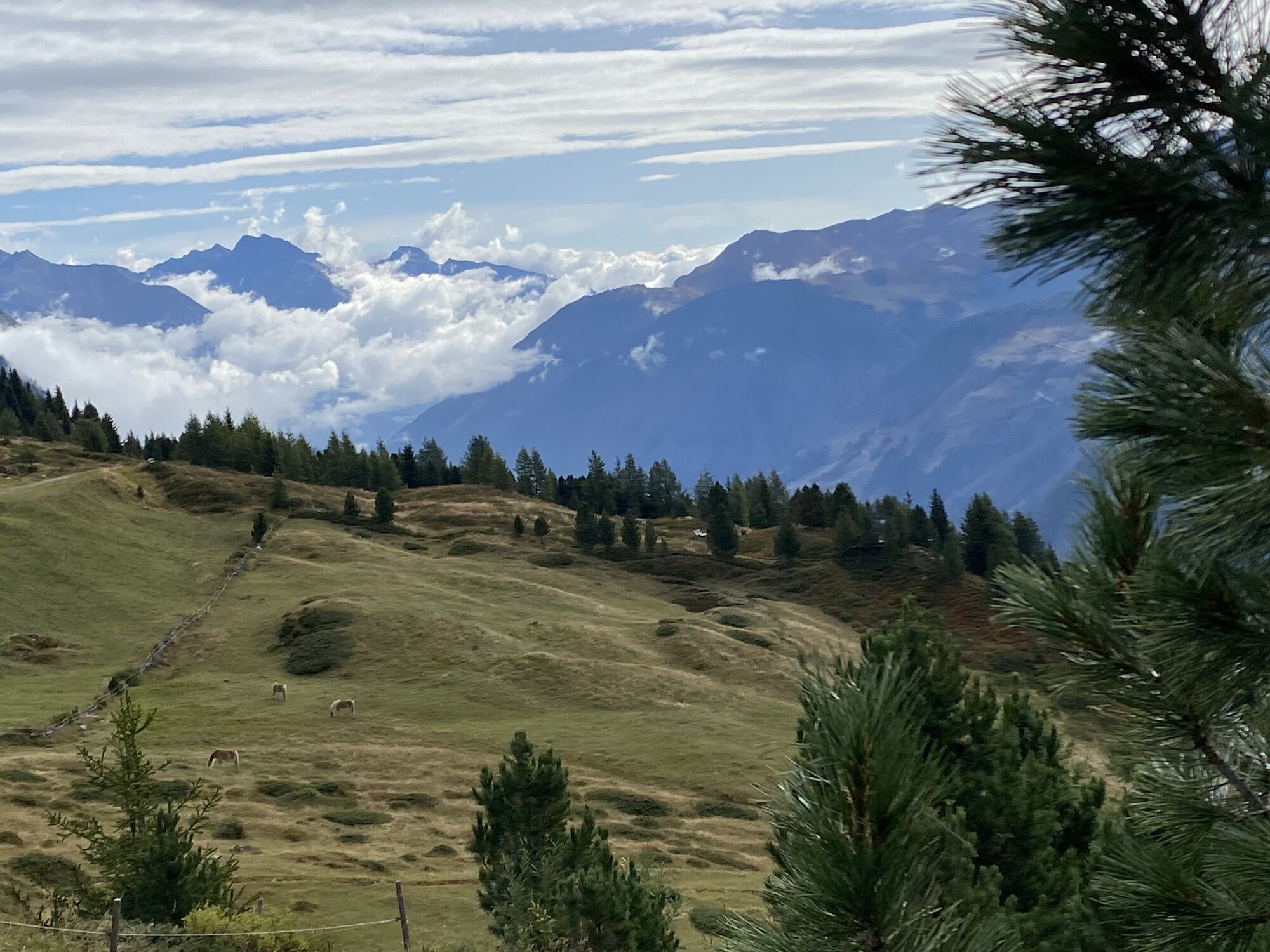
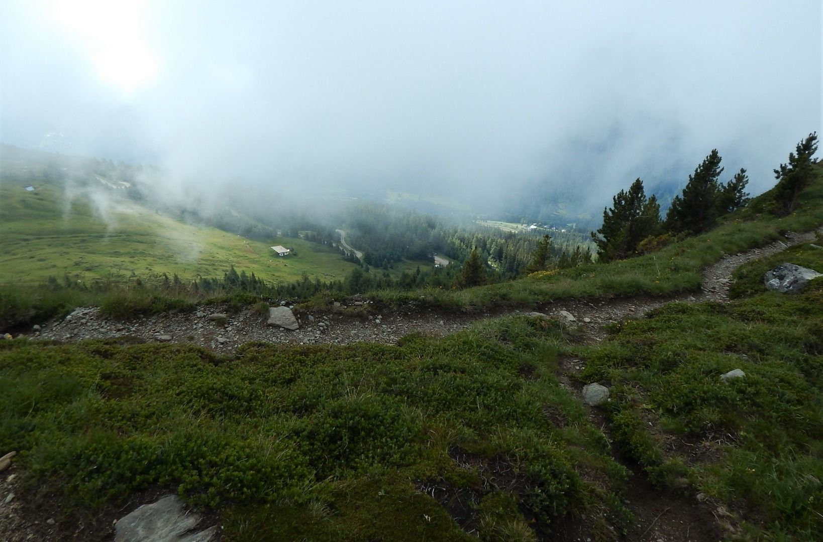
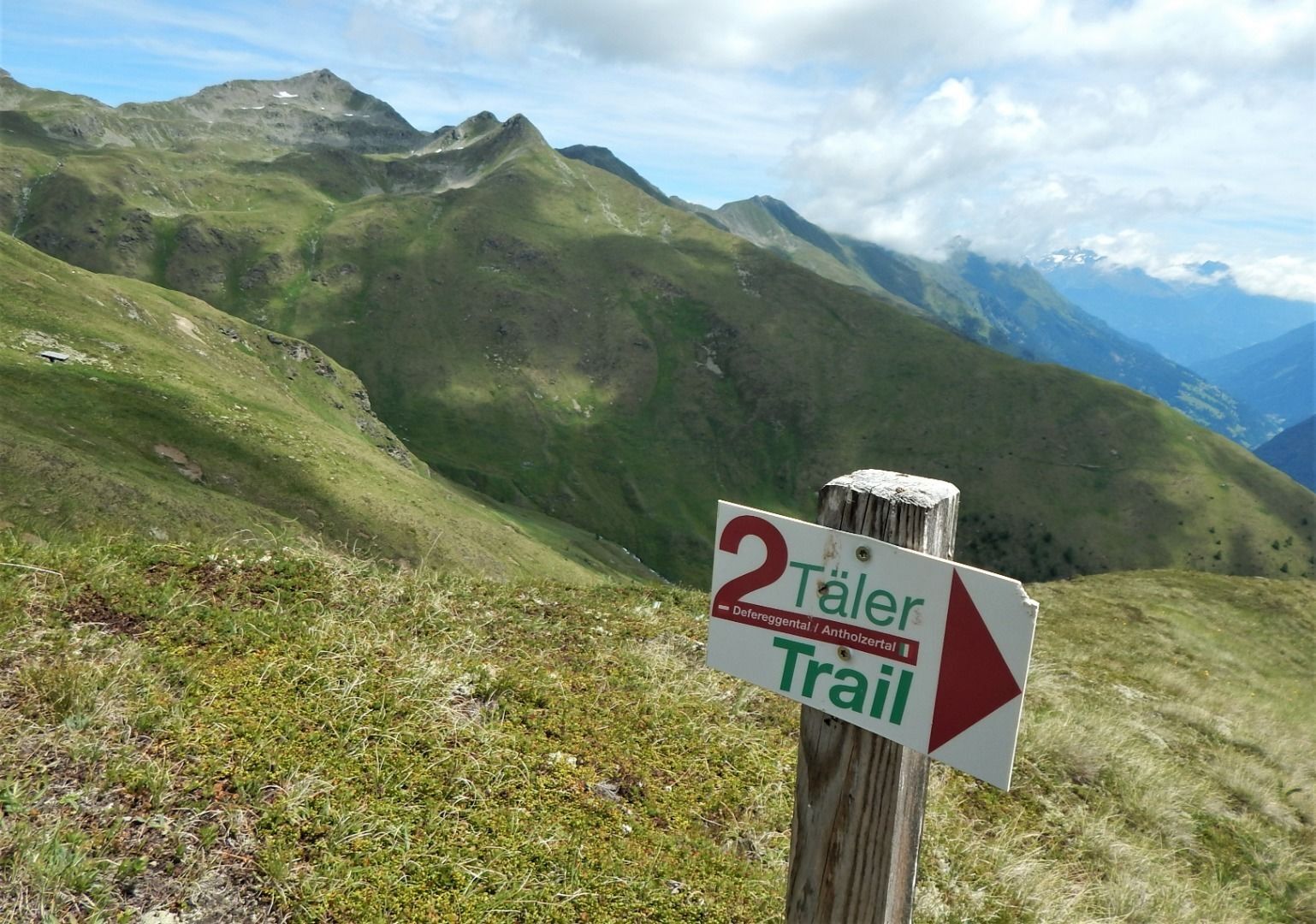
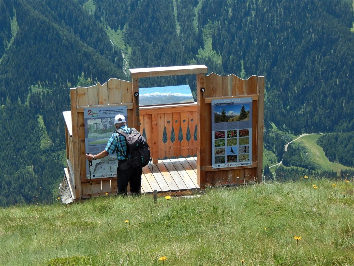
From the village square in St. Veit you walk along the asphalt road to Oberholz until path no. 316 branches off to the left and leads in serpentines through the forest to the snack station Speikbodenhütte. Near the lodge there is also an information platform of the Hohe Tauern National Park. After an extensive rest, take hiking trail 21B to the Gritzer Alm mountain pasture, which invites you to enjoy the magnificent view.
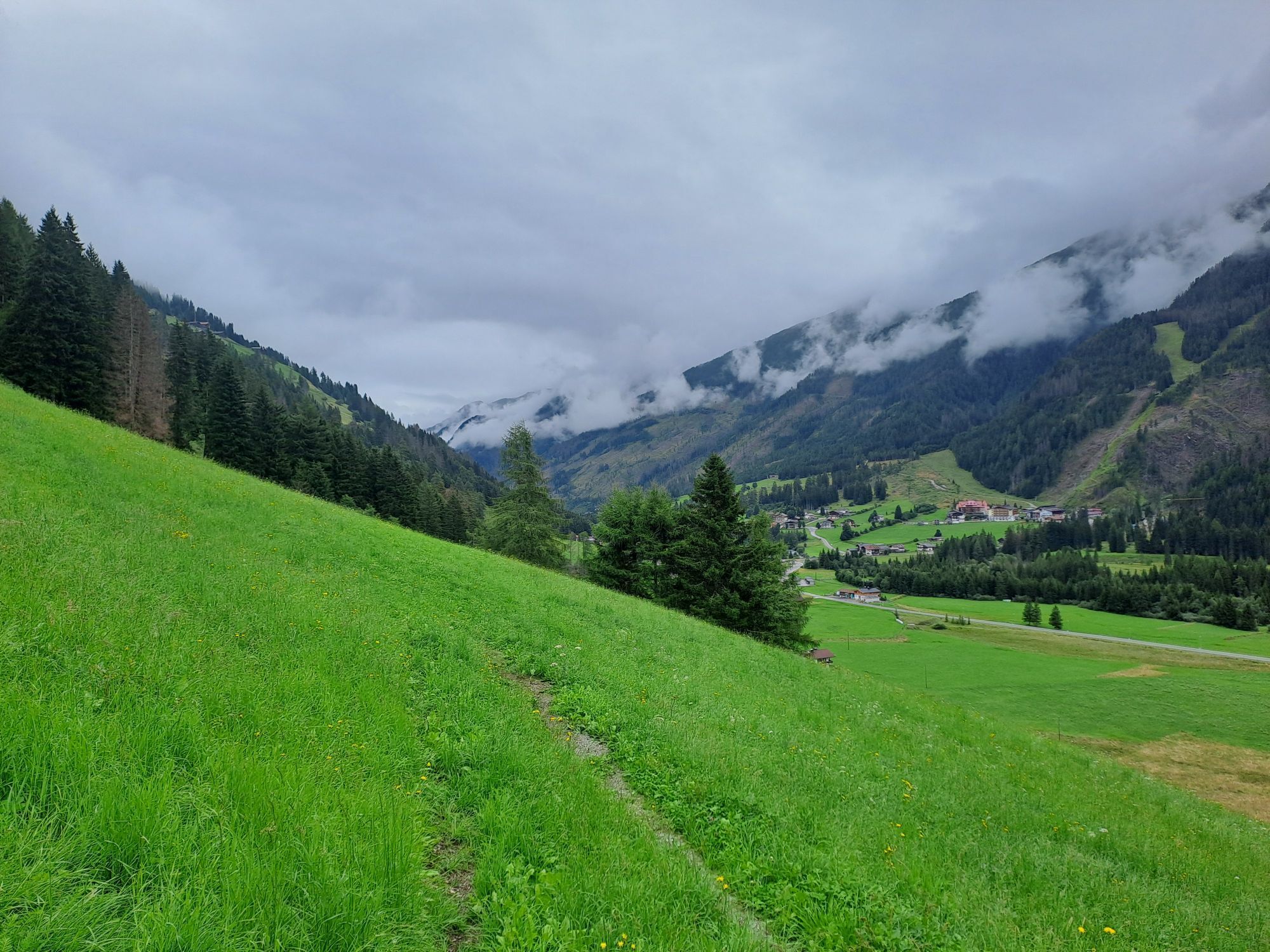
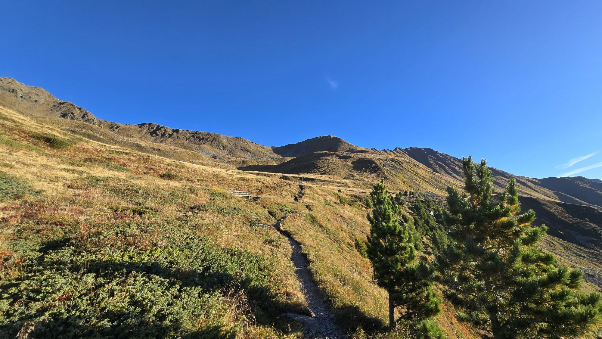
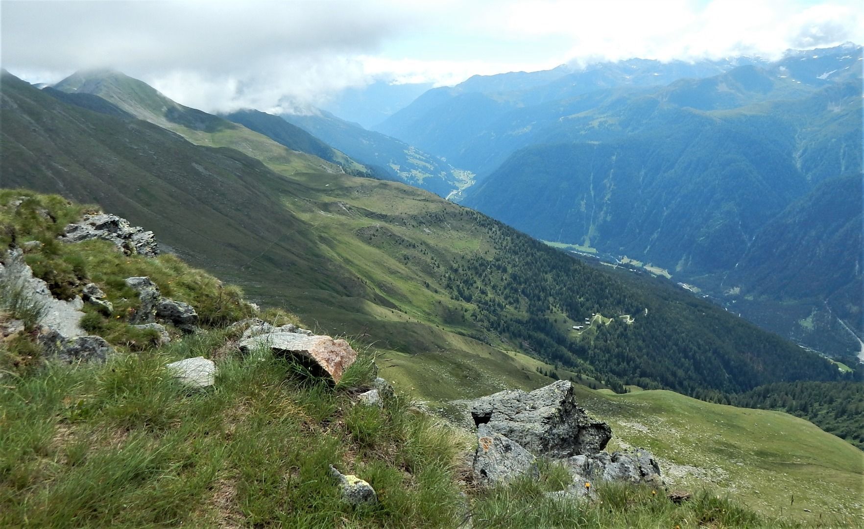
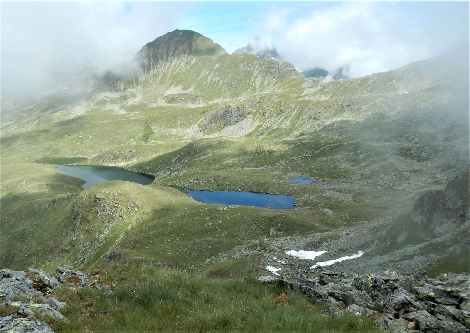
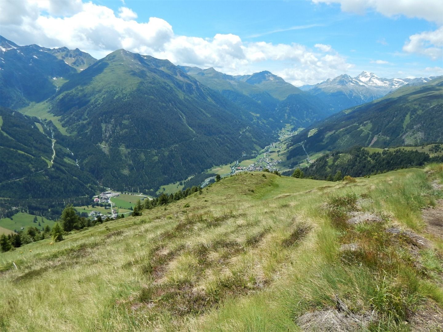
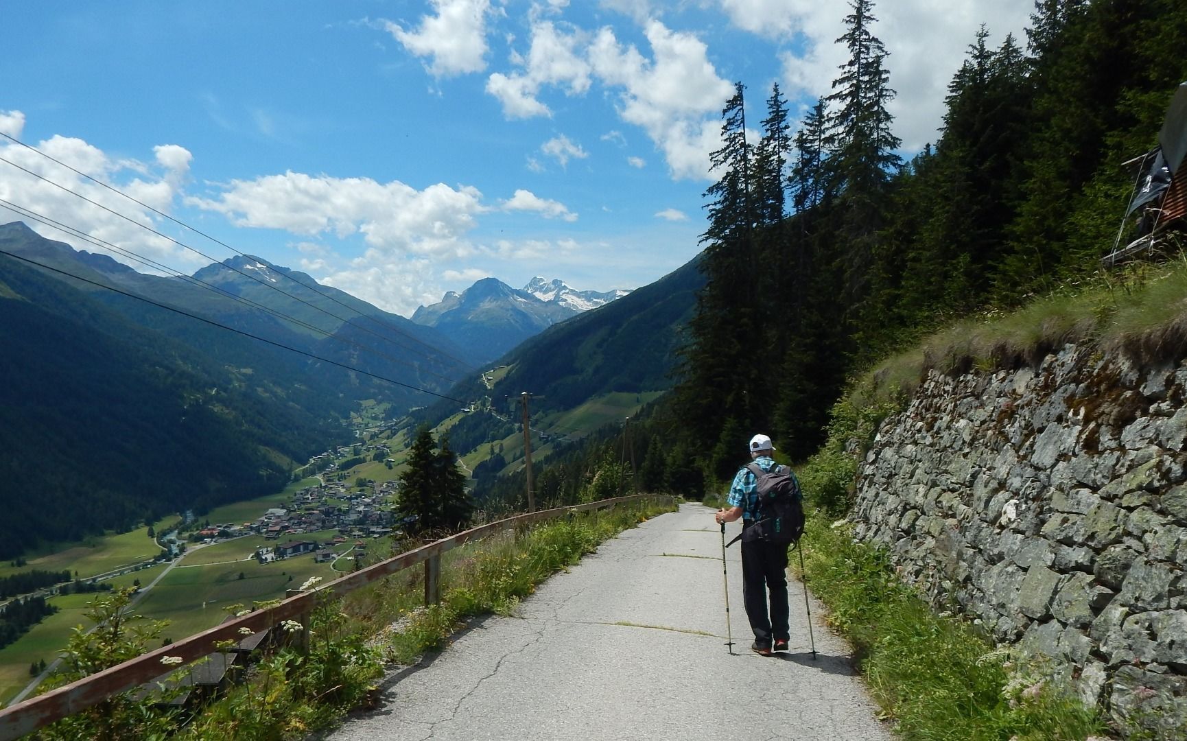
Follow path no. 316 uphill to the tree line and crossroads of paths 316 and 23A and from here take path 23A to the next yellow signpost. From here we continue on the hiking trail 20B with a panoramic crossing of the slope below the Gritzer Hörndl mountain to the lake Gritzer See. The trail then continues westwards, circling the valley on trail no. 315 below the Gasser Hörndl mountain and past the Tögischer Berg, across the Tögischer Berg meadows and the subsequent steep mountain forest down to the hamlet of Tögisch and on towards the valley until you finally reach the stage destination of St. Jakob.
Follow path no. 316 uphill to the tree line and crossroads of paths 316 and 23A and from here take path 23A to the next yellow signpost. From here we continue on the hiking trail 20B with a panoramic crossing of the slope below the Gritzer Hörndl mountain to the lake Gritzer See. The trail then continues westwards, circling the valley on trail no. 315 below the Gasser Hörndl mountain and past the Tögischer Berg, across the Tögischer Berg meadows and the subsequent steep mountain forest down to the hamlet of Tögisch and on towards the valley until you finally reach the stage destination of St. Jakob.
Parcours
Pfarrkirche St. Veit
(1 493 m)
Lieu de culte
0,0 km
St. Veit in Defereggen
(1 495 m)
Village
0,0 km
Alpengasthof Pichler
(1 493 m)
Restaurant
0,0 km
Gsaritzen
(1 611 m)
Quartier de la ville
0,5 km
Speikbodenhütte
(2 030 m)
Restaurant
2,7 km
Erlach
(1 599 m)
Lotissement
13,2 km
St. Jakob
(1 384 m)
Village
14,2 km
Parcours
2TälerTrail - Stage 2: From St. Veit to St. Jakob
moyen
Randonnée
14,34
km
Lourd-Kapelle
(1 493 m)
Lieu de culte
0,0 km
Pfarrkirche St. Veit
(1 493 m)
Lieu de culte
0,0 km
St. Veit in Defereggen
(1 495 m)
Village
0,0 km
Alpengasthof Pichler
(1 493 m)
Restaurant
0,0 km
Gsaritzen
(1 611 m)
Quartier de la ville
0,5 km
Speikbodenhütte
(2 030 m)
Restaurant
2,7 km
Erlach
(1 599 m)
Lotissement
13,2 km
St. Jakob
(1 384 m)
Village
14,2 km
Informations sur l'itinéraire
Itinéraire
Von Huben bis in den Ortskern von St. Veit
Transports en commun
Bushaltestelle St. Veit Dorf
Parking
Direkt im Ortskern von St. Veit in Defereggen
Pas encore d'évaluation
Parcours populaires à proximité
- 4,8
NaturKraftWeg Umbalfälle
facileChemin thématique 5,99 km - 4,5
Circular hike Proßeggklamm
moyenRandonnée 8,41 km - 4,8
Stoden - Clarahütte
moyenRandonnée 7,12 km - 4,7
Wiesbauerspitze 2.767 m
moyenRandonnée 9,66 km - 4,9
Oberhausalm - Jagdhaushütte
facileRandonnée 14,0 km - 4,2
Seespitze
moyenRandonnée 13,7 km - 5,0
Muhs-Panoramaweg
moyenRandonnée 14,0 km - 4,9
Circular hike suspension bridge Isel Canyon via "Hohe Bank"
moyenRandonnée 8,11 km - 5,0
Kleiner Zunig, Matrei in Osttirol, Österreich Matrei in Osttirol, Österreich
moyenRandonnée 12,6 km Kreuzspitze, 2.624 m
moyenRandonnée 5,27 km

Randonnée et suivi

Plus de 550.000 propositions de circuits, des cartes détaillées et un planificateur d'itinéraire intuitif font de cette application un must pour tous les passionnés de nature.

Ne manquez pas les offres et l'inspiration pour vos prochaines vacances
S'inscrire à la newsletter
Erreur
Une erreur s'est produite. Veuillez réessayer.Merci pour votre inscription
Votre adresse électronique a été ajouté à la liste de diffusion.
Parcours en Europe
Autriche Suisse Allemagne Italie Slovénie France Pays-Bas Belgique Pologne Liechtenstein République tchèque Slovaquie Espagne Croatie Bosnie-Herzégovine Luxembourg Andorre Portugal Islande Royaume-Uni Irlande Grèce Albanie Macédoine du Nord Malte Norvège Monténégro Moldavie Kosovo Hongrie Saint-Marin Roumanie Estonie Lettonie Bélarus Chypre Lituanie Serbie Bulgarie Monaco Danemark Suède Finlande