


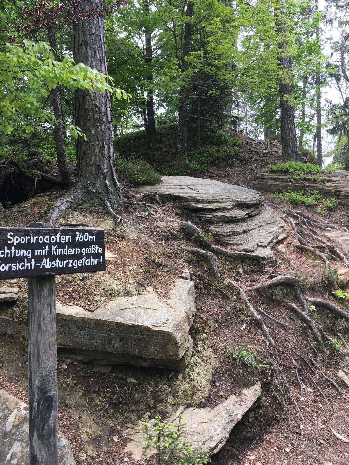
Sporiroaofen circular route
Photos de nos utilisateurs
-
 © NellaCréé le 25.03.2026
 -
 © NellaCréé le 25.03.2026
 -
 © NellaCréé le 25.03.2026
 -
 © NellaCréé le 25.03.2026
 -
 © NellaCréé le 25.03.2026
 -
 © Franz RussCréé le 24.02.2026
 -
 © Franz RussCréé le 18.07.2025
 -

 © Matthias ZachCréé le 03.05.2025
 -
 © Matthias ZachCréé le 03.05.2025
 -
 © Kurt BuchtaCréé le 20.04.2025
 -
 © Manfred KöglerCréé le 04.04.2025
 -
 © Manfred KöglerCréé le 04.04.2025
 -
 © Manfred KöglerCréé le 04.04.2025
 -
 © Manfred KöglerCréé le 04.04.2025
 -
 © Manfred KöglerCréé le 04.04.2025
 -
 © Manfred KöglerCréé le 04.04.2025
 -
 © SondermeierCréé le 21.05.2021
 -
 © SondermeierCréé le 21.05.2021
 -
 © SondermeierCréé le 21.05.2021
 -
 © SondermeierCréé le 21.05.2021
 -
 © SondermeierCréé le 21.05.2021


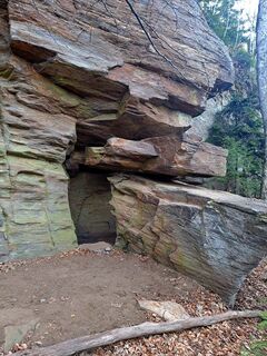
Unique rock formations that you would not expect in this region make this hike a very special one. But also an old mill like from another time or the water turbine of the Klugbauer power plant are a special...
Unique rock formations that you would not expect in this region make this hike a very special one. But also an old mill like from another time or the water turbine of the Klugbauer power plant are a special experience.
Don't forget to pack a snack in your rucksack, because along the wonderful trail there are numerous opportunities for a rest in nature.
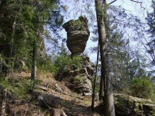
Besides the Sporiroaofen, you should also visit the spectacular natural monument with the imposing name Mannagettaofen. Named after the geologist Peter Beck-Mannagetta, the needle of the Mannagetta Furnace (685 m) is about 10 metres high and consists of horizontally layered slab gneiss. For this you have to leave the path for a short while, but it really pays off!
A detour at the Sauerbrunn healing spring is a must afterwards. Even the ancient Romans knew about the healing effect of the "soda sour" and used it for bathing, drinking cures and as a "cure" against the plague. This hike is not stingy with highlights, look forward to it.
Signposting: 10G and 10
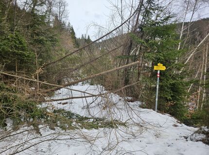
The asphalt road on which you start goes uphill until you turn right into a narrow, quite steep forest path that leads uphill along an old hollow path to the hamlet of Mausegg, where you reach the paved road again. On the left, you will see the stone breaker cross a little way off. What is special about it is the blue-clad Mother of God at the feet of the crucified.
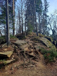
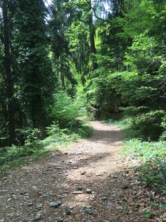
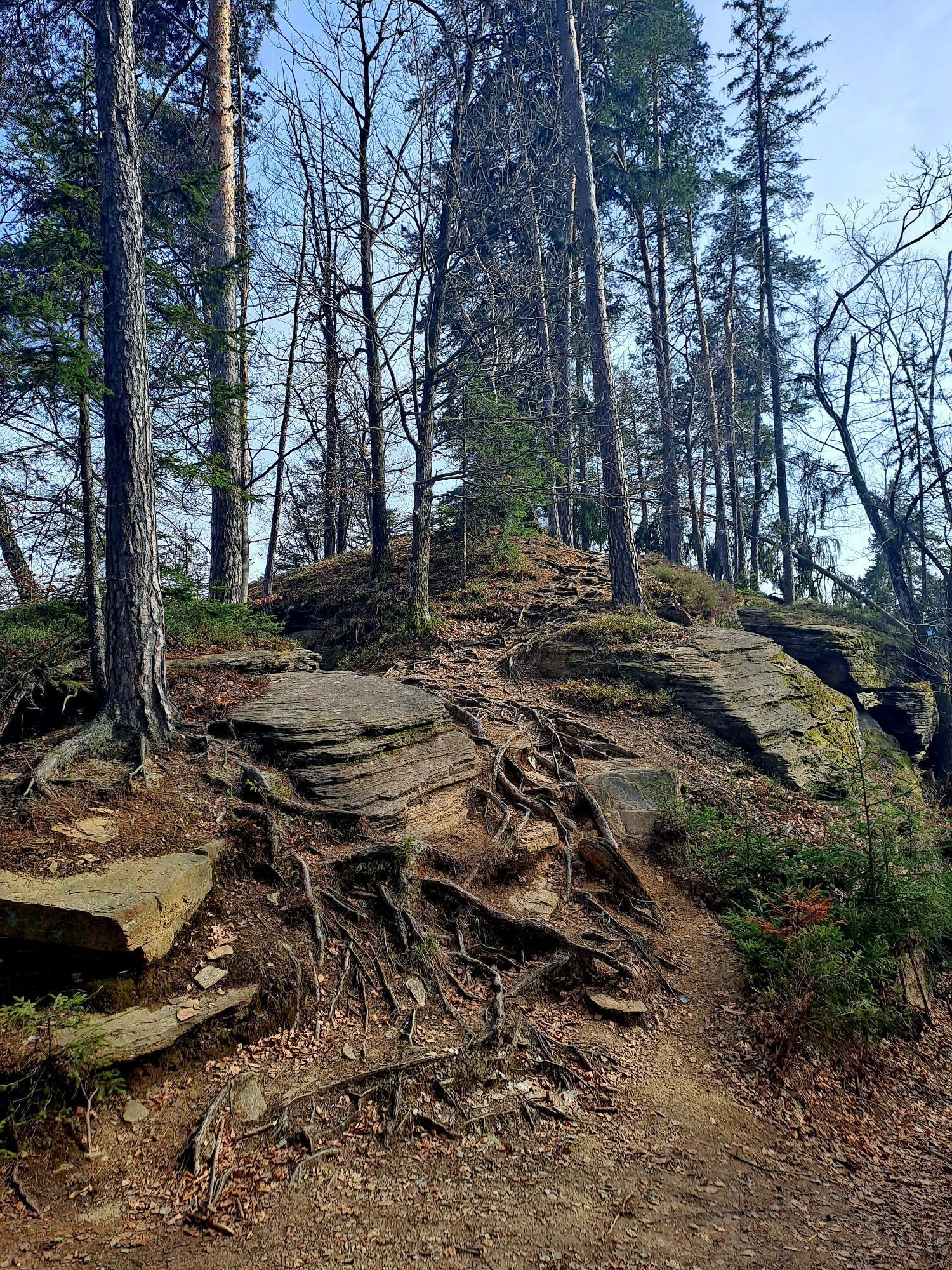
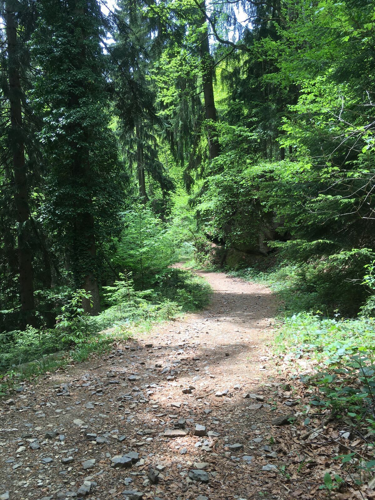
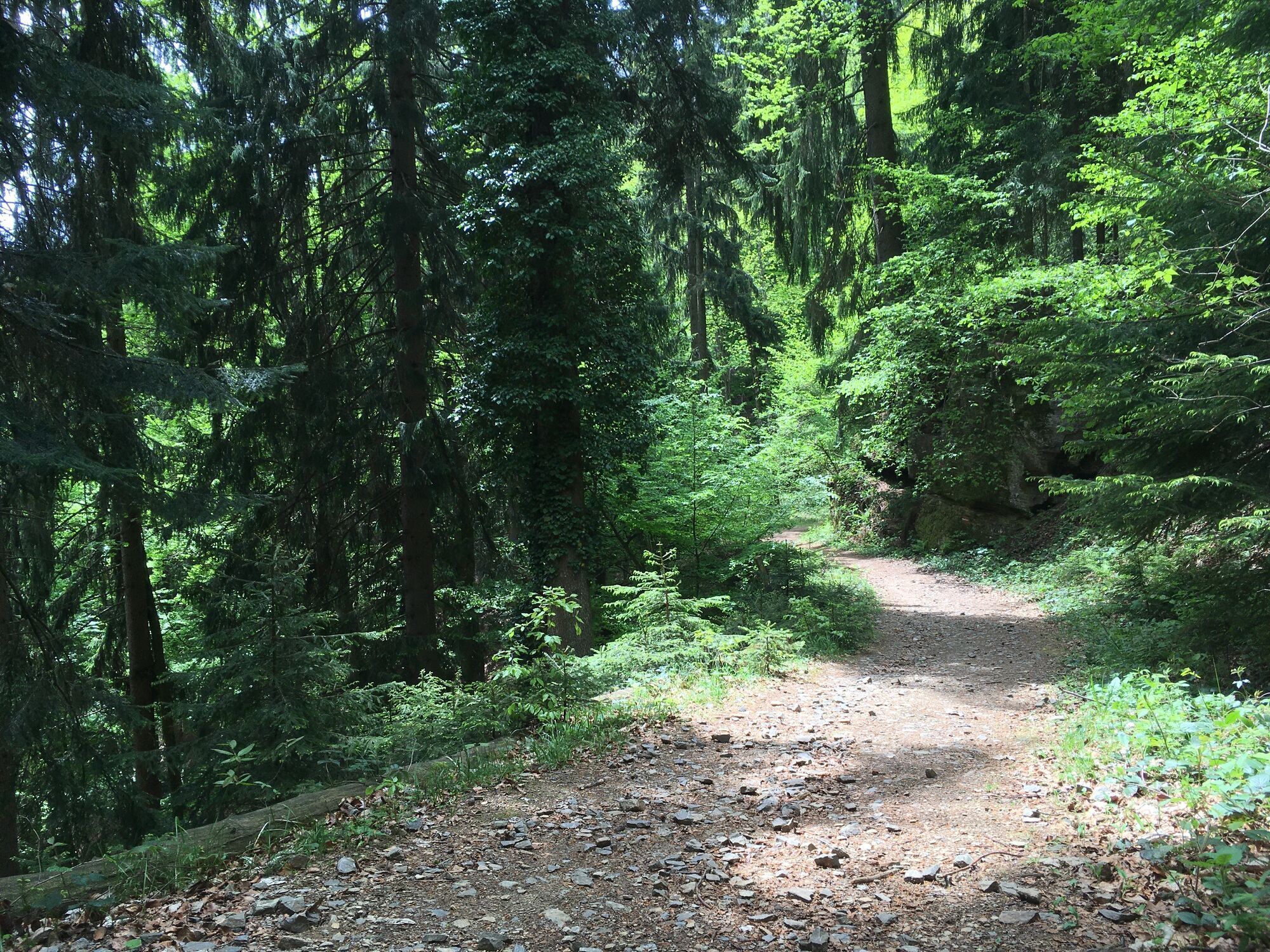
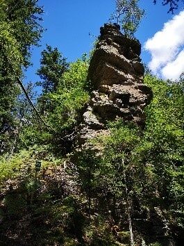
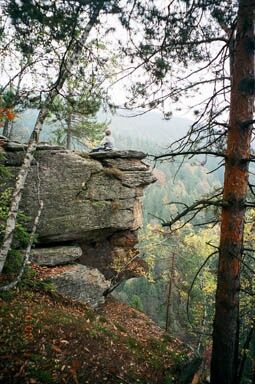
Here you continue straight on through a pasture gate, pass the abandoned Klug vulgo Vastlhansl farm and then hike up a forest path to Sporiroaofen. Already here, larger rock formations arouse your interest. Once you arrive at your destination, it takes about an hour.
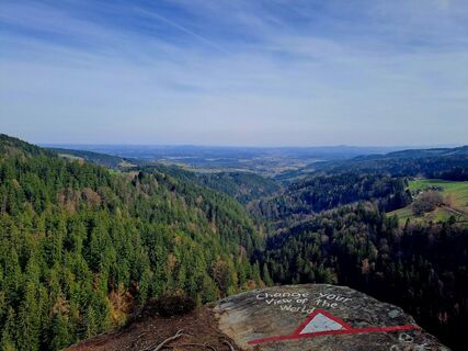
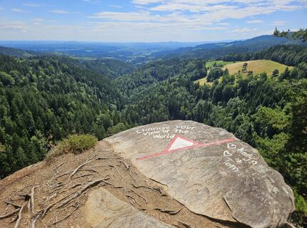
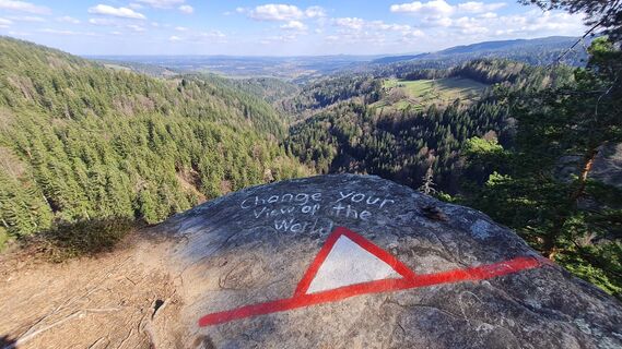
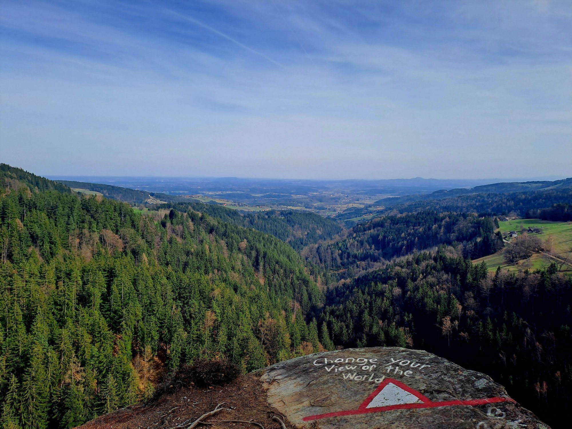
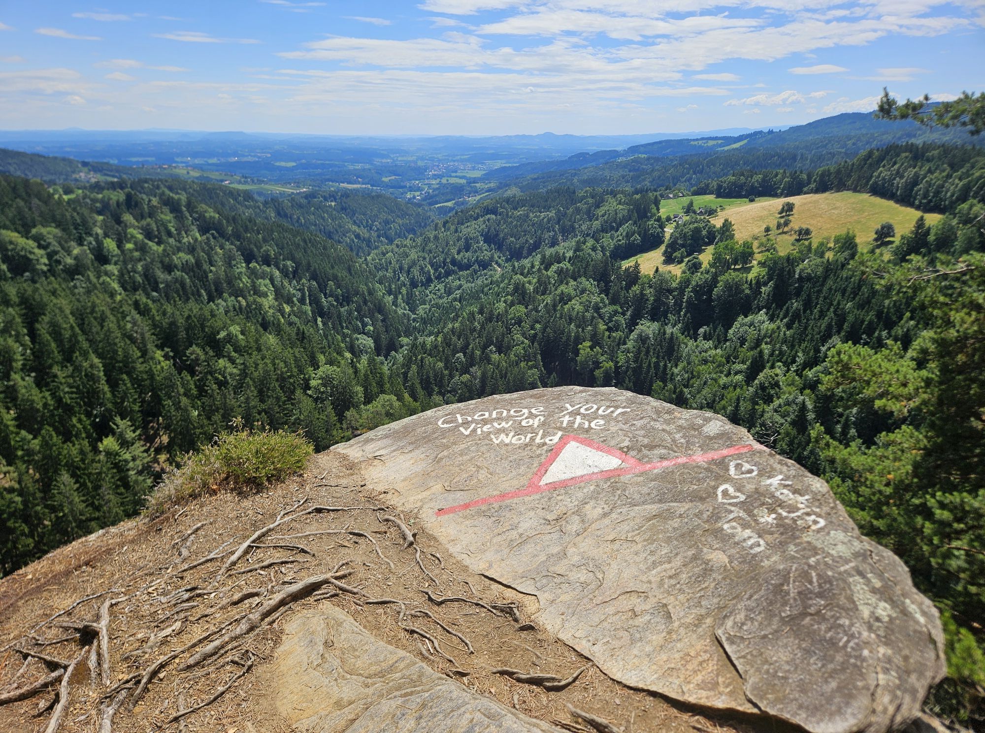
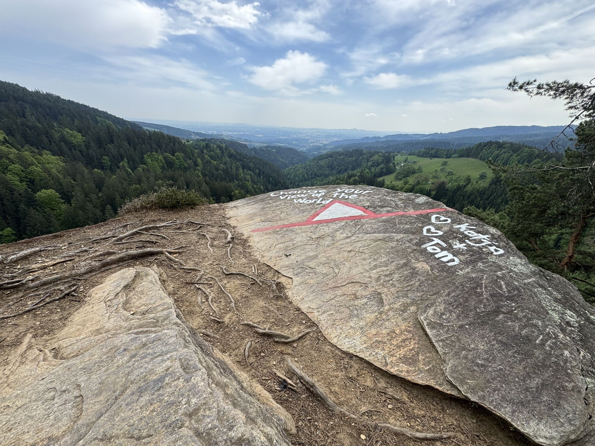
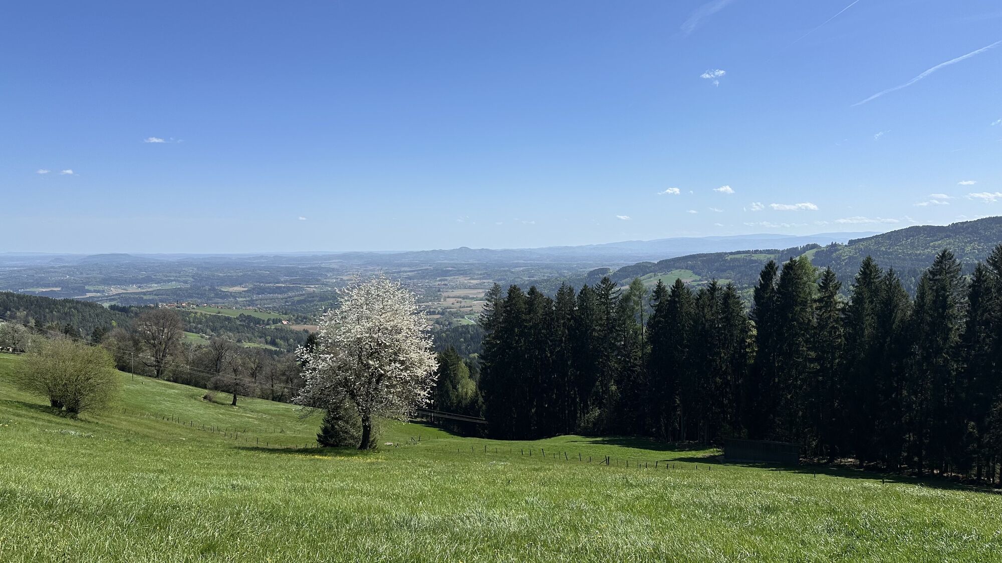
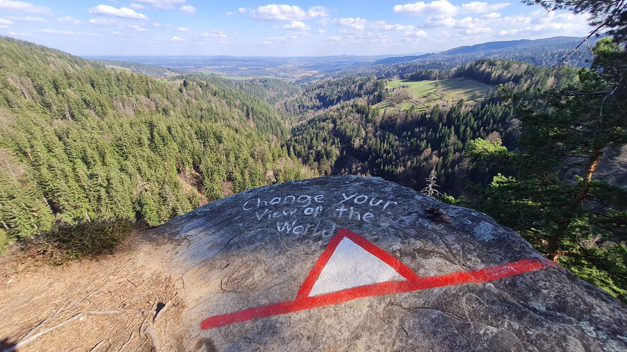
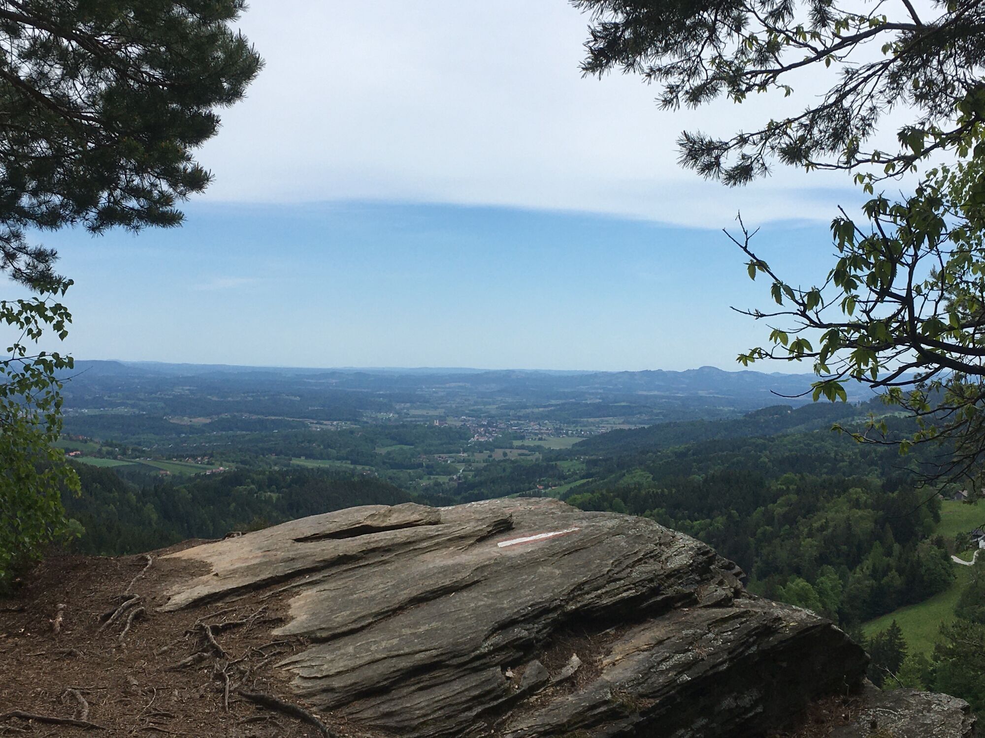
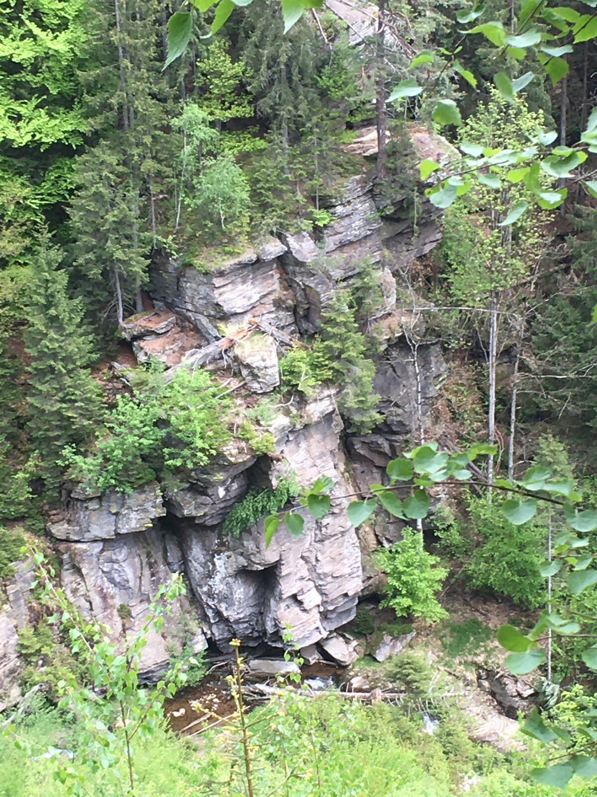
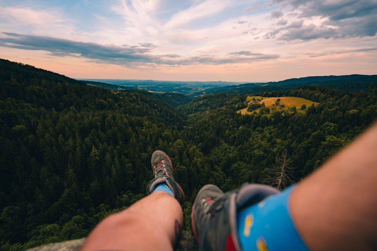
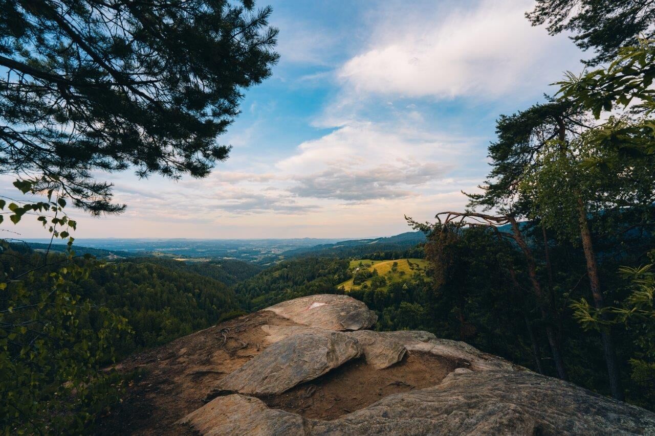
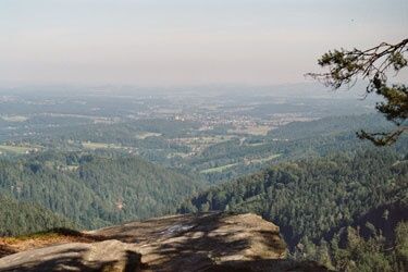
The imposing plateau is a geological highlight. The boulders drop steeply 120 metres to the Falleggbach stream and offer a wonderful distant view from the plateau. Here it pays to have binoculars with you. The terrain is not secured and therefore very dangerous. Smaller children are not allowed to climb the plateau unaccompanied by adults. The climb really pays off. Take your time and enjoy the distant view. It is a unique experience.
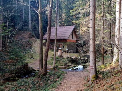
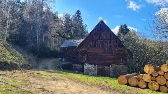
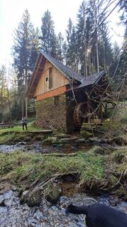
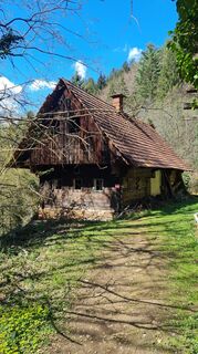
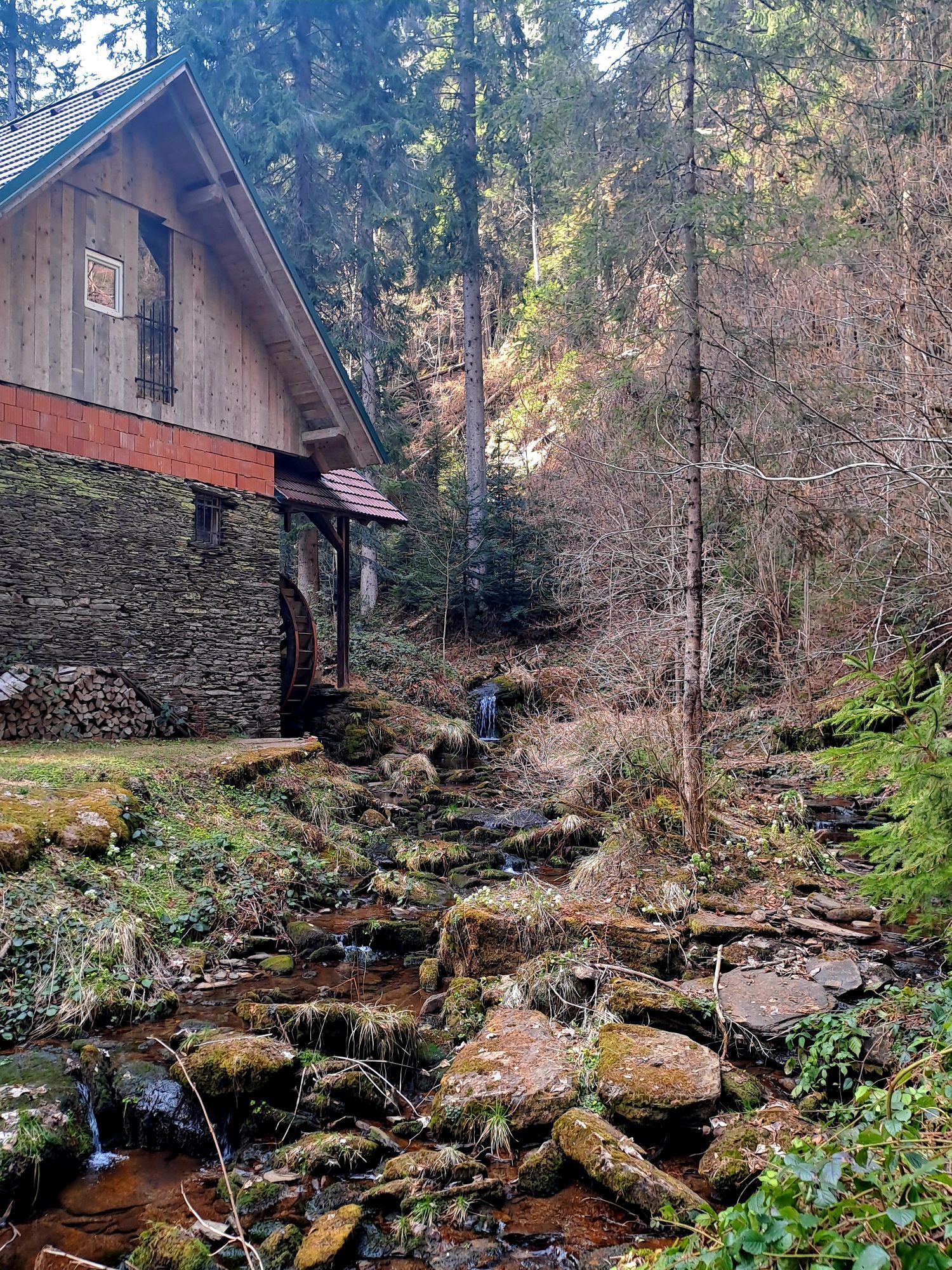
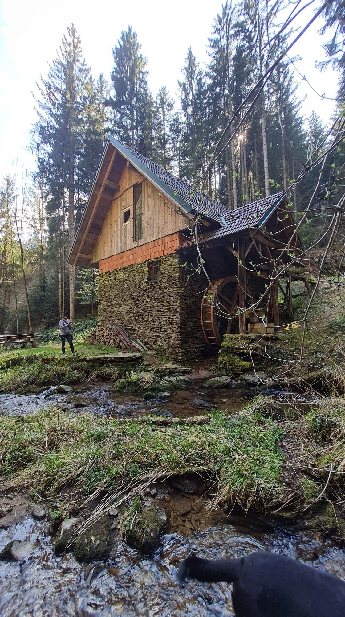
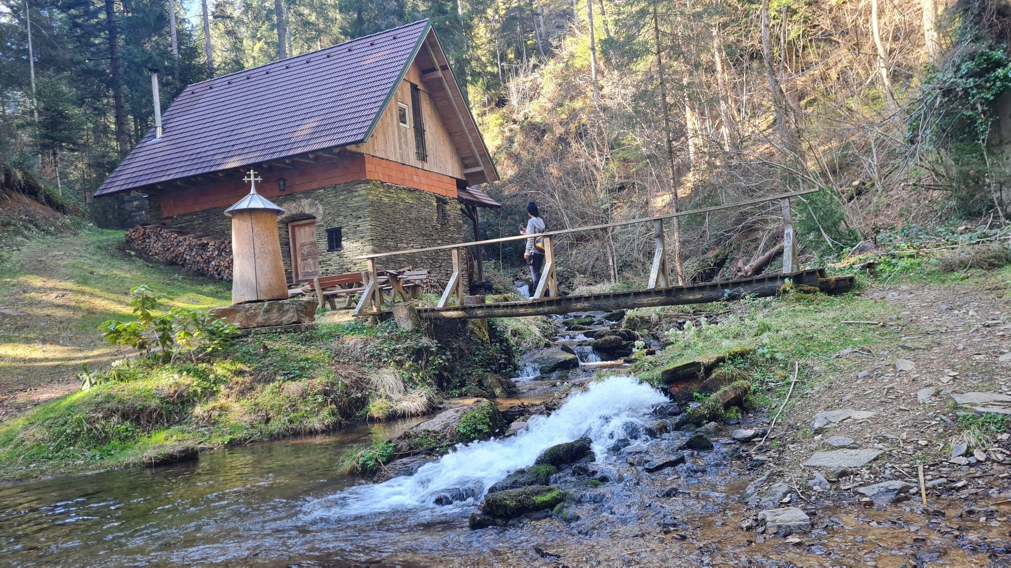
When you have had your fill, the way back leads to a knoll with a fork in the path. Go straight down to the Falleggbach stream along the trail marking Sauerbrunn 10G. Arriving at the Falleggbach, you will see the old Sporimühle mill and right next to it the water turbine of the Klugbauer power plant. This is a good place to stop and have some regional delicacies that you have brought with you. Don't forget to capture the mill with your mobile phone or camera. Time has stood still here, enjoy the moment.
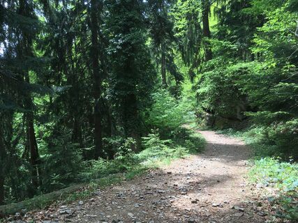
Freshly invigorated, continue hiking until you reach a fork in the path and continue downhill on the right, following the 10G mark. With a big step you cross a small gully. Here you can refresh your tired feet a little. About 150 metres before the end of the forest, a gravelled forest path branches off from the trail to the right. Here, a detour along the forest path leads down to the Mannagettaofen nature monument, which is well worth seeing.
From the barrier, walk 150 metres along the path in a south-easterly direction and after the hairpin bend 140 metres in a westerly direction. Then you cross a small channel and come to a fork in the path. Here you go down to the left, first in a south-easterly, then in a south-westerly direction. After another 200 metres, several ovens rise abruptly upwards. In the middle is the natural monument Mannagettaofen. Unlike the Sporiroaofen, this group of ovens can only be admired from below. Climbing up is forbidden! If you continue down to the Falleggbach stream, you can still see the remains of an old mill. You have to leave the path a little for this experience, but it really pays off.
Back on the original trail, you hike buoyantly past the forest road barrier and farms on the asphalt road to the hiking trail junction at the Schneebauer farm. You go steeply down the forest to the right to the Falleggbach stream. Pause for a moment and enjoy the sound of the water. Then walk over the bridge, catch sight of the spring house of the Sauerbrunn healing spring and reach the car park where you started. A visit to the newly renovated Sauerbrunn mineral spring goes without saying. Bad Sauerbrunn is known for its sulphurous and ferruginous water. Do not hesitate to taste it and draw new energy from it. A worthy conclusion to a special tour.
Proper backpack packing makes many things easier: Pack heavy things first. The water bottle should always be within easy reach in a side pocket. All things that are often needed, such as sunglasses, camera or hiking map, belong on top. An emergency kit including blister plasters belongs in every rucksack and it is always advisable to dress according to the "onion system"!
Rescue: 144
Tip for reporting an emergency - give answers to the six W-questions: What happened? How many injured? Where did the accident happen (possibly GPS coordinates)? Who reported the accident (call-back number)? When did the accident happen? Weather at the accident site?
From the north: Motorway Munich - Salzburg - Eben - Schladming - Liezen onto the A9 towards Graz. Exit at Lieboch and follow the B76 towards Deutschlandsberg. In Stainz drive in the direction of Marhof.
A9 is subject to toll - Gleinalmtunnel. Alternative: at St. Michael take the S6 towards Bruck and in Bruck take the S35 towards Graz.
From the west: In Villach take the A2 towards Klagenfurt. Take the Steinberg exit and drive in the direction of Stainz, from there along the B76 in the direction of Deutschlandsberg. In Stainz drive in the direction of Marhof.
From the east: A2: Vienna - Aspang - Hartberg - Fürstenfeld - Graz. From Graz continue on the A2 in the direction of Klagenfurt and take the Lieboch exit in the direction of Stainz/Deutschlandsberg/Eibiswald. Follow the B76 to Deutschlandsberg. In Stainz drive in the direction of Marhof.
From the south: A 1 from Marburg as far as Leibnitz. Exit in Leibnitz (Gralla) and continue on the B74 in the direction of Deutschlandsberg (Heimschuh - Gleinstätten - St.Martin - Deutschlandsberg). Pass the LKH Deutschlandsberg, at each of the four roundabouts take the second exit in the direction of Stainz-Graz. In Stainz, drive in the direction of Marhof.
The car park is located approximately 3 kilometres after the end of Marhof on the right-hand side of the road directly at the Sauerbrunn mineral spring.
Parcours populaires à proximité
-
4,4
Großofen, Hebalm
facileRandonnée 10,1 km -
4,6
Filzmoos - Runde, Hebalm
facileRandonnée 8,28 km -
4,3
Rund um den Hirzmann-Stausee
facileRandonnée 10,5 km -
3,5
Reinischkogel: Klugbauer - Rundweg
facileRandonnée 7,02 km -
3,4
Packer Stausee
facileRandonnée 7,47 km -
4,7
Laßnitztalweg – Wanderung "Klause" Deutschlandsberg
moyenRandonnée 10,2 km -
3,7
Bärofen Rundwanderung
facileRaquettes 10,9 km -
3,9
Modriach - Über den Großofen (Großofen-Rundweg)
Randonnée 11,4 km -
4,3
Seerundweg auf der Hebalm
facileChemin thématique 3,79 km -
4,6
Kurze Rundwanderung zum Sporiroaofen, zurück über Klugbauer und Hahnhofhütte
moyenRandonnée 11,9 km

Randonnée et suivi


Ne manquez pas les offres et l'inspiration pour vos prochaines vacances
Votre adresse électronique a été ajouté à la liste de diffusion.