


Randonnée hivernale itinéraire local & promenade Kopphütte
Niveau de difficulté: 3
Commence ton excitant parcours directement devant le servicecenter à Mühlbach, avec le BK Bike Radgeschäft en vue. Laisse monter l’enthousiasme pour l’aventure à venir ! Va vers le dernier carrefour....
Commence ton excitant parcours directement devant le servicecenter à Mühlbach, avec le BK Bike Radgeschäft en vue. Laisse monter l’enthousiasme pour l’aventure à venir ! Va vers le dernier carrefour. Ici, ne tourne pas vers Bergheimat ! Prends plutôt le chemin de gauche qui mène directement à la Kopphütte. Suis le chemin qui monte raide. Sois attentif aux marquages qui te guideront en toute sécurité vers la Kopphütte. La montée demande un effort sportif, mais pas d’inquiétude – l’effort en vaut la peine ! Après une montée qui fait transpirer, tu atteindras la Kopphütte, où tu pourras faire une pause bien méritée. Laisse la magnifique vue t’imprégner et recharge tes batteries pour le chemin du retour.
Options pour le retour :
Option 1 : Pour le retour, tu peux prendre la piste de luge naturelle. Ressens le frisson d’adrénaline en dévalant la piste près de Aldiana et jusqu’au résidence pour personnes âgées. Fais attention à la piste de luge et profite du plaisir – chaque virage devient une expérience inoubliable !
Option 2 : Si tu souhaites revivre l’air frais de la montagne et le paysage impressionnant, prends simplement le même chemin pour revenir. Laisse la beauté de la nature t’imprégner et profite de chaque pas pendant ta descente.


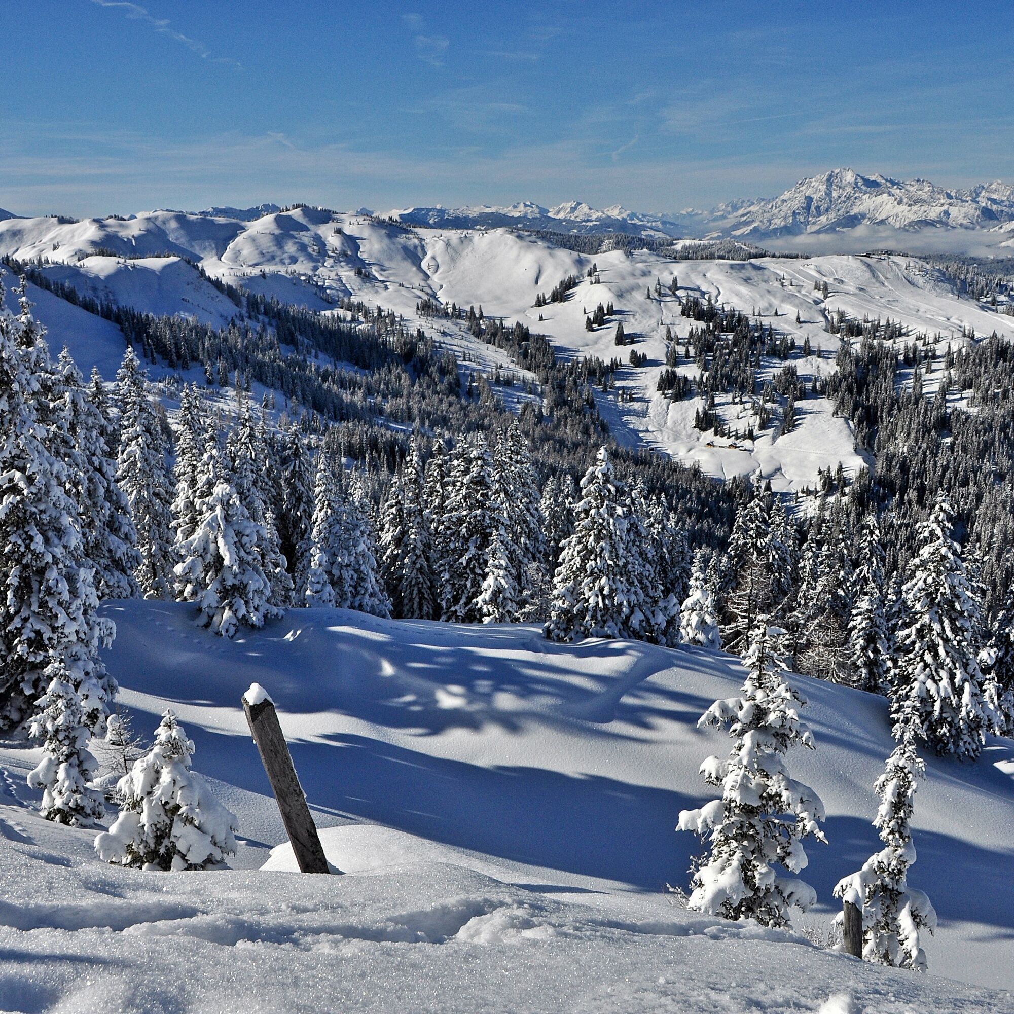
Commence ton parcours directement devant le servicecenter à Mühlbach, avec le BK Bike Radgeschäft en vue. Va en direction du dernier carrefour. Au carrefour, ne tourne pas vers Bergheimat, mais prends le chemin de gauche en direction de la Kopphütte. Suis le chemin qui monte. Fais attention aux marquages qui te guideront vers la Kopphütte. Après une montée sportive, tu atteindras la Kopphütte. Ici, tu pourras faire une pause bien méritée et profiter de la magnifique vue.
Options pour le retour :
Option 1 : piste de luge naturelle
Pour le retour, tu peux prendre la piste de luge naturelle. Elle te fera passer près de Aldiana et du résidence pour personnes âgées. Fais attention à la piste de luge et profite du plaisir et des montées d'adrénaline !
Option 2 : même chemin retour
Sinon, tu peux revenir par le même chemin pour profiter à nouveau de l'air frais de la montagne et du paysage magnifique.
Arrivée depuis Salzburg : Prenez l’autoroute A10 jusqu’à la sortie Bischofshofen, puis la B311 en direction de Bischofshofen. Suivez la Bundesstraße B164 Hochkönig jusqu’à Mühlbach.
Arrivée depuis Innsbruck/Kufstein : Prenez la Loferer Straße/B178 en direction de St. Johann i.T., puis la Bundesstraße B164 Hochkönig via Saalfelden et Maria Alm jusqu’à Mühlbach.
Puis continuez sur la Mandlwandstraße en direction d’Arthurhaus
Avec le train, vous pouvez profiter de vos vacances dès le début. Aucun embouteillage ne vous empêche d’arriver dans la région Hochkönig !
Vous pouvez réserver votre trajet ferroviaire sur www.oebb.at.
Parking gratuit en face de la caserne des pompiers au centre du village
3
Hochkönig Tourismus GmbH
Am Gemeindeplatz 7
5761 Maria Alm
Tél. +43 6584 20388
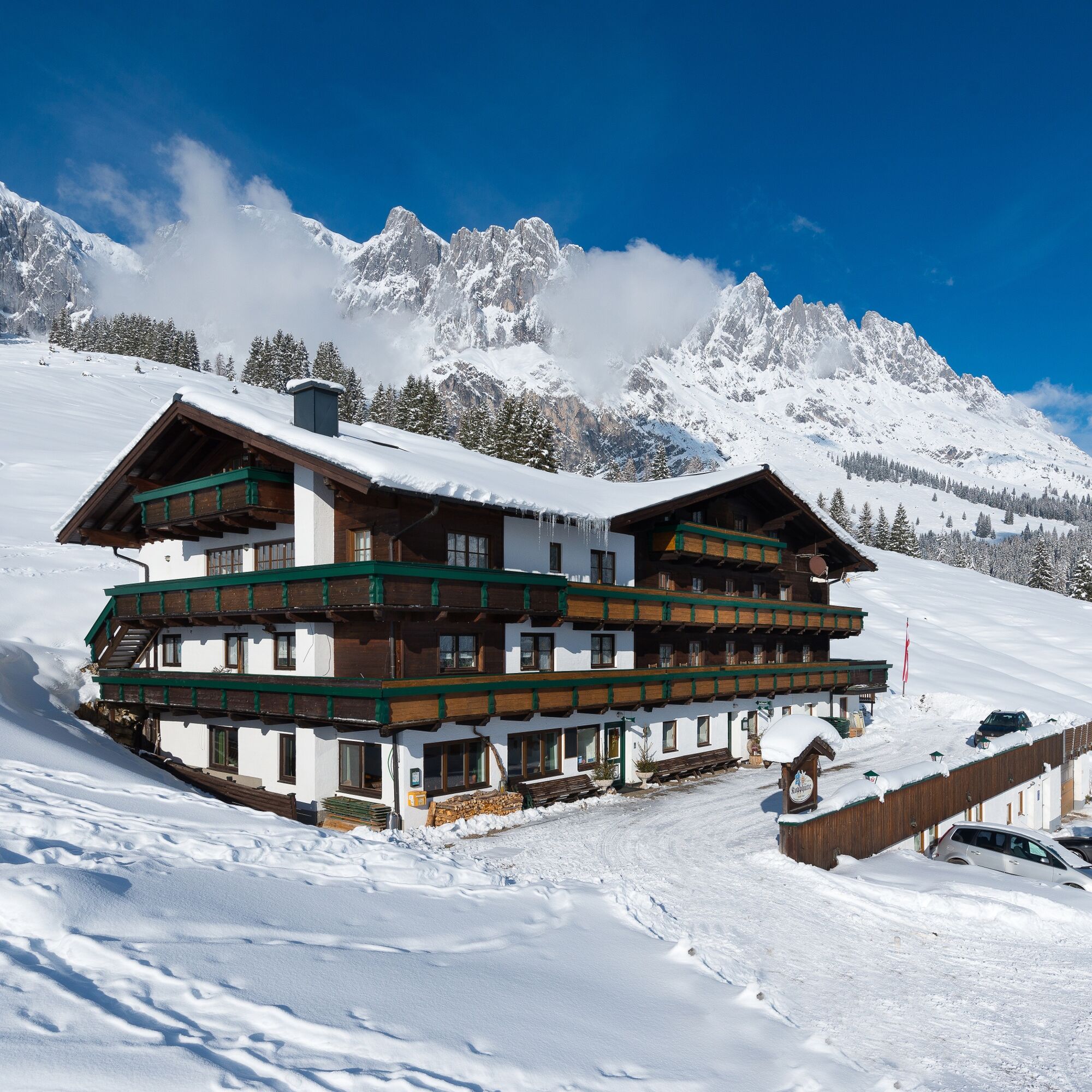
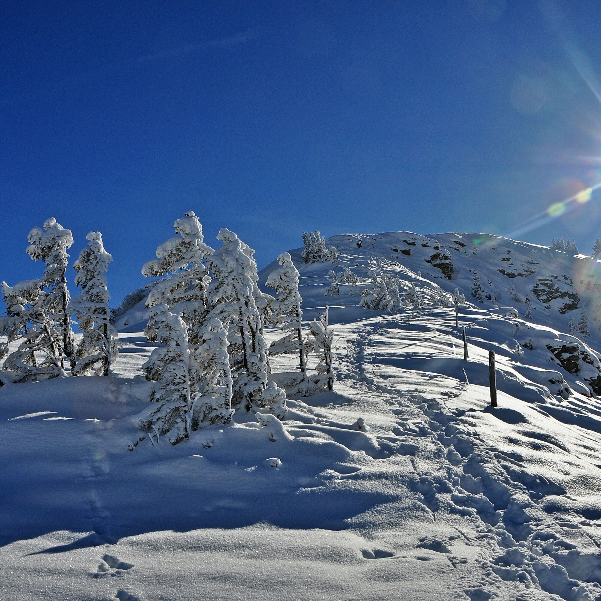
L'auberge alpine Kopphütte t’invite à faire une halte à l'arrivée du sentier de randonnée hivernal ! Note que le chemin de la Kopphütte vers le village est aussi utilisé comme piste de luge. Sois prudent et veille aux autres randonneurs ou lugeurs.
Parcours populaires à proximité
- 4,9
Großarl : Aualm - Liechtensteinkopf - Aukopf - Schuhflicker - Schuhflickersee
moyenRandonnée 5,84 km - 4,8
Ascension Lauskopf
difficileRandonnée 8,16 km - 4,8
Ascension au sommet Taghaube
difficileRandonnée 6,25 km - 4,7
Par le "circuit des Vier Hütten" jusqu'à la Windraucheggalm
moyenRandonnée 10,1 km - 4,7
Randonnée panoramique vers le Hochkeil
moyenRandonnée 6,07 km - 3,6
Wanderung zur Ostpreußenhütte in Werfen (1.630 m)
moyenRandonnée 11,2 km - 4,8
Großarl : Mooslehenalm – Niggeltalalm – Viehhausalm
moyenRandonnée 5,44 km - 4,8
Hochkönig - Gipfel der Gefühle - Matrashaus
difficileRandonnée 20,9 km - 4,4
Randonnée des alpages et refuges "Hochmaisalm & Steinbockalm"
moyenRandonnée 8,10 km - 4,6
Königsjodler Klettersteig (C/D) Hochkönig
difficileVia ferrata 25,8 km

Randonnée et suivi


Ne manquez pas les offres et l'inspiration pour vos prochaines vacances
Votre adresse électronique a été ajouté à la liste de diffusion.