


Abtenau: Postalm-Braunedelkogel
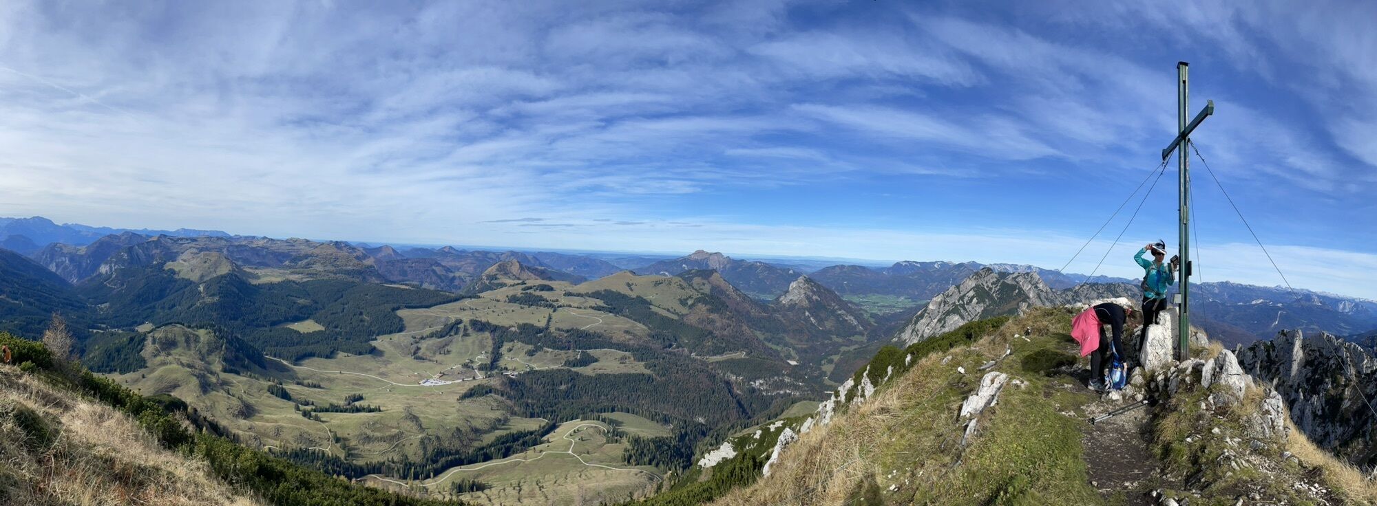
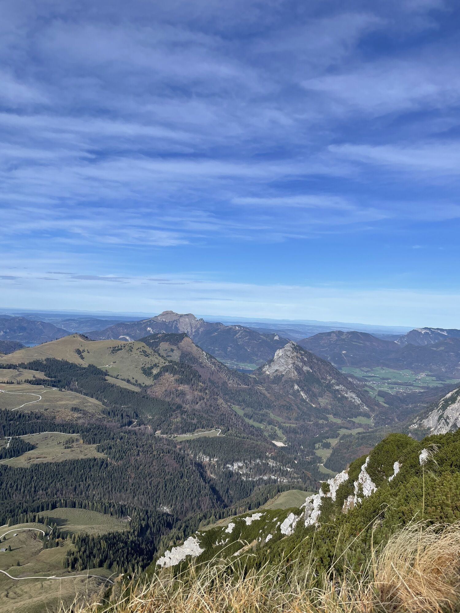
Grandiose panoramic view of the Postalm, the Hoher Dachstein with Gosaukamm mountains, as well as the Tennengebirge mountains and the beautiful Salzkammergut.


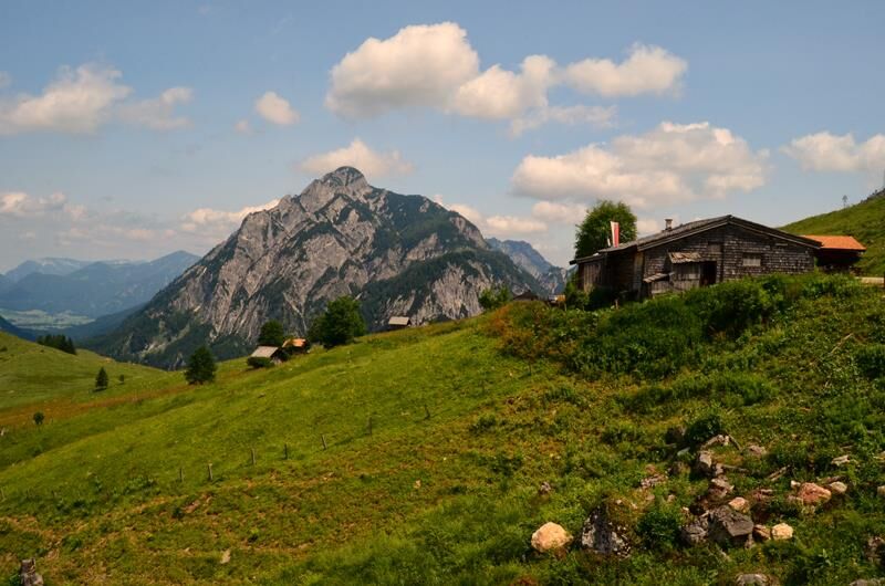


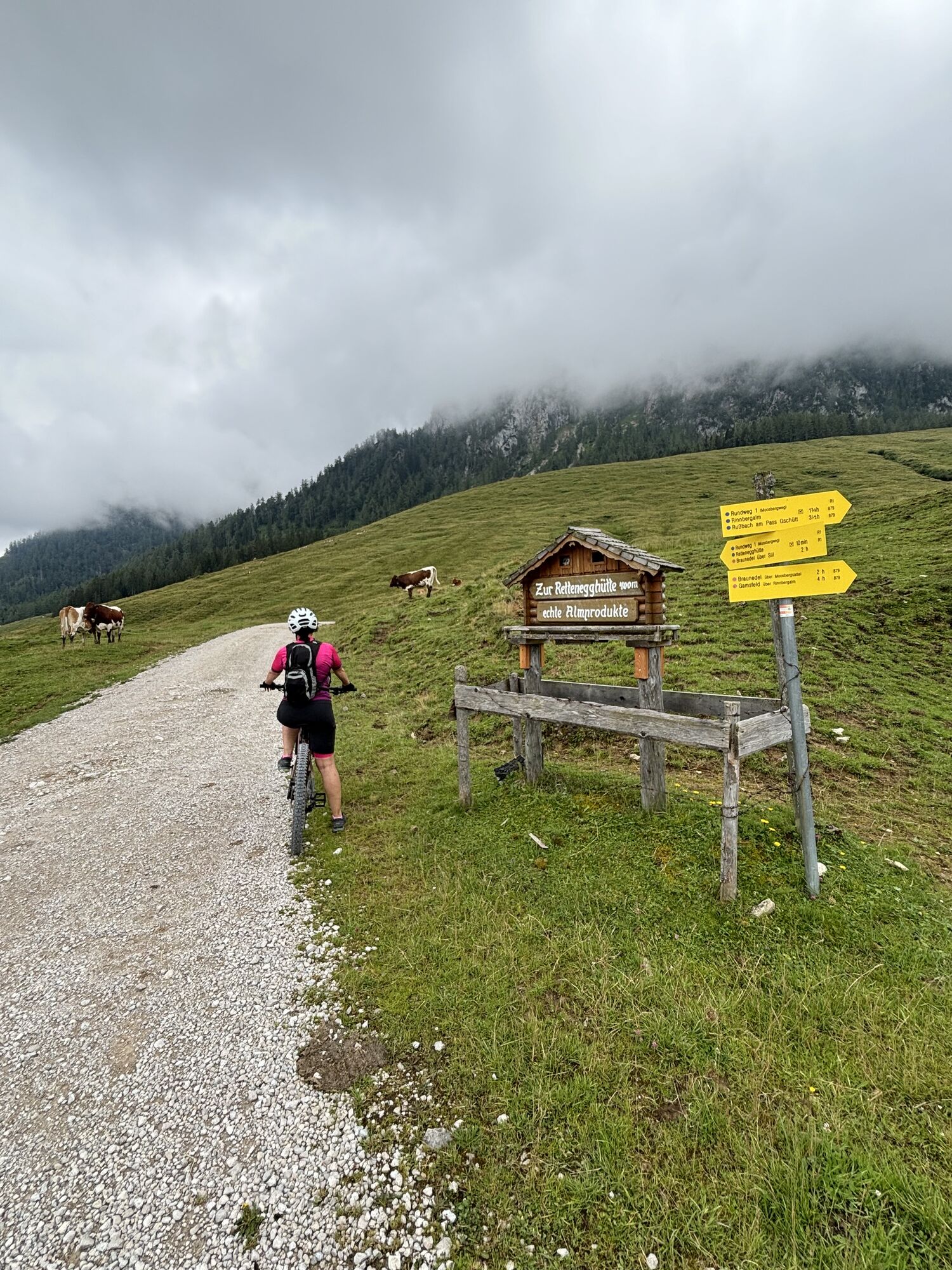
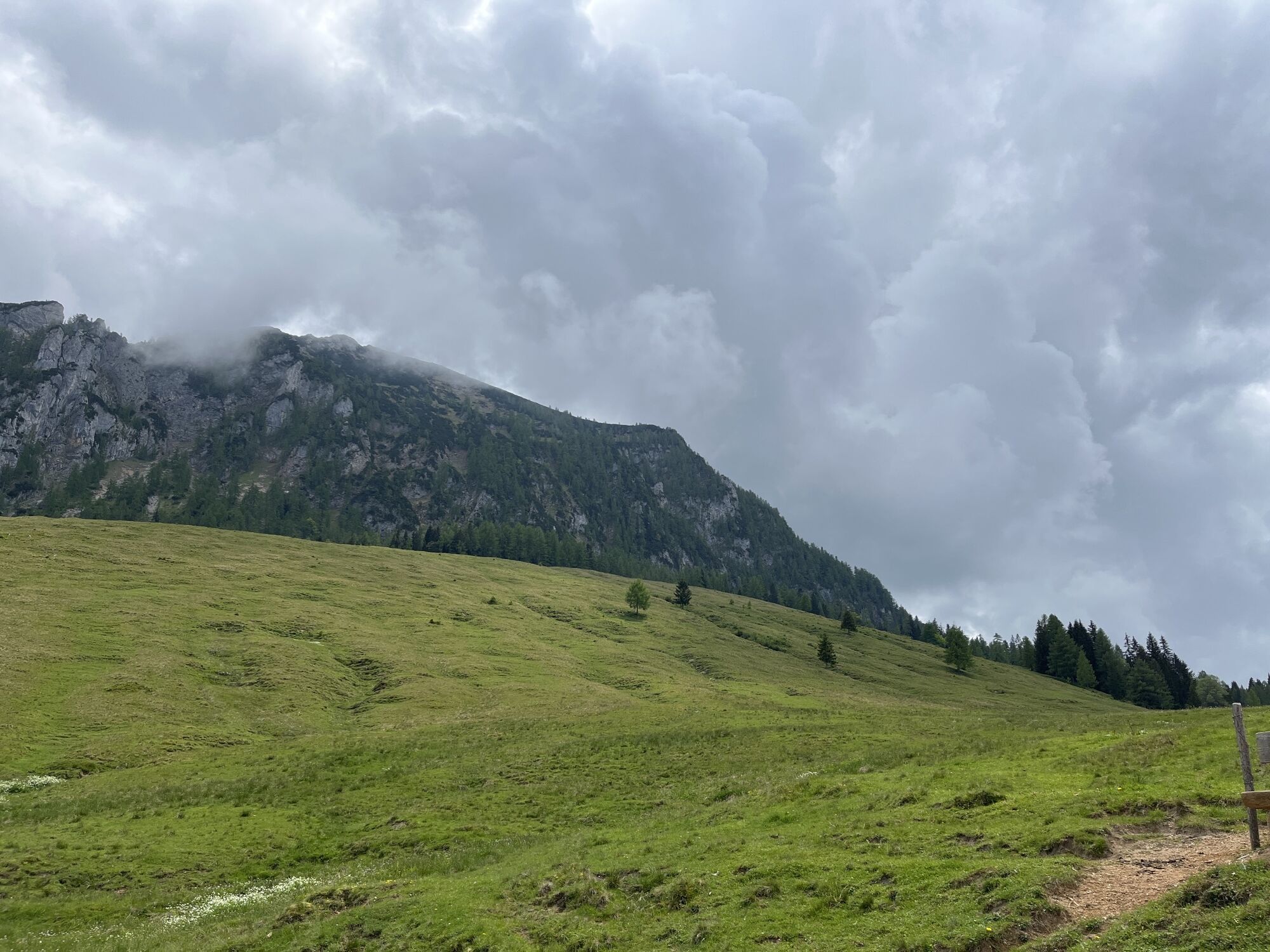
From the eastern side, the hiking trail (878) first leads across the alpine pasture and then into the forest path. The trail goes steadily uphill. In between, the trail passes the rocks of the "Scharfen". After about 1 ¼ hours of walking, you come to the junction "Braunedel" + "Scharfen". At this point, depending on the snow conditions, snow can be found in winter until the middle of July. Now continue above the tree line on a path surrounded by mountain pines. The hike continues for about 30 minutes to the summit of the Braunedel.
Another path leads over the Moosbergsattel up to the Braunedel. Duration: approx. 2 h.
Oui
Sturdy shoes, suitable hiking clothing, hiking poles recommended
Sturdy shoes are absolutely necessary
surefootedness
Via the Postalm Panoramastraße from Abtenau (toll € 10.00 per car) or via Postalm Mautstraße Strobl (toll € 5.00 per person).
10:10 a.m. Tuesday and Thursday (mid-May to mid-October) Postbus from Abtenau town centre (€ 2.00 per trip + one-off toll € 1.50)
various parking options on the Postalm P1-P4
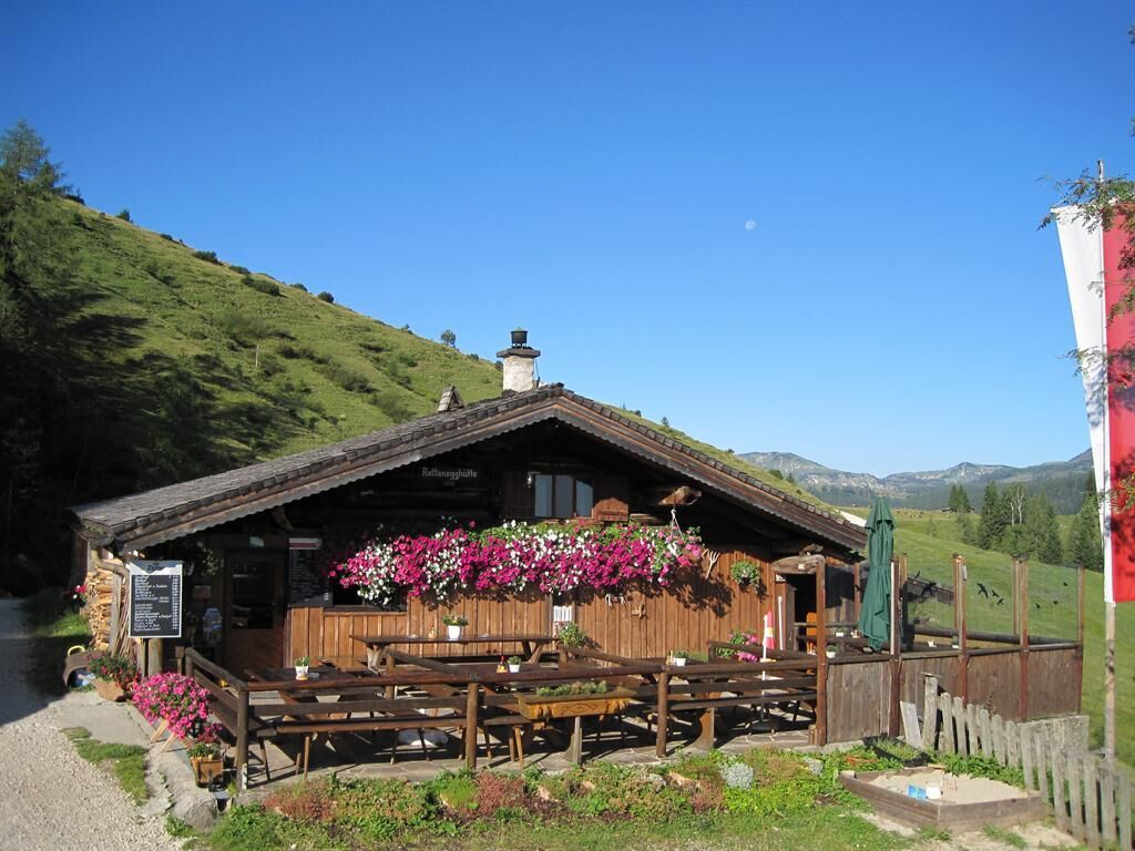
at the foot of the Braunedel at the Rettenegg hut there is a fenced car park
www.abtenau-info.at
After the hike, stop at the Rettenegg hut (1222m) with genuine alpine pasture products and delicious pastries.
Parcours populaires à proximité
-
4,1
Pillstein Panorama Rundweg
facileRandonnée 3,40 km -
4,9
Randonnée gourmande au-dessus du Falkenstein
moyenRandonnée 9,81 km -
4,7
Autour du lac Gosau
facileRandonnée 4,43 km -
4,9
Schwarzeneckalm-Bleckwand
facileRandonnée 5,94 km -
4,8
Gennerhorn über Lämmerbach
moyenRandonnée 10,2 km -
4,8
Schafberg ab Winkl nahe Sankt Gilgen, Österreich
moyenTrail running 6,12 km -
4,8
Von St. Gilgen aufs Zwölferhorn
moyenRandonnée 10,4 km -
4,7
Schafberg
moyenRandonnée 6,85 km -
4,7
Schafberg
moyenRandonnée d'altitude 16,7 km -
4,7
Vorderer u. hinterer Gosausee
moyenRandonnée 15,0 km

Randonnée et suivi


Ne manquez pas les offres et l'inspiration pour vos prochaines vacances
Votre adresse électronique a été ajouté à la liste de diffusion.