


Sinnlehenalm
La randonnée jusqu'à la Sinnlehenalm à environ 950 m est le parcours idéal pour les débutants et les familles. Les randonneurs sont récompensés non seulement par un panorama splendide sur la vallée de...
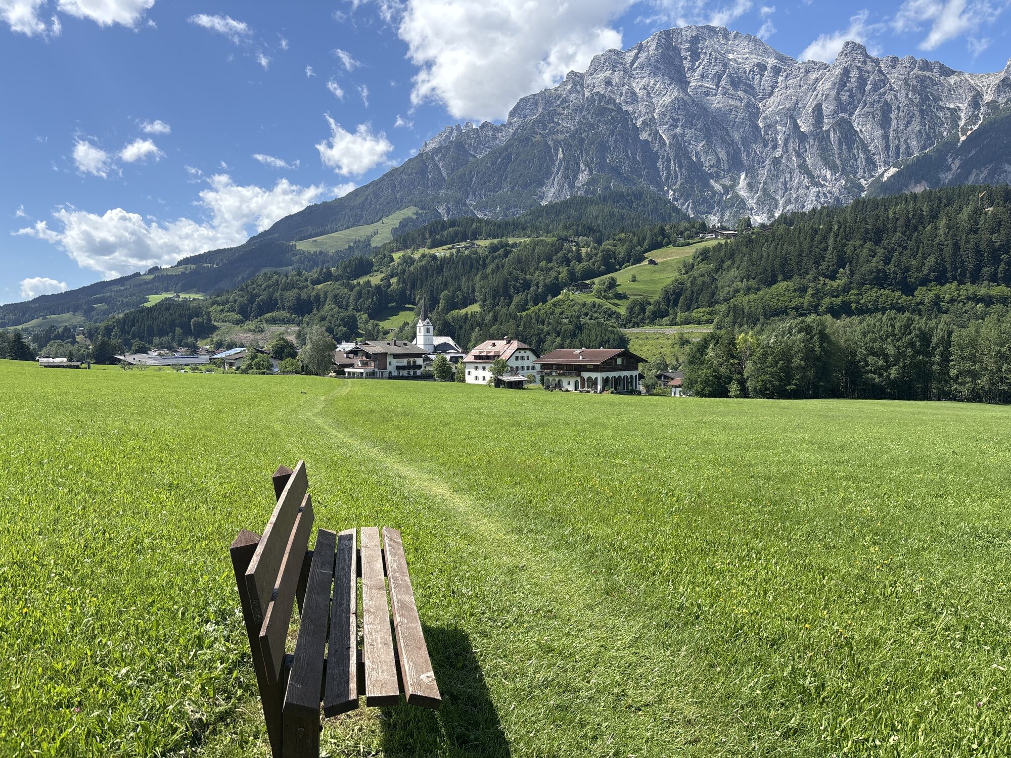
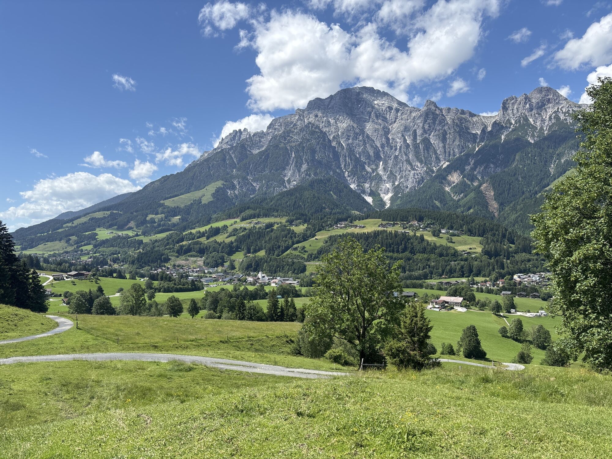
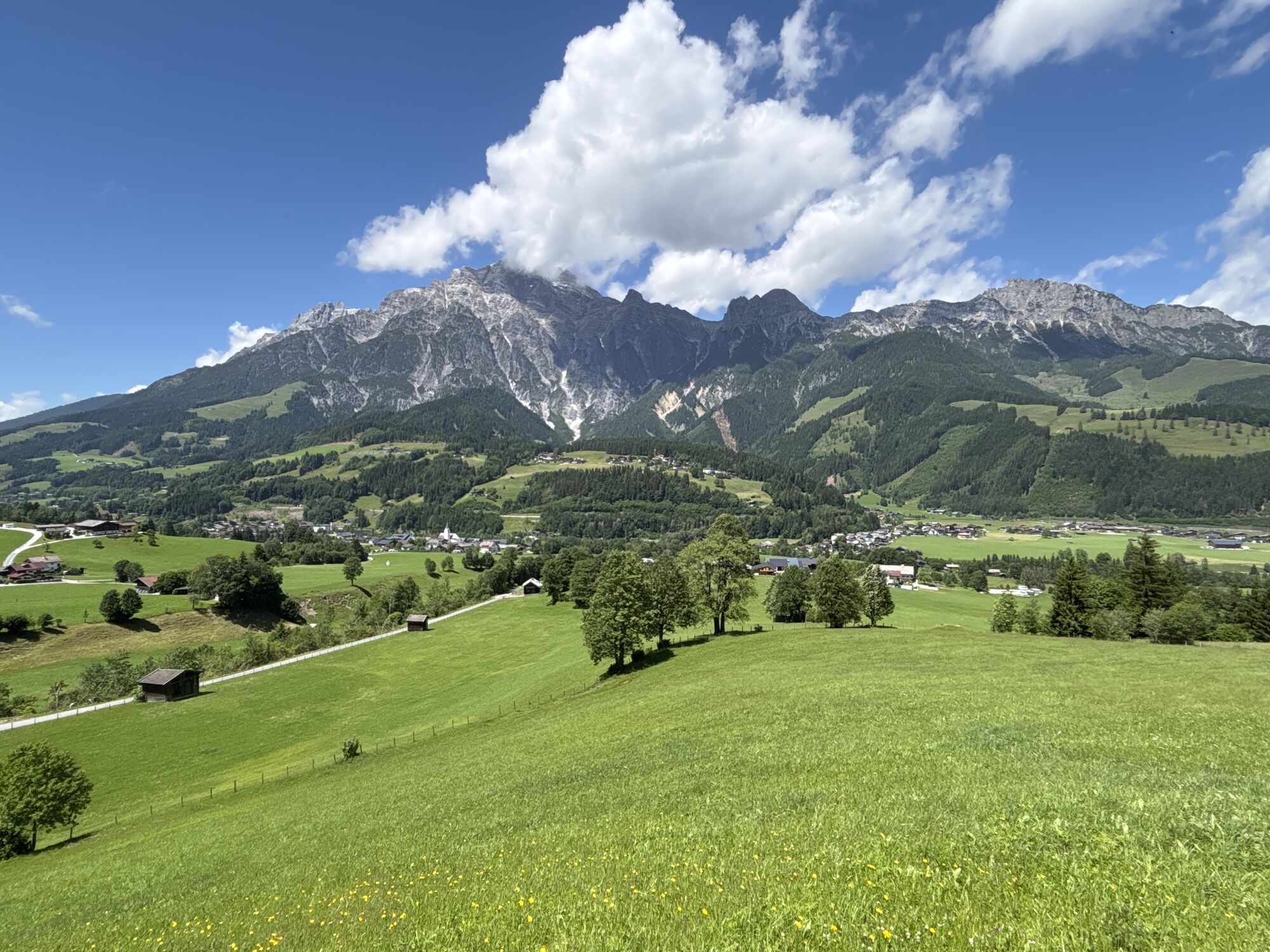
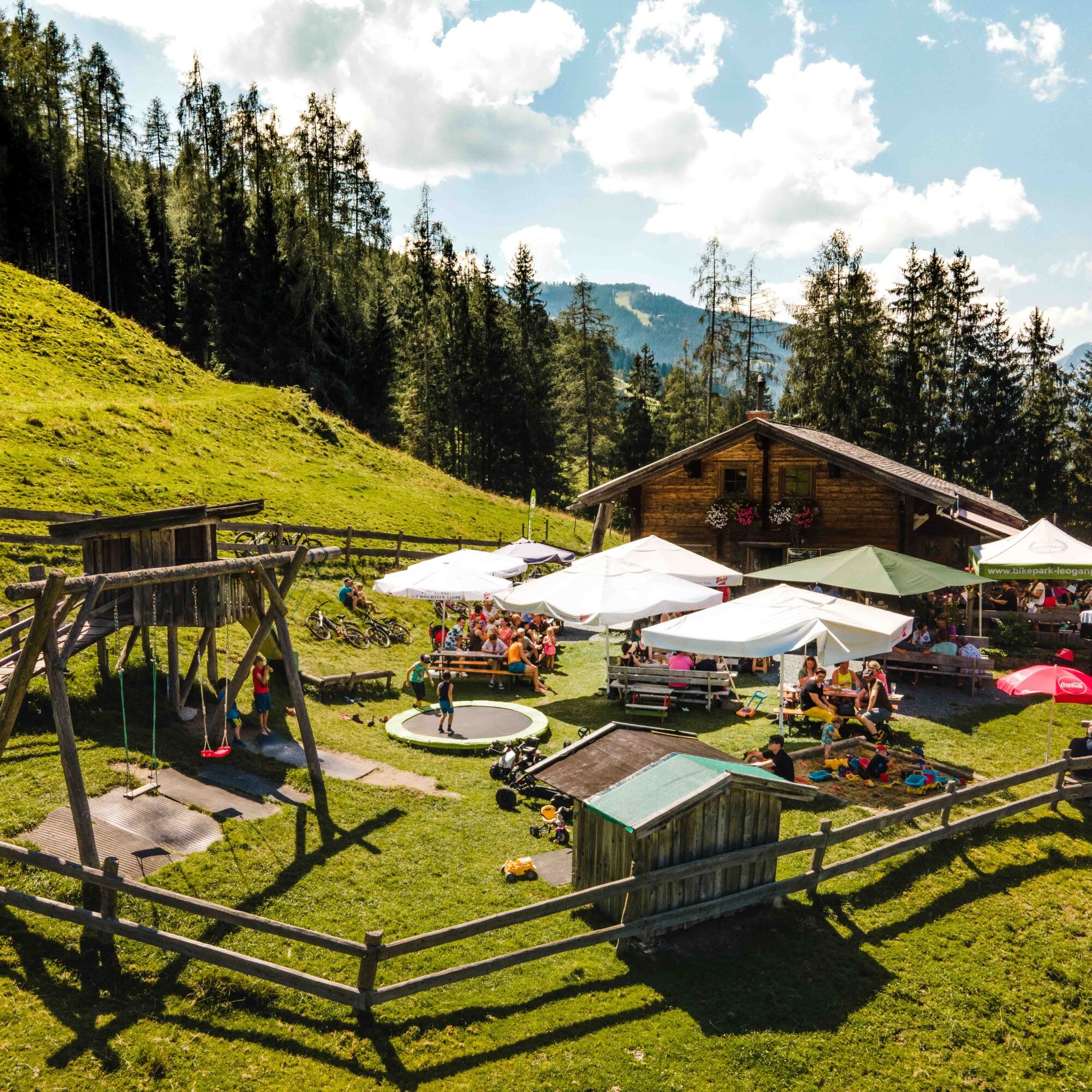
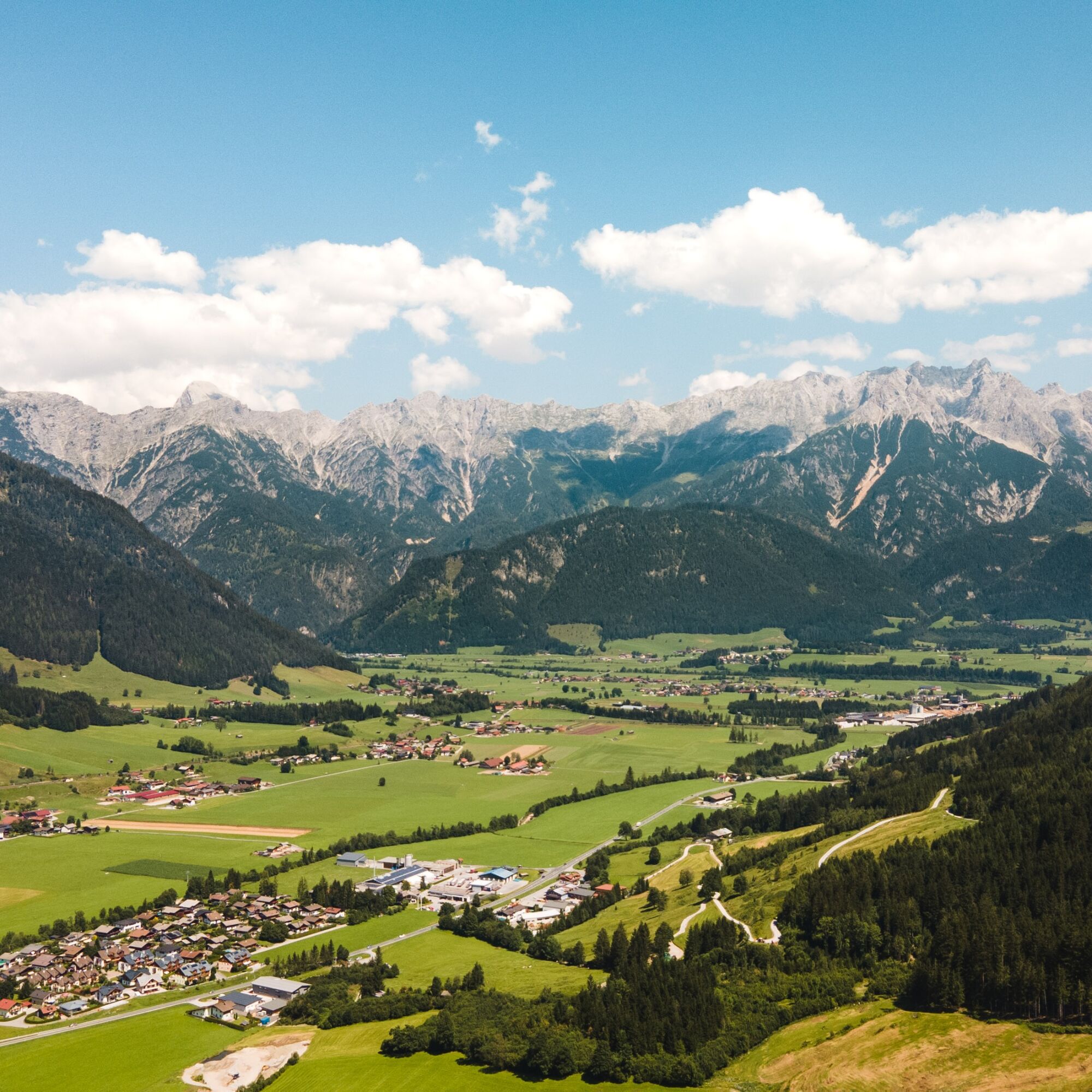
La randonnée jusqu'à la Sinnlehenalm à environ 950 m est le parcours idéal pour les débutants et les familles. Les randonneurs sont récompensés non seulement par un panorama splendide sur la vallée de Leogang, les Steinberge de Leogang et le Birnhorn (2 634 m), mais ils peuvent aussi se régaler d'une collation d'alpage issue de la ferme locale avec du pain fraîchement cuit, du beurre, du lard et du fromage. L'ascension commence depuis le centre-ville de Leogang et passe entre des prairies en légère pente ainsi que par des sentiers forestiers partiellement ombragés menant à l'alpage. Le sentier partiellement ombragé permet aussi aux petits enfants ou aux randonneurs plus âgés de monter. Les enfants peuvent s'amuser autant qu'ils veulent sur l'aire de jeux ou découvrir les animaux de l'alpage de près.

La randonnée commence au centre-ville de Leogang, près de l'église. De là, on suit le sentier balisé à travers des prairies en légère pente et des sentiers forestiers partiellement ombragés jusqu'à la Sinnlehenalm.
Alternativement, l'ascension peut se faire depuis le quartier Hirnreit de Leogang. De là, un large chemin forestier bien balisé mène directement à l'alpage.
Remarque : Des liaisons de l'alpage à la station de collation Huggenberg et à la luge d'été Biberg Saalfelden sont possibles.
Oui
Chaussures de montagne, sac à dos de jour, cartes
En venant de Saalfelden, tournez à gauche au quartier Hirnreit ou continuez directement jusqu'au centre-ville, où un parking est disponible au-dessus de l'église.
EN TRAIN
Avec le train, vous pouvez profiter de vos vacances dès le début. Aucun embouteillage ne vous empêchera de venir à Saalfelden Leogang ! De plus, l'horaire ÖBB vous aide rapidement et facilement à trouver la correspondance idéale jusqu'à la gare "Leogang Steinberge" : www.oebb.at (environ 10 minutes à pied jusqu'au point de départ)
EN BUS
Le point de départ est facilement accessible en bus ligne 690 depuis Saalfelden ou Hochfilzen jusqu'à l'arrêt "Leogang Ortsmitte". À environ 240 mètres en direction du Schanteilift, vous atteignez le début de la randonnée. Plus d'informations sont disponibles sur https://fahrplan.salzburg-verkehr.at/
Centre-ville de Leogang - au-dessus de l'église
Possibilité de restauration : Sinnlehenalm
La Sinnlehenalm est fermée le mercredi ! www.sinnlehen.at
Le goût de Leogang
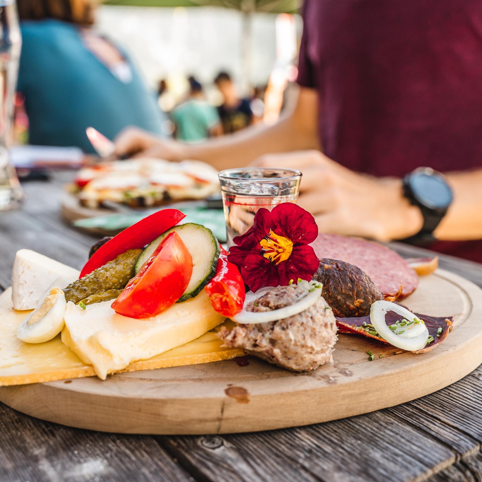
Goûtez la diversité de Leogang lors d'une visite de la fromagerie à la Sinnlehenalm et découvrez comment le fromage et le beurre sont fabriqués ici en altitude. Bien sûr, la dégustation est un must ! Les variétés préférées sont également disponibles à emporter directement à l'alpage.
Webcams de la tournée

Parcours populaires à proximité
-
4,3
Maria Alm - Riemannhaus
Randonnée 3,99 km -
4,6
Steinalm
facileRandonnée 2,71 km -
4,3
Schwalbenwand Nr. 80, 81, 82
moyenRandonnée 13,0 km -
4,4
Cabane Peter-Wiechenthaler
moyenRandonnée 4,32 km -
4,9
Breithorn
moyenRandonnée 10,0 km -
4,5
Seisenbergklamm
facileRandonnée 2,41 km -
4,2
Passauer Hütte
difficileRandonnée 4,14 km -
4,1
Maurerkogel (Top)
Randonnée 10,5 km -
4,6
MTB Tour Ramseiden-Round (Tour 1)
moyenVTT 18,9 km -
4,9
Schönfeldspitze 12.08.2020
difficileRandonnée d'altitude 15,3 km
Randonnée et suivi


Ne manquez pas les offres et l'inspiration pour vos prochaines vacances
Votre adresse électronique a été ajouté à la liste de diffusion.