Oberschlettenbach - Vorderweidenthal - Lauterschwan - Landgasthof Zur Mühle
difficile
Naviguer
Naviguer
Télécharge cette visite sur ton portable
Oberschlettenbach - Vorderweidenthal - Lauterschwan - Landgasthof Zur Mühle
difficile
Vélo gravel
34,64
km
Scanner le code QR et commencer la navigation dans l'application bergfex

Randonnée & tracking


Oberschlettenbach - Vorderweidenthal - Lauterschwan - Landgasthof Zur Mühle
difficile
Distance
34,64
km
Durée
03:00
h
Ascension
1 132
m
Altitude
181 -
288
m
Téléchargement de la piste
Oberschlettenbach - Vorderweidenthal - Lauterschwan - Landgasthof Zur Mühle
difficile
Vélo gravel
34,64
km
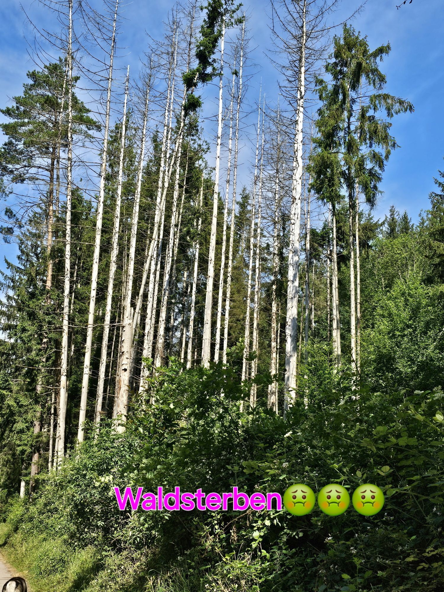
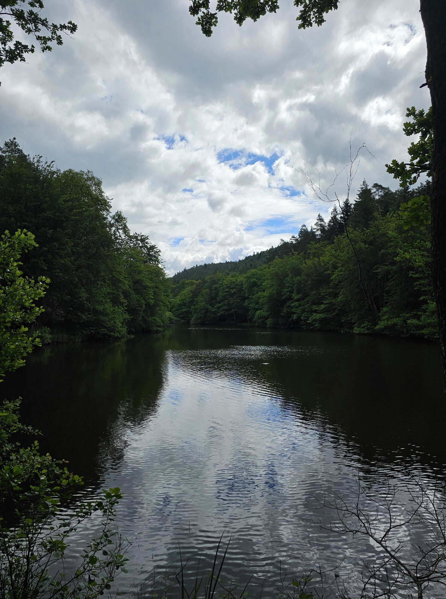
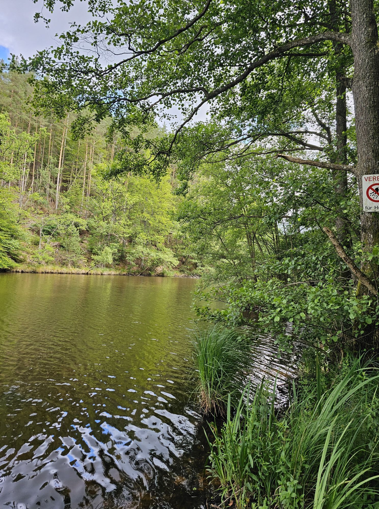
Photos de nos utilisateurs
Parcours
Oberschlettenbach
(250 m)
Village
0,1 km
Vorderweidenthal
(233 m)
Village
3,0 km
Bobenthal
(186 m)
Village
15,1 km
Landgasthof Zur Mühle
(183 m)
Restaurant
15,6 km
Bobenthal
(186 m)
Village
23,0 km
Niederschlettenbach
(190 m)
Village
26,4 km
Erlenbach bei Dahn
(207 m)
Village
29,8 km
Parcours
Oberschlettenbach - Vorderweidenthal - Lauterschwan - Landgasthof Zur Mühle
difficile
Vélo gravel
34,64
km
Oberschlettenbach
(250 m)
Village
0,1 km
Vorderweidenthal
(233 m)
Village
3,0 km
Lauterschwan
(251 m)
Village
6,7 km
Hedwigsbrunnen
(212 m)
Source
13,0 km
Bobenthal
(186 m)
Village
15,1 km
Landgasthof Zur Mühle
(183 m)
Restaurant
15,6 km
Landgasthof Zur Mühle
(183 m)
Restaurant
22,7 km
Bobenthal
(186 m)
Village
23,0 km
Altes Schulhaus
(189 m)
Restaurant
26,2 km
Niederschlettenbach
(190 m)
Village
26,4 km
Zum Berwartstein
(210 m)
Restaurant
29,6 km
Erlenbach bei Dahn
(207 m)
Village
29,8 km
Pirmasenser Brunnen
(228 m)
Source
30,6 km
Vorderweidenthal
(233 m)
Village
31,8 km
Oberschlettenbach
(250 m)
Village
34,5 km
Pas encore d'évaluation
Parcours populaires à proximité
-
4,8
Dahner Felsenpfad
moyenRandonnée 13,2 km -
4,0
Chemin des châteaux d'Annweiler
moyenRandonnée 7,72 km -
4,8
Lemberg - Salzwoog - Schwamborn-Quelle - Teufelstisch
moyenRandonnée 11,9 km -
4,8
Napoleon-Steig
moyenRandonnée 12,3 km -
4,5
Eschbach-Trifelsblick-Madenburg-Eschbach
facileRandonnée 9,37 km -
4,8
Wasigenstein und Zigeunerfelsen von Obersteinbach
Randonnée 10,6 km -
4,5
Schusterpfad
moyenRandonnée 16,4 km -
3,7
Dahn - Lachberg - Vogelsberg
moyenRandonnée 18,7 km -
4,5
Eyberg-Tour (Variante)
moyenRandonnée 11,4 km -
4,5
Vosges du Nord - Circuit des 4 châteaux
moyenRandonnée 6,49 km
Randonnée et suivi

Plus de 550.000 propositions de circuits, des cartes détaillées et un planificateur d'itinéraire intuitif font de cette application un must pour tous les passionnés de nature.

Ne manquez pas les offres et l'inspiration pour vos prochaines vacances
S'inscrire à la newsletter
Erreur
Une erreur s'est produite. Veuillez réessayer.
Merci pour votre inscription
Votre adresse électronique a été ajouté à la liste de diffusion.
Parcours en Europe
Autriche
Suisse
Allemagne
Italie
Slovénie
France
Pays-Bas
Belgique
Pologne
Liechtenstein
République tchèque
Slovaquie
Espagne
Croatie
Bosnie-Herzégovine
Luxembourg
Andorre
Portugal
Islande
Royaume-Uni
Irlande
Grèce
Albanie
Macédoine du Nord
Malte
Norvège
Monténégro
Moldavie
Kosovo
Hongrie
Saint-Marin
Roumanie
Estonie
Lettonie
Bélarus
Chypre
Lituanie
Serbie
Bulgarie
Monaco
Danemark
Suède
Finlande