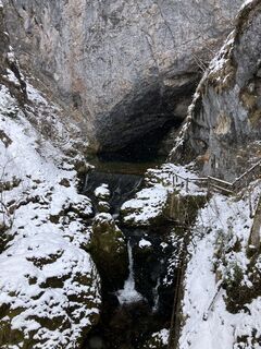
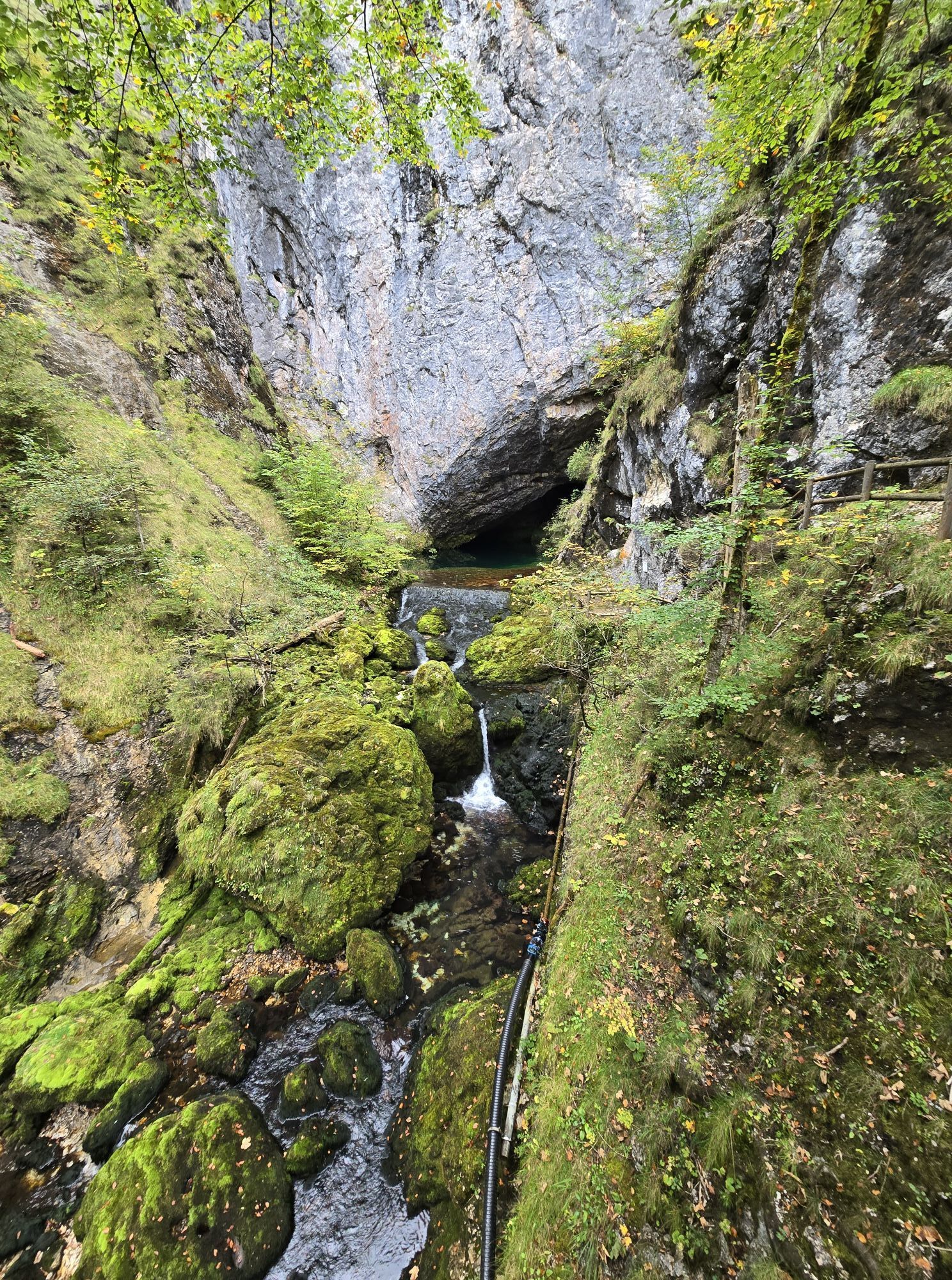
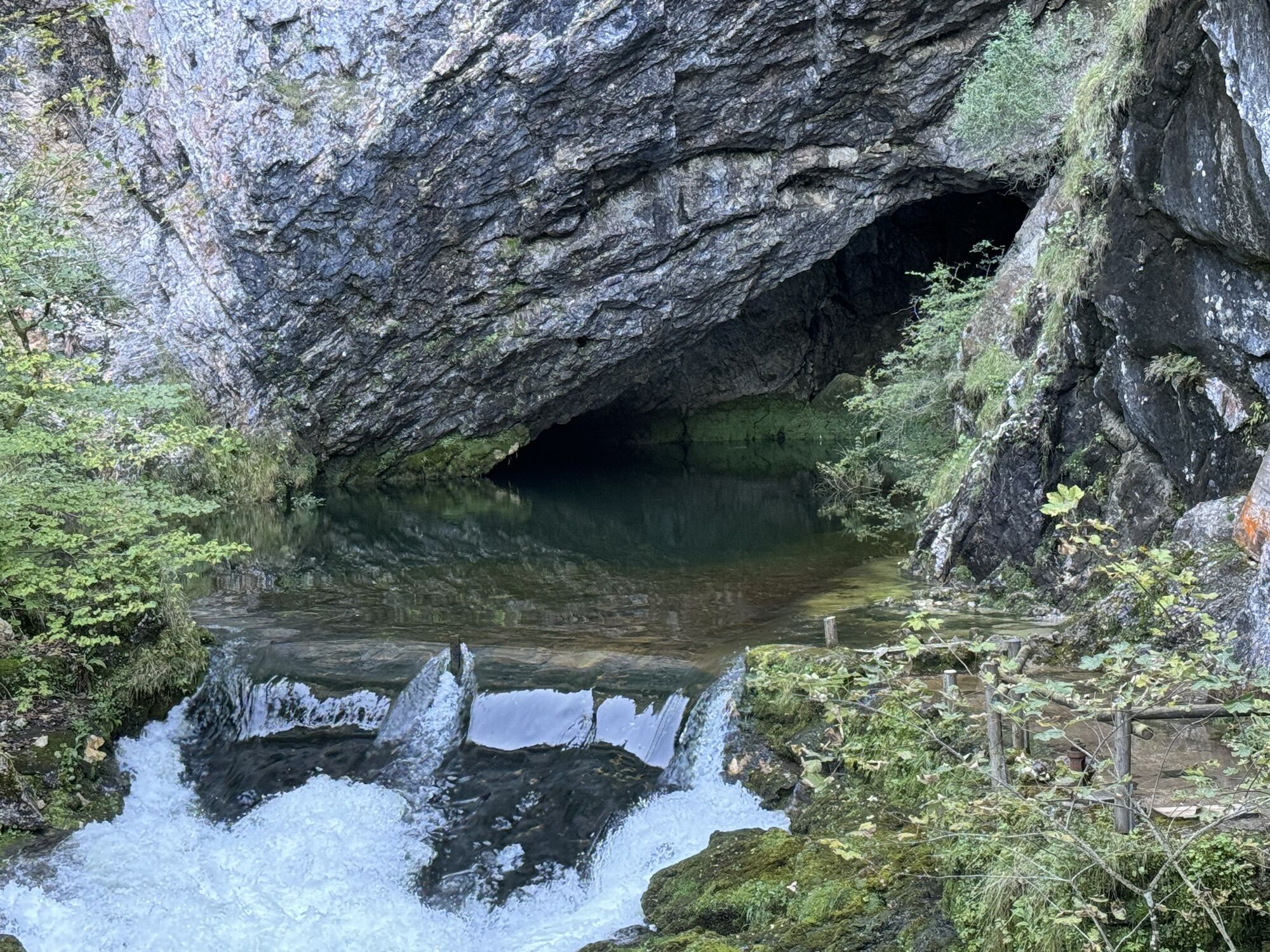
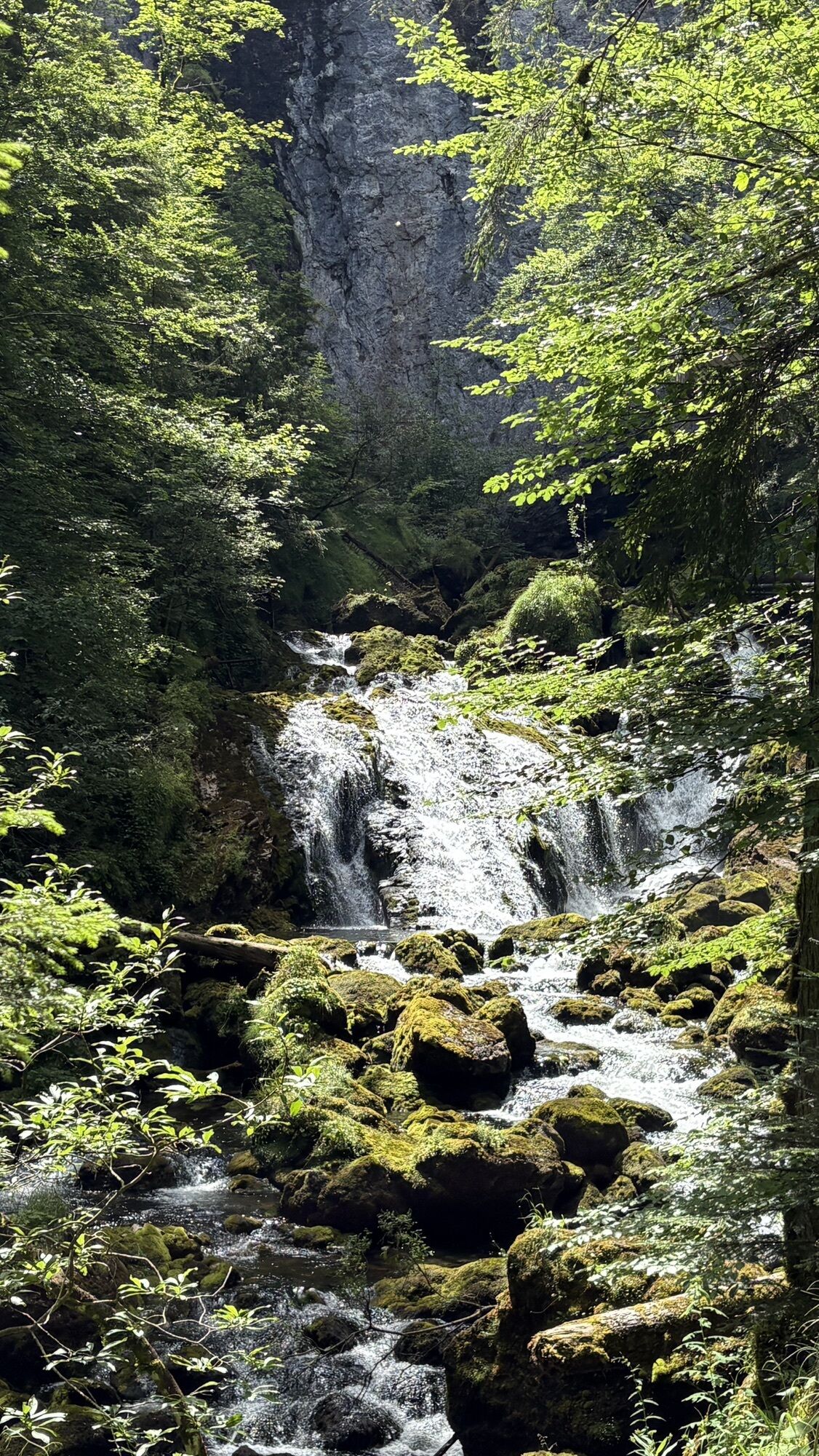
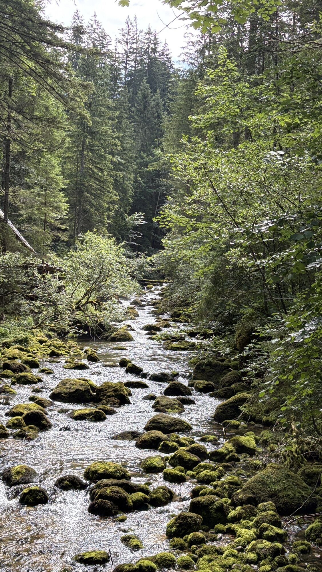
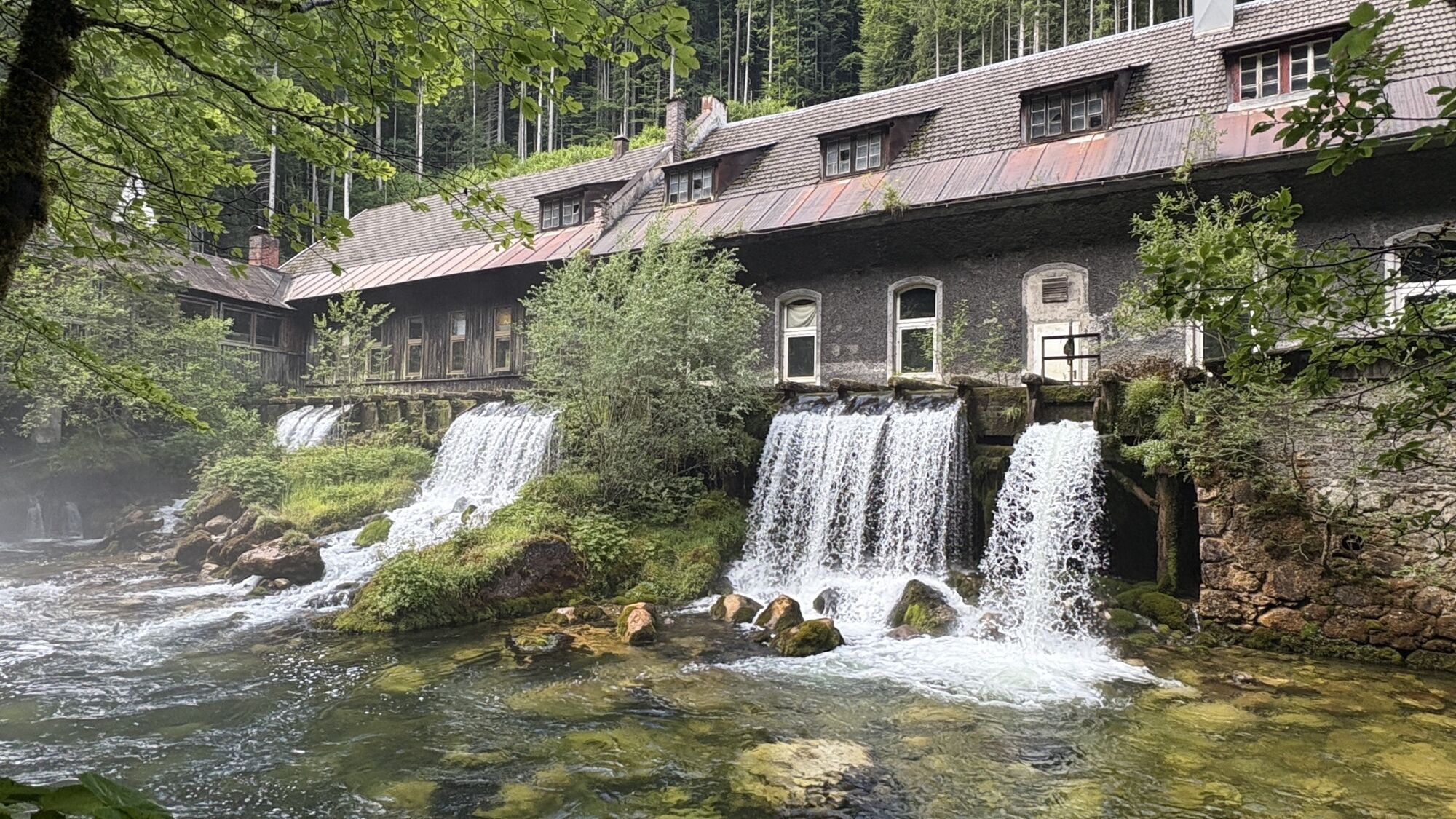
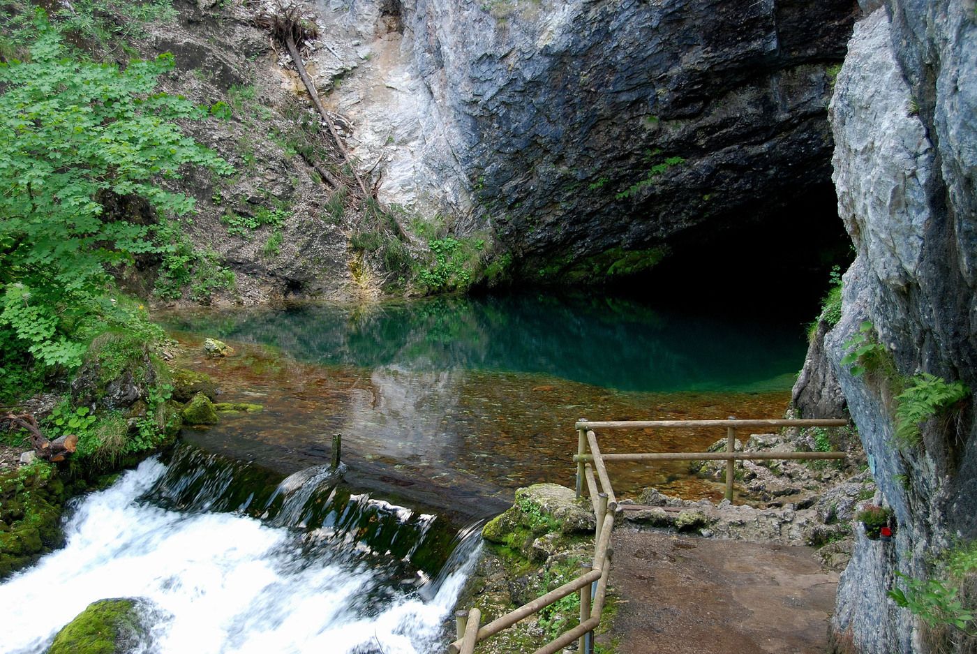
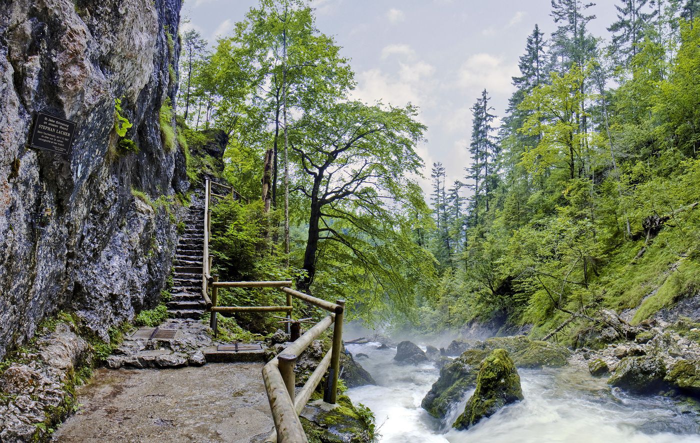
Pießling Ursprung
Randonnée 4,6
Naviguer
Naviguer
Télécharge cette visite sur ton portable
Pießling Ursprung
Randonnée
1,13
km
Scanner le code QR et commencer la navigation dans l'application bergfex

Randonnée & tracking


Pießling Ursprung
Randonnée 4,6
Distance
1,13
km
Durée
01:30
h
Ascension
175
m
Altitude
684 -
950
m
Téléchargement de la piste
Pießling Ursprung
Randonnée
1,13
km
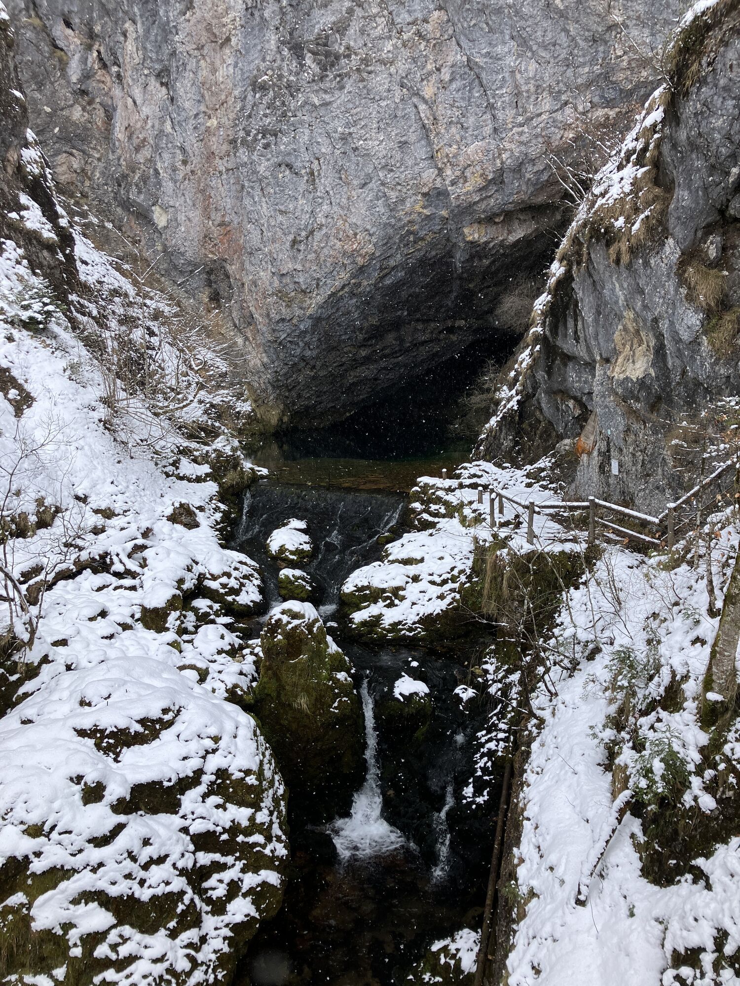
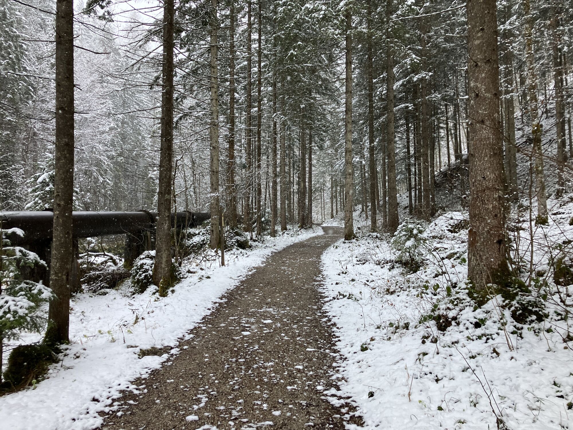
Photos de nos utilisateurs
 © VladiCréé le 31.03.2026
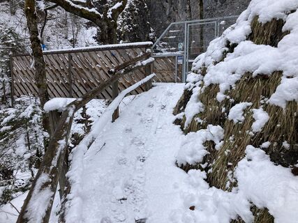 © VladiCréé le 31.03.2026
 © VladiCréé le 31.03.2026
 © VladiCréé le 31.03.2026
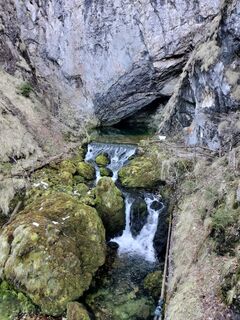
 © NIKOLAOS ASLANIDISCréé le 07.03.2026
 © NIKOLAOS ASLANIDISCréé le 07.03.2026
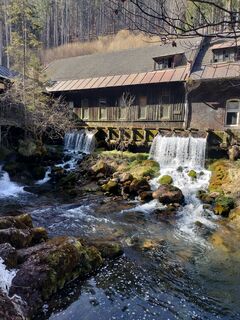 © NIKOLAOS ASLANIDISCréé le 07.03.2026
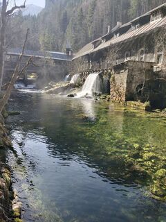 © NIKOLAOS ASLANIDISCréé le 07.03.2026
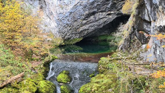
 © Doris und Stefan KarlingerCréé le 19.10.2025
 © enipeus 65Créé le 28.09.2025
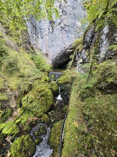 © enipeus 65Créé le 28.09.2025
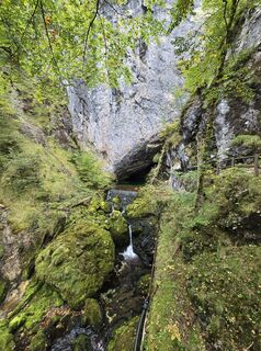 © enipeus 65Créé le 28.09.2025
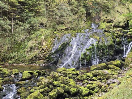 © enipeus 65Créé le 28.09.2025
 © enipeus 65Créé le 28.09.2025
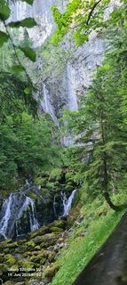
 © Waldmeister1955Créé le 19.06.2025
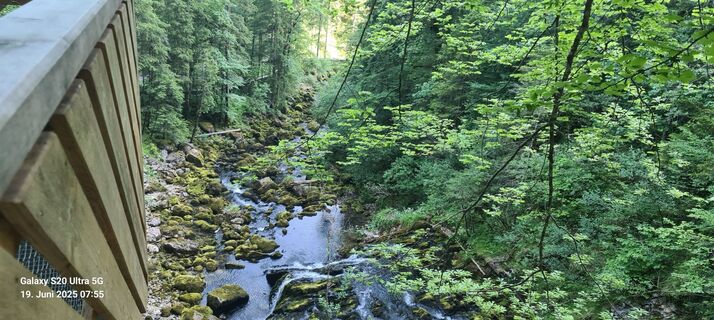 © Waldmeister1955Créé le 19.06.2025
 © Michael KoglerCréé le 04.01.2025
 © ClaudiaCréé le 21.09.2024
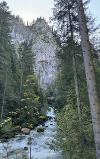 © ClaudiaCréé le 21.09.2024
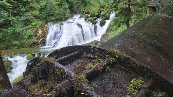
 © Eric StoklassaCréé le 04.08.2023
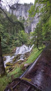 © Eric StoklassaCréé le 04.08.2023
 © Astrid K.Créé le 13.07.2025
 © Astrid K.Créé le 13.07.2025
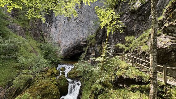 © Astrid K.Créé le 13.07.2025
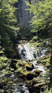 © Astrid K.Créé le 13.07.2025
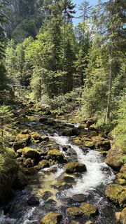 © Astrid K.Créé le 13.07.2025
 © Astrid K.Créé le 13.07.2025
 © Astrid K.Créé le 13.07.2025
 © Astrid K.Créé le 13.07.2025


Weg-Nummer: 19
Gehzeit: 3/4 Std.
Schwierigkeitsgrad: blau
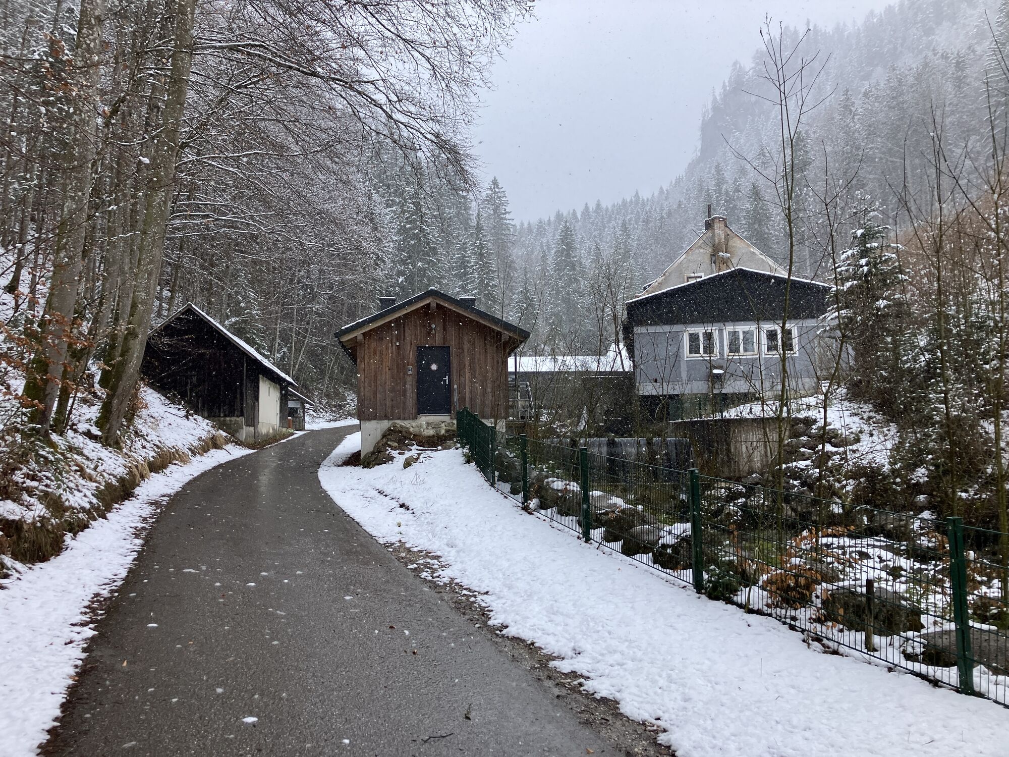
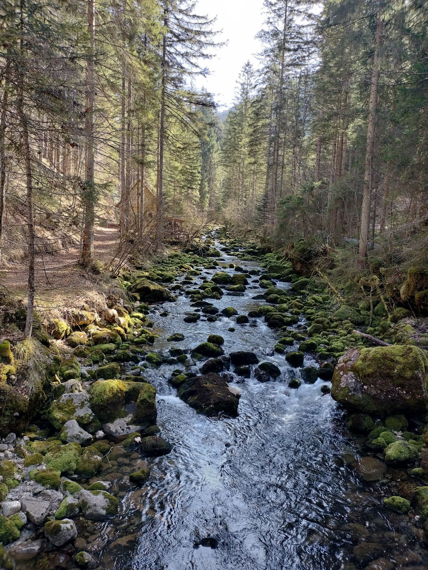
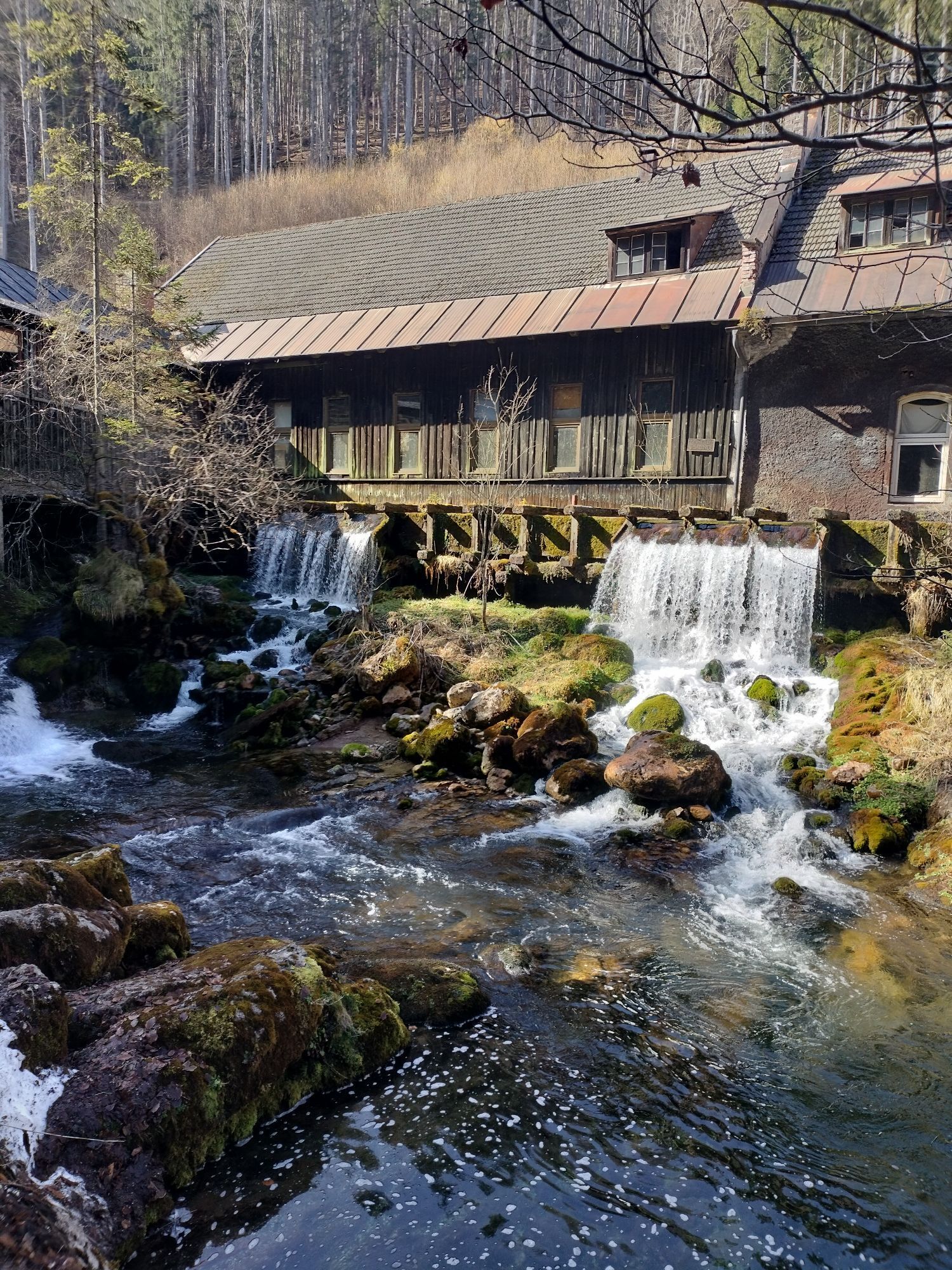
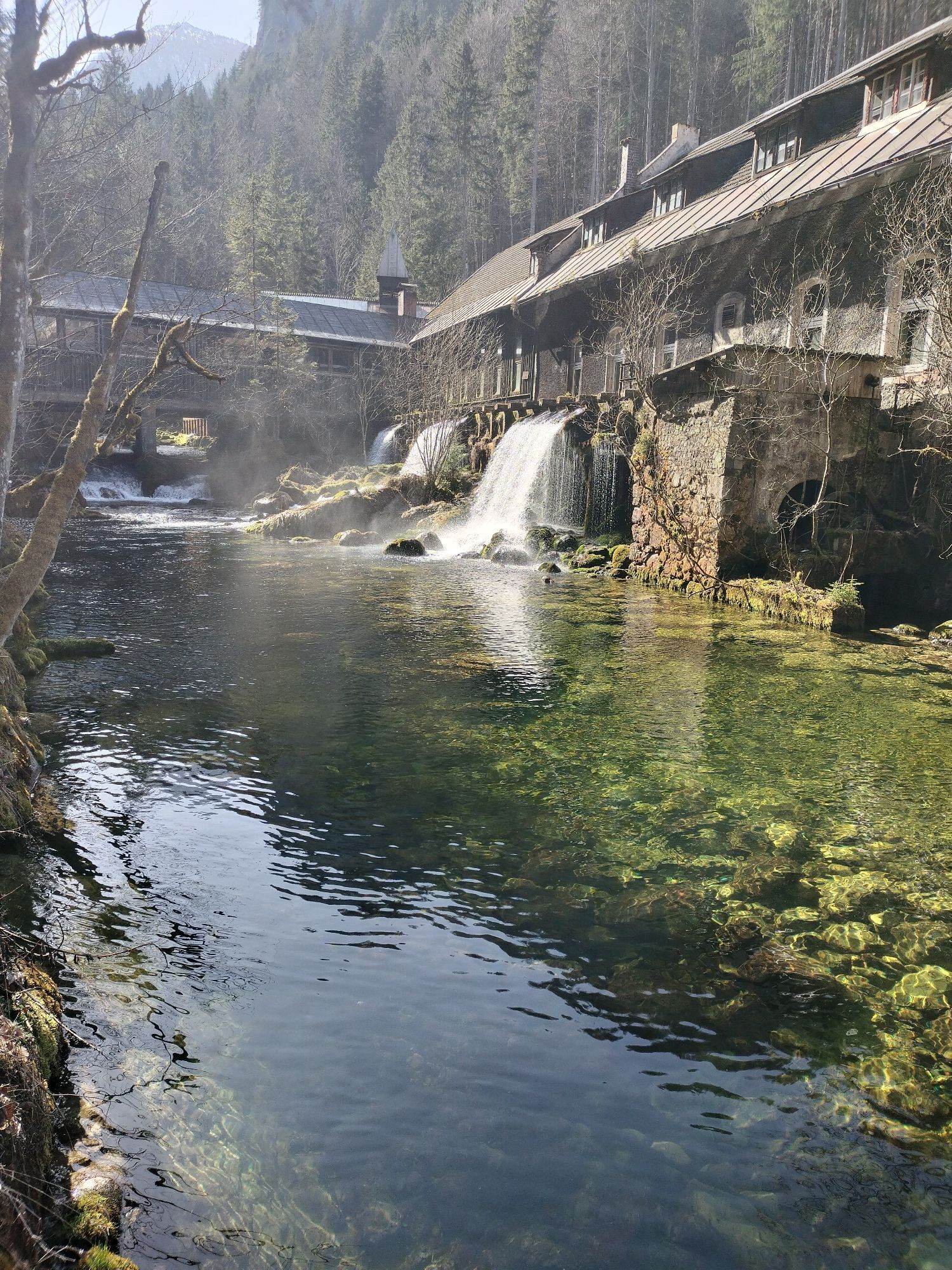
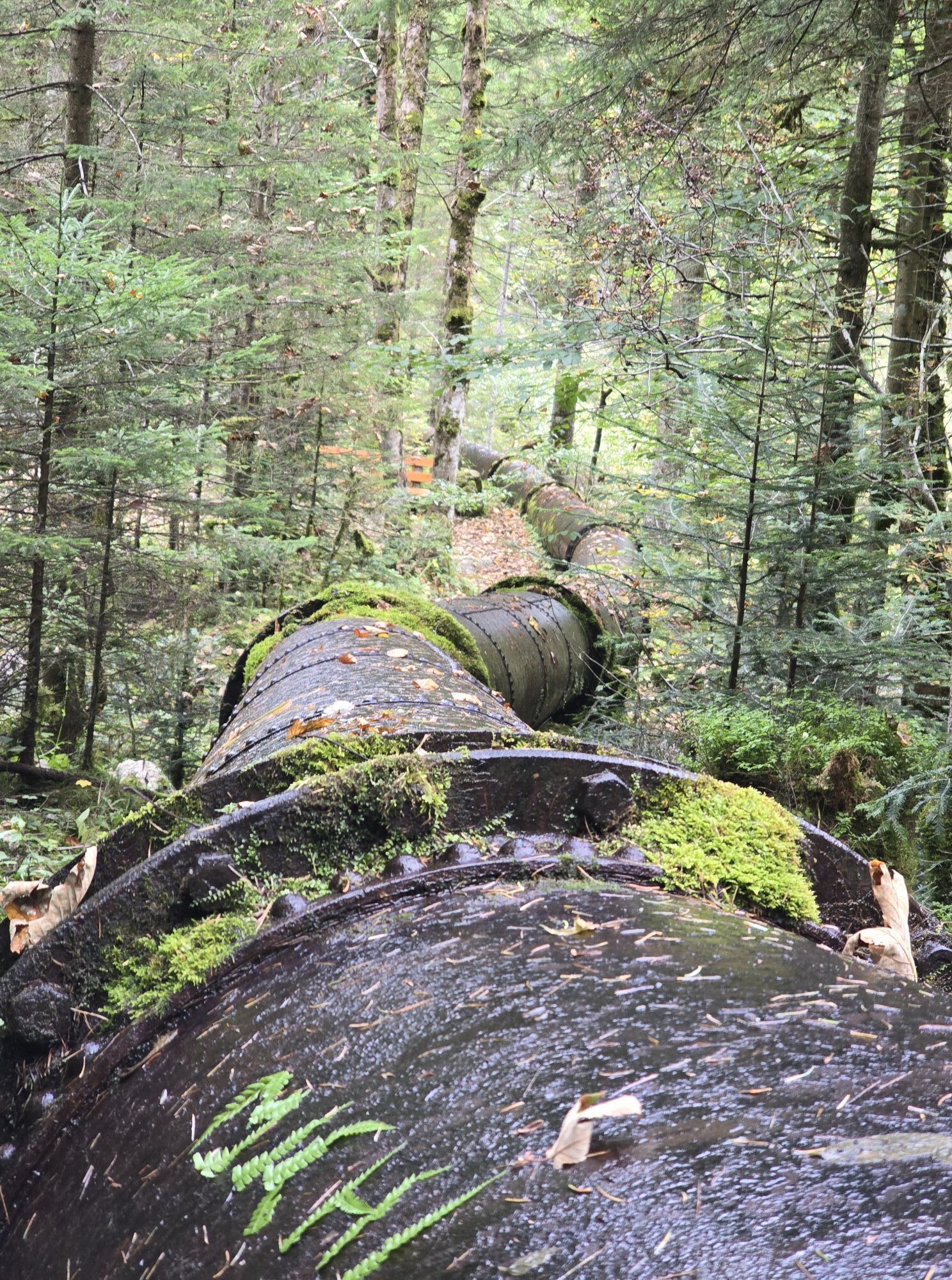
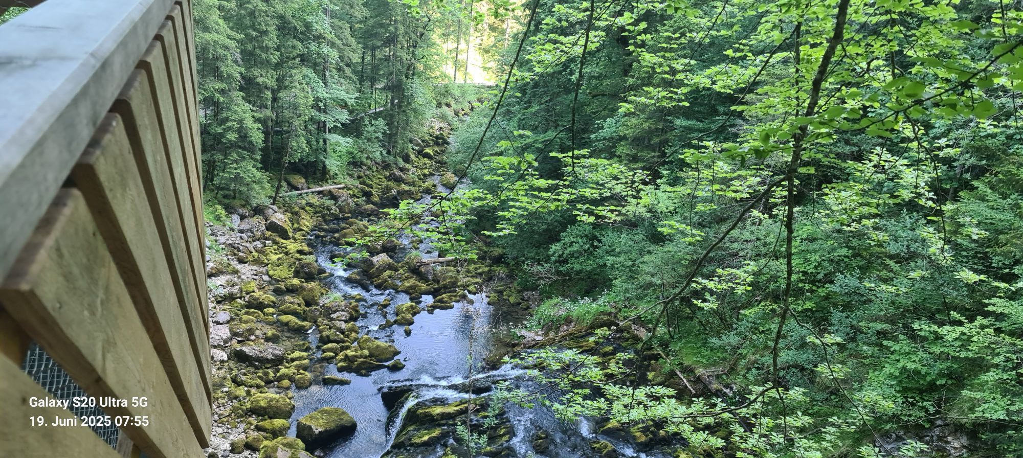
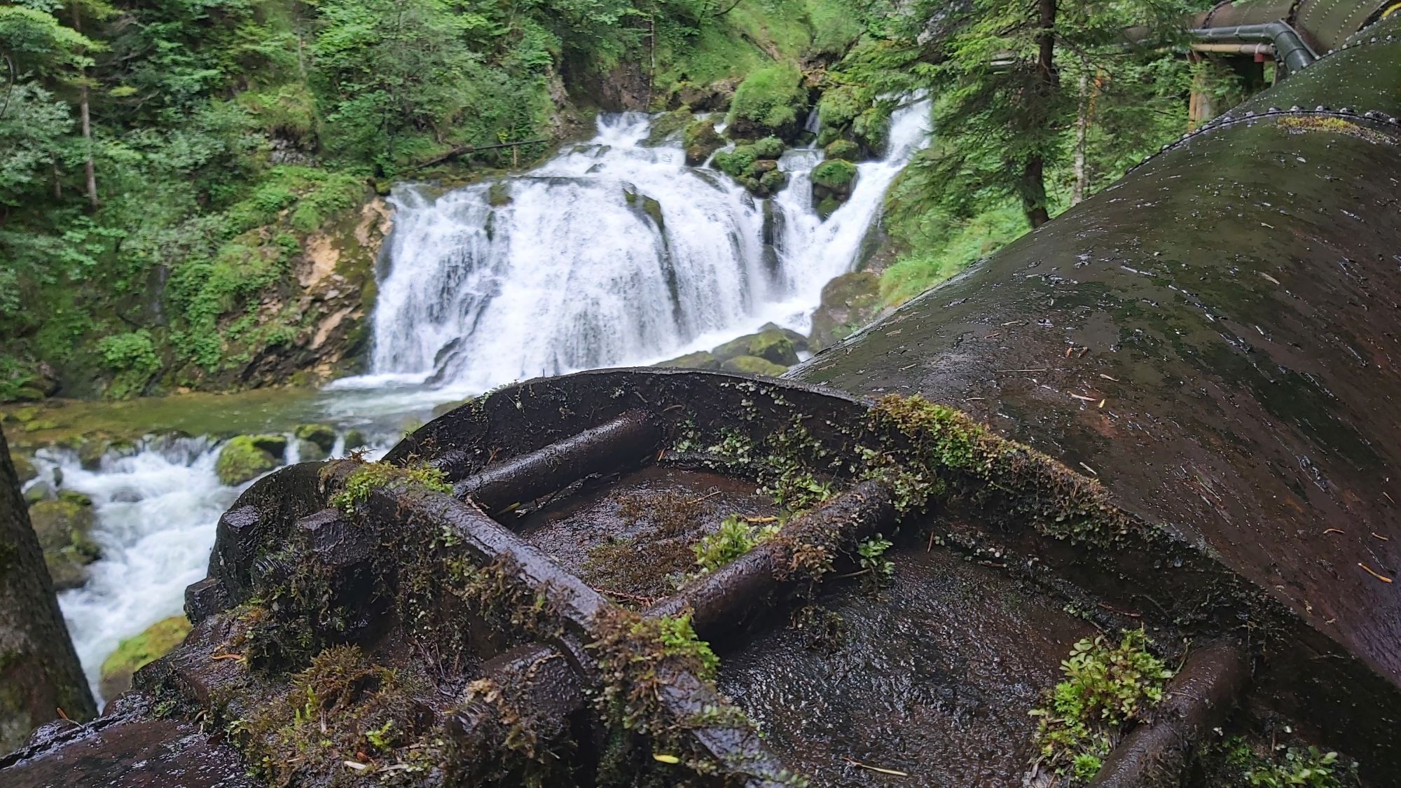
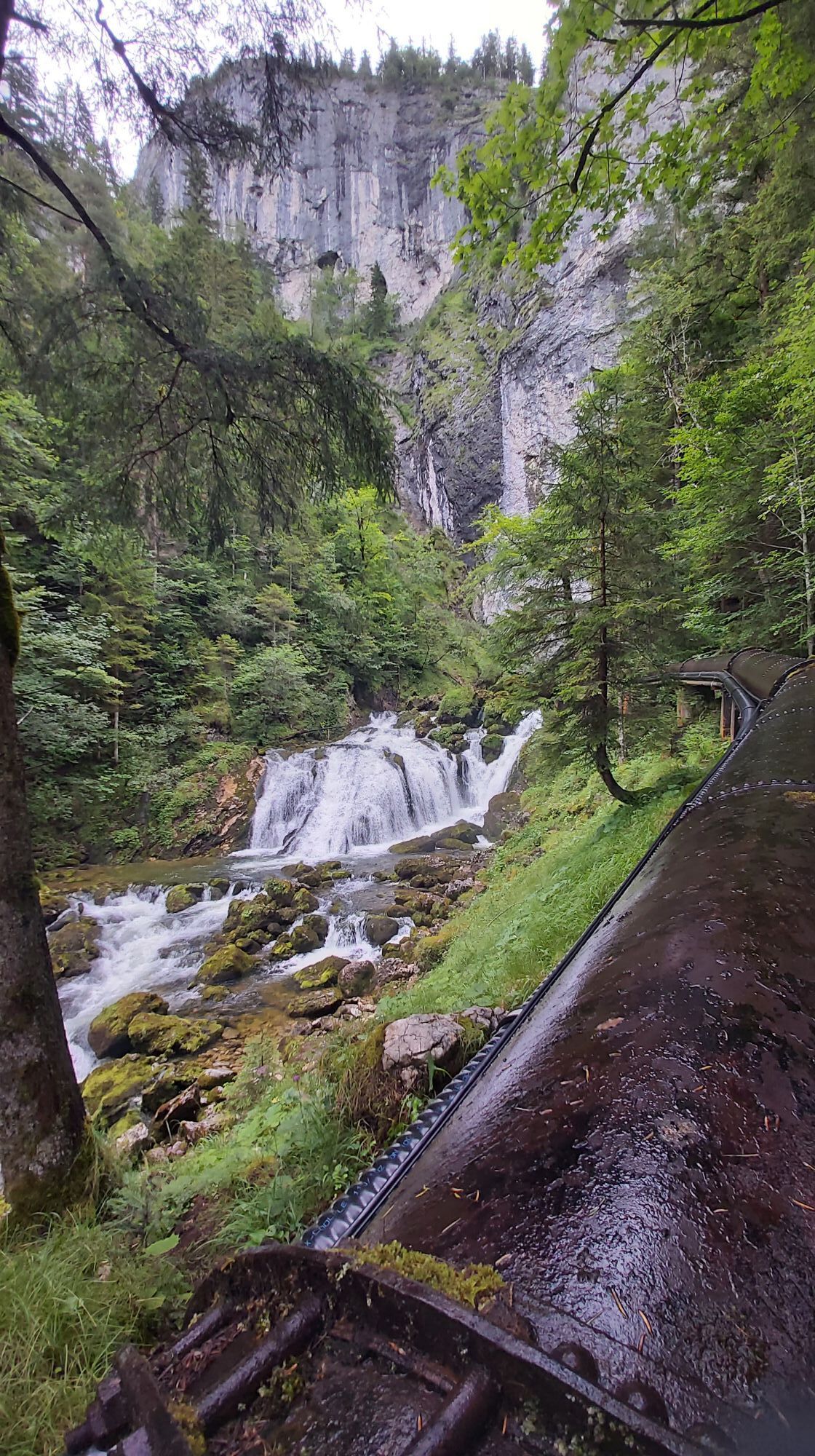
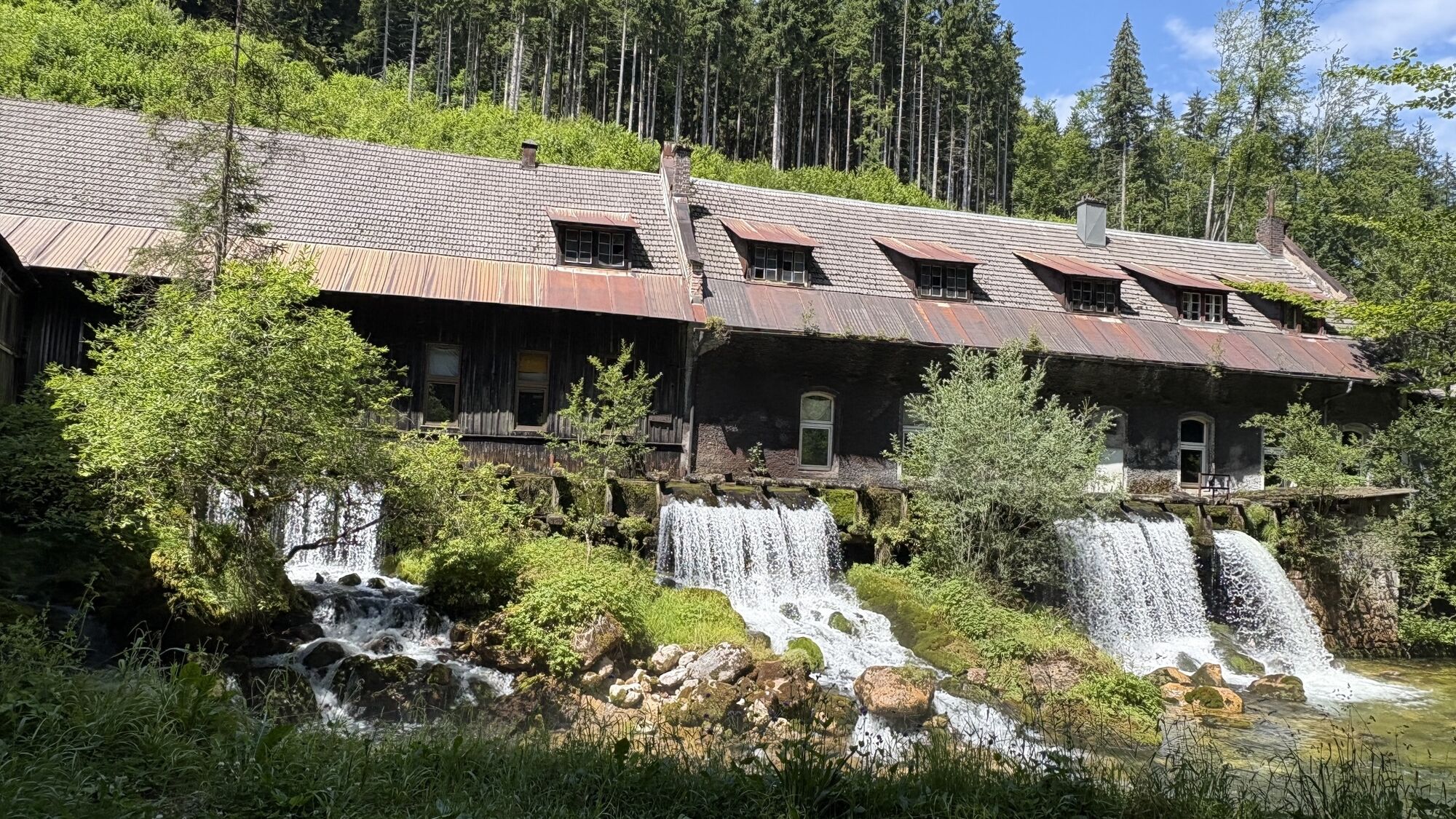
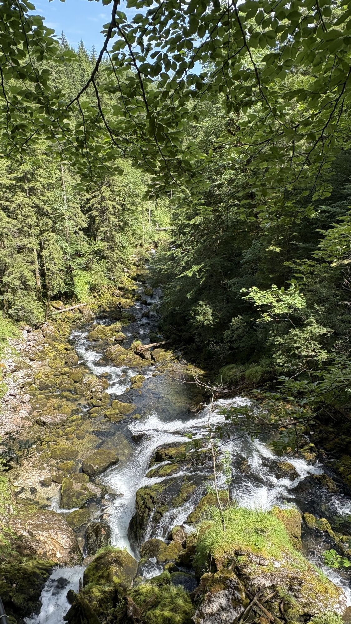
GH Sengsschmied in Roßleithen (Bushaltestelle) - Sensenwerk - linkes Bachufer - Brücke - Pießling-Ursprung; geeignet auch für Kinderwägen.
Parcours
Roßleithen
(687 m)
Village
0,0 km
Gasthof zum Sengsschmied
(694 m)
Restaurant
0,0 km
Parcours
Pießling Ursprung
Randonnée
1,13
km
Roßleithen
(687 m)
Village
0,0 km
Gasthof zum Sengsschmied
(694 m)
Restaurant
0,0 km

Informations sur l'itinéraire
Repos et restauration
GH Sengsschmied
Cartes
Wanderkarte Pyhrn-Priel erhätlich in allen Pyhrn-Priel Tourismusbüros!
Zone forestière
Oui
Informations sur l'itinéraire
Itinéraire
Mit dem Bus: GH Sengsschmied in Roßleithen (Bushaltestelle).
Mit dem Auto: Abfahrt Roßleithen-Windischgarsten links - gleich nach Bäckerei Grillneder rechts - Ortszentrum Roßleithen - GH Sengsschmied (Parkplatz)
Évaluations
5
(7)
4
(2)
3
(1)
2
(0)
1
(0)
Parcours populaires à proximité
- 5,0
RundWanderWelt Hinterstoder - Polsterlucken-Runde
Randonnée 3,94 km - 4,4
Spital am Pyhrn: Wurzeralm - Dümlerhütte - Rote Wand
moyenRandonnée 10,1 km - 4,3
Wurzeralm NaturErlebnisWelt - 2 Millionen Jahren in 2 Stunden
Randonnée 6,09 km - 4,9
Nazogel und Angerkogel
moyenRandonnée 10,9 km - 4,7
Bergwanderung auf den Spering
moyenRandonnée 7,50 km - 4,2
Rund um den Gleinkersee
Randonnée 1,70 km - 3,9
Dr. Vogelgesang-Klamm
facileRandonnée 2,67 km - 4,5
Von der Bosruckhütte auf den Großen Pyhrgas
difficileRandonnée 9,57 km - 4,0
Hinterstoder - Großer Priel
difficileRandonnée 10,7 km - 4,0
Vorderstoder - Zellerhütte
moyenRandonnée 11,1 km
Randonnée et suivi

Plus de 550.000 propositions de circuits, des cartes détaillées et un planificateur d'itinéraire intuitif font de cette application un must pour tous les passionnés de nature.

Ne manquez pas les offres et l'inspiration pour vos prochaines vacances
S'inscrire à la newsletter
Erreur
Une erreur s'est produite. Veuillez réessayer.Merci pour votre inscription
Votre adresse électronique a été ajouté à la liste de diffusion.
Parcours en Europe
Autriche Suisse Allemagne Italie Slovénie France Pays-Bas Belgique Pologne Liechtenstein République tchèque Slovaquie Espagne Croatie Bosnie-Herzégovine Luxembourg Andorre Portugal Islande Royaume-Uni Irlande Grèce Albanie Macédoine du Nord Malte Norvège Monténégro Moldavie Kosovo Hongrie Saint-Marin Roumanie Estonie Lettonie Bélarus Chypre Lituanie Serbie Bulgarie Monaco Danemark Suède Finlande