


Welterbesteig Wachau 07 : Aggsbach Markt-Emmersdorf (parc naturel Jauerling-Wachau)
Welterbesteig Wachau : De Aggsbach Markt à Emmersdorf
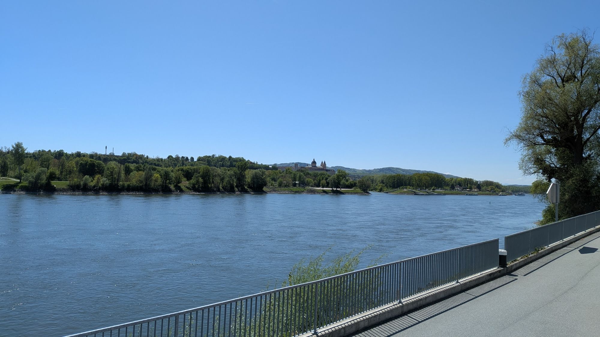
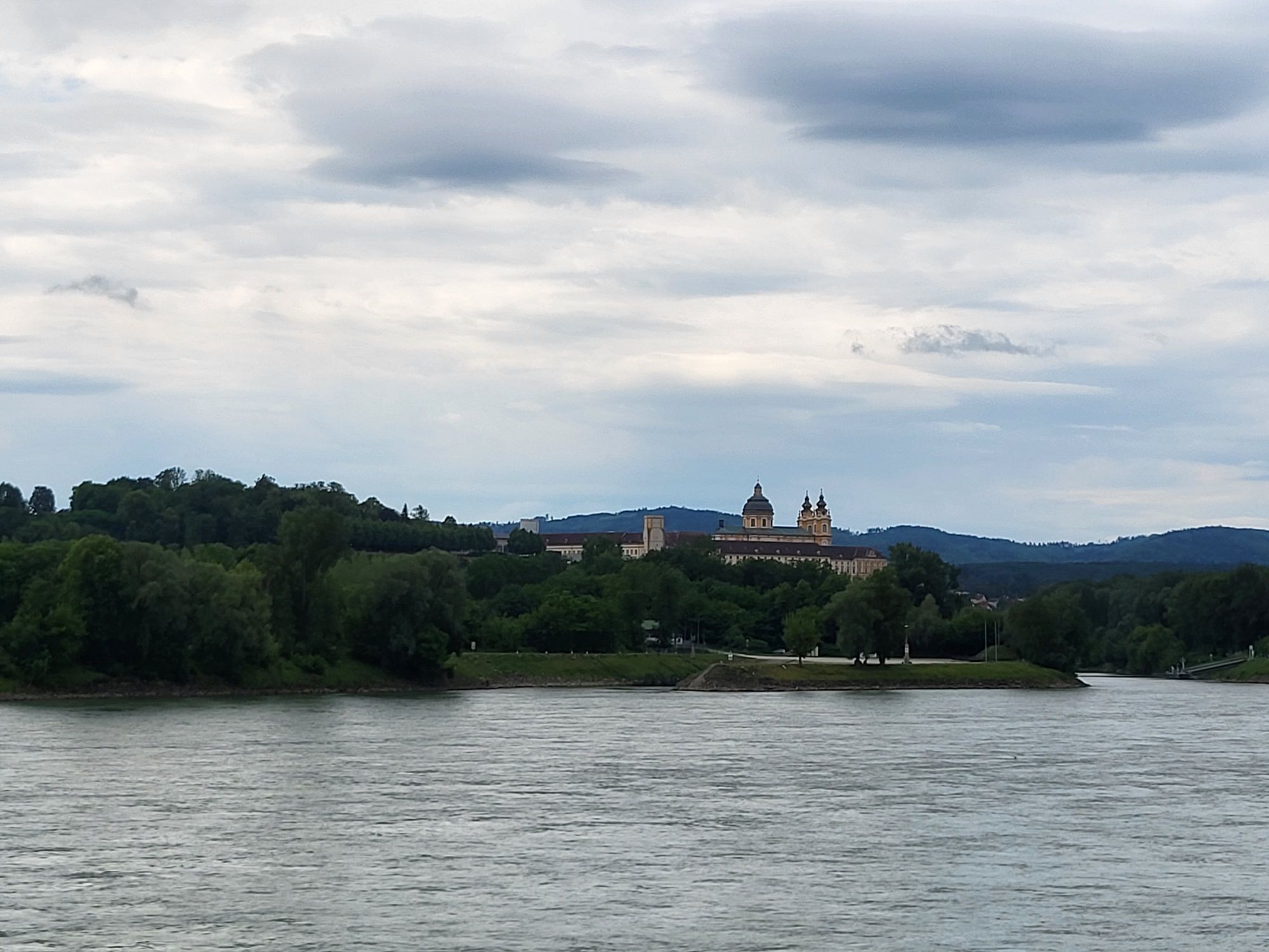
L'étape de Aggsbach Markt à Emmersdorf relie des paysages forestiers et vallonnés paisibles à des paysages culturels impressionnants le long du Danube....
Welterbesteig Wachau : De Aggsbach Markt à Emmersdorf
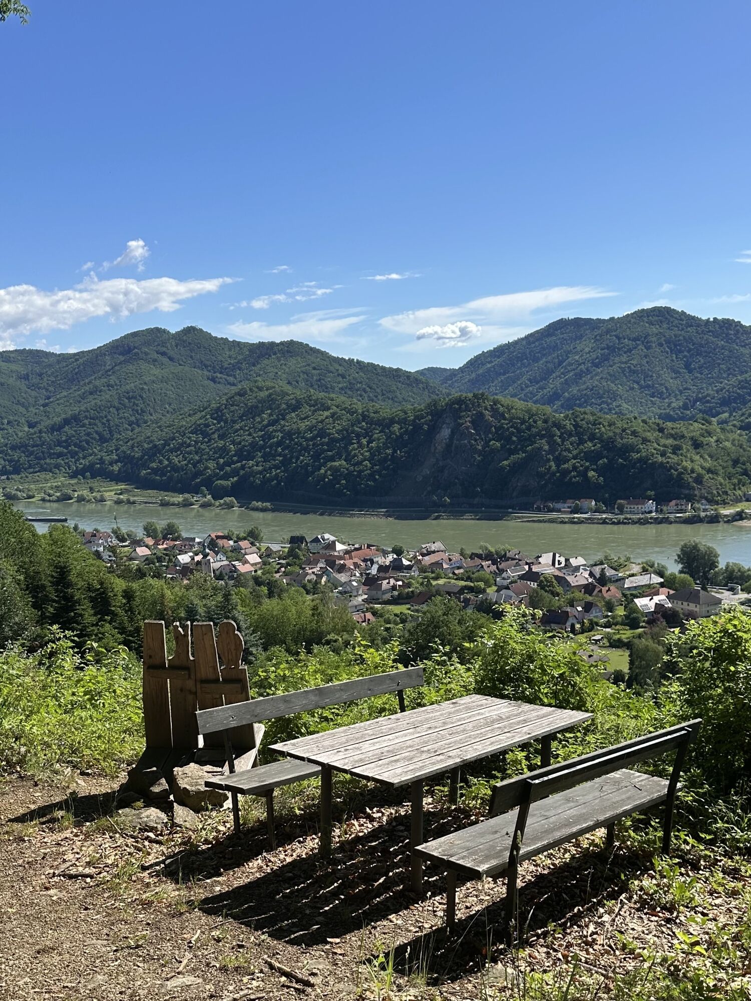
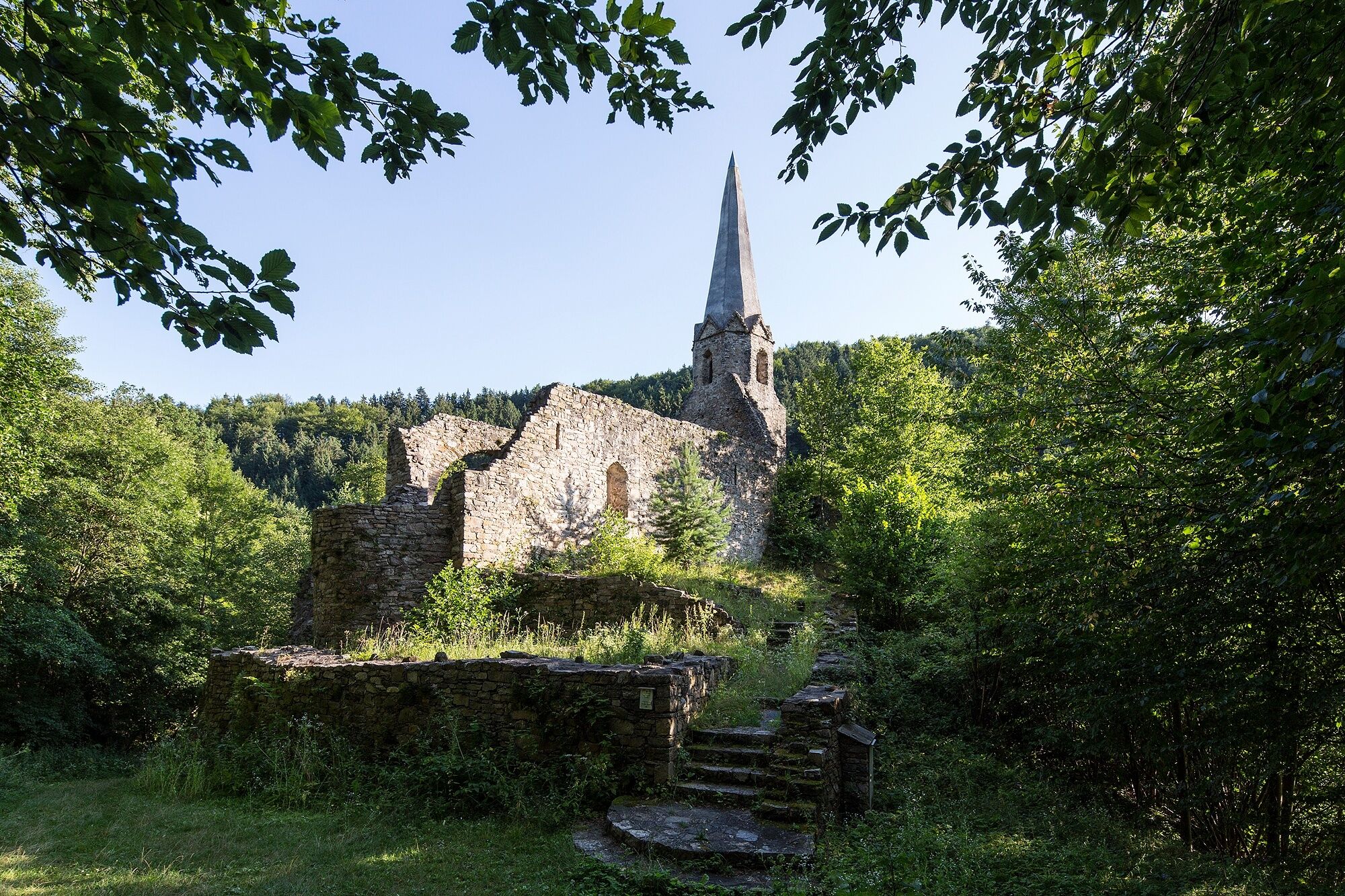
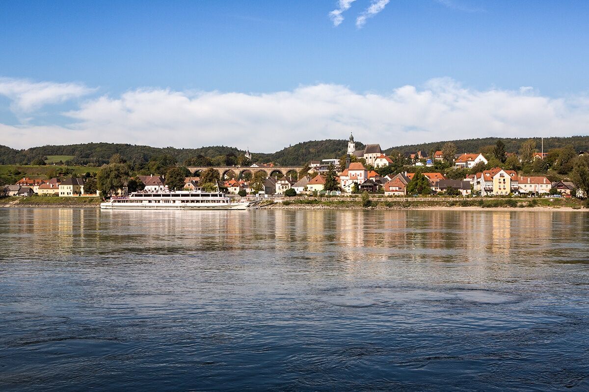
L'étape de Aggsbach Markt à Emmersdorf relie des paysages forestiers et vallonnés paisibles à des paysages culturels impressionnants le long du Danube. Sur des chemins variés, l'itinéraire mène au sommet de l'Edelberg puis vers le plateau de Bärenreut, qui offre de larges vues sur les environs. Le chemin poursuit son cours à travers les localités de Zintring et Felbring jusqu'aux ruines du château de Gossam, un point historique marquant de cette étape.
Ensuite, la route suit le sentier historique du facteur postal en descendant vers Mödelsdorf. Un ancien chemin marchand conduit finalement à la ville de la Renaissance d'Emmersdorf sur le Danube, où cette étape du Welterbesteig Wachau se termine dans une atmosphère détendue.
En randonnée sur le Welterbesteig Wachau, on comprend pas à pas pourquoi la Wachau a été désignée région du patrimoine mondial de l'UNESCO. Le long des sites soigneusement sélectionnés du patrimoine mondial, se dévoilent les points forts caractéristiques du patrimoine - l'interaction entre le paysage culturel historique, la viticulture traditionnelle, des espaces naturels exceptionnels et le Danube en tant qu'élément formateur.
Grâce à de bonnes liaisons ferroviaires, l'arrivée détendue et durable dans la Wachau est facilement possible. Dans la région, un réseau dense de transports publics garantit que toutes les étapes peuvent être facilement atteintes en bus, train, ferries et bateaux. Cela permet également de combiner différentes étapes très simplement.
Le Welterbesteig Wachau est en outre récompensé par le label de qualité autrichien de la randonnée. Cette certification symbolise des normes élevées en matière de cheminement, signalisation, sécurité et infrastructure, confirmant le Welterbesteig comme une offre de randonnée fiable et de qualité au cœur du patrimoine mondial de l'UNESCO.
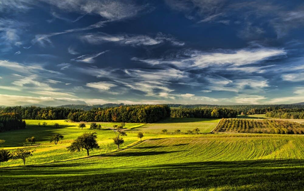
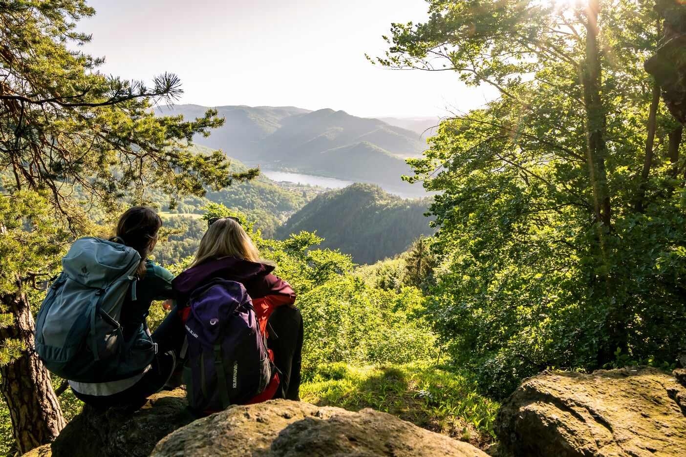
À la place du marché dans l'ancien village viticole d'Aggsbach Markt, nous tournons à gauche et montons immédiatement à droite au heuriger Kurz. Nous traversons les voies de chemin de fer du Wachaubahn et montons à gauche vers l'Edelberg. Par un beau chemin forestier, notre chemin continue jusqu'au Glatzberg culminant à 482 m. Depuis Glatzberg, nous montons constamment vers le plateau de Bärenreut. Ici, nous profitons de la belle vue sur le Jauerling et Maria Laach, avant de suivre le chemin marchand jusqu'à Zintring avec son clocher remarquable. Dans le hameau, nous croisons le sentier circulaire du Jauerling. À la dernière maison, nous tournons à gauche et traversons la vallée du Grimsingbach pour arriver à Felbring à la maison d'hôtes Waldruhe (point de tampon, mais la maison d'hôtes est fermée !).
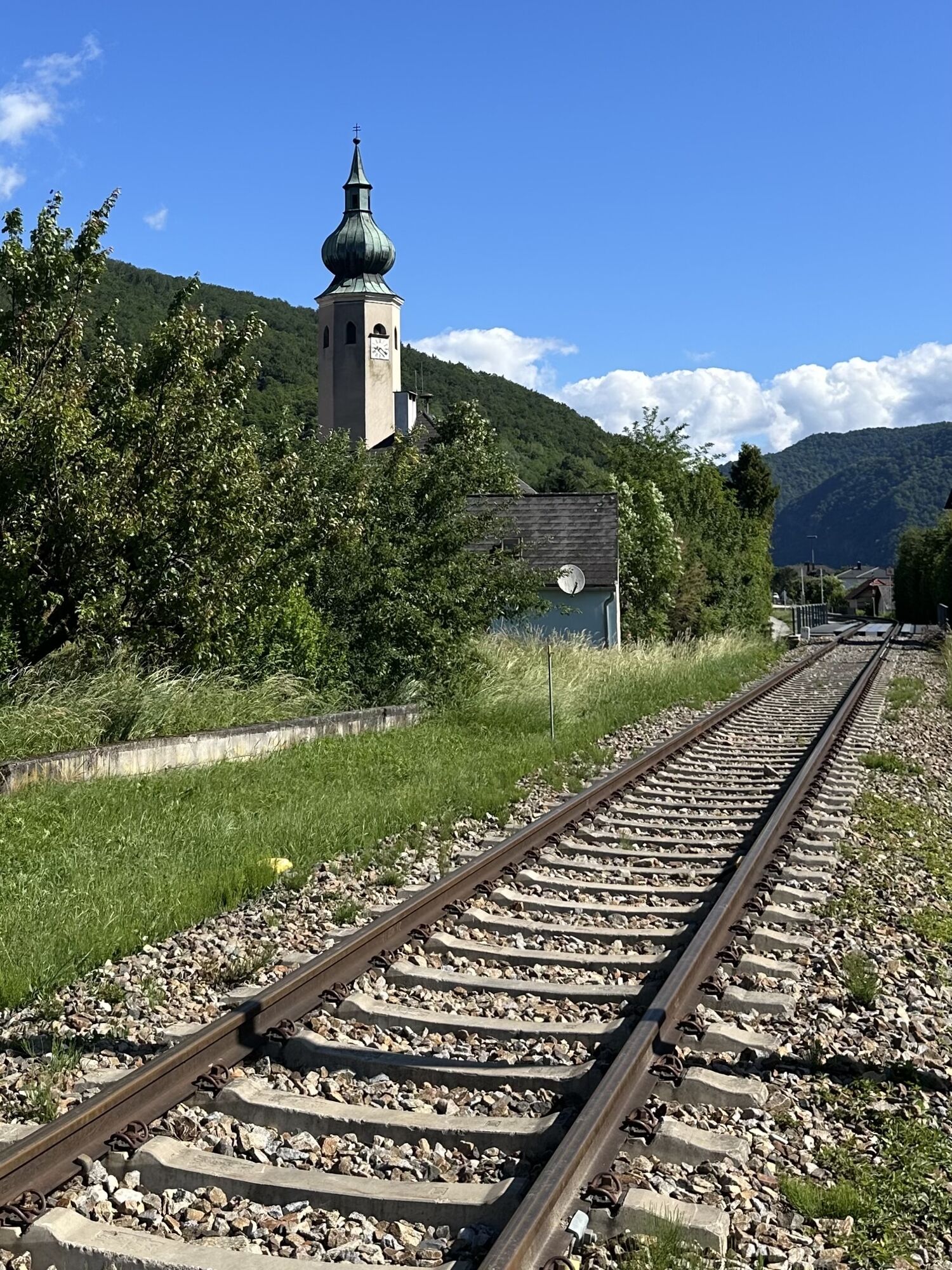
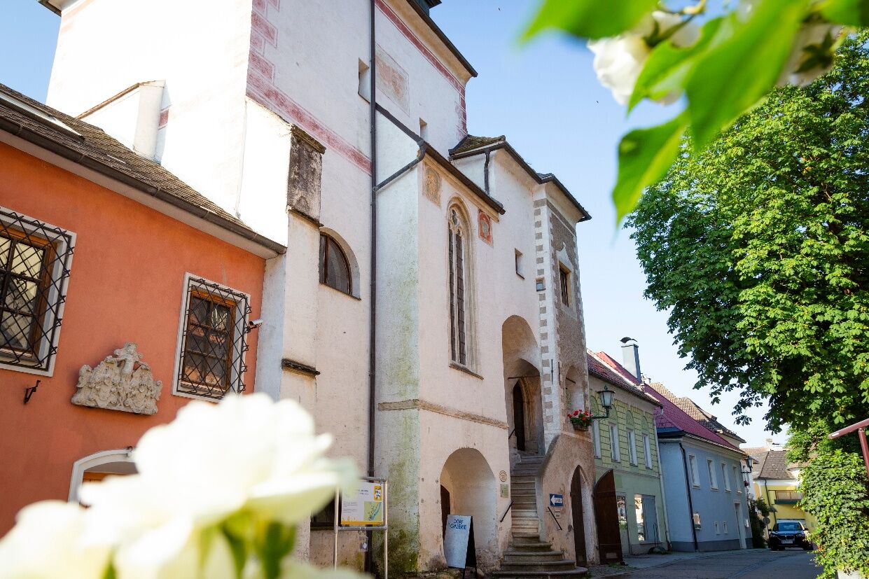
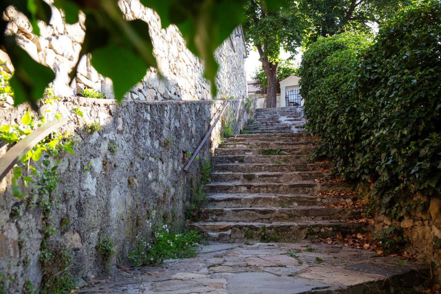
Après avoir traversé la route principale, nous tournons à gauche et recroisons le sentier circulaire du Jauerling. À travers une plantation de sapins de Noël, notre chemin continue en forêt en descente jusqu'au Käfermühle et au ruisseau de Felbring, que nous traversons. Pour une excursion intéressante jusqu'à la chapelle du château de Gossam, nous suivons la route vers la gauche. Après une minute, nous atteignons les ruines avec la pittoresque chapelle du château, qui invite à une pause agréable. De retour à Käfermühle, nous passons à gauche de la maison et suivons le sentier historique du facteur postal jusqu'au hameau de Mödelsdorf. Après la fin de la localité, nous tournons à gauche sur un chemin marchand qui nous conduit à la ville Renaissance et ancienne ville viticole d'Emmersdorf (actuellement il n'y a pas de viticulture autour d'Emmersdorf). En ville, nous tournons à gauche vers l'église fortifiée St. Nikolaus, qui invite à la visite. Ensuite, nous suivons la bifurcation vers la gare et descendons par l'escalier Kolomani. Au pied de l'escalier, nous atteignons la rue du marché avec ses bâtiments Renaissance et la chapelle Marie-Madeleine, où notre étape se termine.
Chaussures de randonnée solides, protection contre la pluie, boissons et ravitaillement suffisants ainsi qu'une carte de randonnée de la Wachau et un calendrier des vins nouveaux. Vous trouverez une liste d'équipement sur www.welterbesteig.at dans la rubrique Service/Conseils.
Numéro d'urgence de la protection en montagne Wachau : 140
A1 jusqu'à la sortie Melk, puis continuer sur la B3a et la B3 jusqu'à Aggsbach Markt ou Emmersdorf
Les localités sont accessibles sept jours sur sept par les transports publics. Le retour au point de départ de la randonnée est possible.
Sur la rive nord de la Wachau, la ligne de bus 715 circule entre Krems-Spitz-Emmersdorf-Melk ou Melk-Emmersdorf-Spitz-Krems. www.vor.at
Le train Wachau circule uniquement les week-ends et jours fériés de fin mars à fin octobre, ainsi que tous les jours de juillet à septembre : www.wachaubahn.at
Des stations de location de vélos Nextbike se trouvent à Aggsbach Markt et Emmersdorf, www.nextbike.at
Au camping ou à la salle Venus en face à Aggsbach Markt ou au parking près des quais d'embarquement à Emmersdorf
Comme lieu de restauration et d'hébergement, nous recommandons les établissements Best of Wachau : www.bestof-wachau.at. Les établissements Best of Wachau se trouvent à Emmersdorf.
Autres possibilités de restauration :
Café-Pub Donauwelle, Aggsbach Markt : ouvert toute l'année, tél. 02712/373.
Le point de tampon se trouve à Felbring.
À Emmersdorf, plusieurs auberges sont ouvertes toute l'année.
Un heuriger se trouve à Aggsbach Markt : Fam. Kurz. Tél. 0676/473 07 29. À Willendorf, il y a aussi l'heuriger Rudolf Schrutz, tél. 02712/543
Veuillez consulter le calendrier actuel des heuriger.
Pour une planification simple et confortable des tours, l'application Wachau-Nibelungengau-Kremstal est recommandée. Téléchargez facilement pour Androidou iPhone.
Activités le long du parcours

Aggsbach, Niederösterreich/Österreich
16.06.2026 – Randonnée
Aggsbach Markt, Niederösterreich/Österreich
06.06.2026 – Faire du vélo
Aggsbach Markt, Niederösterreich/Österreich
18.05.2026 – Randonnée2026 05 07 Welterbesteig 7 mit Su
07.05.2026 – Randonnée
Aggsbach Markt, Niederösterreich/Österreich
25.04.2026 – RandonnéeAggsbach, Niederösterreich/Österreich
12.11.2025 – Randonnée
Parcours populaires à proximité
- 4,5
Welterbesteig Wachau 03: Weißenkirchen-Spitz
facileChemin de Grande Randonnée 10,4 km - 4,5
Maria Langegg - Rote Wand - Hoher Stein - Kastlkreuz
moyenRandonnée 11,4 km - 4,5
Seekopf und Hirschwand
moyenRandonnée 2,83 km - 3,9
Spitz a. d. Donau Jauerling Schwallenbach retour 16.04.2016
moyenRandonnée 20 km - 3,9
Spitz - Buchberg - Runde
moyenRandonnée 9,60 km - 4,5
Welterbesteig Wachau 08: Emmersdorf-Melk
facileChemin de Grande Randonnée 9,90 km - 4,0
Rote Wand und Hoher Stein
moyenRandonnée 7,80 km - 4,4
St. Michael - Buschandlwand - Runde
moyenRandonnée 10,6 km - 4,4
AGGSTEIN Ruine, Aggstein, Druidentürme und zurück 20241019
moyenRandonnée 7,50 km - 4,6
Welterbesteig Wachau 06: Maria Laach-Aggsbach Markt (Naturpark Jauerling-Wachau)
facileChemin de Grande Randonnée 7,04 km
Randonnée et suivi


Ne manquez pas les offres et l'inspiration pour vos prochaines vacances
Votre adresse électronique a été ajouté à la liste de diffusion.