


Forest & Vine Route
The Forest & Vine Route can be started in all seven municipalities of the Manhartsberg region. Starting in Eggenburg (station/train avenue), it first follows the Manhartsberg Cycle Path southwards and...
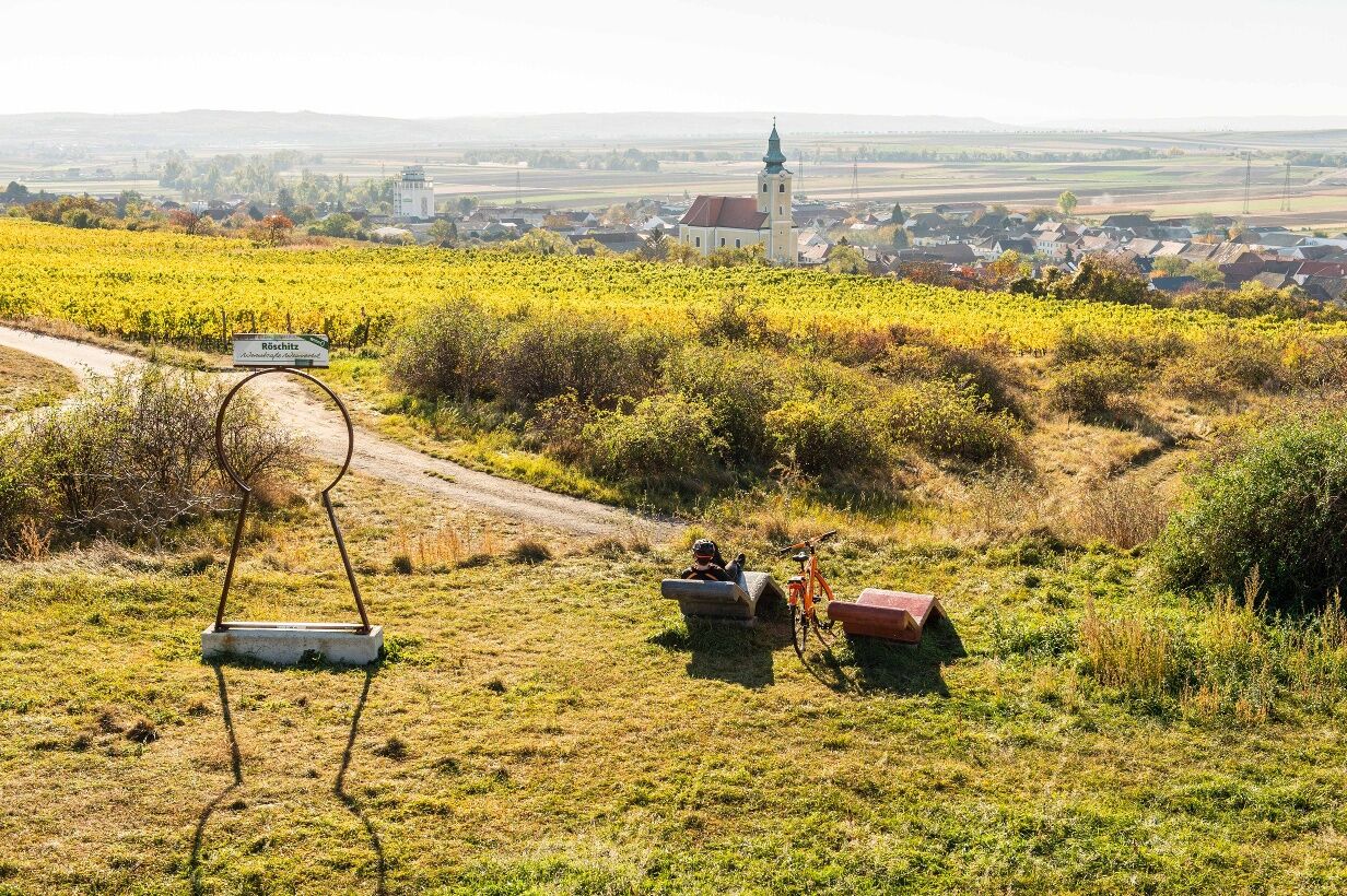
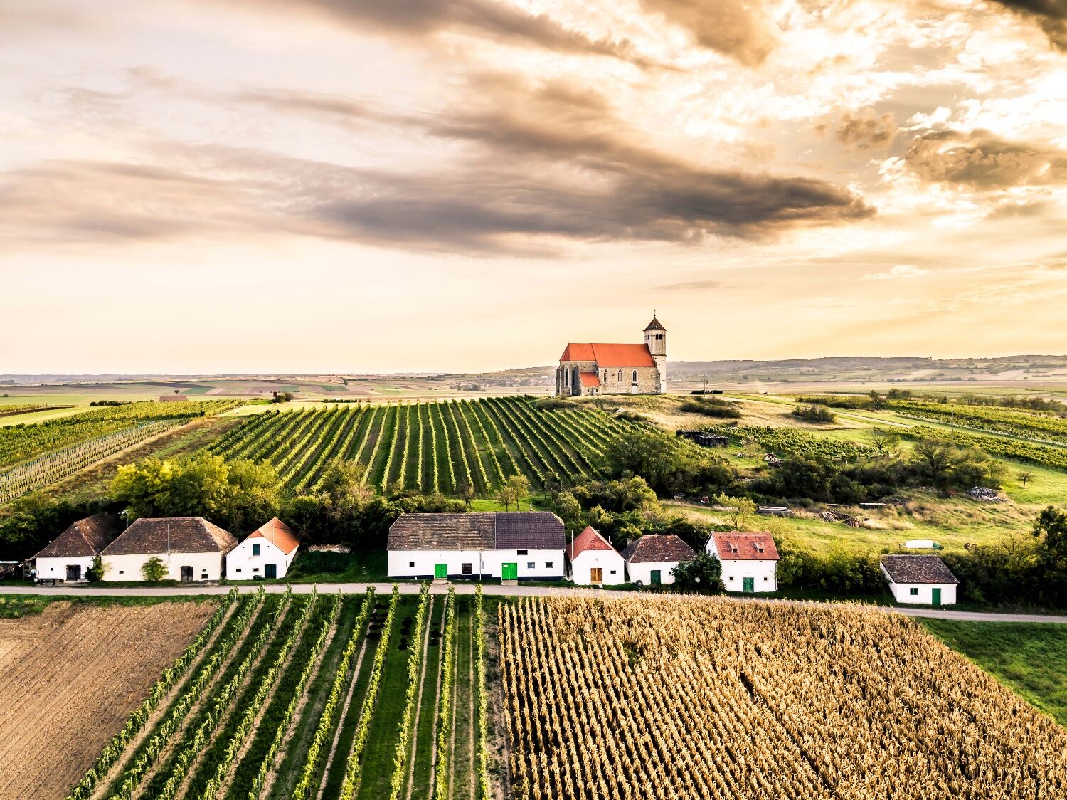
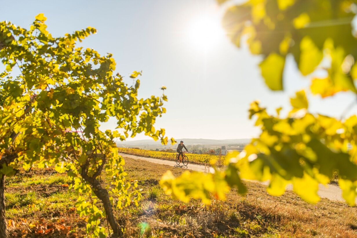
<p>The Forest & Vine Route can be started in all seven municipalities of the Manhartsberg region. Starting in Eggenburg (station/train avenue), it first follows the Manhartsberg Cycle Path southwards and leads over Zogelsdorf and Burgschleinitz to Maissau. From Maissau (intersection Sonndorfer Street/Horner Street), it follows the Amethyst Cycle Path via Unterdürnbach to Limberg. In Limberg (intersection Kleinstraße/Main Street), it heads north over the Dragonfly Pond near the Limberg quarry and the Straninger Au to Straning. From there it continues via Etzmannsdorf (past a cyclist's rest) and Grafenberg to Wartberg to the viewpoint at Wartberg Church Hill with a wonderful view over the region and a cyclist's rest at the foot of the church hill. From Wartberg, the route goes further north to Klein-Reinprechtsdorf (cyclist's rest with drinks), where it follows the Riesling Cycle Path from the intersection with the local street to Röschitz (intersection Schulgasse/Lange Zeile). From then on it continues north along the Weinviertel DAC Cycle Path through Röschitz to the cyclist's rest Ried Reipersberg. From there, the route goes northwest through the vineyards to Feldberg and again southwards via Roggendorf, Klein-Jetzelsdorf and Kattau to Sigmundsherberg. From the intersection Bahnstraße/Kleinmeiseldorferstraße in Sigmundsherberg, the route follows the Manhartsberg Cycle Path again via Kleinmeiseldorf and Engelsdorf back to the starting point in Eggenburg (station/train avenue).</p><p>Points of interest (among others): numerous viewpoints with information about landscape features, Burg Burgschleinitz, churches, museums, Zogelsdorf demonstration quarry, medieval Eggenburg with Krahulez Museum, lavender show garden Unterdürnbach and Amethyst World Maissau.</p><p>Along the "Forest & Vine Route," one of the three "Climate Change Cycle Routes" of the KLAR Region Horn (Climate Change Adaptation Model Region) has also been implemented. In addition to the sights in the region, specially designated climate change points can be visited. At these points, the effects of climate change are visible or measures are shown that have already been implemented to adapt to climate change in the region. All climate change points are described on the website of the KLAR Region Horn: www.klar-horn.at/massnahmen/massnahme-9/</p><p>The route offers two shortcut options:</p><p>* Eggenburg (intersection Horner Street/Archduke Karl Ring) - Stoitzendorf - Klein-Reinprechtsdorf (= section of the Riesling Cycle Path)</p><p>* Burgschleinitz - Straning</p>

<p>Eggenburg - Zogelsdorf - Burgschleinitz - Maissau - Unterdürnbach - Straning - Etzmannsdorf - Grafenberg - Wartberg - Klein-Reinprechtsdorf - Röschitz - Roggendorf - Klein-Jetzelsdorf - Kattau - Sigmundsherberg - Kleinmeiseldorf - Engelsdorf - Eggenburg</p>
Verantwortlicher für den Inhalt dieser Tour
Waldviertel Tourismus
Letzte Aktualisierung: 28.10.2025
Parcours populaires à proximité
-
4,4
DAC Radtour-Weinviertel
moyenFaire du vélo 55,1 km -
4,1
»tut gut« Wanderweg Pulkau | Route 2
moyenRandonnée 7,29 km -
4,3
Gars am Kamp, Hirschbachrunde , Schimmelsprung und retour nach Unwetter 2024 Niederösterreich/Österreich
moyenRandonnée 8,91 km -
3,5
Pierre & vin
moyenRandonnée 10,8 km -
Zum Gipfel des Manhartsbergs
facileRandonnée 17,6 km -
4,8
Von Mühlbach am Manhartsberg zur Krotenmühle
facileRandonnée 3,17 km -
5,0
Eggenburg und Kogelsteine
facileRandonnée 8,25 km -
4,5
Bergrunde
moyenRandonnée 5,18 km -
3,0
Tobelbach-Runde
facileRandonnée 10 km -
5,0
Parcours géologique
moyenRandonnée 11,4 km
Randonnée et suivi


Ne manquez pas les offres et l'inspiration pour vos prochaines vacances
Votre adresse électronique a été ajouté à la liste de diffusion.