


From Nova Gorica to Mt Škabrijel
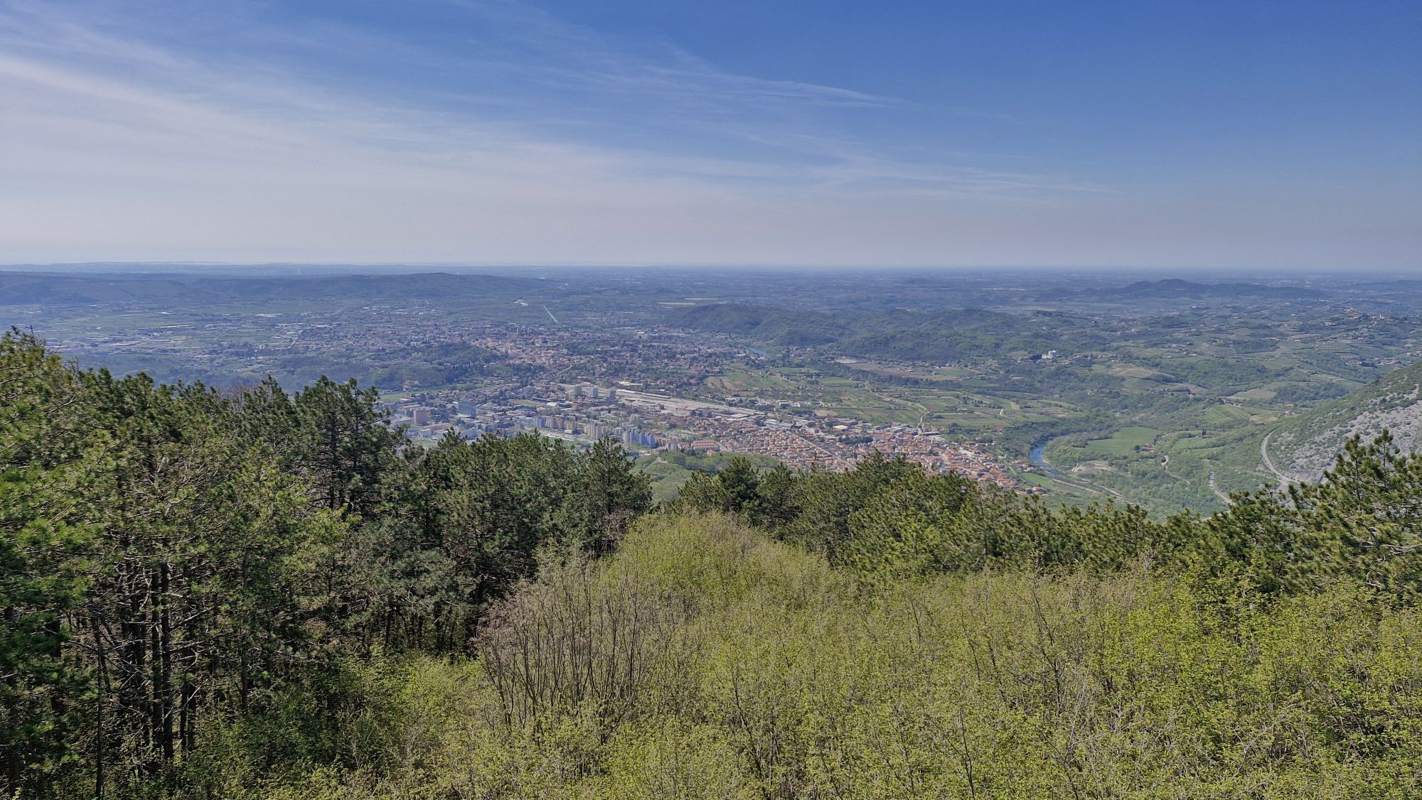
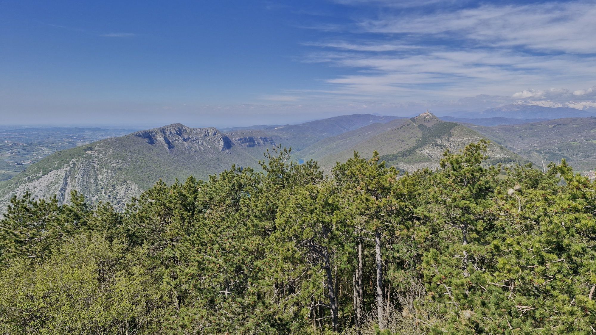
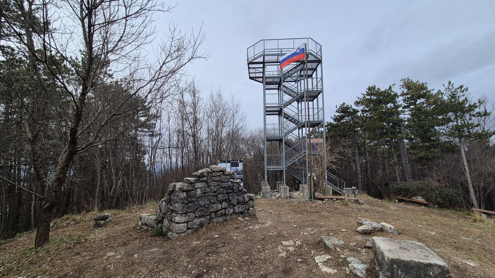


Starting in the centre of Nova Gorica, before long the route runs through vineyards and past several vantage points to the top of Mt Škabrijel. There, you can climb the lookout tower and take in the views...
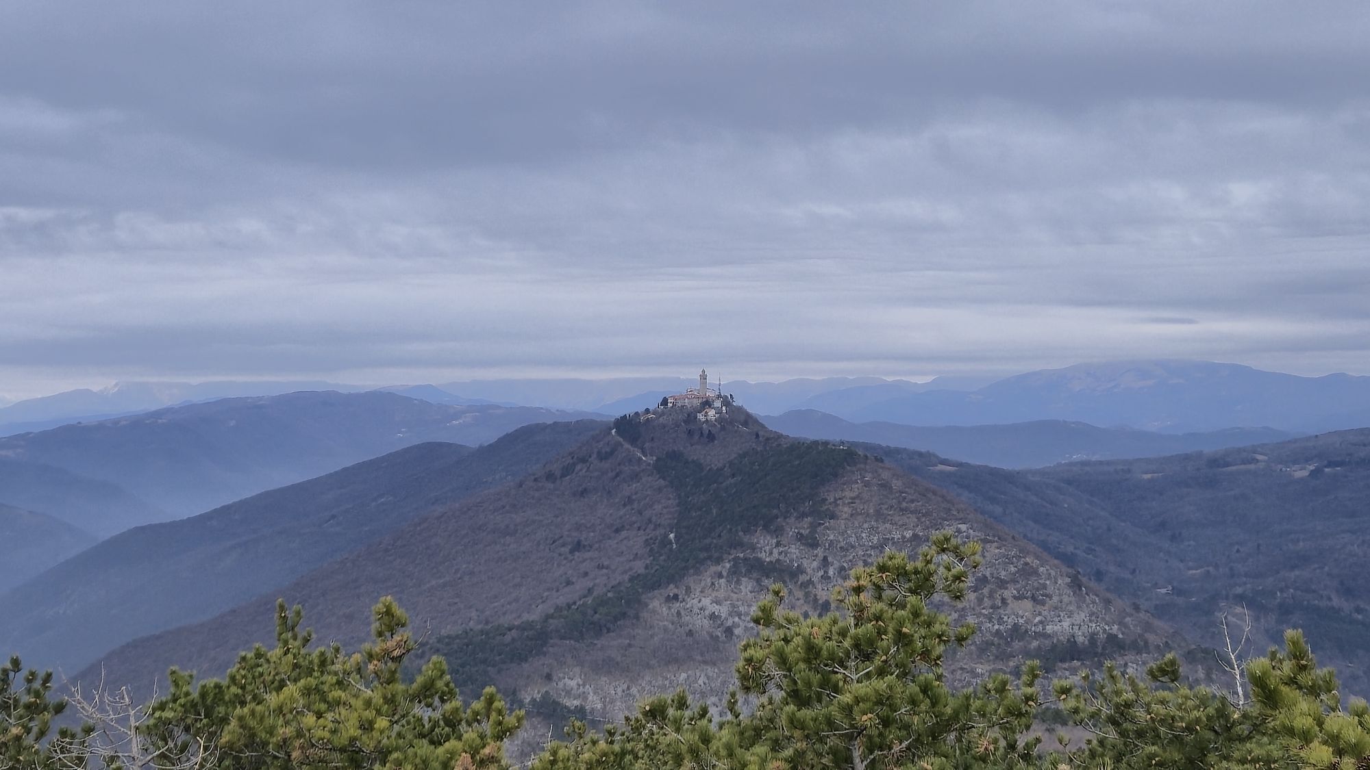
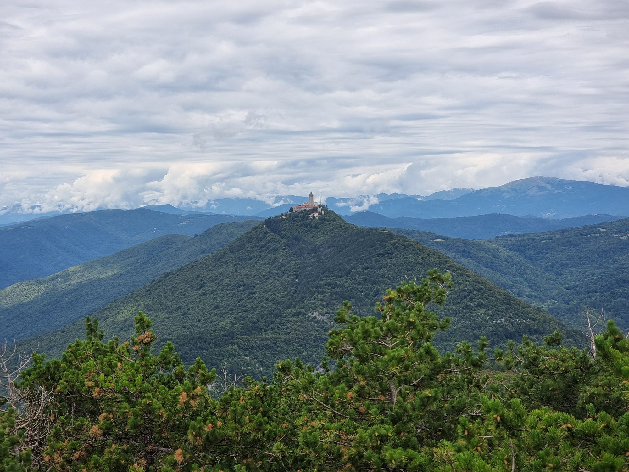
Starting in the centre of Nova Gorica, before long the route runs through vineyards and past several vantage points to the top of Mt Škabrijel. There, you can climb the lookout tower and take in the views of the Julian Alps, the Karst and the Adriatic Sea. The path runs over a hillside that witnessed fierce fighting took during the First World War.


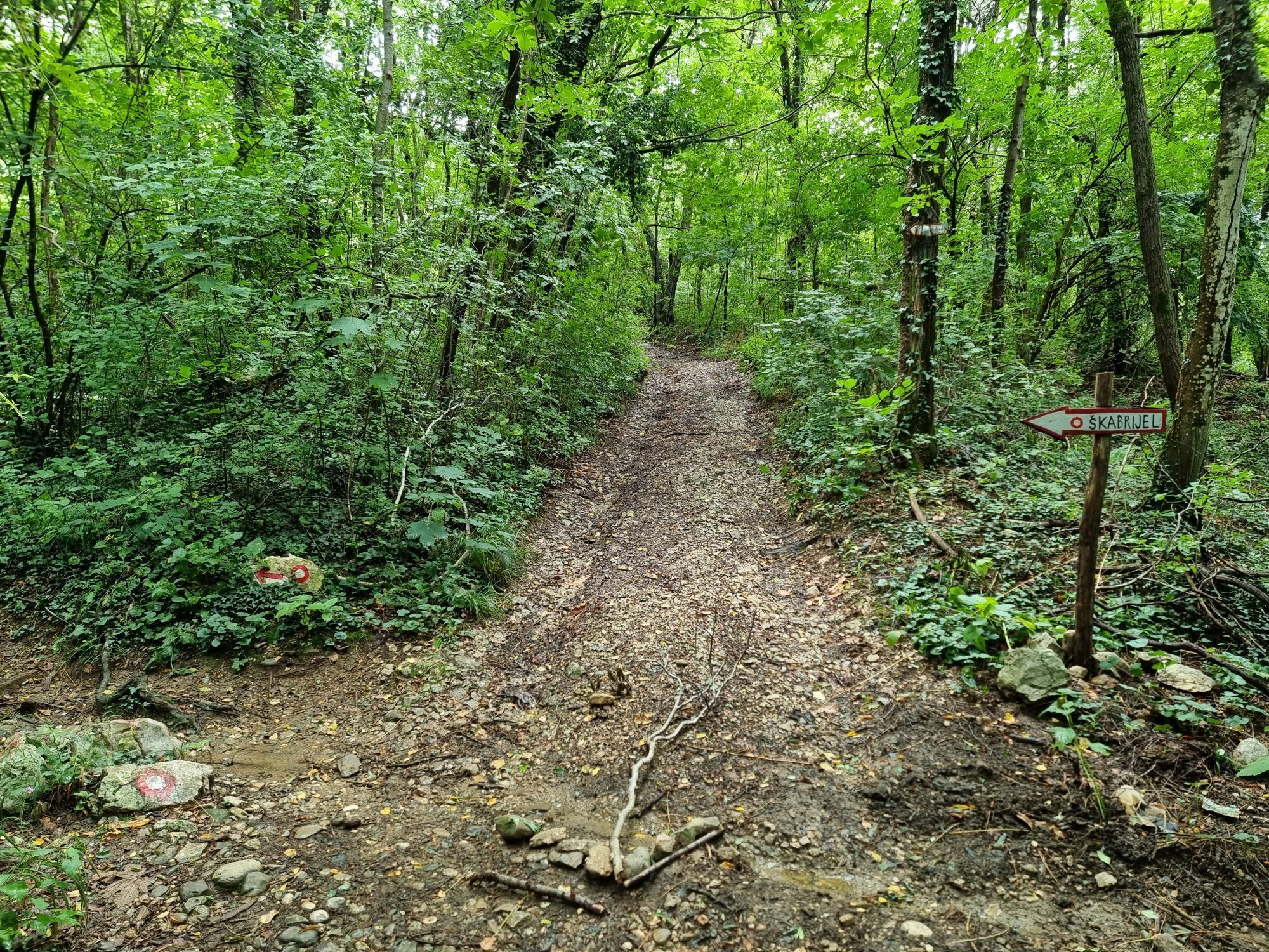
From the parking lot in KidriÄeva ulica first head to the junction with Vojkova cesta and cross it. Continue past the church, police station and a row of houses to the traffic light crossing on the Solkan bypass below VetrišÄe. Pass the crossing toward VetrišÄe and after 50 m go left uphill toward Mt Škabrijel.
Continue through the vineyards and the hamlet of Varda. Follow the markings. When you reach the asphalt path leading to Kekec Inn atop Mt Sv. Katarina, pass that path and continue approx. 50 m. Then, turn left to the path going uphill until you reach the gravel dirt road. On the gravel, turn left to the asphalt road coming down from the Kekec Inn. Here, head right to the summit of Mt Škabrijel. After 15 minutes of hiking, the asphalt stops and the markings for Škabrijel direct us left. You can catch your breath at the bench and quench your thirst from water from the natural spring water faucet. Before long, the gravel road takes you to the next junction. Go right and uphill (straight ahead will get you to Prevala and further Mt Sveta Gora) over an increasingly deteriorating cart track. After a couple of minutes, a marked footpath forks left immediately after a right turn. The mellow well-kept mule track, which takes you to the summit of Mt Škabrijel, tends to get very muddy after heavy rain and is pretty steep on a small section. The path, leading through the woodlands over its entire length, is especially nice on sunny and hot days.
Oui
Oui
Hiking boots and hiking poles
No special safety issues
Starting point: parking lot in KidriÄeva ullica in front of the Hotel Perla in Nova Gorica.
Starting point: parking lot in KidriÄeva ullica in front of the Hotel Perla in Nova Gorica.
Parcours populaires à proximité
- 3,7
Parcours vers le pont naturel en pierre de Skozno
facileRandonnée 5,62 km - 4,0
Rundgang von Cormons
facileRandonnée 7,31 km - 4,7
Etappe 30 Alpe-Adria-Trail: Breg bei Golo Brdo - Šmartno
moyenChemin de Grande Randonnée 27,4 km Boucle Collio - Brda (R014)
moyenPiste cyclable longue distance 60,6 kmParcours Gorizia - Kanal (SLO) (P004)
moyenPiste cyclable longue distance 22,2 kmCarsus Trail - un sentier de longue distance à travers la région du Karst en Slovénie et en Italie
moyenChemin de Grande Randonnée 102,2 kmCividale del Friuli - Gorizia (C304)
moyenPiste cyclable longue distance 39,4 kmParcours vélo - Brda, vallée de Vipava, Karst
difficileFaire du vélo 93,3 kmSentier Vigne Alte : boucle complète avec Pradis, Spessa et Subida
moyenRandonnée 14,0 kmJULIANA TRAIL – étape 20 : Šmartno - Solkan
difficileRandonnée 13,3 km
Randonnée et suivi


Ne manquez pas les offres et l'inspiration pour vos prochaines vacances
Votre adresse électronique a été ajouté à la liste de diffusion.