Three Oaks - Little Galley Hill - Galley Hill
moyen
Naviguer
Naviguer
Télécharge cette visite sur ton portable
Three Oaks - Little Galley Hill - Galley Hill
moyen
Vélo de course
85,98
km
Scanner le code QR et commencer la navigation dans l'application bergfex

Randonnée & tracking


Three Oaks - Little Galley Hill - Galley Hill
moyen
Distance
85,98
km
Durée
04:41
h
Ascension
871
m
Altitude
2 -
160
m
Téléchargement de la piste
Three Oaks - Little Galley Hill - Galley Hill
moyen
Vélo de course
85,98
km
Parcours
Christ Church, Ore
(104 m)
Lieu de culte
3,4 km
Hastings
(11 m)
Ville
6,7 km
Little Galley Hill
(14 m)
Sommet
12,2 km
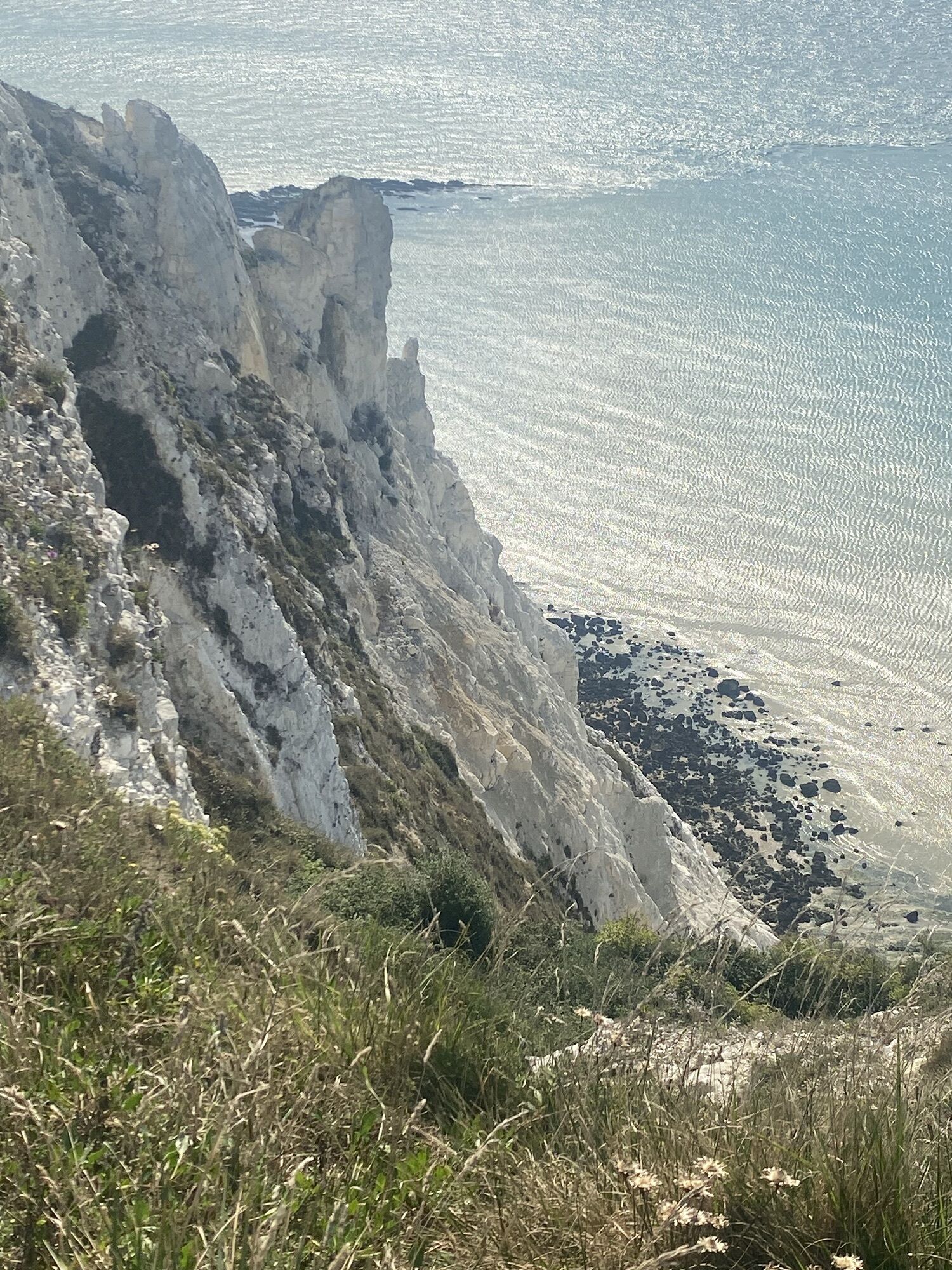
Galley Hill
(16 m)
Sommet
13,0 km
Pevensey Baptist Church
(6 m)
Lieu de culte
26,7 km
Galley Hill
(16 m)
Sommet
73,0 km
Little Galley Hill
(14 m)
Sommet
73,9 km
Parcours
Three Oaks - Little Galley Hill - Galley Hill
moyen
Vélo de course
85,98
km
Three Oaks
(48 m)
Village
0,0 km
nawaaz
(103 m)
Restaurant
3,3 km
Seventh Day Adventist Church Hastings
(109 m)
Lieu de culte
3,4 km
Christ Church, Ore
(104 m)
Lieu de culte
3,4 km
Ore
(87 m)
Quartier
3,4 km
Clive Vale
(63 m)
Quartier
4,1 km
Belmont
(53 m)
Quartier
4,5 km
High Wickham
(39 m)
Quartier
5,0 km
Minnis Rock
(45 m)
Entrée de la grotte
5,1 km
All Saints Church
(26 m)
Lieu de culte
5,4 km
Old Town
(8 m)
Quartier
5,8 km
Hastings
(11 m)
Ville
6,7 km
Trinity Triangle
(8 m)
Quartier de la ville
7,0 km
America Ground
(9 m)
Quartier de la ville
7,1 km
Pizzarelli
(9 m)
Restaurant
8,4 km
Azur
(10 m)
Restaurant
8,6 km
St Leonards
(53 m)
Ville
9,1 km
West Marina
(11 m)
Quartier
9,8 km
Bulverhythe
(3 m)
Quartier
10,8 km
Glyne Gap
(7 m)
Quartier
12,2 km
Little Galley Hill
(14 m)
Sommet
12,2 km
Galley Hill
(16 m)
Sommet
13,0 km
Central
(10 m)
Quartier
14,7 km
Bexhill-on-Sea
(12 m)
Ville
14,9 km
Cooden
(14 m)
Quartier
17,9 km
Cooden Beach
(8 m)
Gare ferroviaire
18,3 km
Pevensey
(3 m)
Village
25,1 km
Pevensey Bay
(4 m)
Gare ferroviaire
25,7 km
Pevensey Bay
(4 m)
Village
26,6 km
Ocean View Bakery & Restaurant
(5 m)
Restaurant
26,6 km
Miah Traditional Indian Restaurant And Takeaway
(5 m)
Restaurant
26,7 km
Pevensey Baptist Church
(6 m)
Lieu de culte
26,7 km
St Wilfrid's Church Pevensey Bay
(5 m)
Lieu de culte
26,7 km
Sovereign Harbour
(2 m)
Quartier
29,5 km
Holywell
(47 m)
Quartier
36,7 km
East Dean
(47 m)
Village
42,1 km
Birling Gap
(15 m)
Village
44,0 km
Beachy Head
(156 m)
Restaurant
48,3 km
Meads
(42 m)
Quartier
51,5 km
All Saints
(6 m)
Lieu de culte
52,4 km
Eastbourne
(11 m)
Ville
52,4 km
Sovereign Harbour
(2 m)
Quartier
58,6 km
Pevensey Bay
(4 m)
Village
61,3 km
Pevensey Baptist Church
(6 m)
Lieu de culte
61,4 km
Miah Traditional Indian Restaurant And Takeaway
(5 m)
Restaurant
61,4 km
Beachlands
(3 m)
Quartier de la ville
62,7 km
Normans Bay
(3 m)
Gare ferroviaire
64,6 km
Cooden Beach
(8 m)
Gare ferroviaire
67,6 km
Cooden
(14 m)
Quartier
68,1 km
Bexhill-on-Sea
(12 m)
Ville
71,1 km
Central
(10 m)
Quartier
71,4 km
Galley Hill
(16 m)
Sommet
73,0 km
Glyne Gap
(7 m)
Quartier
73,8 km
Little Galley Hill
(14 m)
Sommet
73,9 km
Bulverhythe
(3 m)
Quartier
75,3 km
West Marina
(11 m)
Quartier
76,3 km
St Leonards
(53 m)
Ville
77,0 km
Azur
(10 m)
Restaurant
77,5 km
Pizzarelli
(9 m)
Restaurant
77,6 km
America Ground
(9 m)
Quartier de la ville
79,0 km
Hastings
(11 m)
Ville
79,2 km
Trinity Triangle
(8 m)
Quartier de la ville
79,2 km
Blacklands
(32 m)
Quartier
80,8 km
St Helen's
(134 m)
Quartier
82,4 km
St Helens Church
(138 m)
Lieu de culte
82,6 km
The Conqueror's March
(137 m)
Restaurant
82,9 km
Three Oaks
(48 m)
Village
85,9 km
Pas encore d'évaluation
Parcours populaires à proximité
-
Beachy Head
facileRandonnée 3,51 km -
St Andrew's Church, Alfriston - St Mary and St Peter's Church. - Combe Hill - Boreham Street
Chemin de pèlerinage 33,4 km -
Boreham Street - Penhurst Parish Church - St Laurence - Senlac Hill
Chemin de pèlerinage 18,2 km -
Bexhill-on-Sea - Central
facileRandonnée 6,08 km -
Steven's Crouch - Catsfield
facileRandonnée 4,46 km -
Steven's Crouch - Catsfield - Senlac Hill - Battle
moyenRandonnée 12,4 km -
Herstmonceux - Herstmonceux Free Church - All Saints' Church - The Sundial Restaurant
moyenRandonnée 11,7 km -
Birling Gap - Holywell - Eastbourne - Cow Gap
moyenRandonnée 12,4 km -
Ore - Galley Hill - Little Galley Hill - Holy Trinity Hastings
moyenVTT 34,8 km -
Eastbourne - Beachy Head - Holywell
moyenRandonnée 10,9 km
Randonnée et suivi

Plus de 550.000 propositions de circuits, des cartes détaillées et un planificateur d'itinéraire intuitif font de cette application un must pour tous les passionnés de nature.

Ne manquez pas les offres et l'inspiration pour vos prochaines vacances
S'inscrire à la newsletter
Erreur
Une erreur s'est produite. Veuillez réessayer.
Merci pour votre inscription
Votre adresse électronique a été ajouté à la liste de diffusion.
Parcours en Europe
Autriche
Suisse
Allemagne
Italie
Slovénie
France
Pays-Bas
Belgique
Pologne
Liechtenstein
République tchèque
Slovaquie
Espagne
Croatie
Bosnie-Herzégovine
Luxembourg
Andorre
Portugal
Islande
Royaume-Uni
Irlande
Grèce
Albanie
Macédoine du Nord
Malte
Norvège
Monténégro
Moldavie
Kosovo
Hongrie
Saint-Marin
Roumanie
Estonie
Lettonie
Bélarus
Chypre
Lituanie
Serbie
Bulgarie
Monaco
Danemark
Suède
Finlande