


Etappe 0: Alpina Antica Trail | ET0: Chiemsee - Übersee
Niveau de difficulté: T1

A peaceful evening stroll along Bavaria’s most famous lake to kick off the Alpina Antica Trail
A short walk before the actual start of the Alpina Antica Trail from Lake Chiemsee to Venice – and yet so lovely:...
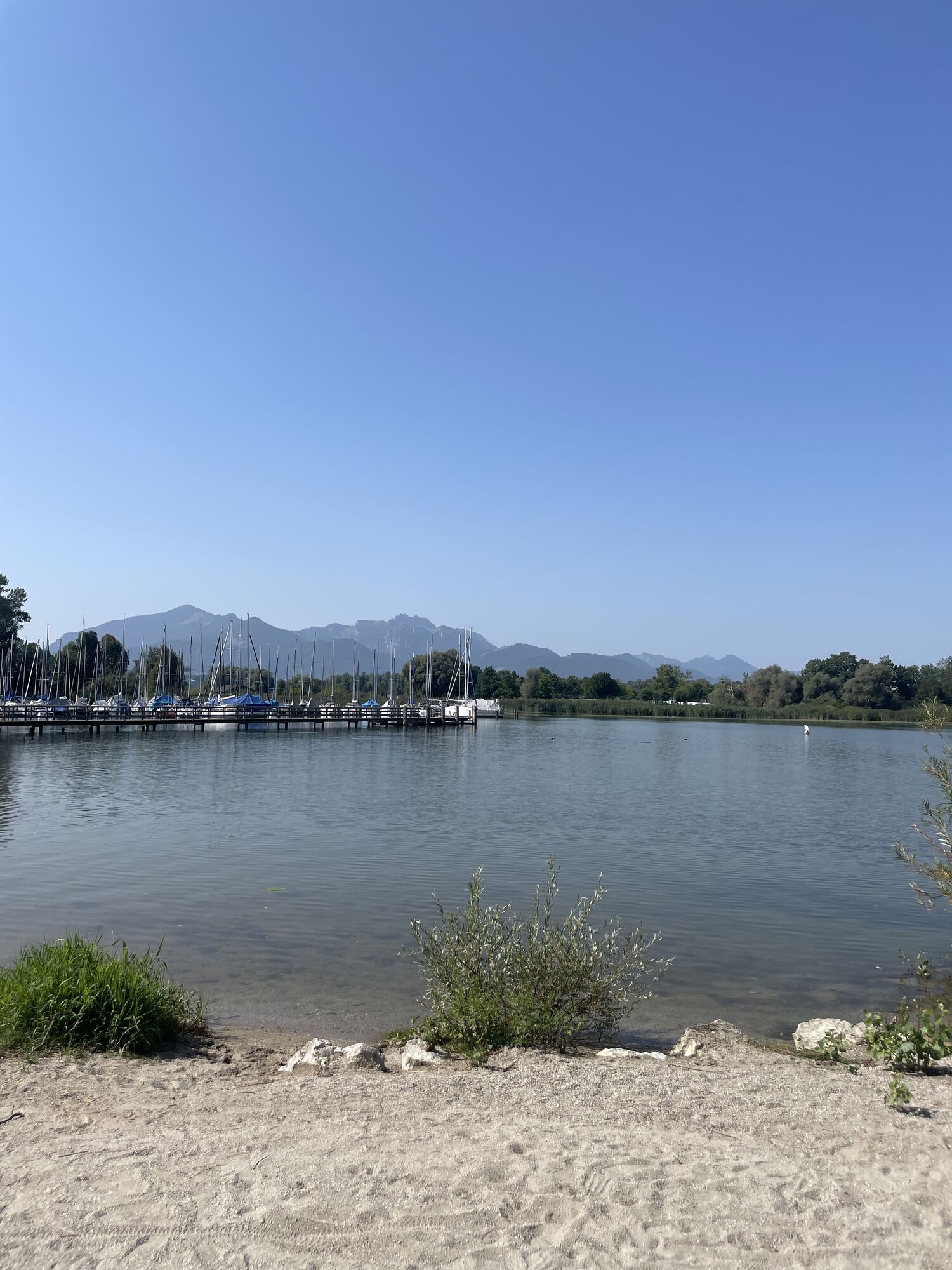
A short walk before the actual start of the Alpina Antica Trail from Lake Chiemsee to Venice – and yet so lovely: As the official start of the Alpina Antica Trail is in the centre of the village of Übersee, 2.5 km from Lake Chiemsee, we strongly recommend taking this one-and-a-half-hour walk from Übersee along beautiful paths to Chiemseepark on the southern shore of the lake and back on the evening of your arrival or before your first stage of the Alpina Antica Trail. This way, you can start your Alpine crossing to Venice right on the shores of Lake Chiemsee – and it would be a bit of a ‘sin’ not to pay a visit to the famous lake and its wonderful Chiemseepark, complete with its little harbour. The views of the lake and the Alps to the south, both near and far, are simply too beautiful to miss.

The starting point for this walk to Lake Chiemsee is the public car park just south of the church in Übersee. Facing from the car park towards the church, keep to the right along the road and, just past the church, turn left onto the footpath towards “Chiemseestrand/-park” (No. 1, 01). The path takes you past the church and over a bridge into a small park. Here, keep left, running parallel to a stream. After briefly crossing an asphalt road and then another footpath, you’ll pass the tourist information office at the rear and soon reach a larger road. Follow this road to the left, walk past a farm shop and, just past a small DIY store, turn left into Dornau-Straße (signposted “Chiemseepark, Strandbad”). After about 80 m, a footpath branches off to the right along the Überseer Bach stream, which soon turns into a small tarmac road. Now follow the yellow signs for “Chiemseepark, Strandbad No. 1, 01” through the Feldwies district until you pass under the motorway. You have now reached the southern shore of Lake Chiemsee and the Chiemseepark on the lakeside promenade.To return to Übersee, follow the same route.
T1
Chiemseepark, situated in Feldwieser Bucht on the beach promenade, with its beer gardens, cafés and restaurants, as well as the large lido including a lounge area, not only offers the most spacious access to Lake Chiemsee but also stunning sunsets. You could hardly ask for a more pleasant start to a crossing of the Alps!
Parcours populaires à proximité
-
4,7
Kampenwand
moyenRandonnée 4,35 km -
4,6
Hochgern
moyenRandonnée en montagne 15,1 km -
4,4
Hochgernhaus
moyenRandonnée 15,1 km -
4,5
Wandertour Hochgern
moyenRandonnées d'hiver 14,7 km -
3,8
Hochfelln über Bründling Alm
moyenRandonnée 7,93 km -
4,8
Hochfelln ab Glockenschmiede und zurück über Farnbödenalmen
moyenRandonnée 13,1 km -
4,9
Rundweg zur Schnappenkirche
moyenRandonnée 11,1 km -
4,3
Hochfelln Gipfel
moyenRandonnée 5,62 km -
4,3
Rund um den Hartsee bei Eggstätt (Rosenheim)
facileRandonnée 5,43 km -
3,5
Grassauer und Rottauer Almen
Randonnée 9,93 km
Randonnée et suivi


Ne manquez pas les offres et l'inspiration pour vos prochaines vacances
Votre adresse électronique a été ajouté à la liste de diffusion.