


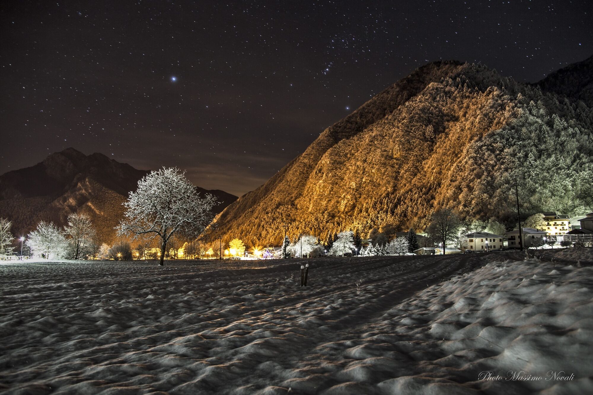
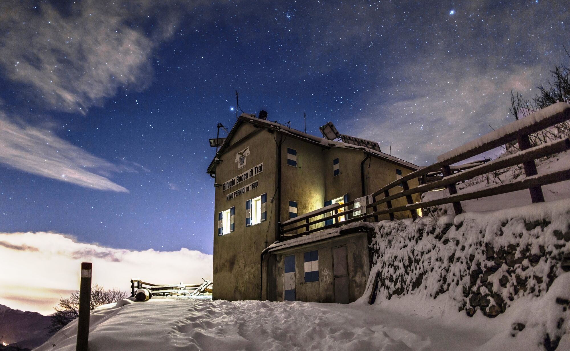
Snowshoeing to Rifugio Pernici


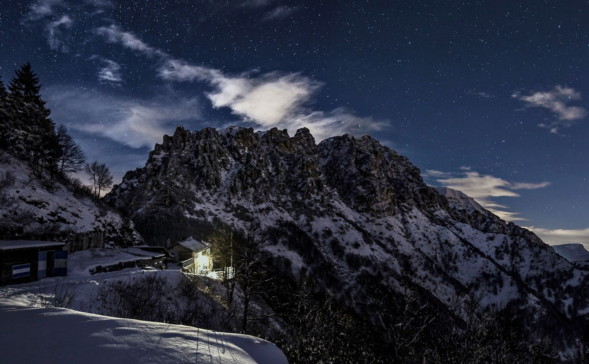
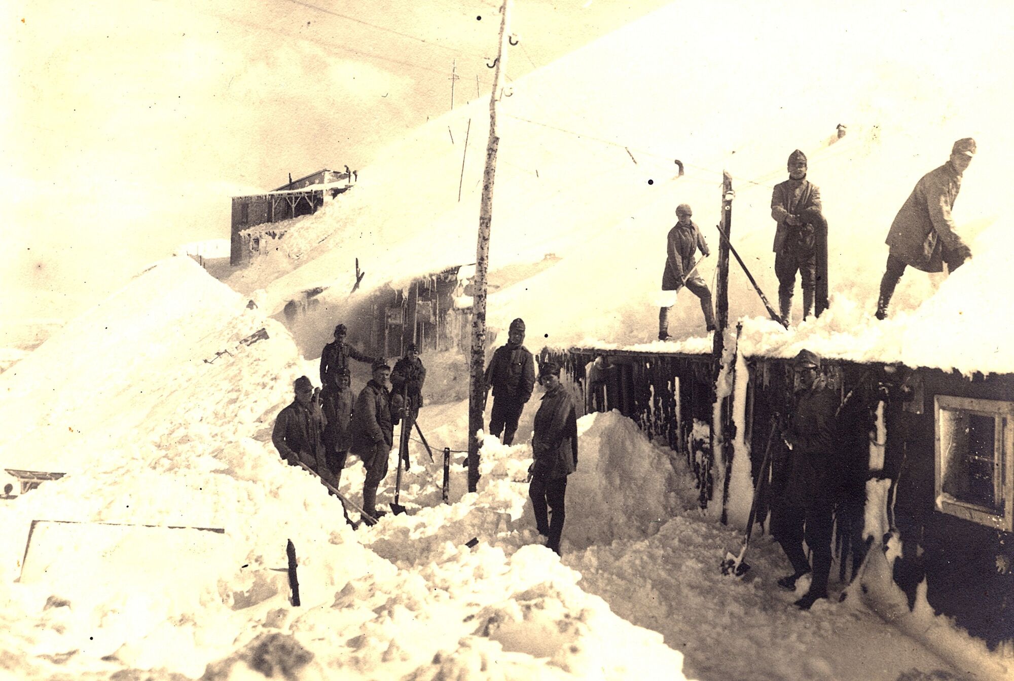
Rifugio Pernici was built as barracks for Austrian officers fighting on the front of the First World War, known in Italian as guerra bianca, White War. Nowadays, instead of bringing death and hardships,...
Rifugio Pernici was built as barracks for Austrian officers fighting on the front of the First World War, known in Italian as guerra bianca, White War. Nowadays, instead of bringing death and hardships, snow brings beauty and fun!
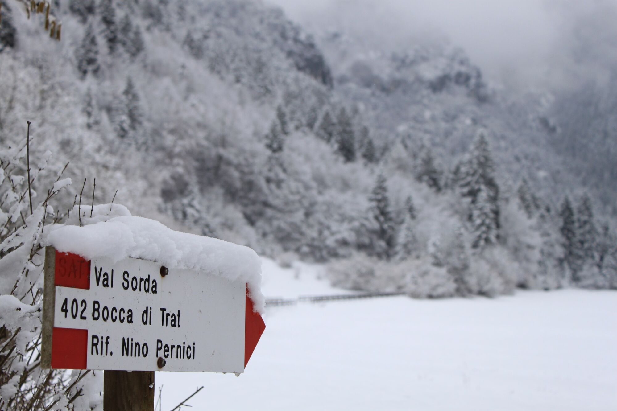
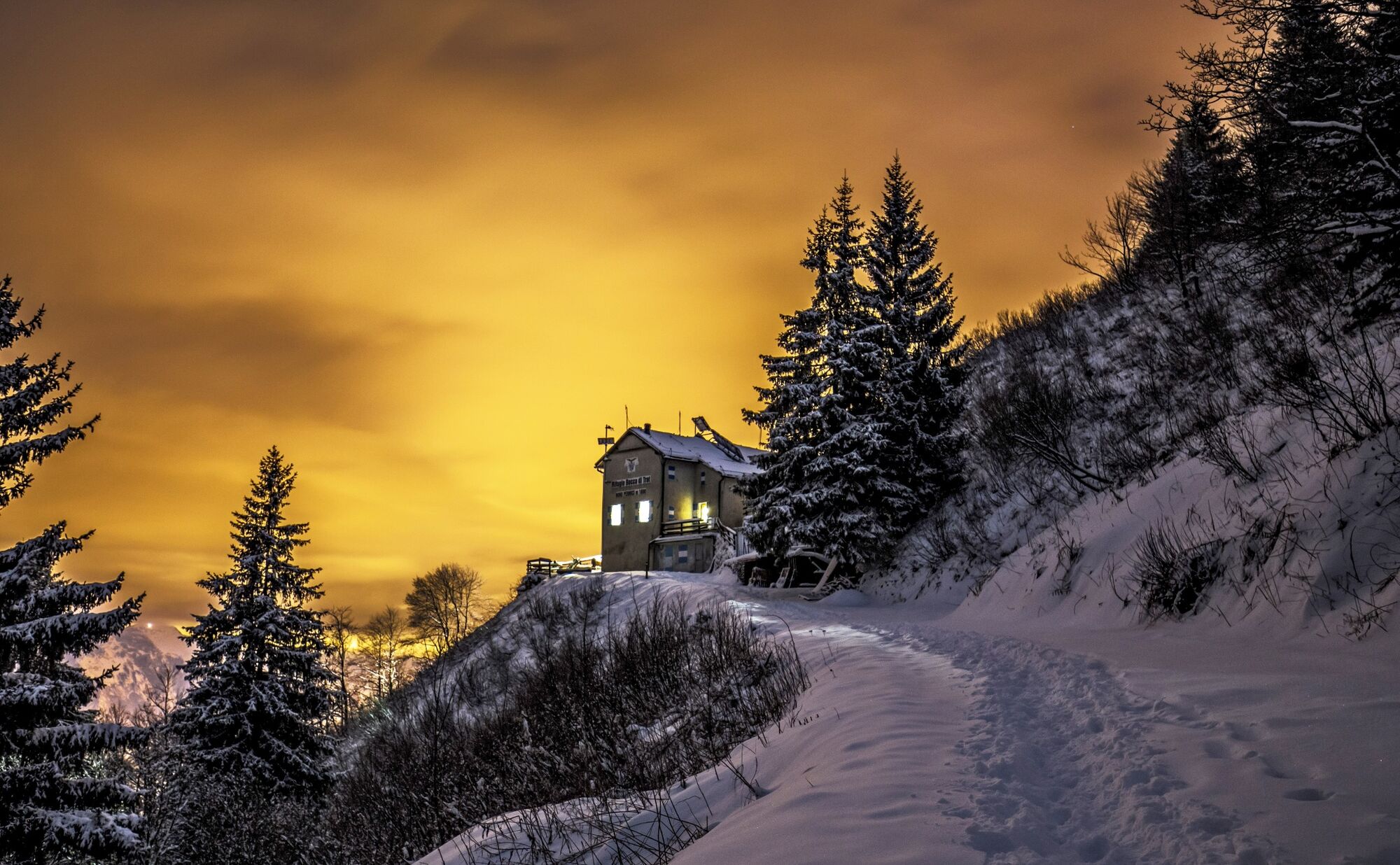
From the car park walk downhill along Via alla Vasca and turn left into Via dell’Albertoca. At the sawmill take the road towards Malga Trat and from to Bocca di Trat. Follow the path to Rifugio Pernici.
Snowshoes and snow clothing.
Snow doesn’t always cover the whole route. Snowshoes might be needed for a stretch of the road only.
Please note that the practicability of the itineraries in a mountain environment is strictly linked to the contingent conditions and is therefore influenced by natural phenomena, environmental changes and weather conditions. For this reason, the information contained in this page may have changed. Before leaving for a tour, make sure the path you will approach is still accessible by contacting the owner of the mountain hut, the alpine guides or the visitor centres of the nature parks, the info offices of the local tourist board.
Find out how to reach Garda Trentino.
The main towns in Garda Trentino - Riva del Garda, Arco, Torbole sul Garda, Nago, Ledro and Comano – are connected by several urban and intercity bus lines which will take you to the starting point of tours or in the immediate surroundings.
You can also get to Riva del Garda and Torbole sul Garda by the public ferry service.
Car park near the church of Lenzumo.
For more information on routes, services and outdoor friendly accommodation: Garda Trentino - +39 0464 554444
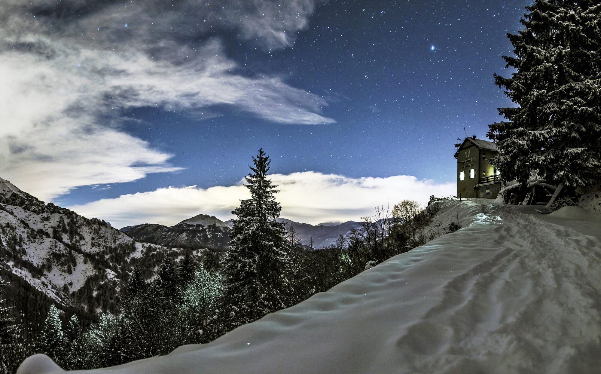
Under the stars, the winter landscape is even more magical! During the Christmas holidays it is possible to stay the night at the refuge.
Parcours populaires à proximité
- 4,7
Bocca Fortini - Tour
difficileVTT35,4 km - 4,8
Via Ferrata Fausto Susatti - Cima Capi (from Ledro)
moyenVia ferrata7,11 km - 4,7
Walking around Lake Ledro
facileRandonnée9,40 km - 4,1
Tremalzo Big - Tour
difficileVTT45,6 km - 4,7
Tremalzo Garda XXL - Tour
difficileVTT66,6 km - 4,7
Via Ferrata delle Laste e Gallerie di Cima Rocca
facileVia ferrata6,38 km - 5,0
Via Ferrata Signora delle Acque - Rio Ruzza
difficileVia ferrata5,32 km - 4,7
Cima Capi - Cima Rocca
moyenVia ferrata8,36 km - 4,6
Colodri Klettersteig (A/B)
Via ferrata7,50 km - 5,0
Bastione and Santa Barbara, the lords of Riva del Garda
moyenRandonnée2,94 km
Randonnée et suivi


Ne manquez pas les offres et l'inspiration pour vos prochaines vacances
Votre adresse électronique a été ajouté à la liste de diffusion.