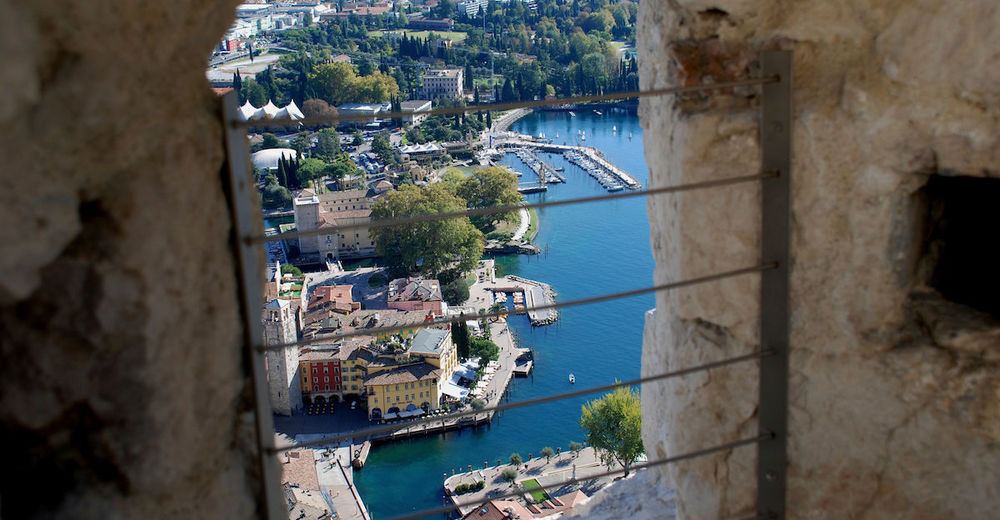
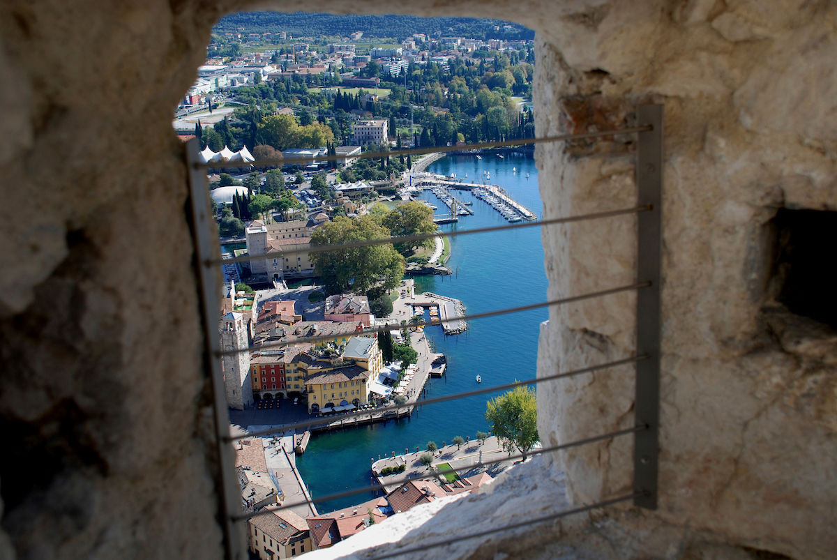
Bastione and Santa Barbara, the lords of Riva del Garda

Randonnée
© Garda Trentino - Patrizia N. Matteotti (Archivio Garda Trentino)
© Garda Trentino - Archivio APT Garda Trentino

© North Lake Garda Trentino - Patrizia N. Matteotti (APT Garda Trentino)

© Garda Trentino - Patrizia N. Matteotti (Archivio Garda Trentino)

© North Lake Garda Trentino - Archivio APT Garda Trentino

- Brève description
-
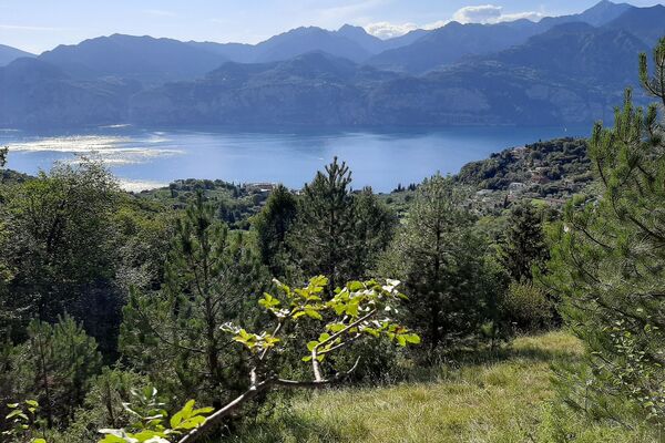
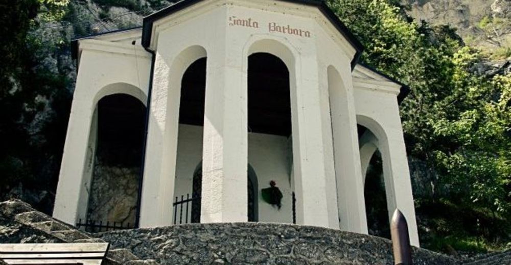
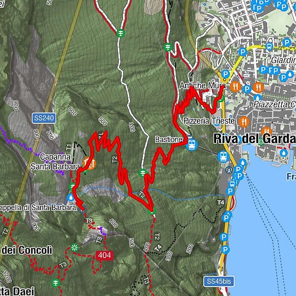
From Riva del Garda to Bastione and then on up to Santa Barbara: this hike touches on two of the symbols of the town perched on the mountainside above Riva del Garda
- Difficulté
-
moyen
- Évaluation
-
- Parcours
-
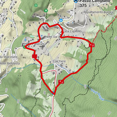
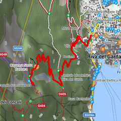
Riva del Garda0,1 kmBastione0,9 kmCapanna Santa Barbara2,6 km
- Meilleure saison
-
janv.févr.marsavrilmaijuinjuil.aoûtsept.oct.nov.déc.
- Hauteur maximale
- 622 m
- Point de mire
-
Santa Barbara
- Profil en hauteur
-
 © outdooractive.com


-
-
AuteurLa randonnée Bastione and Santa Barbara, the lords of Riva del Garda est utilisé par outdooractive.com fourni par.
GPS Downloads


Informations générales
Point de rassemblement
Culturel/Historiquement
Secret
Prometteur
Autres parcours dans les régions
-
Gardasee / Lombardei
433
-
Garda Trentino
660
-
Riva del Garda
300