Eisenreich 2.665m
difficile
Naviguer
Naviguer
Télécharge cette visite sur ton portable
Eisenreich 2.665m
difficile
Ski de randonnée
5,55
km
Scanner le code QR et commencer la navigation dans l'application bergfex

Randonnée & tracking


Eisenreich 2.665m
difficile
Distance
5,55
km
Durée
04:50
h
Ascension
1.242
m
Altitude
1.421 -
2.660
m
Téléchargement de la piste
Eisenreich 2.665m
difficile
Ski de randonnée
5,55
km
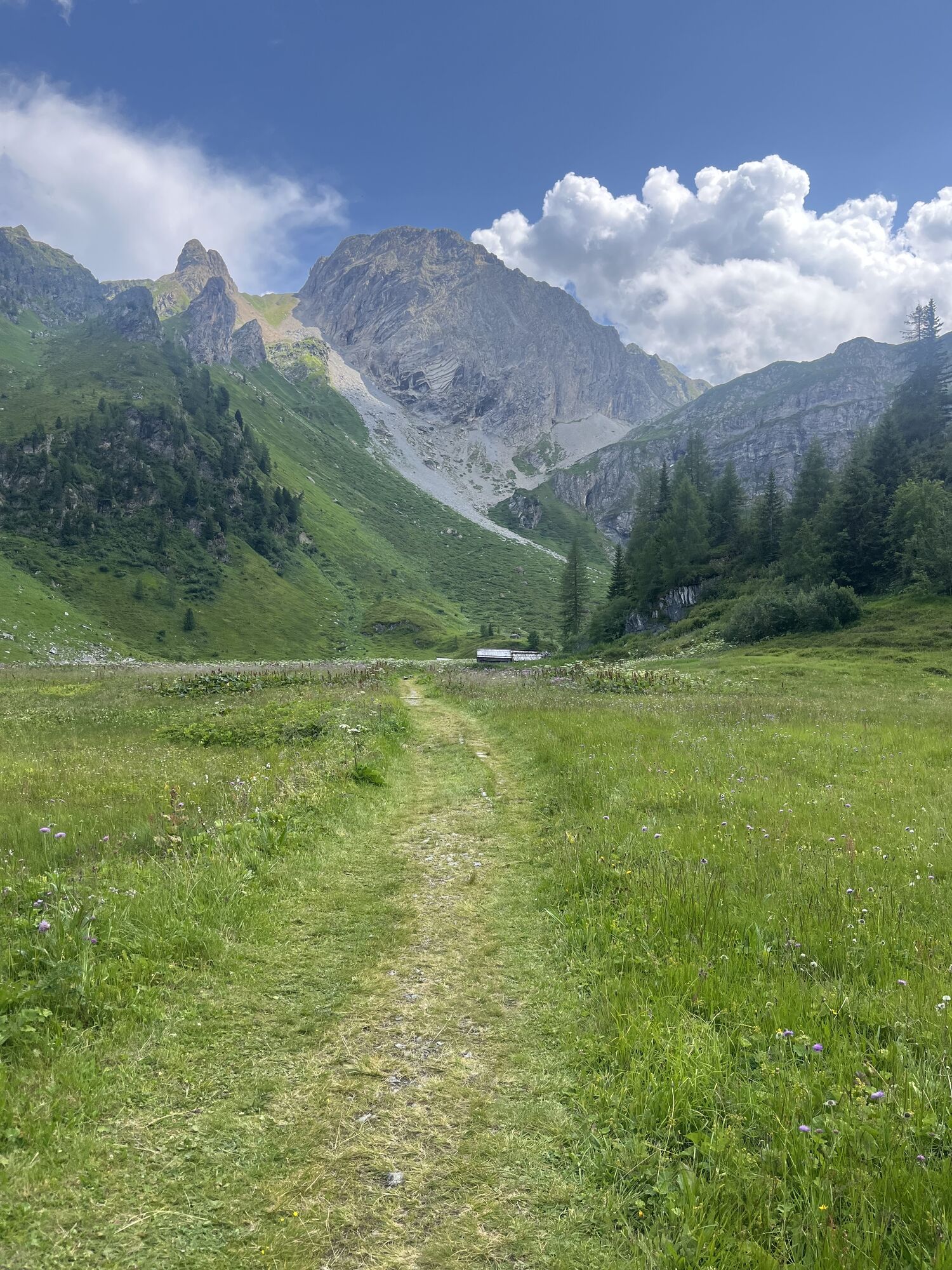
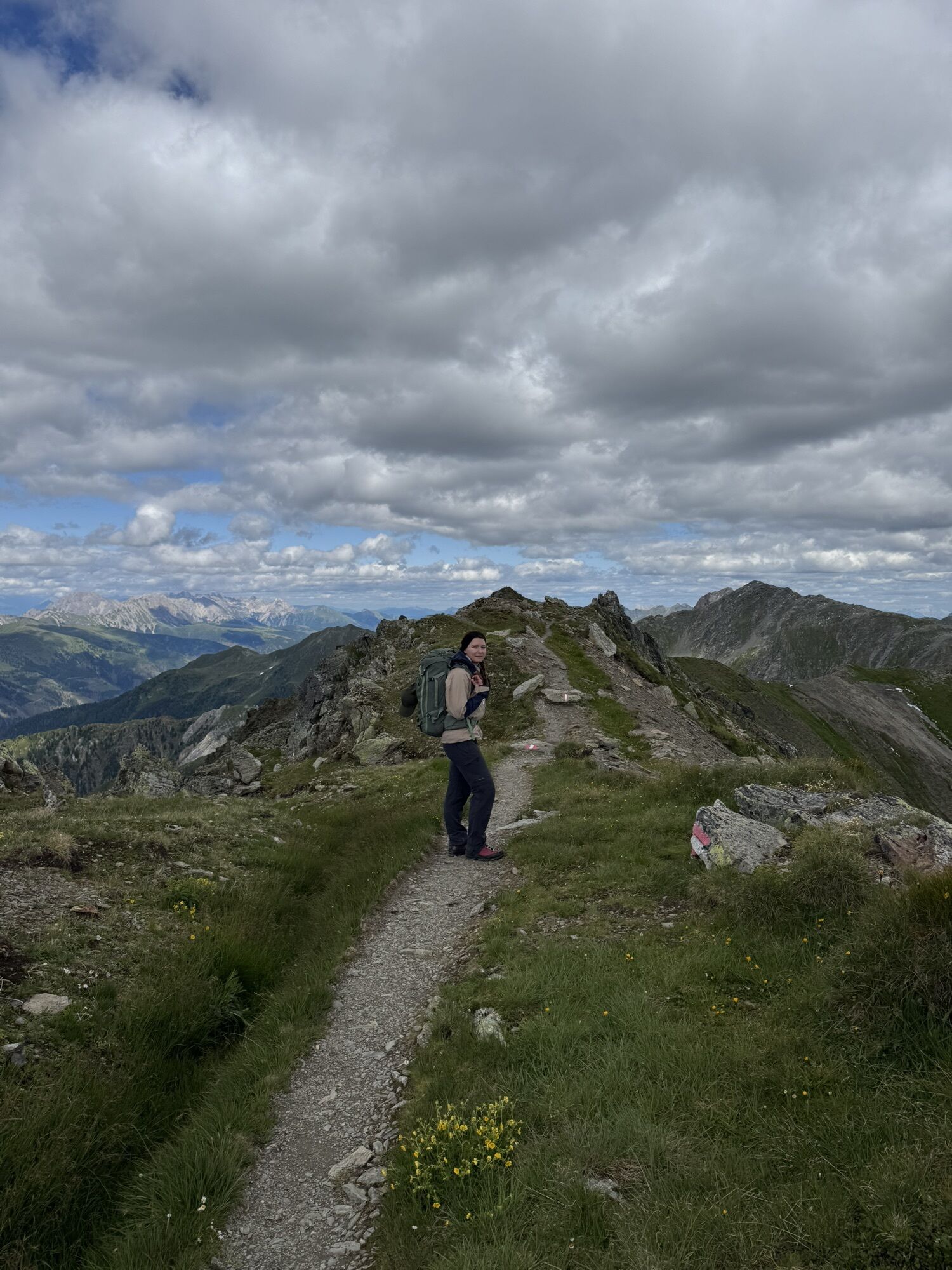
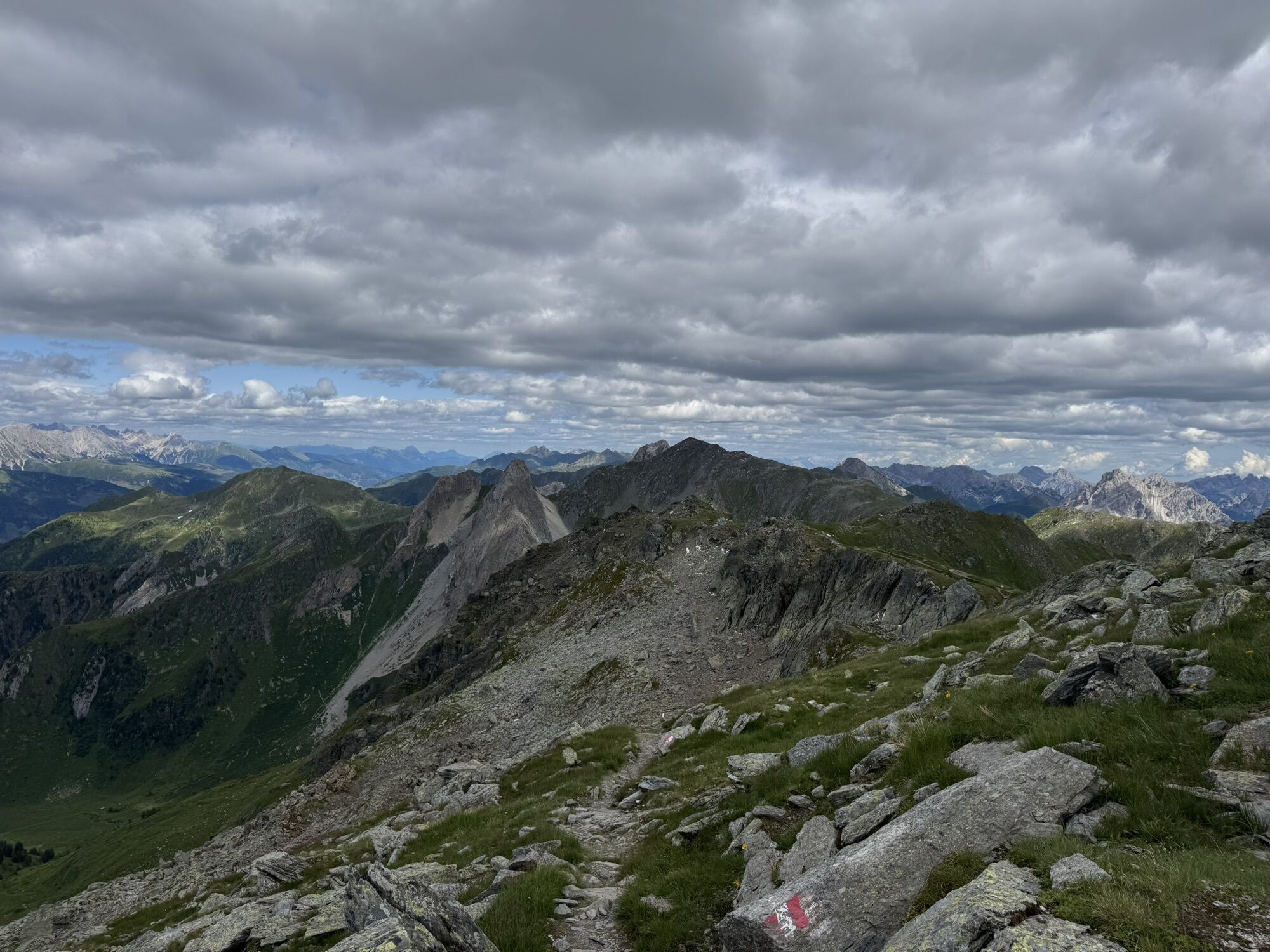

Another tour destination in Kartitsch’s Winklertal is the long draw-out summit of the Eisenreich. It is located to the west of the Pfannspitze and is tackled directly from Obstanser Wiesenboden. During...
Description
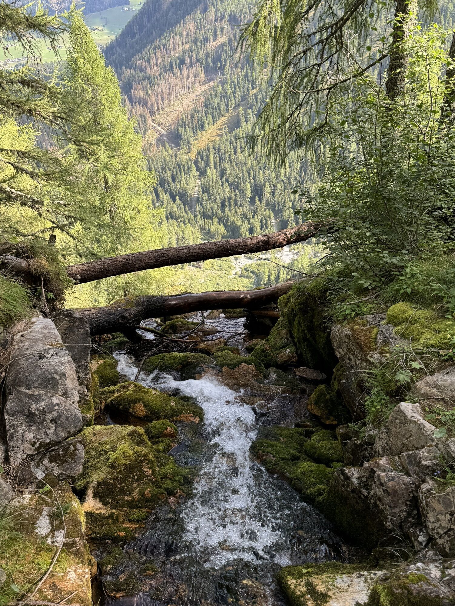
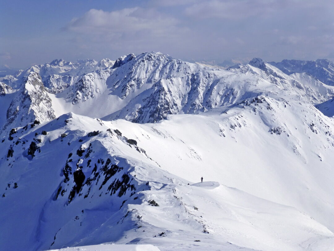
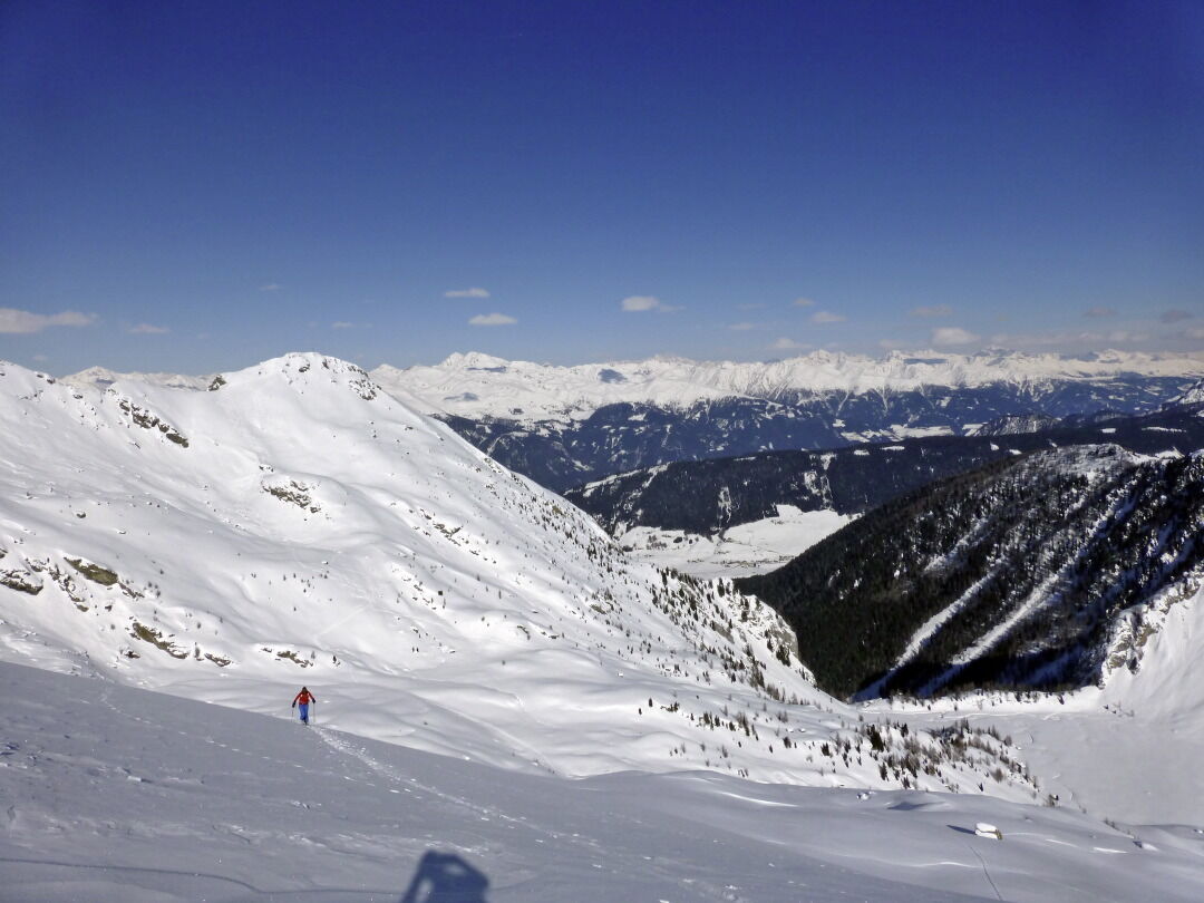
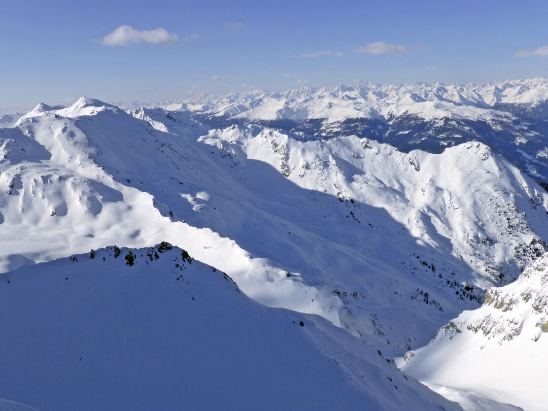
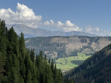
Another tour destination in Kartitsch’s Winklertal is the long draw-out summit of the Eisenreich. It is located to the west of the Pfannspitze and is tackled directly from Obstanser Wiesenboden. During this tour to the blocked rocky area at the head of the Winklertal is to be negotiated before we get to enjoy the ski-friendly slopes. Starting point: the entrance to Obstanser Wiesenboden proceeds the same as the ski tour to the Pfannspitze, and the same precautions apply! The ascent to the Eisenreich proceeds direct from Wiesenboden (1962 m) up via a wide ramp terrain, which, 200 metres after the lovely wooden hay barn in the plateau is like a solidified tongue of ice. Via these, in cleared hairpin bends heading south-west, until at around 2400 m we cross to the south on the accompanying ridge, leaving the superb slopes. Via the ridge which now narrows, the track takes us west on the cleared ridge line, where we proceed up and downhill continuing west to the peak of the Eisenreich, which is very secluded in the winter. This is where Friedensweg 403 proceeds in the summer, bringing together the entire Carnic region and reminds us of the horrors of World War 1. Descent along the ascent track. For photos of the rocky area see the tour to the Gatterspitze.
Additional ski tour tips can be obtained in the ski tour guides by Thomas Mariacher. These are available here: http://www.grafikzloebl.at/verlag/buecher/
Additional ski tour tips can be obtained in the ski tour guides by Thomas Mariacher. These are available here: http://www.grafikzloebl.at/verlag/buecher/
Parcours
Prinz-Heinrich-Kapelle
(1.959 m)
Lieu de culte
3,1 km
Eisenreich - Montagna del Ferro
(2.665 m)
Sommet
5,2 km
Parcours
Eisenreich 2.665m
difficile
Ski de randonnée
5,55
km
Prinz-Heinrich-Kapelle
(1.959 m)
Lieu de culte
3,1 km
Eisenreich - Montagna del Ferro
(2.665 m)
Sommet
5,2 km
Informations sur l'itinéraire
Itinéraire
Mit dem Auto bis zum Sportplatz Kartitsch
Transports en commun
Mit dem Bus bis zur Haltestelle "Kartitsch Gemeindeamt"
Parking
Parkplatz Sportplatz Kartitsch
Évaluations
5
(1)
4
(0)
3
(0)
2
(0)
1
(0)

Parcours populaires à proximité
- 4,9
Drei Zinnen
moyenRandonnée 19,6 km - 4,8
Fischleintal zu den 3 Zinnen Hütte mit Besteigung des Sextner Steins
moyenRandonnée 16,2 km - 4,5
Kartitsch-Obstansersee Hütte
moyenRandonnée 13,1 km - 4,8
Rotwandwiesen kreuzbergpass rundweg
moyenRandonnée 12,0 km - 3,9
Rotwandspitze
moyenVia ferrata 10,6 km - 5,0
Porzehütte (1.942 m)
facileRandonnée 9,01 km - 4,8
Sillianer Hütte 2.447 m
moyenRandonnée 16,8 km - 4,2
Connyalm (2.070 m)
Randonnée 6,36 km - 5,0
Carnic altitude trail. Stage 4: Porzehütte – Hochweißsteinhaus
difficileRandonnée 17,5 km - 3,8
Karnischer Höhenweg KHW 403 - "Weg des Friedens"
moyenRandonnée 46,7 km

Randonnée et suivi

Plus de 550.000 propositions de circuits, des cartes détaillées et un planificateur d'itinéraire intuitif font de cette application un must pour tous les passionnés de nature.

Ne manquez pas les offres et l'inspiration pour vos prochaines vacances
S'inscrire à la newsletter
Erreur
Une erreur s'est produite. Veuillez réessayer.Merci pour votre inscription
Votre adresse électronique a été ajouté à la liste de diffusion.
Parcours en Europe
Autriche Suisse Allemagne Italie Slovénie France Pays-Bas Belgique Pologne Liechtenstein République tchèque Slovaquie Espagne Croatie Bosnie-Herzégovine Luxembourg Andorre Portugal Islande Royaume-Uni Irlande Grèce Albanie Macédoine du Nord Malte Norvège Monténégro Moldavie Kosovo Hongrie Saint-Marin Roumanie Estonie Lettonie Bélarus Chypre Lituanie Serbie Bulgarie Monaco Danemark Suède Finlande