


Piesendorf: Katzsteinalm


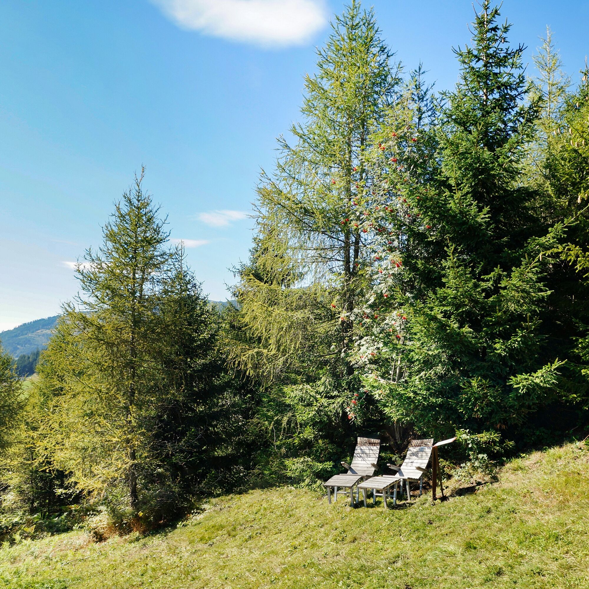
On the approx. 1,000 metres, one also takes the hike to the Naglköpfl with one. Relax along the way in the Tauern loungers with an impressive view of the mountains of the Pinzgau.


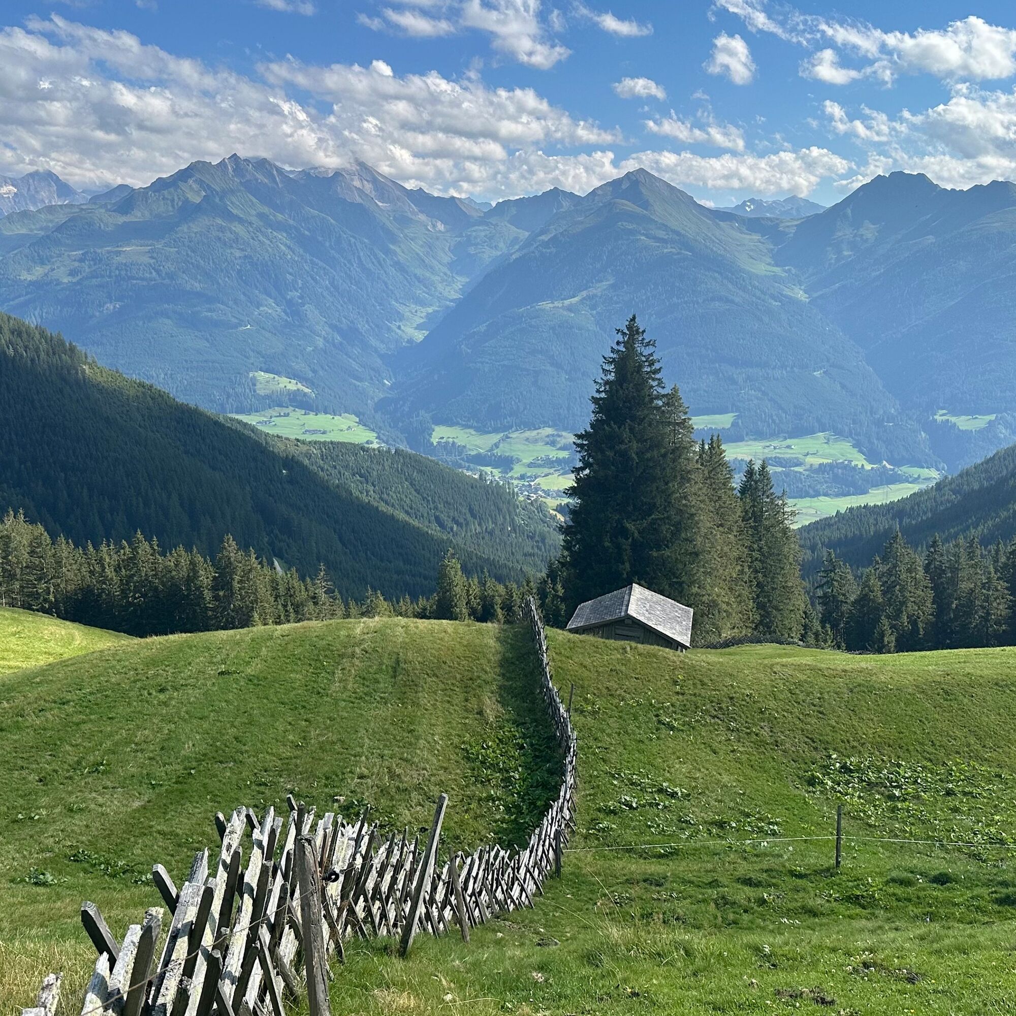
From the car park, follow the Schiliftstraße downhill to the church and turn right into Alte Landesstraße. Immediately turn right again into Bachweg and then left into Kehlbachgasse. Now the Kulturlandschaftsweg trail leads to the Naglköpfl. From here, follow the road, trail no. 19 to Röderlehen and continue along the forest road, trail no. 5 in the direction of Hochprack. At the fork, change to hiking trail 5A and follow it to the Katzsteinalm. The way back is via the same route to Naglbauer. From here, either follow the Kulturlandschaftsweg trail or the road back to the starting point.
Car park at Naglbauer - hiking time approx. 4 hours (there & back)
Car park at Röderlehen - hiking time approx. 3 hours (there & back)
Oui
Ankle-high mountain boot, drinks & snacks, backpack, rain protection, mobile phone
We hope that the snacks and drinks you take with you on your hike will give you the strength to carry back the packaging material and empty cans and bottles.
We kindly ask you to observe the Fair Play & Rules of Conduct!
Fairness and mutual consideration form the basis for a common together and the protection of the various interests in the natural region!
Sufficient parking spaces are available at the parking lot in the Schiliftstraße in Walchen.
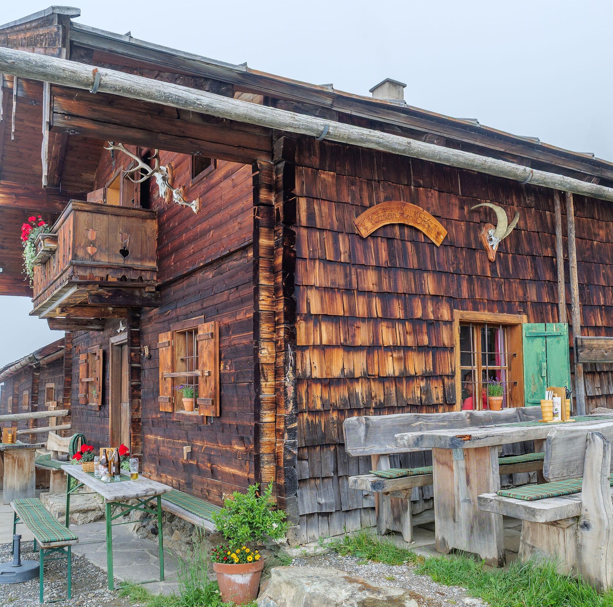
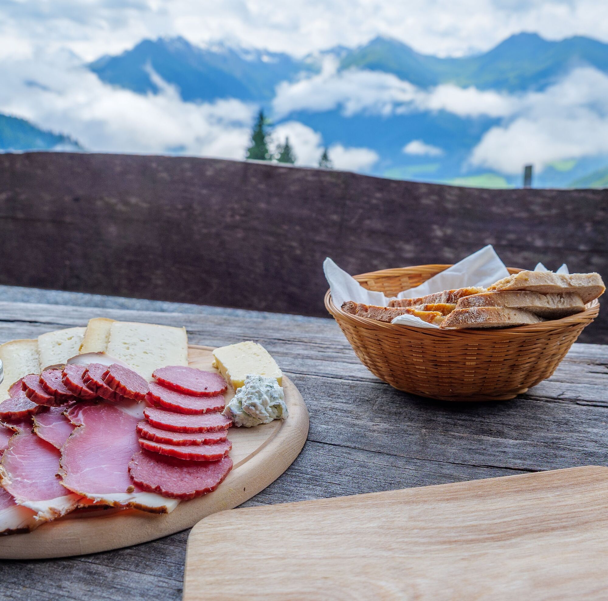
A refreshment on the rustic Katzsteinalm with home-made products such as cheese and bacon rewards the tour.
Parcours populaires à proximité
-
4,7
Tristkogel
difficileRandonnée 15,6 km -
4,5
Sigmund Thun Klamm
facileRandonnée 3,10 km -
4,7
Fusch: Gleiwitzer Hütte
difficileRandonnée 8,26 km -
4,8
Sigmund Thun Klamm, Klammsee, Bürgkogel
facileRandonnée 4,56 km -
4,2
Spielbergalmen
moyenRandonnée 10 km -
5,0
Manlitzkogel
difficileRandonnée 13,4 km -
4,2
Saalachtaler Höhenweg EST (Asitz - Biberg)
moyenRandonnée 13,1 km -
4,4
Thumersbach, Runde um den Zeller See
facileRandonnée 13,3 km -
3,3
Hinterglemm: Talschluß-Höhenweg
facileRandonnée 10,8 km -
4,3
Schattberg Summit Round
moyenRandonnée 3,17 km
Randonnée et suivi


Ne manquez pas les offres et l'inspiration pour vos prochaines vacances
Votre adresse électronique a été ajouté à la liste de diffusion.