


Col de Kunkel dans le patrimoine mondial Sardona
Le col de Kunkel (1357 m d'alt.) relie Vättis à Tamins. La charmante haute plaine se présente comme une arène, entourée par les montagnes du Calanda (2805 m d'alt.), du Crap Mats (2947 m d'alt.) et du...
Le col de Kunkel (1357 m d'alt.) relie Vättis à Tamins. La charmante haute plaine se présente comme une arène, entourée par les montagnes du Calanda (2805 m d'alt.), du Crap Mats (2947 m d'alt.) et du Ringelspitz (3247 m d'alt.) situé dans la Tektonikarena Sardona, la plus haute montagne du canton de Saint-Gall.
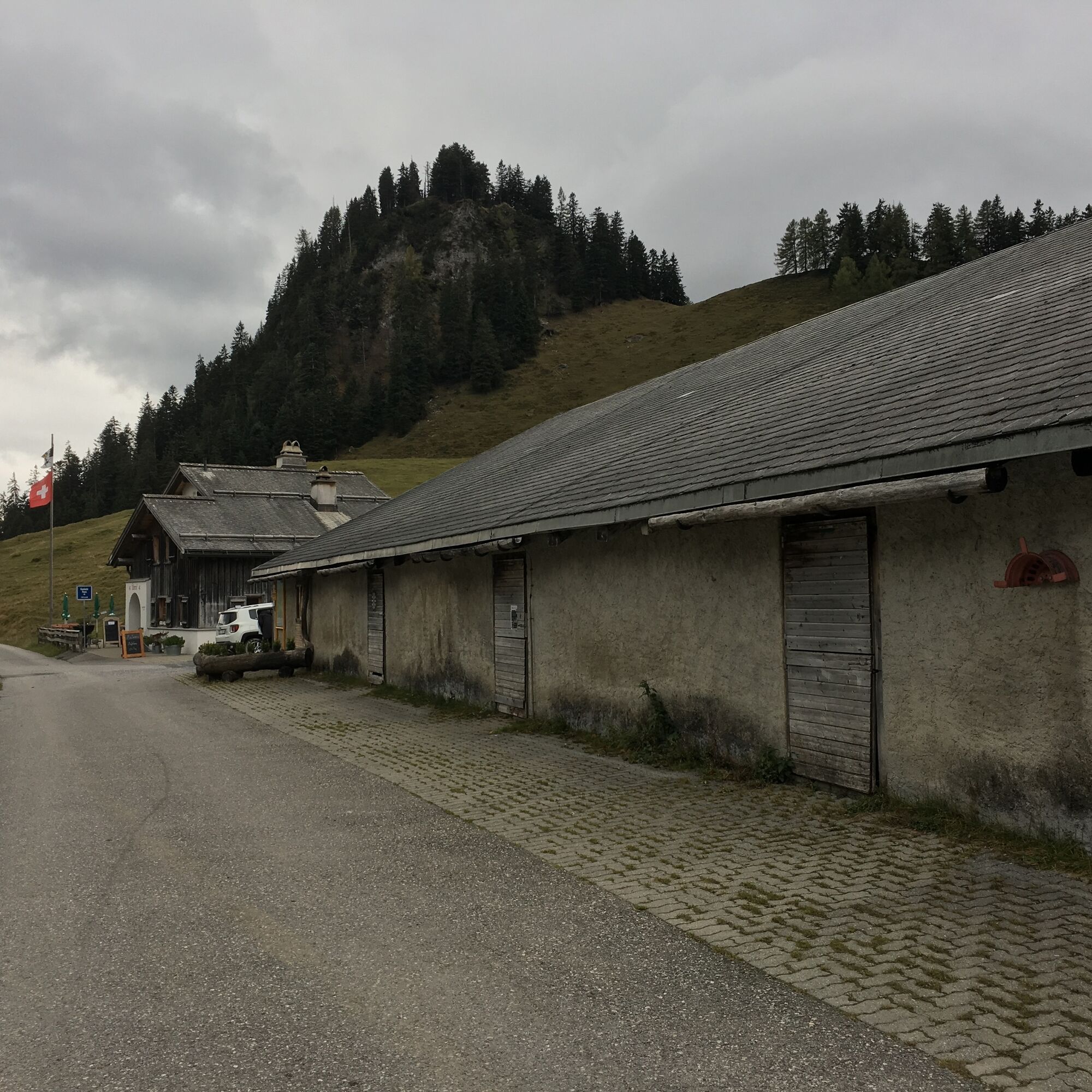
Depuis Vättis (943 m d'alt.), une randonnée facile mène au col de Kunkel. Le sentier longe le ruisseau Görbsbach à travers prairies et parties boisées en montée douce jusqu'à Unter Kunkels (1073 m d'alt.). Quel régal pour les yeux, surtout au début de l'été, lorsque la flore alpine s'éveille ! Sur le flanc gauche de la vallée, dominent les Calanda de Haldenstein et de Felsberg avec leurs formations calcaires escarpées. Quand le chemin devient un peu plus raide, on approche de l'auberge de montagne Eggwald à Ober Kunkels (1148 m d'alt.). Les randonneurs gourmets laissent le « pilote automatique » prendre le contrôle face à ce charmant établissement et se dirigent directement vers le restaurant-jardin. Mais jusqu'au sommet du col de Kunkel (1357 m d'alt.), il ne reste plus beaucoup de chemin.
Le col de Kunkel comme destination ou étape
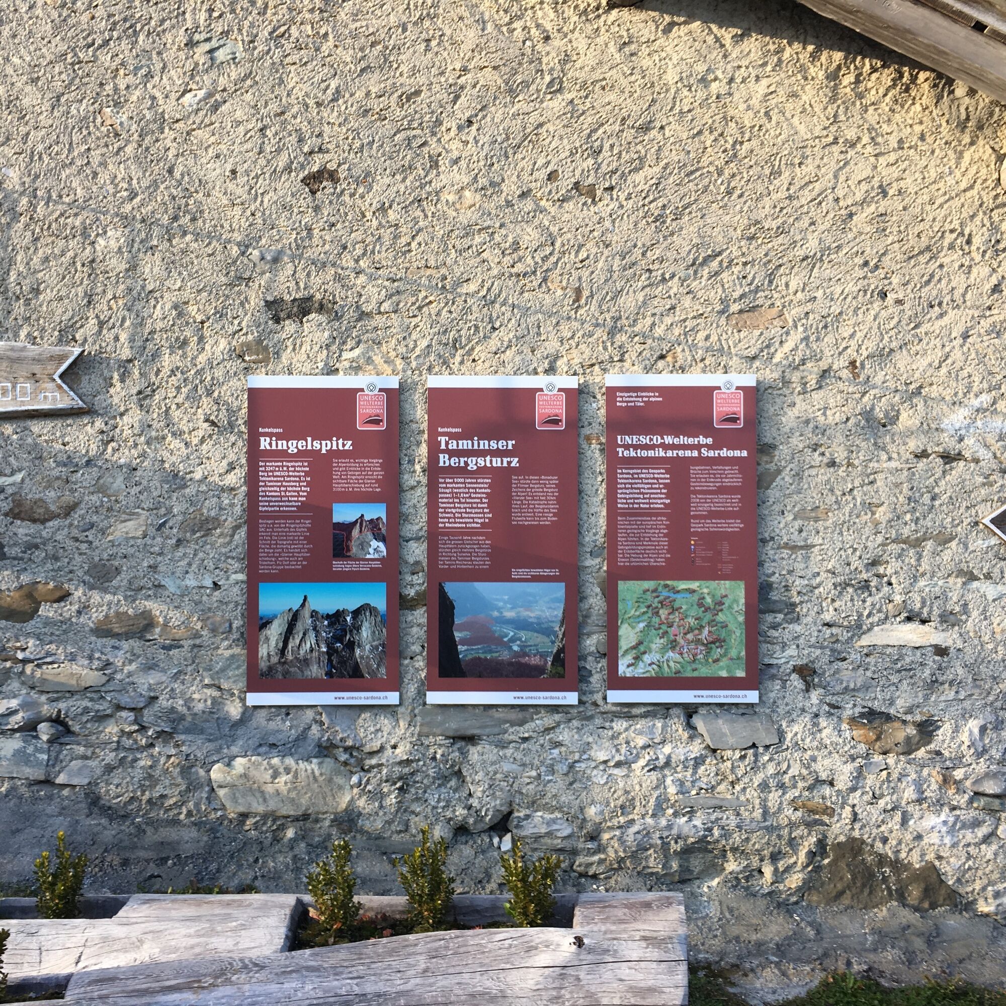
À l'auberge Überuf, on se prélasse volontiers sur la terrasse-jardin ou dans la salle chauffée au poêle à bois. À côté se trouve une salle de séminaire avec des informations sur le patrimoine mondial UNESCO Tektonikarena Sardona. On est fier de pouvoir offrir, avec Kunkels, l'entrée est dans ce pays géologique merveilleux. Un télescope permet de voir de près le Ringelspitz, la principale chevauchement des Glaris ou la niche d'arrachement de la coulée de boue de Tamins. Parfois au fond de la mer, parfois sous 800 mètres de glace glaciaire – l'histoire de la Terre offre aussi beaucoup de variété à Kunkels.
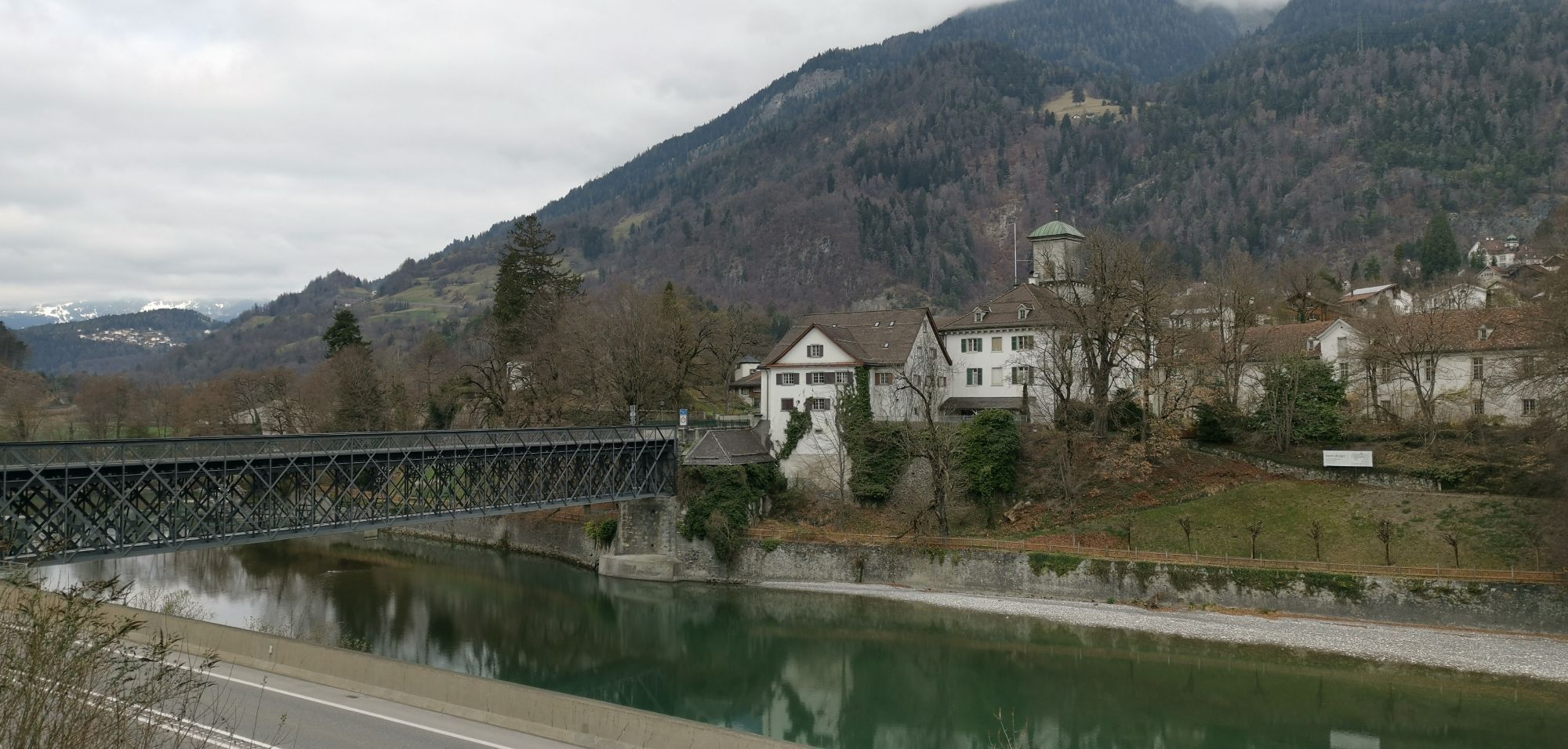
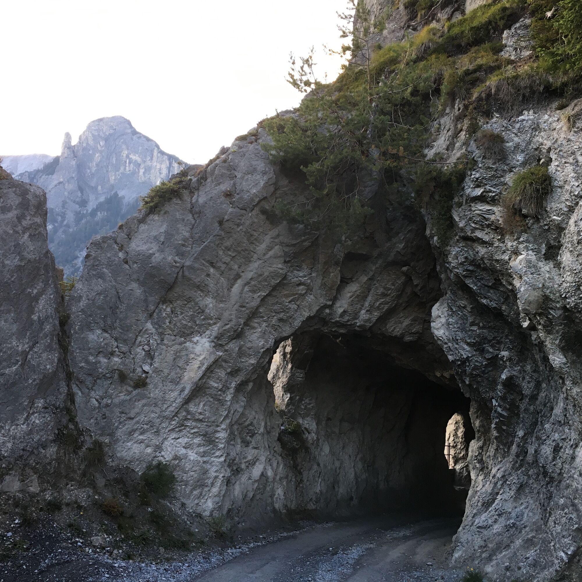
Le chemin le plus court vers la vallée descend par une route construite pendant la Première Guerre mondiale jusqu'à Tamins (660 m d'alt.). La vue depuis le tunnel creusé dans la roche est spectaculaire. Ceux qui veulent continuer en altitude montent via Grossalp jusqu'à la cabane SAC Ringelspitz (1998 m d'alt.). On profite de cette cabane conviviale comme d'un balcon est panoramique de la Tektonikarena Sardona.

Vättis – Unter Kunkels – Ober Kunkels – col de Kunkel - Reichenau
Oui
Équipement de randonnée normal. Selon les conditions météorologiques, de bonnes chaussures (chaussures de randonnée) sont recommandées, sinon des chaussures de trekking légères suffisent pour le parcours.
Emmenez un équipement adapté au parcours et restez sur les sentiers balisés.
Car postal depuis la gare de Bad Ragaz jusqu'à Vättis, départs à xh35, retour : avec la RhB depuis la gare de Reichenau/Tamins
Heidiland Tourismus, office d'information Bad Ragaz
T +41 81 300 40 20
www.heidiland.com
Visitez l'exposition sur les séismes à Vättis et découvrez notamment comment les tremblements de terre sont liés à la formation des montagnes.
Webcams de la tournée
Parcours populaires à proximité
-
4,7
5-Seen Wanderung am Pizol
facileRandonnée 10,1 km -
4,4
Randonnée des 4 lacs : Caumasee - Crestasee - gorge Felsbach
moyenRandonnée 12,8 km -
4,6
Parcours circulaire du Pizalun
facileRandonnée 7,18 km -
4,8
Gorge du Rhin : de Ilanz à Versam au cœur de la Gorge du Rhin
moyenRandonnée 11,4 km -
4,8
Randonnée dans la gorge du Rhin : Senda Ruinaulta (659)
facileRandonnée 9,39 km -
4,8
Randonnée en montagne jusqu'aux marmites de géant de l'alpage Mora : Bargis-Trin
difficileRandonnée 18 km -
4,7
Pizol - Batöni - Weisstannen
difficileRandonnée 11,7 km -
4,7
Le chemin d'eau : Trutg dil Flem 764
difficileChemin thématique 8,56 km -
5,0
Caumasee tour: Flims - Caumasee - Conn - Flims
facileRandonnée 7,94 km -
5,0
Randonnée circulaire Bettlerweg & randonnée des 2 lacs Pizol
moyenRandonnée 11,4 km
Randonnée et suivi


Ne manquez pas les offres et l'inspiration pour vos prochaines vacances
Votre adresse électronique a été ajouté à la liste de diffusion.