


Rotmäuer - Falkenstein - Kreuzberg


Photos de nos utilisateurs
-
 © stmikeCréé le 09.03.2025
 -
 © stmikeCréé le 09.03.2025
 -
 © stmikeCréé le 09.03.2025
 -
 © stmikeCréé le 09.03.2025
 -
 © stmikeCréé le 09.03.2025
 -
 © Angelika Poschinger-RehCréé le 17.02.2025
 -
 © Angelika Poschinger-RehCréé le 17.02.2025
 -
 © Angelika Poschinger-RehCréé le 17.02.2025
 -
 © Angelika Poschinger-RehCréé le 17.02.2025
 -
 © Angelika Poschinger-RehCréé le 17.02.2025
 -
 © Angelika Poschinger-RehCréé le 17.02.2025
 -
 © Angelika Poschinger-RehCréé le 17.02.2025
 -
 © Angelika Poschinger-RehCréé le 17.02.2025
 -
 © Angelika Poschinger-RehCréé le 17.02.2025
 -
 © Angelika Poschinger-RehCréé le 17.02.2025
 -
 © Angelika Poschinger-RehCréé le 17.02.2025
 -
 © Angelika Poschinger-RehCréé le 17.02.2025
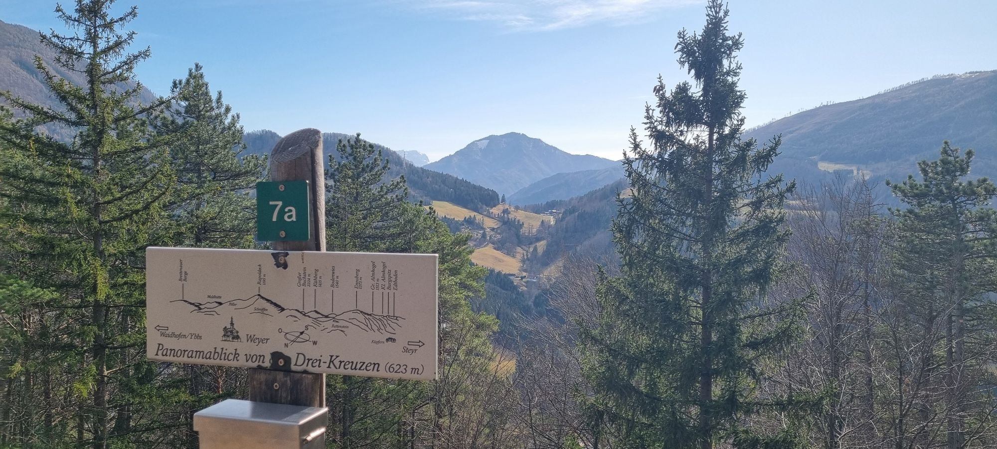


From the marketplace in Weyer you walk along the Gaflenzbach past the Schmidbergerwehr to the Gasselgraben, from where you turn off across the Au in the direction of the Rotmäuer. Mostly on forest paths...
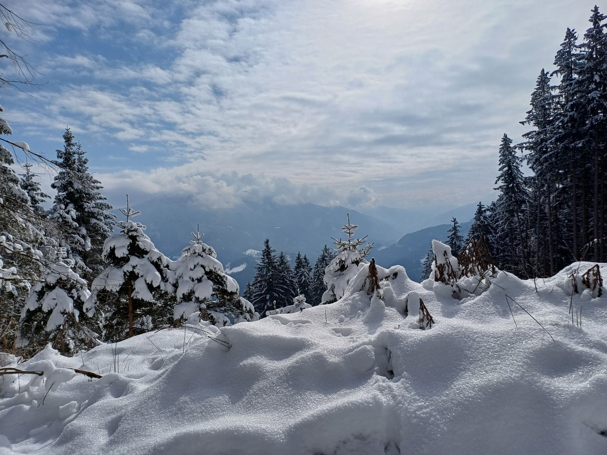
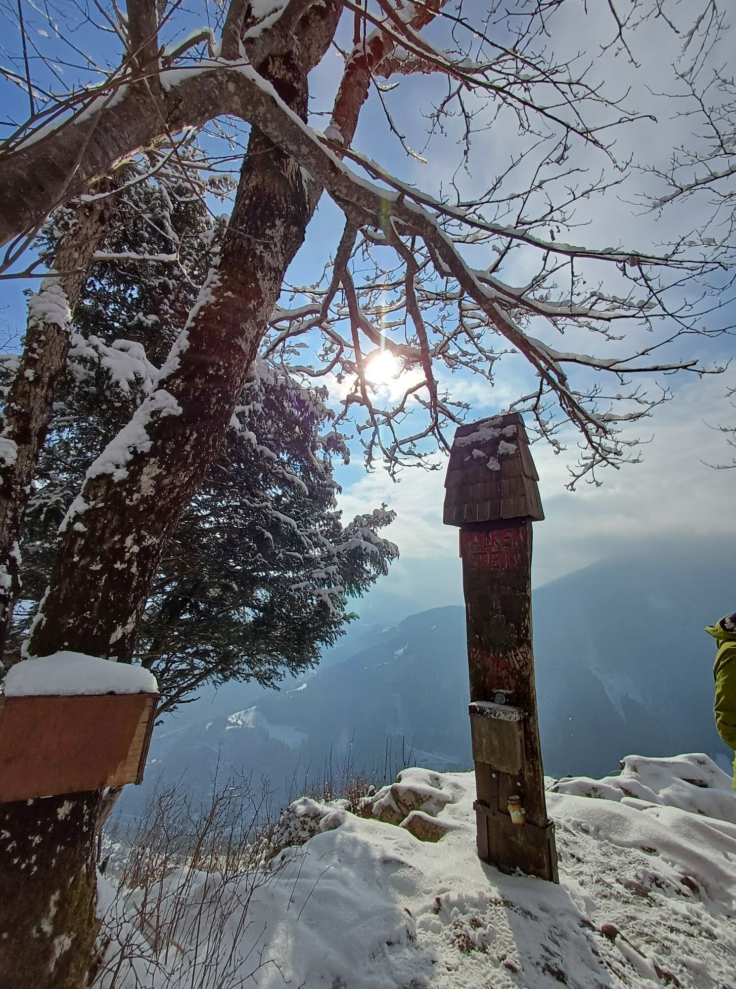
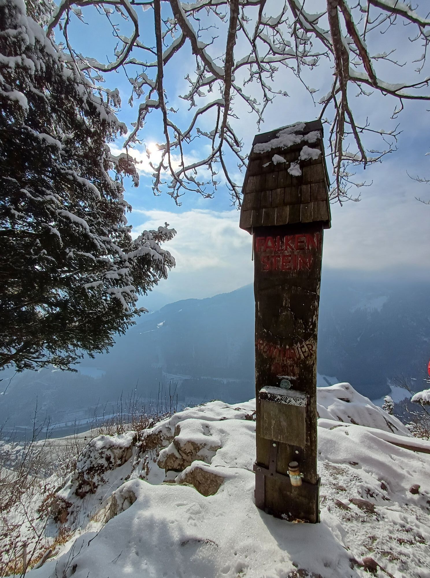
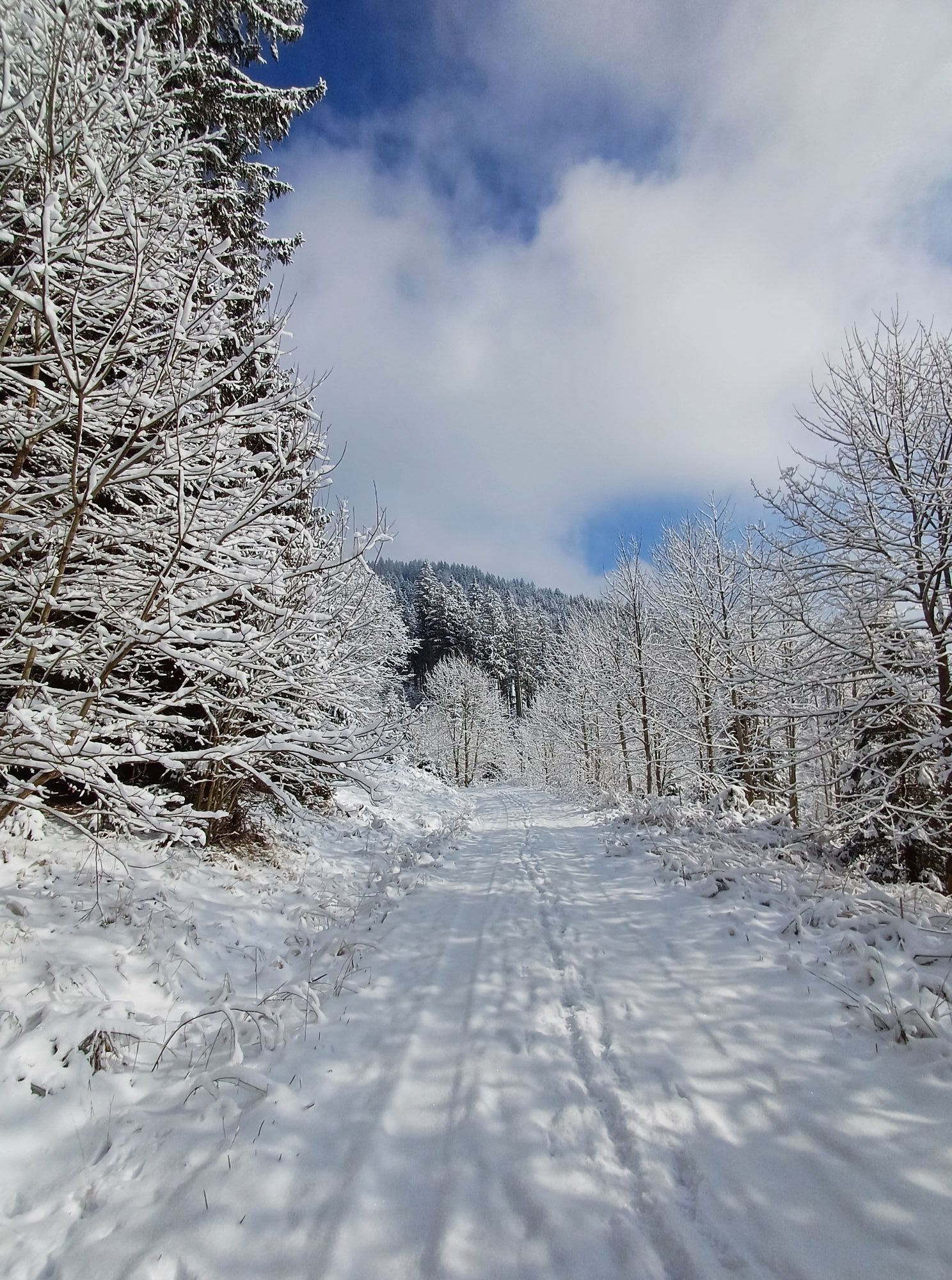
From the marketplace in Weyer you walk along the Gaflenzbach past the Schmidbergerwehr to the Gasselgraben, from where you turn off across the Au in the direction of the Rotmäuer. Mostly on forest paths you reach the summit of the Rotmäuer (837 m). After a short stretch back, you go up to the Falkenstein (993 m) and via the gravel road and then the Kreuzberg nature reserve back to the starting point.
Trail number: E20, E22


From Weyer you get along the Gaflenzbach past the Schmidbergerwehr to the actual start of the trail in the Gasselgraben, which you first follow, then turn left at the Buderhaus in the direction of Rotmäuer.
Passing the Joglbauer and the Kochlöffl, the trail now leads to the summit of the Rotmäuer (837 m). After a short way back, you go up to the Falkenstein (993 m) and via the forest road and then the Kreuzberg nature reserve back to the starting point.
Oui
No gastronomy along the way, so bring drinks and a snack if needed.
From Salzburg/Linz: A1 motorway exit Enns-Steyr > B115 into the Enns Valley.
From Vienna: A1 motorway exit Haag > B42 > B122 > B115 into the Enns Valley
From Passau: A8 Passau > Wels > A1 motorway exit Enns-Steyr > B115 into the Enns Valley
From Graz: A9 Pyhrnautobahn > motorway exit Klaus > Grünburg > into the Ennstal valley
The Ennstalbahn runs between Linz and Weißenbach-St. Gallen.
Details at www.ooevv.at
Railway Stations are located in Ternberg, Trattenbach, Losenstein, Reichraming, Großraming, Gaflenz, Weyer, Küpfern, Kastenreith, Kleinreifling and Weißenbach-St. Gallen.
Weyer/Kreuzberg Parking
Climate-friendly to the National Park Region - railway station Weyer or railway station Kastenreith: By train you can reach the starting point for this hike in about 2 hours from Linz and in about 2.5 hours from Vienna.
Parcours populaires à proximité
-
4,5
Steinerner Jäger (1185m) und Schieferstein (1206m) ab Parkplatz Hochhabichler
moyenRandonnée 4,46 km -
4,8
Ennser Hütte - Almkogel (via parking Bamacher)
moyenRandonnée 3,53 km -
4,3
Hollenstein Stupfmauer Voralpe Tanzboden retour 20.08.2016
moyenRandonnée 15,6 km -
5,0
Viehtaleralm, Bodenwies Gipfel, Rundweg
moyenRandonnée 13,3 km -
4,7
GROSSRAMING Bamacher, Burgspitz, Almkogel, Ennshütte 20240730
moyenRandonnée 10 km -
3,9
Schieferstein und Steinerner Jäger von Reichraming, Oberösterreich
moyenRandonnée 3,82 km -
4,6
Opponitzer Schluchtenwanderweg
facileRandonnée 4,42 km -
3,7
Lindaumauer (1103 m)
Randonnée 3,40 km -
4,0
Ennser Hütte, Stallburgalm, Burgspitz, Almkogel
moyenRandonnée 11,6 km -
3,0
Ennser Hütte - Almkogel (from Großraming railway station)
moyenRandonnée 9,33 km
Randonnée et suivi


Ne manquez pas les offres et l'inspiration pour vos prochaines vacances
Votre adresse électronique a été ajouté à la liste de diffusion.