


Sebaldusweg stage 2 | Laussa - Maria Neustift


Discover along the way:
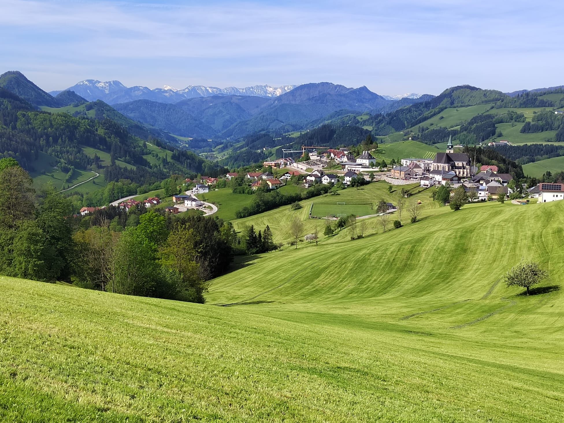
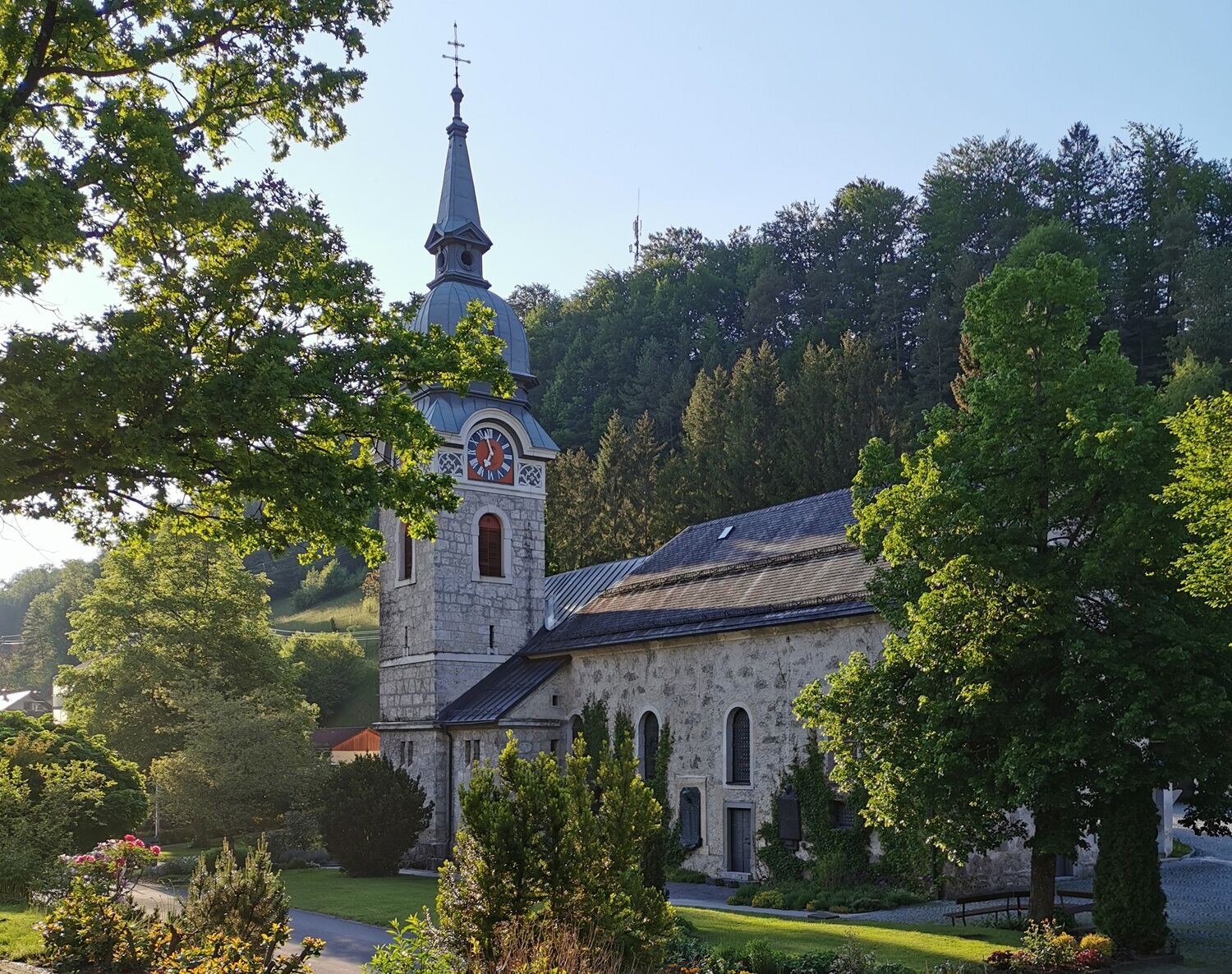
Parish church in Laussa (consecrated to St. Mary), limestone wall nature reserve and open-air swimming pool in Laussa, several chapels, stations of the Motorikpark Laussa, pilgrimage...
Parish church in Laussa (consecrated to St. Mary), limestone wall nature reserve and open-air swimming pool in Laussa, several chapels, stations of the Motorikpark Laussa, pilgrimage church Maria Neustift (Maria Heil der Kranken), salvation path as well as signposted chapel paths with a magnificent panorama in Maria Neustift, traditional wood-fired oven pastries.
Off the beaten track:
Laussa Orchideenwiese nature reserve, sport climbing with over 180 routes on several rocks situated in and around the village centre, including the famous "Sauzahn", THE climbing centre in the Enns Valley. Maria Neustift family-friendly hikes on the Glasenberg and Freithofberg, Ramingtaler Bogenparcours.
Breathe deeply:
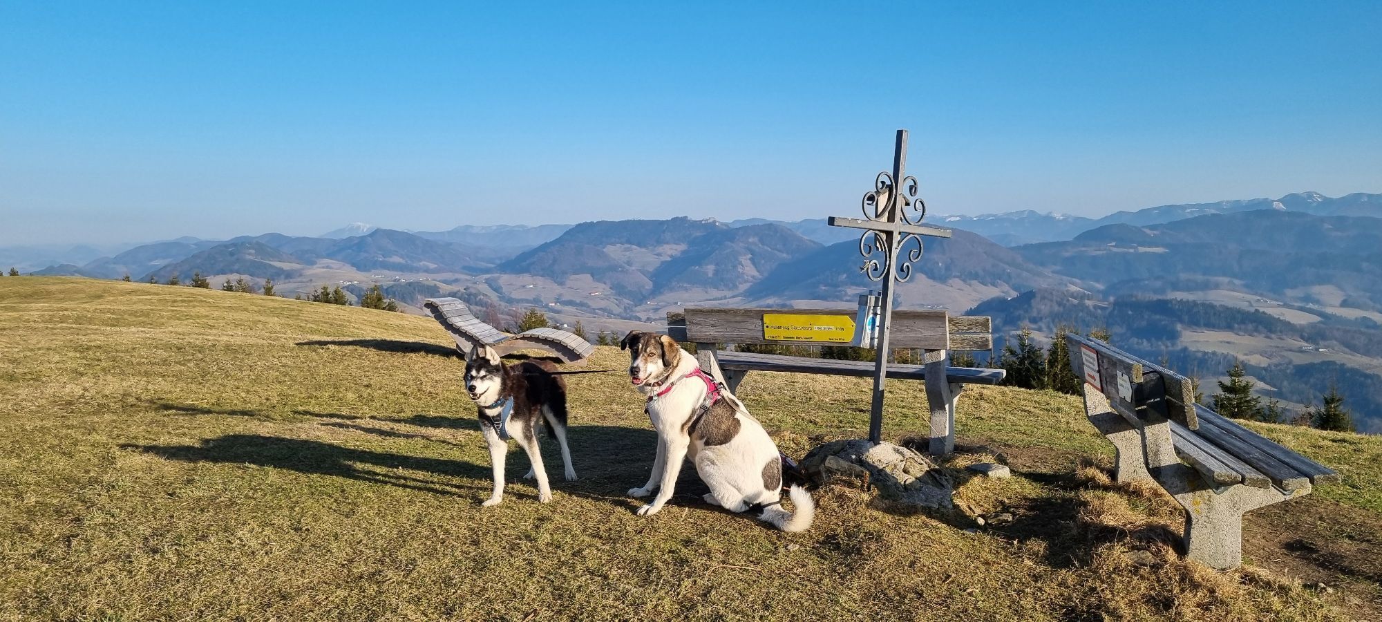
Plattenberg - wind turbines Enjoy the view on the entire ridge of the Sonnberg.


From the Laussa parish church, walk to the Geiger inn, then behind the inn along the climbing rock and up via a meadow path. At the Breitn Chapel, turn left onto the Rotbauer Güterweg (goods path), along the Flößerweg (raftsmen's path), and after a long stretch uphill, past the Schneiderweg holiday farm, you reach the turnoff onto the ridge of the Sonnberg. From here you follow the long-distance hiking trail 04/06, pass the Laussa wind farm, then the Spadenberg and arrive at Maria Neustift via the Glasenberg - a detour to the summit is very worthwhile because of the view and the panorama of pre-Alpine peaks.
Alternative from Gasthof Kleinschönleiten: from the inn, hike along the Kneipp Peace Trail (E 50) across the juniper heath to the Rebenstein Wall natural monument and from there continue in the direction of Sonnberg, where you meet up with the Sebaldus Trail again.
Sturdy walking shoes, sun and rain protection, first aid kit for emergencies, possibly walking sticks.
As there are few opportunities to stop for refreshments directly along the trail, it is advisable to take enough snacks and drinks with you.
A1 motorway exit Enns-Steyr > B115 into the Enns Valley. From Vienna: A1 motorway exit Haag > B42 > B122 > B115 into the Enns Valley From Passau: A8 Passau > Wels > A1 motorway exit Enns-Steyr > B115 into the Enns Valley From Graz: A9 Pyhrnautobahn > motorway exit Klaus > Grünburg > into the Ennstal valley
The Ennstalbahn runs between Linz and Weißenbach-St. Gallen. Details at www.ooevv.at
Railway Stations are located in Steyr, Garsten, Lahrndorf, Dürnbach, Ternberg, Trattenbach, Losenstein, Reichraming, Großraming, Gaflenz, Weyer, Küpfern, Kastenreith, Kleinreifling and Weißenbach-St. Gallen.
Großraming: Public parking spaces behind the Landesmusikschule or at the former Salzwimmer Inn.
Losenstein: Public parking spaces at the railway station or at the Blasl family inn.
Laussa: Öffentliche Parkplätze (public parking spaces) opposite Kaufhaus Baumgartner.
Maria Neustift: Öffentliche Parkplätze (public parking spaces) on the left behind the Gemeindeamt (municipal office).
Gaflenz: Public parking spaces at the municipal office, open-air swimming pool
Weyer: Kreuzberg car park
Information on places to stop for refreshments and overnight stays or bookable offers at www.sebaldusweg.at
Maria Neustift Glasner Hütte, Roisentaverne, GasthausBäckerei Schaupp, BäckereiCafe Steinparzer
Webcams de la tournée
Parcours populaires à proximité
- 4,4
Ternberg -Schoberstein
moyenRandonnée6,60 km - 4,5
Steinerner Jäger (1185m) und Schieferstein (1206m) ab Parkplatz Hochhabichler
moyenRandonnée4,46 km - 4,8
Ennser Hütte - Almkogel (via parking Bamacher)
moyenRandonnée3,53 km - 4,6
Pfaffenmauer - Schoberstein - Gipfel der Lust Gasthof Klausriegler, Oberösterreich/Österreich
moyenRandonnée9,72 km - 4,7
GROSSRAMING Bamacher, Burgspitz, Almkogel, Ennshütte 20240730
moyenRandonnée10 km - 3,9
Schieferstein und Steinerner Jäger von Reichraming, Oberösterreich
moyenRandonnée3,82 km - 4,8
Schoberstein via Trattenbach/Gasthaus Klausriegler
moyenRandonnée2,60 km - 3,7
Lindaumauer (1103 m)
Randonnée3,40 km - 4,0
Ennser Hütte, Stallburgalm, Burgspitz, Almkogel
moyenRandonnée11,6 km - 4,2
Gipfel der Lust, Koglerstein, Schobersteinhaus
facileRandonnée8,56 km
Randonnée et suivi


Ne manquez pas les offres et l'inspiration pour vos prochaines vacances
Votre adresse électronique a été ajouté à la liste de diffusion.