


The steep trail: Seebodenalp - Rigi Staffel (or vice versa)
The starting point of this challenging hike on the north slope of the Rigi is the hiking paradise of Seebodenalp. It is situated on a large, protruding terrace at 1020 m.a.s.l. above Küssnacht am Rigi....
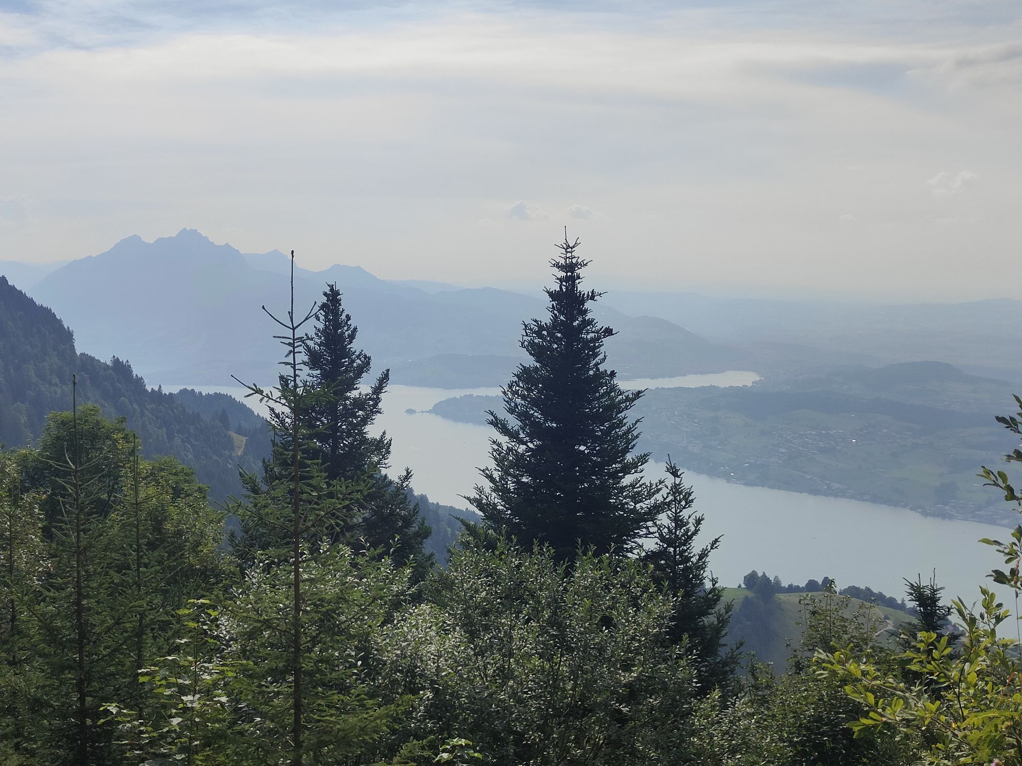
The starting point of this challenging hike on the north slope of the Rigi is the hiking paradise of Seebodenalp. It is situated on a large, protruding terrace at 1020 m.a.s.l. above Küssnacht am Rigi. Lake Lucerne glistens at your feet and Rigi Kulm towers high above. The fastest and most comfortable way to reach the forest-lined alp is by cable car from Küssnacht to Seebodenalp. Rustic mountain restaurants invite you to enjoy and stay a while.
Notes
The current operating status of the railways and hiking trails can be found here. So that future generations can also enjoy the Queen of the Mountains, we ask you to dispose of your waste at the stations or take it home with you. Thank you.
Seebodenalp (1020 m) - Grodboden (1030 m) - Holderen (1116 m) - Düssen (1300 m) - Rigi Staffel (1604 m)
Sturdy shoes and clothing suitable for the weather. Possibly walking sticks. Food and drinks for the road.
Take the A4 motorway to the Küssnacht am Rigi exit and follow the signs for Weggis - Vitznau.
Approach and parking
Take public transport to the valley station of the Küssnacht-Seebodenalp cable car. The cable car is in continuous operation when the number of guests is high. To the timetable
Metered parking is available at the valley station of the Küssnacht-Seebodenalp cable car.
However, we recommend public transport instead of a car: sit back, enjoy and do something good for the environment to boot.
As a reward, I treat myself to a cool Rigi beer at the Lok 7 restaurant on Rigi Staffel. Brewed at the Hotel Seebodenalp.

Parcours populaires à proximité
-
3,9
Rundweg Seebodenalp Küssnacht am Rigi, Schweiz
moyenRandonnée 9,56 km -
4,4
Seebodenalp Panoramaweg
facileRandonnée 5,25 km -
3,9
Gnipen - ab Goldau - Rundwanderung
moyenRandonnée 10,6 km -
4,8
Rigi Kulm von Vitznau aus
moyenRandonnée 17,6 km -
4,8
Home-Rigi Kulm-Home
moyenRandonnée 18,6 km -
5,0
Kleine Rigi Runde🥾🏔
moyenRandonnée 14,0 km -
5,0
Zugerberg - via Blasenberg - Rundwanderung
facileRandonnée 9,44 km -
5,0
Emmetten/Niederbauen - Niederbauen Chulm - Hundschopf - Fulberg - Oberbauenstock - Zingel - Wandeli - Choltal - Emmetten
moyenRandonnée 18,4 km -
4,5
Wildspitz bei Sattel-Aegeri
facileRandonnée 12,9 km -
3,5
Logenplatz über dem Vierwaldstädter See
moyenVia ferrata 8,87 km
Randonnée et suivi


Ne manquez pas les offres et l'inspiration pour vos prochaines vacances
Votre adresse électronique a été ajouté à la liste de diffusion.