


ÖPNV-Tour: Auf dem Rothaarsteig von Dillenburg nach Haiger
From the train station in Dillenburg, the path to the main Rothaarsteig trail is signposted. From Hofgarten, follow the Westerwald variant of the Rothaarsteig. On your way out of Dillenburg, you first...
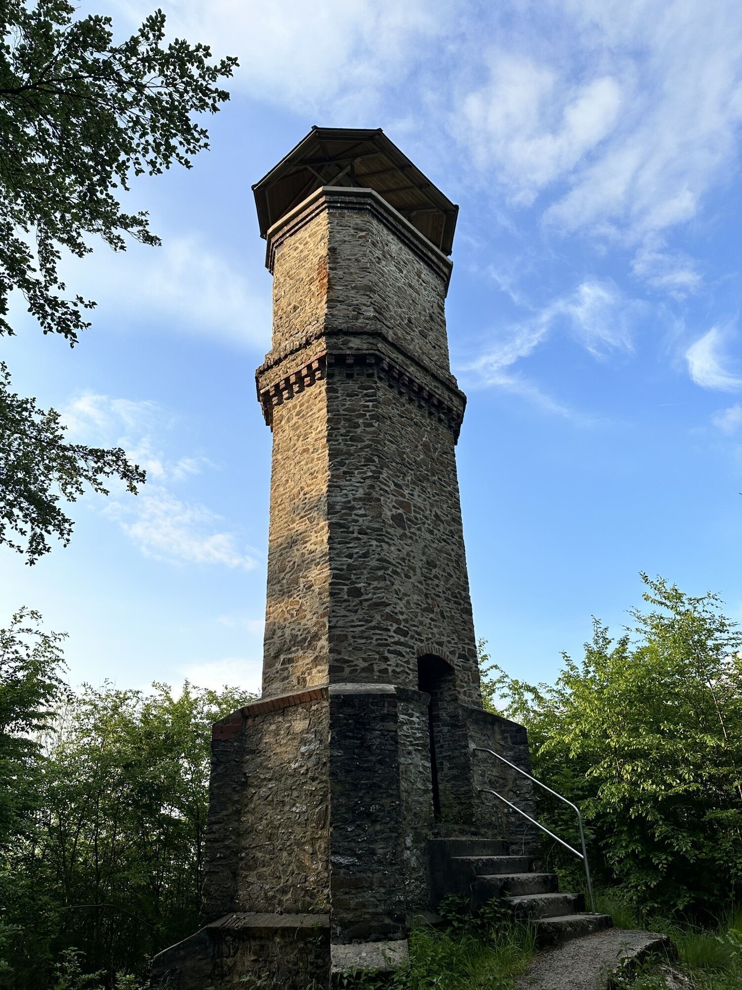
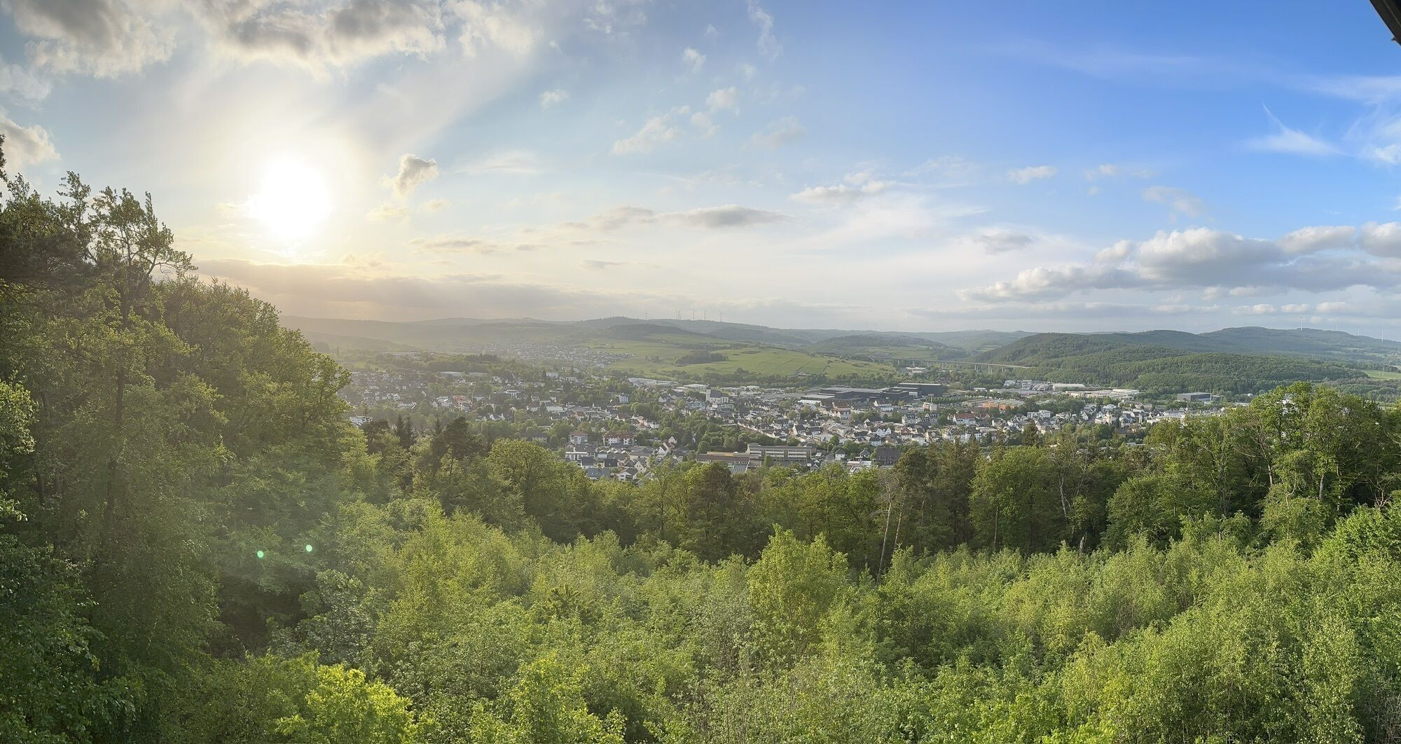
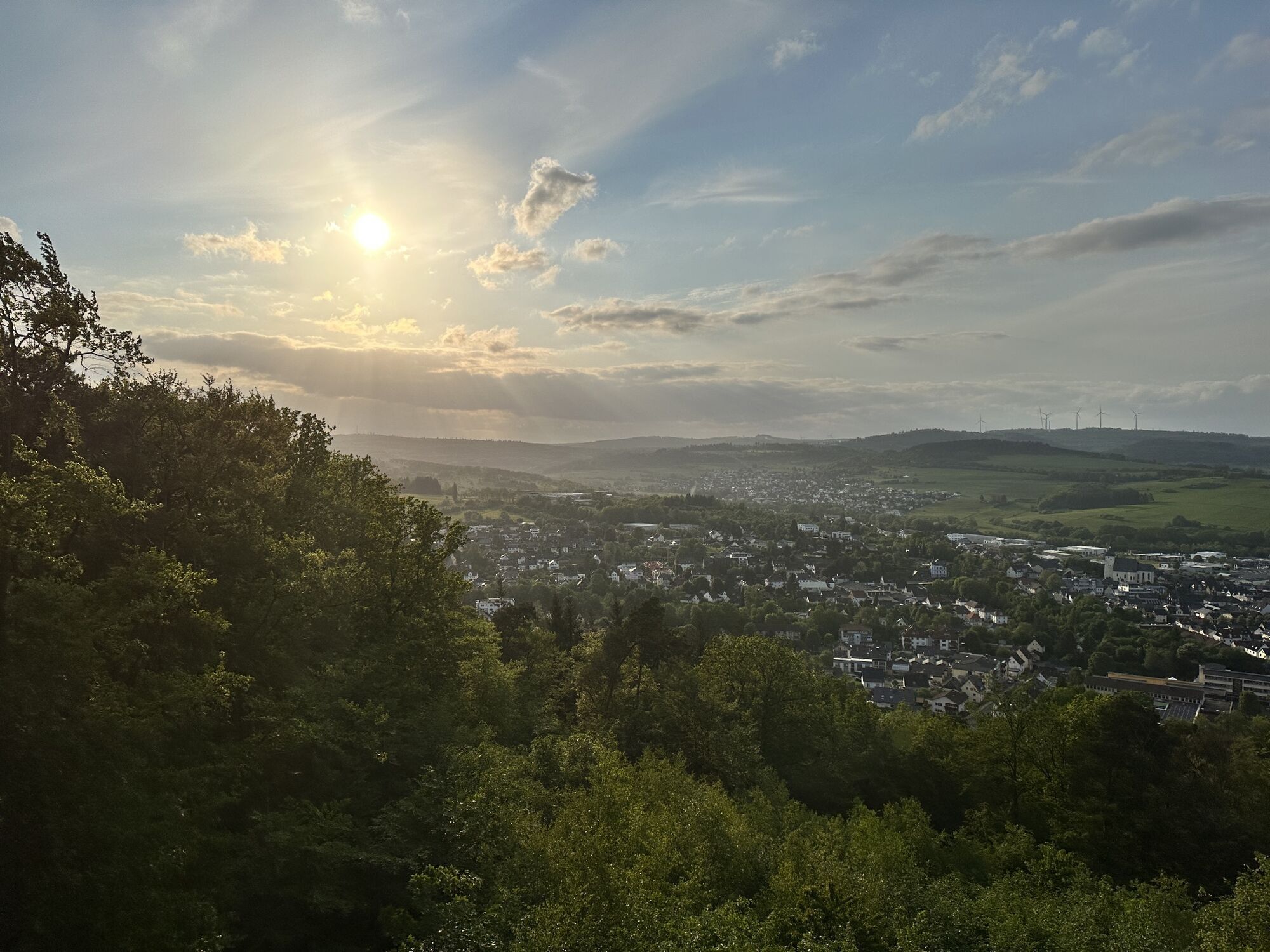
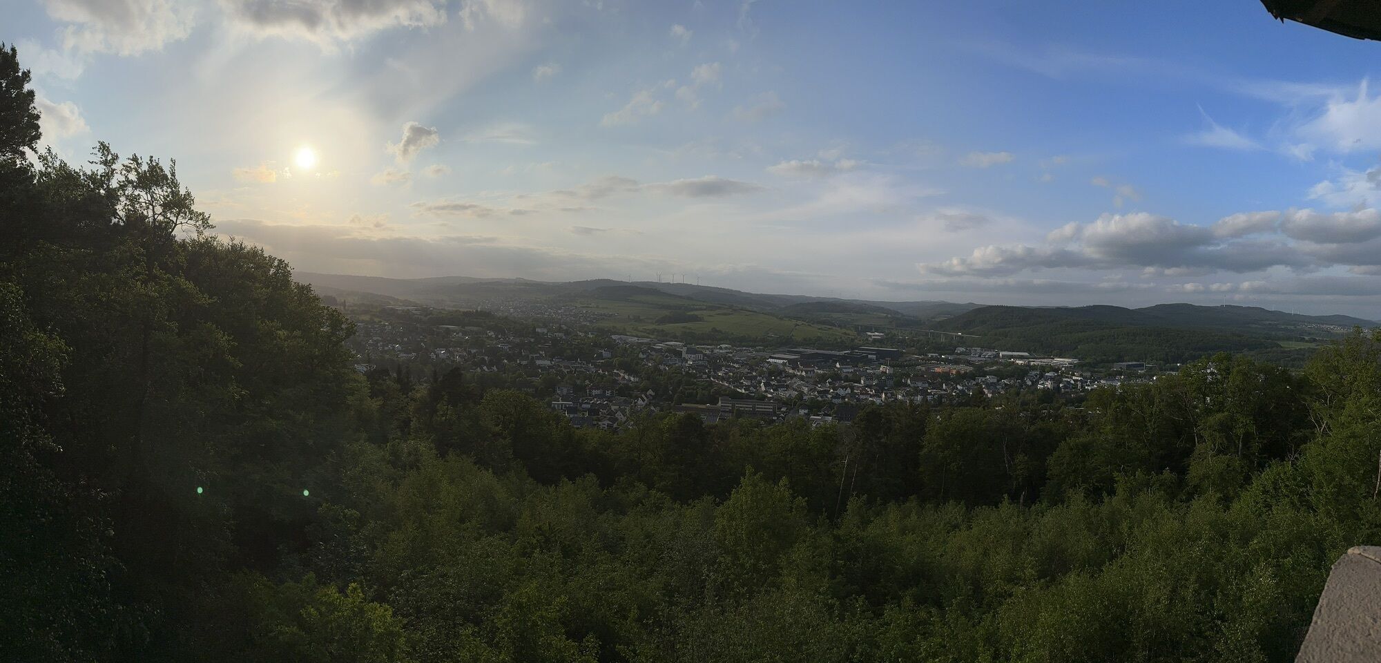
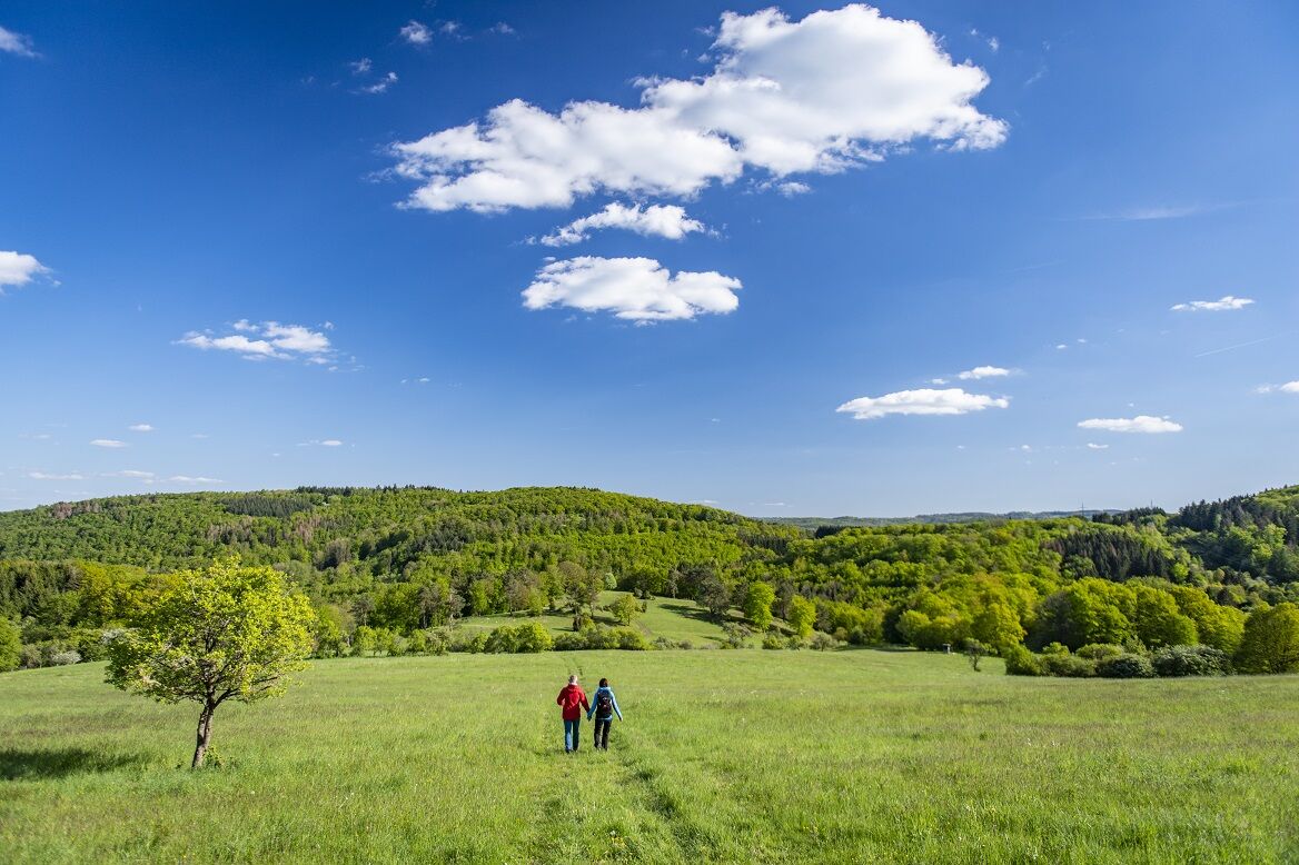
From the train station in Dillenburg, the path to the main Rothaarsteig trail is signposted. From Hofgarten, follow the Westerwald variant of the Rothaarsteig. On your way out of Dillenburg, you first pass the Waat-Tret installation, inviting you to experience different surfaces with bare feet. Only about 1.5 kilometers further, you encounter the CO2 experience trail, which makes the connections between climate change, CO2, forest, and wood use interactively tangible. On your further way, you hike over the Kornberg near Donsbach, which offers a particularly extensive and beautiful view. A Rothaarsteig forest swing invites you to relax. Refreshed, you continue on the main trail, which you leave after the waypoint "Stangenwaage." Via the yellow-marked Rothaarsteig access path Haiger-South, you walk past the Eduard Tower to the train station in Haiger.

Dillenburg - Waat-Tret-Installation - CO2 Experience Trail - Kornberg - Haiger
The Rothaarsteig leads over numerous natural paths away from agricultural and forestry roads. Therefore, weatherproof clothing and sturdy footwear are a must for every hike. We want you to experience the "Path of the Senses" not only "dry" but also "happy on your feet."
In our small hiking shop at www.rothaarsteig.de/shop you will also find a selection of Rothaarsteig items to prepare for your route or as souvenirs. We are also happy to recommend the durable and high-quality outdoor equipment from our long-time partner, the outdoor outfitter Tatonka.
Hiking backpack
With a suitable hiking backpack, your route on the Rothaarsteig is twice as much fun! Hiking backpacks provide very comfortable carrying properties thanks to a ventilated carrying system that allows sweat to evaporate immediately. They can be fixed with a waist or hip belt and thus sit firmly on the back during every movement. They are also equipped with a practical holder for hiking poles and often offer a compartment with a hose outlet for a hydration bladder, so fluid supply is always secured.
Here you will find hiking backpacks from the outdoor outfitter Tatonka in various sizes for day hikes and multi-day tours with different ventilated back systems.
Rainwear
If changeable weather is expected for your route on the Rothaarsteig, remember to pack a light rain jacket or a rain poncho. They take up almost no space in your backpack and also protect against unpleasant wind. Also practical are gaiters, which protect the trouser legs from dirt and moisture. Our partner, the outdoor outfitter Tatonka, offers high-quality, breathable rain jackets with minimal packing size, light rain capes, and gaiters for trouser legs to keep them protected from dirt and moisture.
Here you will find rain jackets from Tatonka for women
The rain jackets from Tatonka for men can be found here
First aid kit
To fully enjoy your hike on the Rothaarsteig, a first aid kit should definitely be in your backpack for safety. After all, nothing is more annoying than a blister on the foot or small injuries that cannot be properly cared for immediately. The first aid kits from Tatonka are filled with all essential materials for first treatment of injuries and also include an "outdoor cheat sheet" with a concise and clear guideline for proper behavior in emergencies in the wild.
Here you will find the first aid kits from Tatonka!
Food and drinks
On some stages, especially between Lahnhof and Dillenburg, there are unfortunately no dining options along the way. Remember particularly here to pack food and drinks. Especially in summer, sufficient fluids are important.
The stainless steel bottles, insulated stainless steel flasks, and stainless steel lunch boxes from the German outdoor outfitter Tatonka are not only practical but also unbreakable and durable.
Information about the rescue panels on the Rothaarsteig
Hiking trails mostly run away from towns and settlements, and all hikers have surely wondered what would happen in an emergency. How can I be found here? Where am I exactly? Can the rescue service reach me?
In an emergency, quick action is essential! Therefore, the Rothaarsteig is continuously equipped with so-called rescue signs. On the green-white plaques attached to the posts of the signposts is a number that you must provide when placing an emergency call. This allows rescue forces to know exactly where you are, saving valuable time.
Note on increased forest fire risk
Please keep in mind that due to dryness, there is currently an increased forest fire risk! Therefore, please observe the following:
Adhere to the legal smoking ban in the forest - valid in spring, summer, and autumn, specifically from March 1st to October 31st. Observe the ban on open fires in the forest and within 100 meters of the forest. Take glass out of the forest - the burning glass effect can cause forest fires.If it is (too) late:
Extinguish small initial fires if it is safe for you. Check the spot carefully if necessary. Report fires via "112". Leave the danger area by the shortest route.The forest thanks you!
Dillenburg and Haiger have train stations served by Deutsche Bahn.
Further information can be found at www.bahn.de.
If you come by car, we recommend using public transport at the start of your route and parking the car at the end point. This way, you don't have to adapt your hike to the bus/train schedule.
If you arrive by car to Dillenburg, you can park for free and unlimited at the Aquarena (Stadionstraße 10, Dillenburg).
Further information on the Rothaarsteig is available at www.rothaarsteig.de or by phone on the free service hotline at +49 2974 / 499 4163. Here we will be happy to advise you personally on your route planning.
Waat-Tret installation
CO2 experience trail
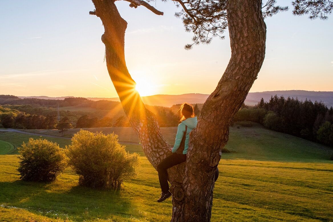
View from Kornberg with forest swing
Activités le long du parcours

Parcours populaires à proximité
-
4,5
GeoRoute Hörreliches Stippbachtal
facileChemin thématique 11,0 km -
Sentier de randonnée de la Lahn 01-19 en remontant le cours du fleuve (parcours complet, randonnée par étapes)
difficileChemin de Grande Randonnée 294,9 km -
Rothaarsteig-Spur Wacholderweg
moyenRandonnée 16,1 km -
Rothaarsteig-Spur Dill-Bergtour
moyenRandonnée 15,9 km -
Rothaarsteig-Spur Gernsdorfer Höhentour
moyenRandonnée 13,4 km -
Rothaarsteig Westerwaldvariante
difficileChemin de Grande Randonnée 71,8 km -
Rothaarsteig von der Haincher Höhe nach Dillenburg
difficileRandonnée 27,3 km -
Rothaarsteig von Irmgarteichen nach Rodenbach
difficileRandonnée 17,0 km -
ÖPNV-Tour auf dem Rothaarsteig: Von Haiger-Dillbrecht nach Wilnsdorf-Rudersdorf
moyenRandonnée 10,7 km -
Rothaarsteig von Rodenbach nach Dillenburg
difficileRandonnée 15,8 km
Randonnée et suivi


Ne manquez pas les offres et l'inspiration pour vos prochaines vacances
Votre adresse électronique a été ajouté à la liste de diffusion.