
Église Saint-Symphorien - Église Notre-Dame-de-l'Assomption - Chalet de Préperny - Villapourçon
difficile
Télécharge cette visite sur ton portable
Église Saint-Symphorien - Église Notre-Dame-de-l'Assomption - Chalet de Préperny - Villapourçon
difficile
Vélo de course
63,30
km
Scanner le code QR et commencer la navigation dans l'application bergfex


Randonnée & tracking





Église Saint-Symphorien - Église Notre-Dame-de-l'Assomption - Chalet de Préperny - Villapourçon
difficile
Distance
63,3
km
Durée
03:43
h
Ascension
1 339
m
Altitude
301 -
879
m

Naviguez dans votre circuit depuis l'application
Téléchargez gratuitement l'application et suivez votre parcours grâce à la navigation GPS et au suivi.
Profitez dès maintenant d'bergfex, dans l'application
Scannez le code QR avec votre appareil photo
Une fois l'application installée, le contenu s'ouvre directement. Si vous ne disposez pas encore de l'application, vous serez redirigé vers la page de téléchargement gratuit.
Téléchargement de la piste
Église Saint-Symphorien - Église Notre-Dame-de-l'Assomption - Chalet de Préperny - Villapourçon
difficile
Vélo de course
63,30
km
Parcours
Église Saint-Symphorien
(428 m)
Lieu de culte
0,3 km
Église Notre-Dame-de-l'Assomption
(330 m)
Lieu de culte
10,9 km
Fâchin
(613 m)
Village
21,0 km
Église Saint-Pierre
(622 m)
Lieu de culte
28,7 km
Col du Haut Folin
(873 m)
Col de montagne
36,3 km
Église Saint-Denis
(659 m)
Lieu de culte
52,0 km
Le Puits
(614 m)
Lotissement
57,5 km
Parcours
Église Saint-Symphorien - Église Notre-Dame-de-l'Assomption - Chalet de Préperny - Villapourçon
difficile
Vélo de course
63,30
km
Église Saint-Symphorien
(428 m)
Lieu de culte
0,3 km
Villapourçon
(425 m)
Village
0,3 km
Pré Chagnot
(395 m)
Couloir/terrain
0,9 km
Les Bourbas
(399 m)
Couloir/terrain
1,9 km
Planchaufaux
(384 m)
Couloir/terrain
2,3 km
Le Larre
(369 m)
Couloir/terrain
2,7 km
Au Dela du Goué
(364 m)
Couloir/terrain
2,8 km
Le Pont du Mousseau
(344 m)
Couloir/terrain
3,2 km
Prés Fellard
(379 m)
Couloir/terrain
3,7 km
Le Mousseau
(406 m)
Lotissement
4,2 km
Mouille Menot
(421 m)
Couloir/terrain
4,5 km
Sur Les Gouttes
(443 m)
Couloir/terrain
5,4 km
Les Charmes
(394 m)
Lotissement
6,6 km
Vénitien-le-Bas
(353 m)
Lotissement
7,3 km
Les Pouilloux
(358 m)
Couloir/terrain
7,4 km
Dennecy
(352 m)
Lotissement
8,7 km
Dennecy-le-Bas
(326 m)
Lotissement
9,1 km
Onlay
(328 m)
Village
10,7 km
Église Notre-Dame-de-l'Assomption
(330 m)
Lieu de culte
10,9 km
Lieux Brion
(344 m)
Couloir/terrain
11,1 km
Les Ichards
(498 m)
Lotissement
15,3 km
Bois des Régies
(611 m)
Couloir/terrain
19,8 km
Écheintre des Régies
(596 m)
Couloir/terrain
19,9 km
Meloise Baudot
(585 m)
Couloir/terrain
20,2 km
Vouevre
(569 m)
Couloir/terrain
20,9 km
Fâchin
(613 m)
Village
21,0 km
Les Planchottes
(548 m)
Couloir/terrain
21,2 km
Les Quins
(528 m)
Couloir/terrain
22,0 km
Petits Prés du Châtelet
(488 m)
Couloir/terrain
23,3 km
Pré Chauveau
(496 m)
Couloir/terrain
23,6 km
Queue de la Forêt
(502 m)
Couloir/terrain
23,9 km
Prés du Sault
(536 m)
Couloir/terrain
24,5 km
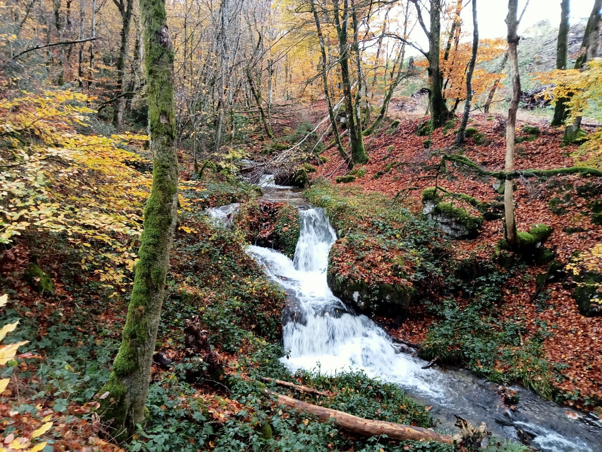
Cascade de Voucoux
(544 m)
Chute d'eau
24,7 km
Les Gorys
(584 m)
Lotissement
26,0 km
Champs Dessous
(581 m)
Couloir/terrain
26,1 km
Champs du Moulin
(586 m)
Couloir/terrain
26,8 km
Les Trinquets
(611 m)
Lotissement
26,9 km
Moulin de la Tournelle
(581 m)
Lotissement
26,9 km
Les Barats
(606 m)
Lotissement
27,3 km
Prés des Prés
(627 m)
Couloir/terrain
27,9 km
Arleuf
(629 m)
Village
28,7 km
Église Saint-Pierre
(622 m)
Lieu de culte
28,7 km
La Petite Méloise
(624 m)
Couloir/terrain
29,0 km
Champ Mouillefert
(629 m)
Couloir/terrain
29,1 km
Prés Brenot
(622 m)
Couloir/terrain
29,3 km
Le Marault
(633 m)
Lotissement
30,1 km
Le Maraut Champ du Coudray
(640 m)
Couloir/terrain
30,1 km
Four Handerbe
(648 m)
Couloir/terrain
30,3 km
Fosse
(665 m)
Lotissement
30,9 km
Fou des Angles
(684 m)
Couloir/terrain
31,0 km
Fontaine du Maubruy
(780 m)
Source
33,2 km
Chalet de Préperny
(806 m)
Refuge
34,0 km
Préperny
(804 m)
Couloir/terrain
34,0 km
Col du Haut Folin
(873 m)
Col de montagne
36,3 km
Col de la Croisette
(623 m)
Col de montagne
42,2 km
Franet
(554 m)
Lotissement
44,9 km
Bois de Rire
(475 m)
Lotissement
46,8 km
Saint-Prix
(450 m)
Lieu de culte
47,4 km
Le Bourg
(451 m)
Lotissement
47,5 km
Chez Franck et Francine
(450 m)
Restaurant
47,6 km
Argentolle
(501 m)
Lotissement
49,8 km
Champ Dernier
(645 m)
Lotissement
51,4 km
Église Saint-Denis
(659 m)
Lieu de culte
52,0 km
Glux-en-Glenne
(663 m)
Village
52,1 km
La petite auberge
(665 m)
Restaurant
52,2 km
L'Haut de la Croix
(678 m)
Lotissement
52,4 km
Fontian
(707 m)
Lotissement
53,4 km
Les Francillons
(670 m)
Lotissement
53,9 km
Anvers
(668 m)
Lotissement
54,6 km
Bois des Chantes
(577 m)
Couloir/terrain
56,1 km
Le Puits
(614 m)
Lotissement
57,5 km
Le puits de Sidonie
(608 m)
Restaurant
57,6 km
La Croix des Cerisiers
(611 m)
Lotissement
58,1 km
Moulin de Rangère
(556 m)
Lotissement
59,5 km
Dragne
(544 m)
Lotissement
60,5 km
Le Détour
(553 m)
Couloir/terrain
60,8 km
Champs de la Baume
(489 m)
Couloir/terrain
61,8 km
Pré Battu
(445 m)
Couloir/terrain
62,5 km
Champs des Battus
(473 m)
Couloir/terrain
62,5 km
Villapourçon
(425 m)
Village
63,2 km


Pas encore d'évaluation
Parcours populaires à proximité
-
CycloRoute71
moyenFaire du vélo 678,1 km -
Parcours de découverte culturelle : d'Autun à Bibracte
moyenMoto 90,6 km -
Les Gorges de La Canche
moyenRandonnée 24,9 km -
CycloRoute71 - Etape 7 d'Autun à Etang-sur-Arroux
moyenFaire du vélo 60,9 km -
Itinérance Verte en Autunois-Morvan
moyenFaire du vélo 31,2 km -
A VTT dans le Morvan
moyenVTT 27,2 km -
Ah! nos pizz' - Haut Folin - Bas Folin - Chez Cécile
difficileVTT 52,7 km -
5,0
Le Chaudron - Mont Beuvray - Chapelle Saint-Martin - Col du Rebout
moyenRandonnée 7,57 km -
5,0
La Pompie - Les Batugoniats - Dragne - Villapourçon
facileRandonnée 5,23 km -
Château-Chinon - Le Briot - Pontchareau - L Echeintre
facileVTT 8,61 km
Randonnée et suivi

Plus de 550.000 propositions de circuits, des cartes détaillées et un planificateur d'itinéraire intuitif font de cette application un must pour tous les passionnés de nature.

Ne manquez pas les offres et l'inspiration pour vos prochaines vacances
S'inscrire à la newsletter
Erreur
Une erreur s'est produite. Veuillez réessayer.
Merci pour votre inscription
Votre adresse électronique a été ajouté à la liste de diffusion.
Parcours en Europe
Autriche
Suisse
Allemagne
Italie
Slovénie
France
Pays-Bas
Belgique
Pologne
Liechtenstein
République tchèque
Slovaquie
Espagne
Croatie
Bosnie-Herzégovine
Luxembourg
Andorre
Portugal
Islande
Royaume-Uni
Irlande
Grèce
Albanie
Macédoine du Nord
Malte
Norvège
Monténégro
Moldavie
Kosovo
Hongrie
Saint-Marin
Roumanie
Estonie
Lettonie
Bélarus
Chypre
Lituanie
Serbie
Bulgarie
Monaco
Danemark
Suède
Finlande





