
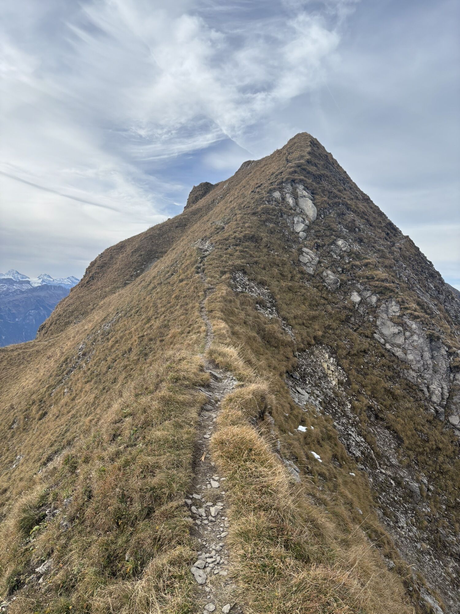
Wildbach (See) - Wildbach - Brienzer Rothorn - Schongütsch
difficile
Télécharge cette visite sur ton portable
Wildbach (See) - Wildbach - Brienzer Rothorn - Schongütsch
difficile
Randonnée
24,57
km
Scanner le code QR et commencer la navigation dans l'application bergfex

Randonnée & tracking


Wildbach (See) - Wildbach - Brienzer Rothorn - Schongütsch
difficile
Distance
24,57
km
Durée
09:06
h
Ascension
1 953
m
Altitude
571 -
2 340
m
Téléchargement de la piste
Wildbach (See) - Wildbach - Brienzer Rothorn - Schongütsch
difficile
Randonnée
24,57
km
Parcours
Chummelen Erli
(654 m)
Couloir/terrain
1,5 km
Egg Planalp
(1 335 m)
Couloir/terrain
5,3 km
Husstatt
(1 359 m)
Couloir/terrain
5,6 km
Zinsel
(1 348 m)
Couloir/terrain
5,7 km
Brienzer Rothorn
(2 348 m)
Sommet
11,6 km
Schongütsch
(2 319 m)
Sommet
12,6 km
Milibachfall
(1 040 m)
Chute d'eau
21,2 km
Parcours
Wildbach (See) - Wildbach - Brienzer Rothorn - Schongütsch
difficile
Randonnée
24,57
km
Wildbach (See)
(566 m)
Débarcadère des ferries
0,0 km
Wildbach
(572 m)
Restaurant
0,0 km
Chummelen Erli
(654 m)
Couloir/terrain
1,5 km
Schnabel
(676 m)
Couloir/terrain
2,1 km
Milibachfall
(879 m)
Point de vue
3,3 km
Egg Planalp
(1 335 m)
Couloir/terrain
5,3 km
Moos
(1 328 m)
Couloir/terrain
5,4 km
Restaurant Planalp
(1 343 m)
Restaurant
5,5 km
Wyder
(1 362 m)
Couloir/terrain
5,5 km
Husstatt
(1 359 m)
Couloir/terrain
5,6 km
Zinsel
(1 348 m)
Couloir/terrain
5,7 km
Trummler
(1 361 m)
Couloir/terrain
5,7 km
Planalp
(1 341 m)
Gare ferroviaire
5,7 km
Station Planalp
(1 343 m)
Couloir/terrain
5,7 km
Gipfel Restaurant Rothorn
(2 287 m)
Restaurant
11,3 km
Brienzer Rothorn
(2 348 m)
Sommet
11,6 km
Bergstation Luftseilbahn Sörenberg-Brienzer Rothorn
(2 266 m)
Station de télécabines
11,8 km
Rothorn
(2 266 m)
Restaurant
12,0 km
Brienzer Rothorn
(2 239 m)
Couloir/terrain
12,2 km
Brienzer Rothorn
(2 252 m)
Gare ferroviaire
12,3 km
Schongütsch
(2 319 m)
Sommet
12,6 km
Station Planalp
(1 343 m)
Couloir/terrain
18,8 km
Trummler
(1 361 m)
Couloir/terrain
18,9 km
Planalp
(1 341 m)
Gare ferroviaire
18,9 km
Zinsel
(1 348 m)
Couloir/terrain
18,9 km
Husstatt
(1 359 m)
Couloir/terrain
18,9 km
Wyder
(1 362 m)
Couloir/terrain
19,0 km
Restaurant Planalp
(1 343 m)
Restaurant
19,0 km
Moos
(1 328 m)
Couloir/terrain
19,1 km
Egg Planalp
(1 335 m)
Couloir/terrain
19,2 km
Milibachfall
(1 040 m)
Chute d'eau
21,2 km
Schnabel
(676 m)
Couloir/terrain
22,5 km
Chummelen Erli
(654 m)
Couloir/terrain
23,0 km
Wildbach
(572 m)
Restaurant
24,5 km
Wildbach (See)
(566 m)
Débarcadère des ferries
24,5 km
Pas encore d'évaluation
Parcours populaires à proximité
-
4,3
Schnitzlerweg Axalp - extended
moyenRandonnée 11,2 km -
3,4
Höhenwanderung Brienzer Rothorn
moyenRandonnée 9,16 km -
4,9
Augstmatthorn
facileRandonnée 10,9 km -
5,0
Jägerstübli - Lombachalp - Augstmatthorn - Suggiturm
moyenRandonnée 6,55 km -
5,0
Schynige Platte - Faulhorn - First
difficileRandonnée 16,8 km -
5,0
Brienzersee Route
VTT 38,1 km -
4,8
Glaubenberg - Rickhubel - Fürstein - Glaubenberg Pass
moyenRandonnée 9,20 km -
5,0
Bachalpsee Rundwanderung
moyenRandonnée 21,4 km -
4,5
First - Bachalpsee (n° 50)
moyenRandonnées d'hiver 3,31 km -
5,0
Rundtour Grosse Scheidegg-First
VTT 23,8 km
Randonnée et suivi

Plus de 550.000 propositions de circuits, des cartes détaillées et un planificateur d'itinéraire intuitif font de cette application un must pour tous les passionnés de nature.

Ne manquez pas les offres et l'inspiration pour vos prochaines vacances
S'inscrire à la newsletter
Erreur
Une erreur s'est produite. Veuillez réessayer.
Merci pour votre inscription
Votre adresse électronique a été ajouté à la liste de diffusion.
Parcours en Europe
Autriche
Suisse
Allemagne
Italie
Slovénie
France
Pays-Bas
Belgique
Pologne
Liechtenstein
République tchèque
Slovaquie
Espagne
Croatie
Bosnie-Herzégovine
Luxembourg
Andorre
Portugal
Islande
Royaume-Uni
Irlande
Grèce
Albanie
Macédoine du Nord
Malte
Norvège
Monténégro
Moldavie
Kosovo
Hongrie
Saint-Marin
Roumanie
Estonie
Lettonie
Bélarus
Chypre
Lituanie
Serbie
Bulgarie
Monaco
Danemark
Suède
Finlande