


Lag Serein: A long circular hike from S. Benedetg


The tour starts from the gravel parking lot at the Miraval restaurant just before Sogn Benedetg. After a few hundred meters on the village road to Sogn Benedetg, the ascent begins via the hiking trail...
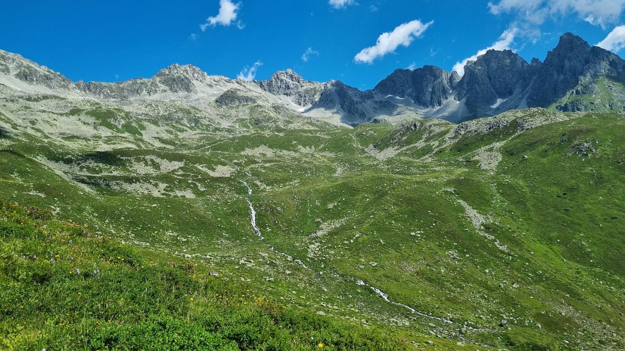
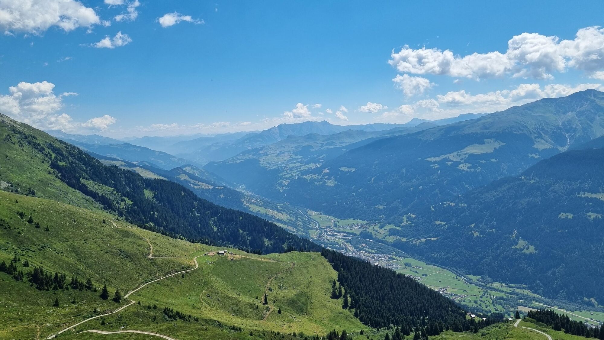
The tour starts from the gravel parking lot at the Miraval restaurant just before Sogn Benedetg. After a few hundred meters on the village road to Sogn Benedetg, the ascent begins via the hiking trail in the direction of Alp Glivers. After all, you have already covered around 650 of the more than 1000 meters in altitude here. So a stop at the Alpbeizli on Alp Glivers is well deserved.
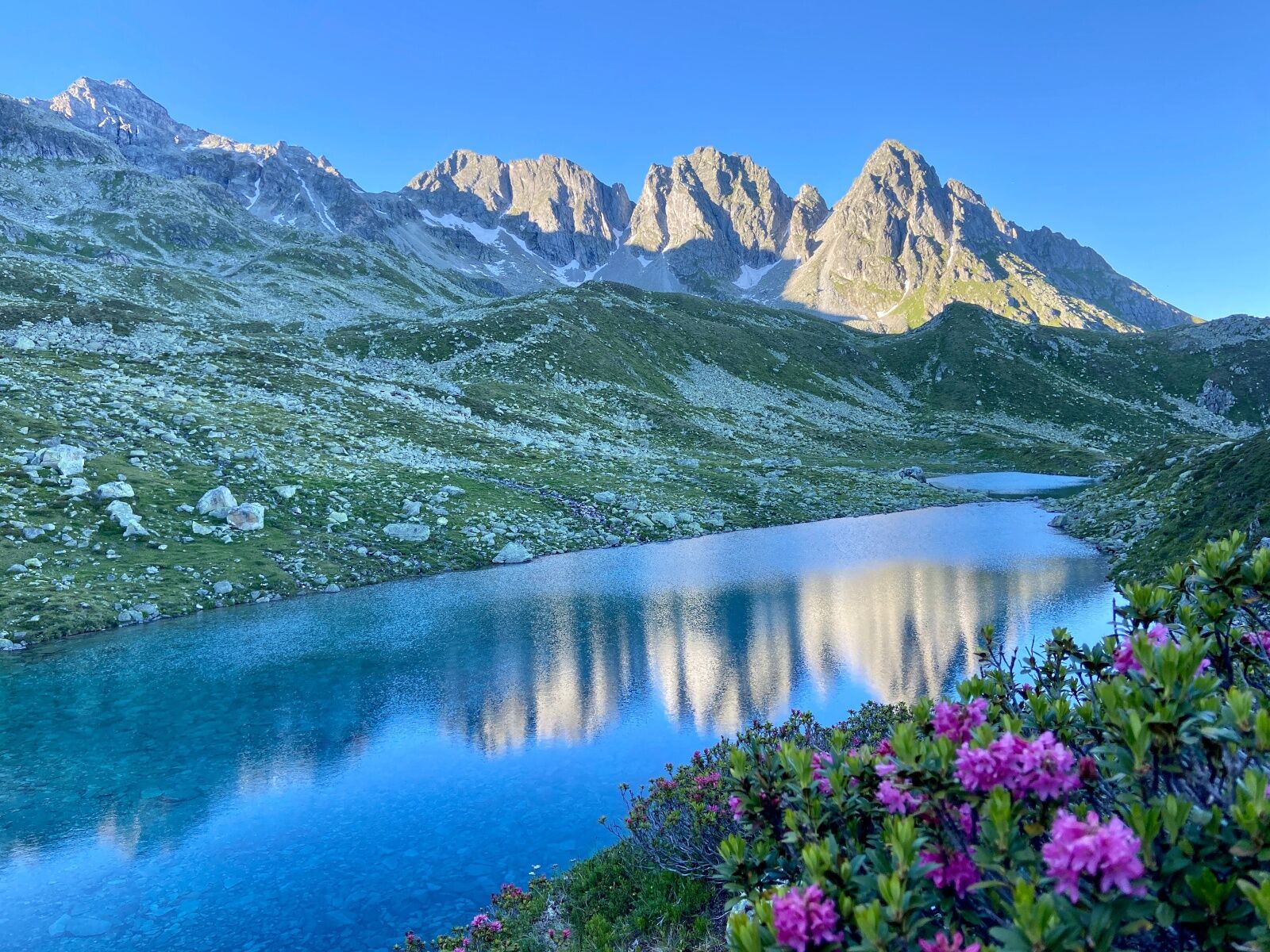
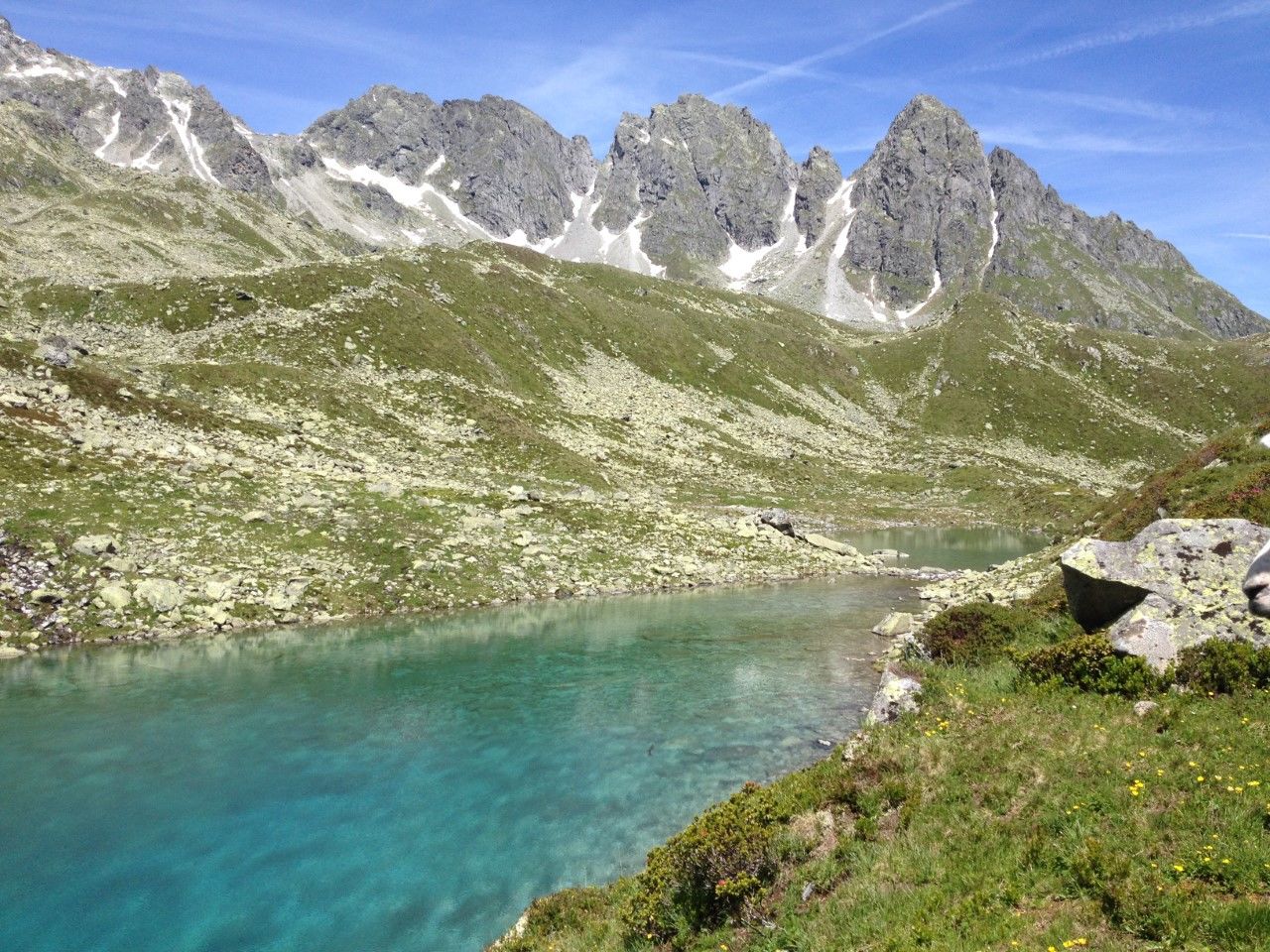
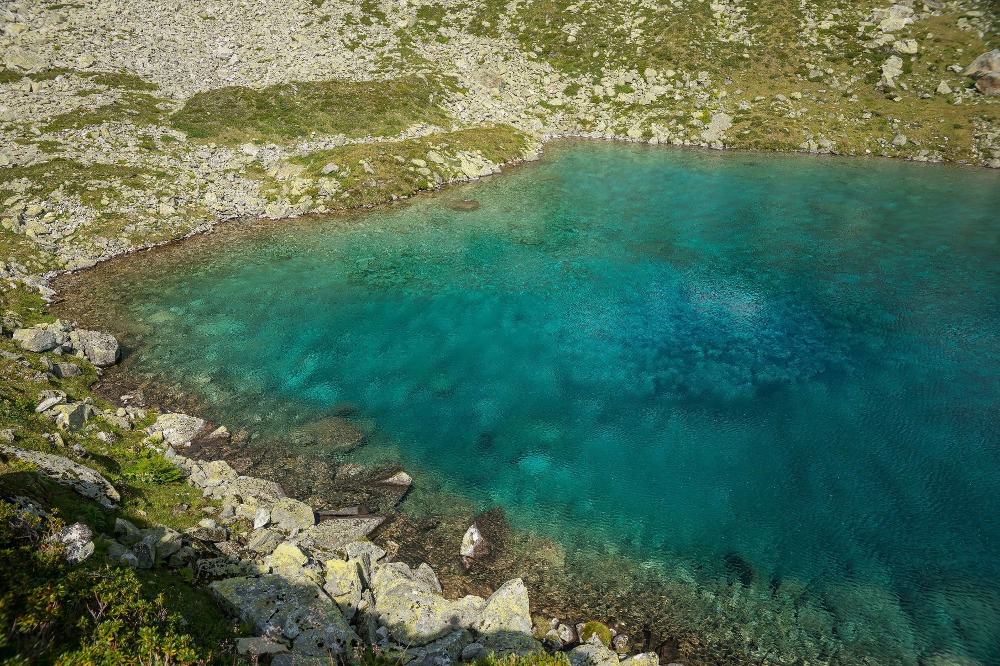
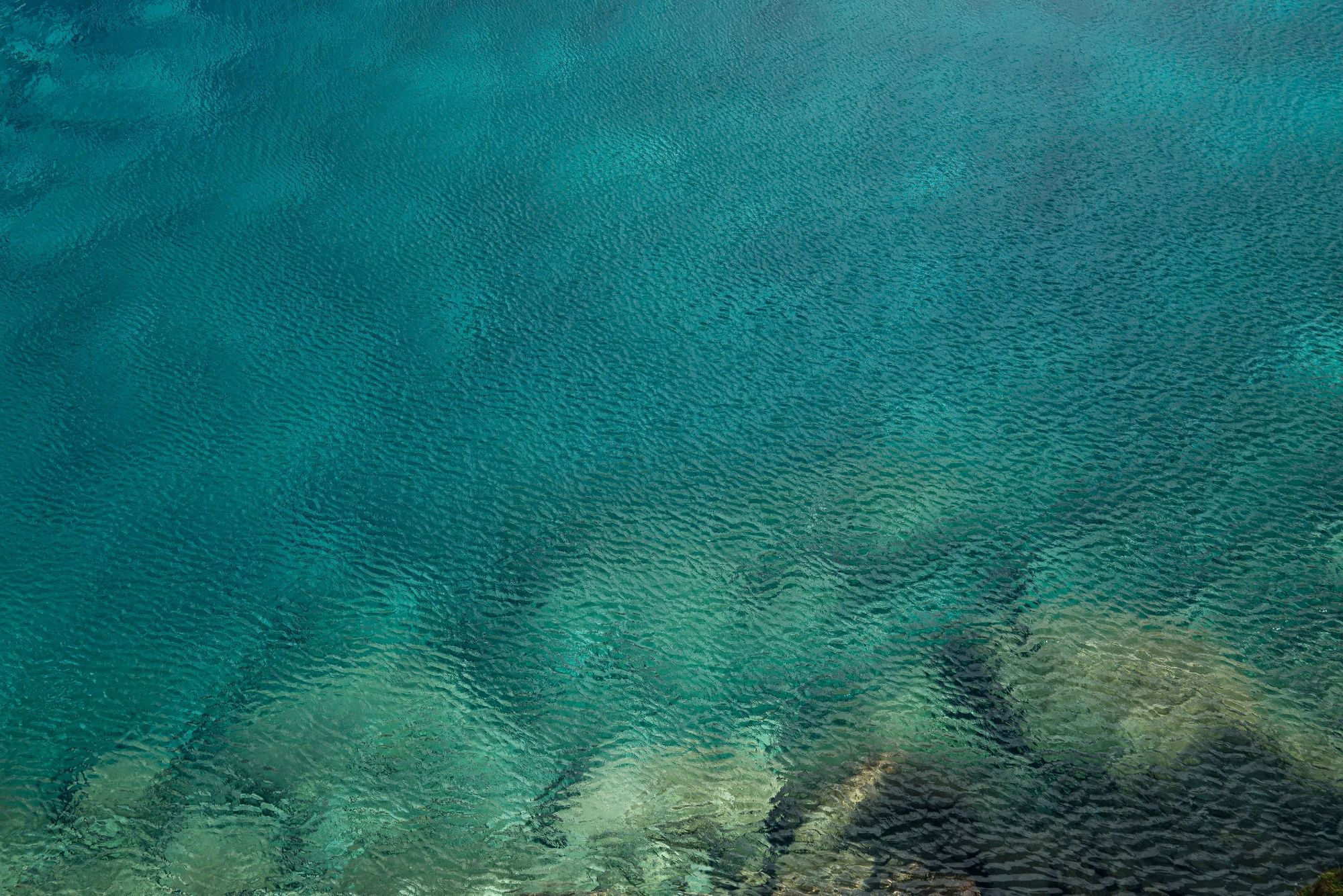
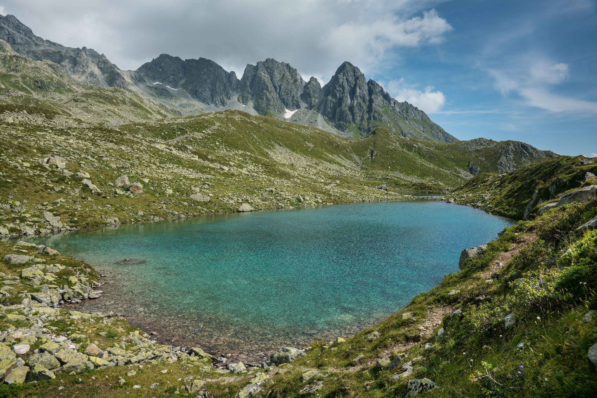
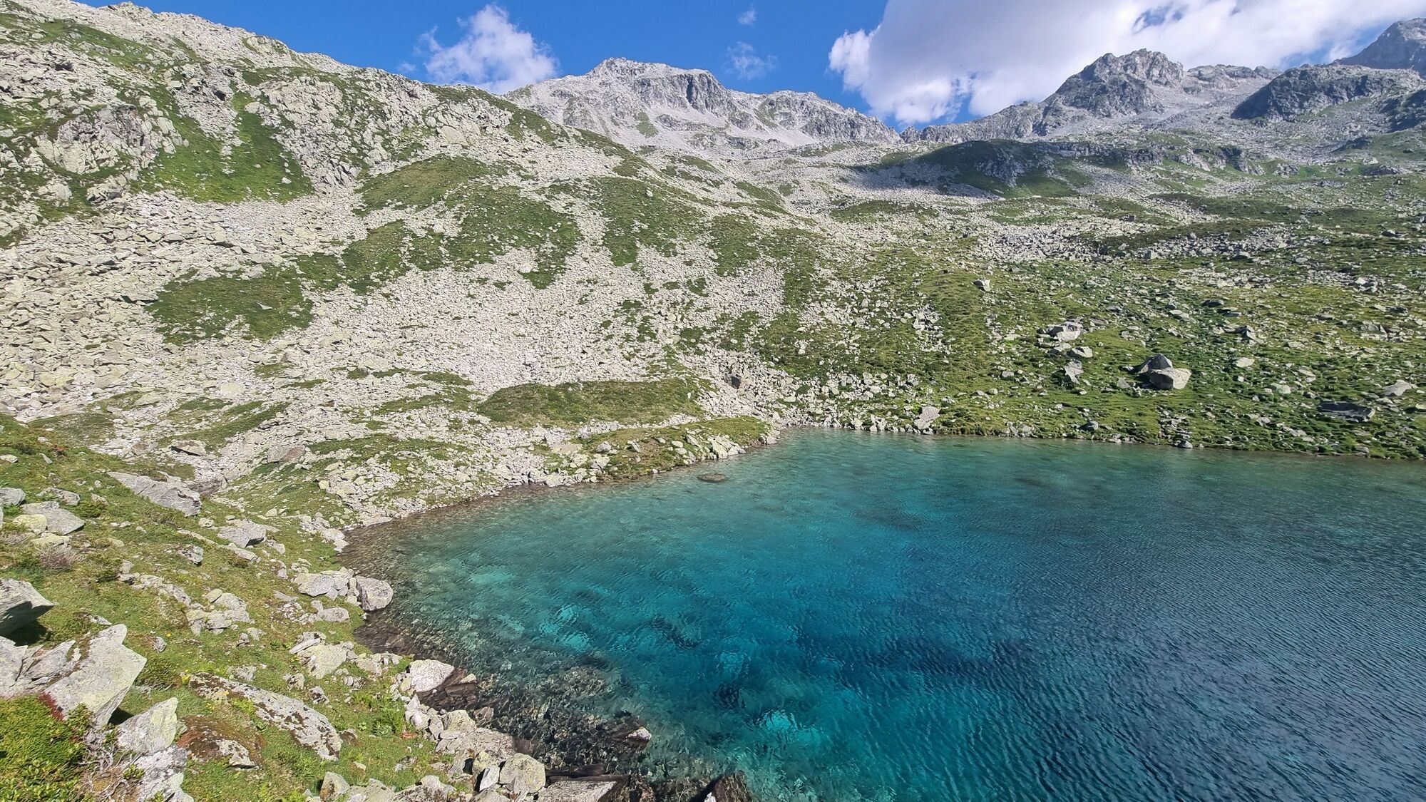
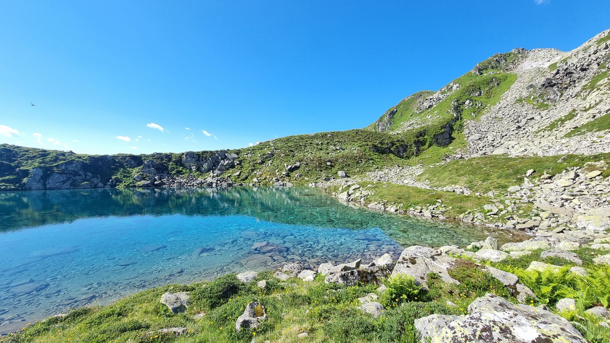
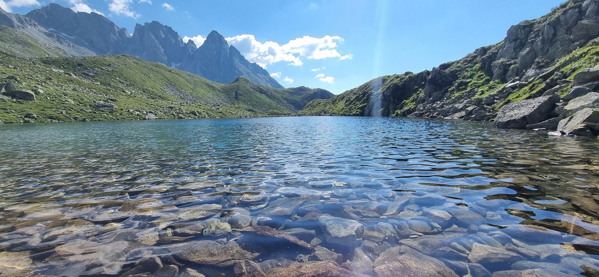
A hiking trail continues up to Lag Serein. It is one of the most beautiful mountain lakes in Graubünden - at least that's what people say. Nestled in a rocky desert, decorated with mountain flowers and barren meadows, it lies at the foot of the gigantic Tödi massif.
The first few meters of the way back are identical to the ascent. Then it's back to Sogn Benedetg via Alp Crap Ner and Fallas, a full 1000 meters downhill. On hot summer days, you will appreciate the shady forest in the lower section.

Sogn Benedetg - Cuolms da Tscheps - Alp Glivers - Lag Serein - Alp Crap Ner - Sogn Benedetg
Oui
Good hiking boots with a good tread, clothing suitable for the weather (rain jacket), first aid kit, drink, food, possibly hiking poles
The tour should not be undertaken in uncertain weather conditions. Weather changes are frequent in the mountains. If a rain front or similar is approaching during the hike, you should turn back in good time.
144 Emergency call, first aid
1414 Mountain rescue REGA
112 International emergency call
From Zurich on the A 3 or from St. Gallen on the A 13 to Chur and continue to the Reichenau exit in the direction of Disentis/Ilanz/Flims as far as Sumvitg. Then turn right at the end of the village onto the side road towards S. Benedetg (approx. 2 km) and drive to the gravel parking lot at the Miraval restaurant.
By car via Göschenen
From Basel on the A 2 via Lucerne to Göschenen, continue on the old pass road through the Schöllenen Gorge to Andermatt and over the Oberalp Pass/Disentis to Sumvitg. At the entrance to the village, turn left onto the side road towards S. Benedetg (approx. 2 km) and continue to the gravel parking lot at the Miraval restaurant.
By train via Chur or Göschenen
From Göschenen via Disentis or from Chur directly with the RhB to Sumvitg/Cumpadials.
From here, walk to the start of the hike in the direction of Sumvitg and then up to S. Benedetg (approx. 2 times 45 minutes).
Gravel parking lot at the Miraval restaurant (parking lot not subject to charge).
You can also spend the night on the Glivers Alp. For example, Lag Serein can also be visited early in the morning. Hikes in the direction of Trun, Punteglias and Brigels or Cavardiras would thus be possible.
Stop off at the Ustria Miraval restaurant near Sogn Benedetg (parking lot and start of the tour)
You can shorten the hike considerably by purchasing a transportation permit to Alp Glivers.
A stop at Alp Glivers is almost a “must”.
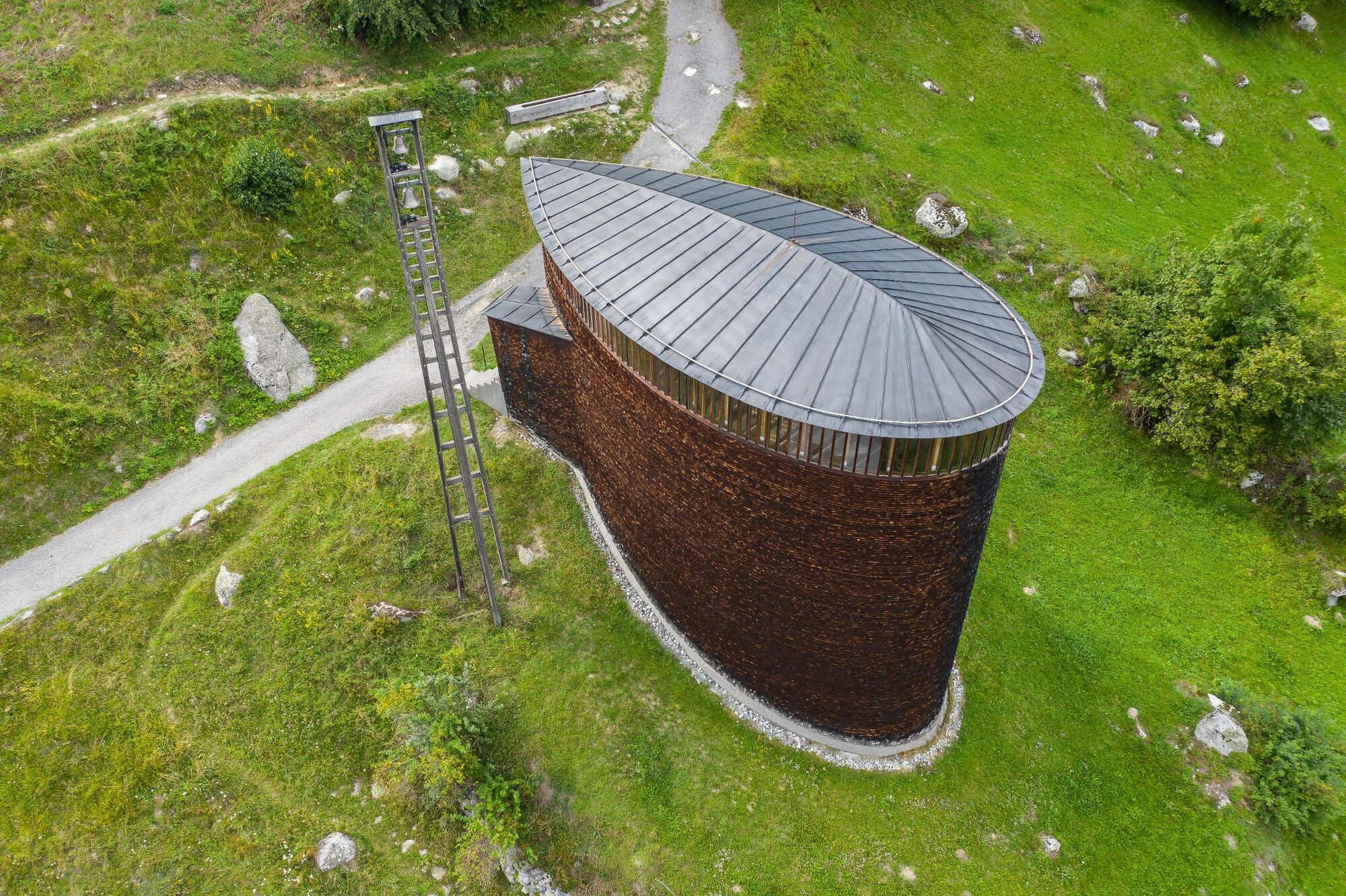
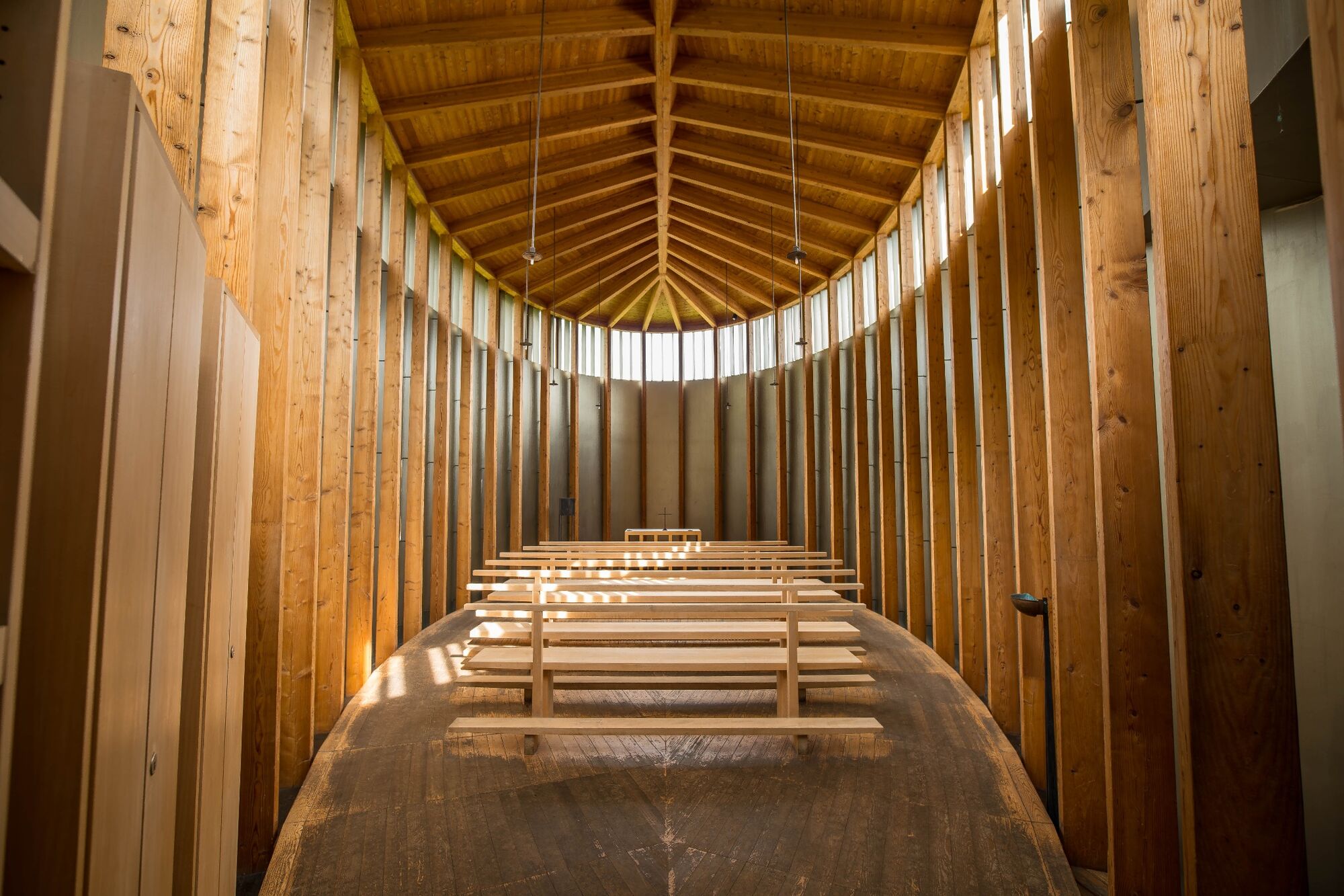
A visit to the chapel in Sogn Benedetg is also absolutely worthwhile. It was designed by star architect Peter Zumthor and is a showpiece of architecture.
Parcours populaires à proximité
- 5,0
High valley Val Frisal
moyenRandonnée11,3 km Kalktrittli - Nüschentäli - Muttsee - Obersee - Muttenchopf - Mörtel - Limmerensee - Kalktrittli (durch Stollen)
moyenRandonnée14,8 km- 5,0
2-Tages-Wanderung Greina Hochebene
moyenRandonnée14,9 km Rueras - Hexensee - Rueras
moyenRandonnée9,71 km- 5,0
Breil/Brigels - Val Frisal Rundwanderung
moyenRandonnée20,8 km - 1,0
Wasserfälle Bauns bei Sedrun
facileRandonnée3,45 km - 5,0
Kistenpasshütte-Breil/Brigels
moyenRandonnée13,7 km 3-Tagestour Greina-Lucomagno: Vrin - Capanna Scaletta (Etappe 1)
difficileChemin de Grande Randonnée17,2 kmKronenwanderung: Brigels - Bifertenhütte (Etappe 4)
difficileRandonnée9,12 km- 4,5
Die Puntegliashütte am Fusse des Tödimassivs
difficileRandonnée13,5 km

Randonnée et suivi


Ne manquez pas les offres et l'inspiration pour vos prochaines vacances
Votre adresse électronique a été ajouté à la liste de diffusion.