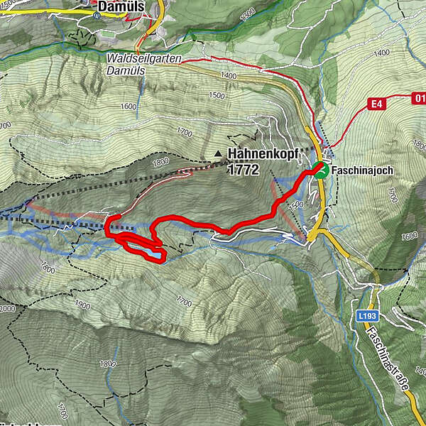
Via the Stafelalpsee to the Fanz-Josef-Hütte | Fontanella-Faschina

Randonnée

© Alpenregion Bludenz Tourismus GmbH - Alex Kaiser

© Alpenregion Bludenz Tourismus GmbH - Alex Kaiser

© Vorarlberg Tourismus GmbH
- Brève description
-
Leisurely hike for connoisseurs to the Stafelalpsee and further to the Franz-Josef-Hütte.
- Difficulté
-
moyen
- Évaluation
-
- Parcours
-
Faschina0,0 kmFranz-Josef-Hütte2,6 kmFaschina4,4 km
- Meilleure saison
-
janv.févr.marsavrilmaijuinjuil.aoûtsept.oct.nov.déc.
- Hauteur maximale
- 1.700 m
- Point de mire
-
Parking lot at the Faschinajoch, Fontanella-Faschina
- Profil en hauteur
-


- Auteur
-
La randonnée Via the Stafelalpsee to the Fanz-Josef-Hütte | Fontanella-Faschina est utilisé par outdooractive.com fourni par.
GPS Downloads


Informations générales
Point de rassemblement
Autres parcours dans les régions
-
St. Gallen - Bodensee
2065
-
Biosphärenpark Großes Walsertal
2006
-
Damüls
576


