
Dates des itinéraires
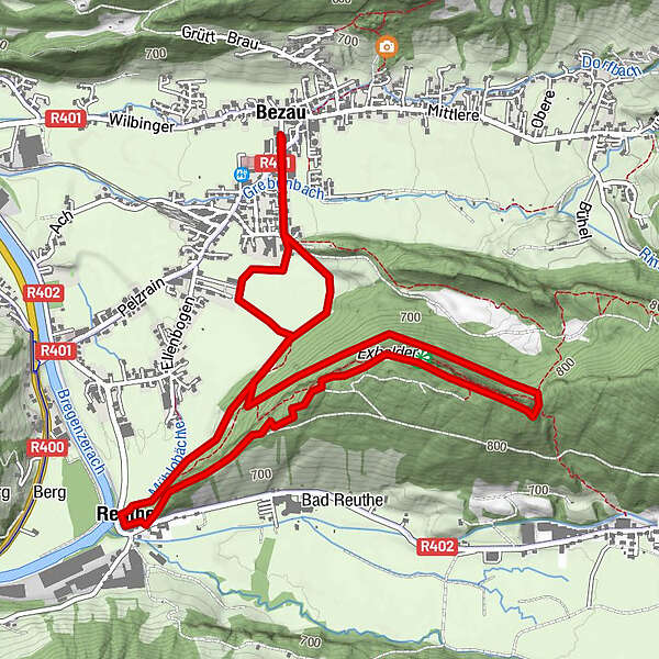
6,73km
641
- 841m
217hm
214hm
02:30h
- Brève description
-
Ausreichend bezeichnete Steige und Wanderwege, mäßig steiler Aufstieg
- Difficulté
-
moyen
- Évaluation
-
- Point de départ
-
Tourismusbüro in Bezau
- Parcours
-
Gasthof HirschenBezauKlosterkirche Bezau0,1 kmPfarrkirche Reuthe4,5 kmReuthe4,6 kmKlosterkirche Bezau6,4 kmGasthof Hirschen6,5 kmBezau6,7 km
- Meilleure saison
-
janv.févr.marsavrilmaijuinjuil.aoûtsept.oct.nov.déc.
- Hauteur maximale
- 841 m
- Cartes
-
Tourismusbüro Bezau
GPS Downloads


Nature du chemin
Asphalte
Gravier
Pelouse
Forêt
Rocher
Exposé
Autres parcours dans les régions
-
St. Gallen - Bodensee
2067
-
Bregenzerwald
2297
-
Bezau
662


