Damülser Mittagspitze

Logo Damülser Mittagspitze
Dates des itinéraires
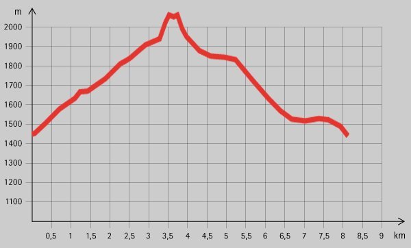
8,5km
- 2.095m
Distance
670hm
Montée
03:30h
 
Durée
Brève description

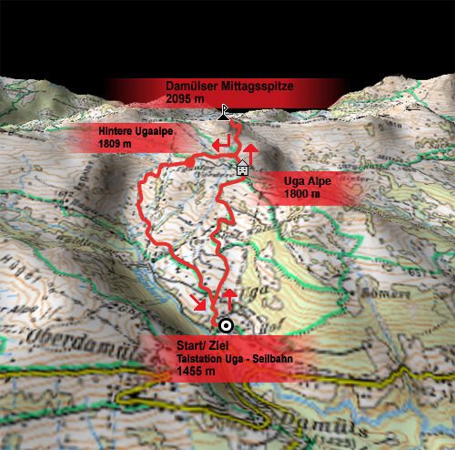
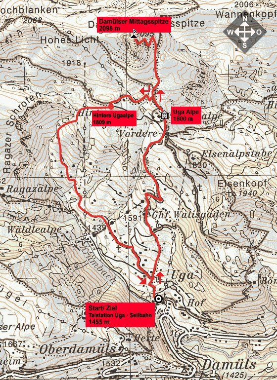
Schöne Tour auf den wohl markantesten und bekanntesten Damülser Aussichtsberg.

Évaluation
Technique
Endurance
Paysage
Résultat
Point de départ

Talstation Sesselbahn Uga (1455 m)


Hauteur maximale
2.095 m

Repos/Rassembler

Gasthof Walisgaden, Uga Alpe;

Cartes

Informations par téléphone

0043 (0)5510 620-0

Link

2,8
Évaluation globale

5

25

%

4

17

%

3

0

%

2

25

%

1

33

%

GPS Downloads
  • GPX GPS Exchange Format (XML)
  • KML Google Earth, Google Maps
Codes de téléchargement QR pour les téléphones portables

Nature du chemin

Asphalte
Gravier
Pelouse
Forêt
Rocher
Exposé
Autres parcours dans les régions

Randonnées populaires dans la région

Rote Wand 2704m

difficile Randonnée
13,9km | 1181hm | 06:00h

Hoher Freschen

difficile Randonnée
16,13km | 1005hm | 07:00h

Glatthorn

moyen Randonnée
6,49km | 507hm | 02:30h

Faschina | Rund um's Zafernhorn

moyen Randonnée
10,09km | 634hm | 04:15h