

© Alpenregion Bludenz Tourismus GmbH - Melanie Fleisch

© Alpenregion Bludenz Tourismus GmbH - Melanie Fleisch

© Alpenregion Bludenz Tourismus GmbH - Melanie Fleisch

© Alpenregion Bludenz Tourismus GmbH - Melanie Fleisch

© Vorarlberg Tourismus GmbH

- Brève description
-
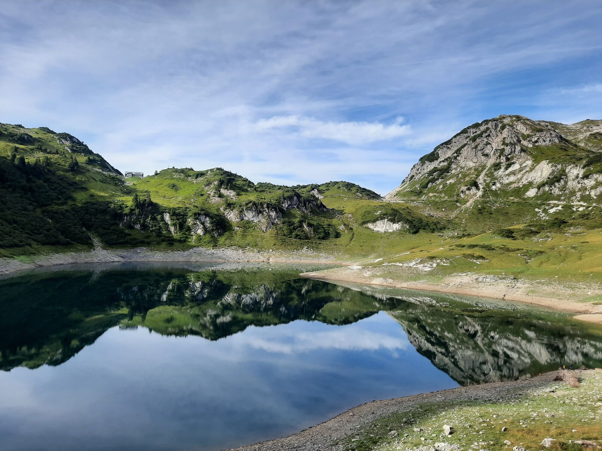
Leisurely hike at alpine heights around the Formarinsee lake with a view of the mighty Rote Wand.
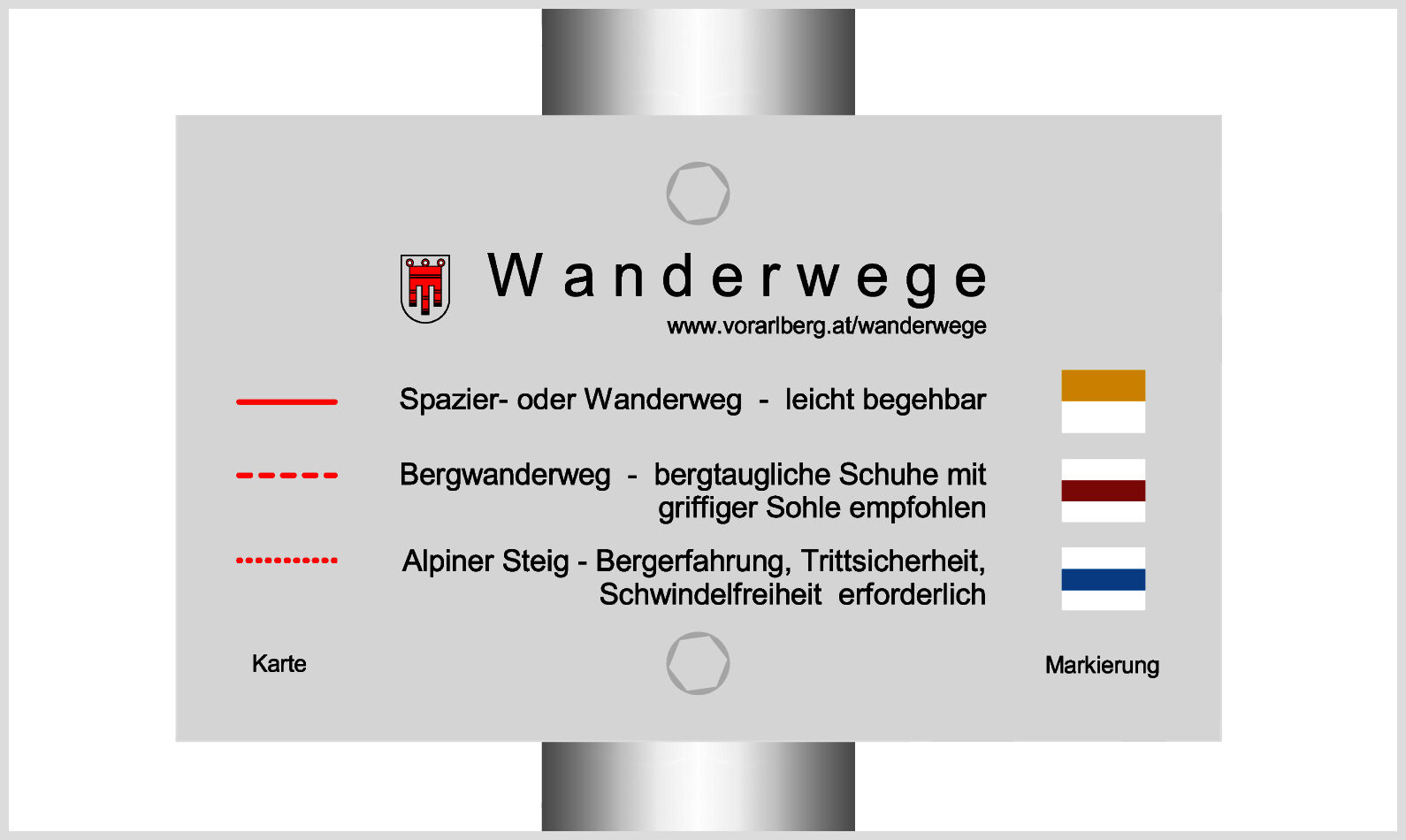
- Difficulté
-
facile
- Évaluation
-
- Parcours
-
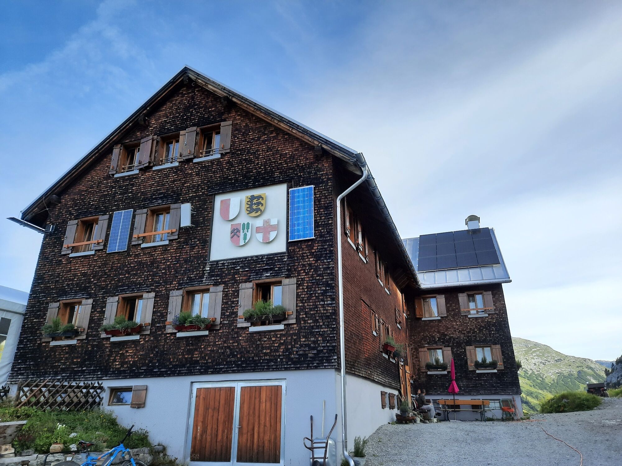
Freiburger Hütte2,3 km
- Meilleure saison
-
janv.févr.marsavrilmaijuinjuil.aoûtsept.oct.nov.déc.
- Hauteur maximale
- 1.914 m
- Point de mire
-
Bus stop Alpe Formarin
- Profil en hauteur
-


- Auteur
-
La randonnée Around the Formarinsee | Dalaas est utilisé par outdooractive.com fourni par.
GPS Downloads


Informations générales
Point de rassemblement
Prometteur
Autres parcours dans les régions
-
Klostertal
1788
-
Dalaas / Wald am Arlberg
466


