© Warth-Schröcken Tourismus - Sebastian Stiphout

© Warth-Schröcken Tourismus - Sebastian Stiphout

© Warth-Schröcken Tourismus - Sebastian Stiphout

- Brève description
-
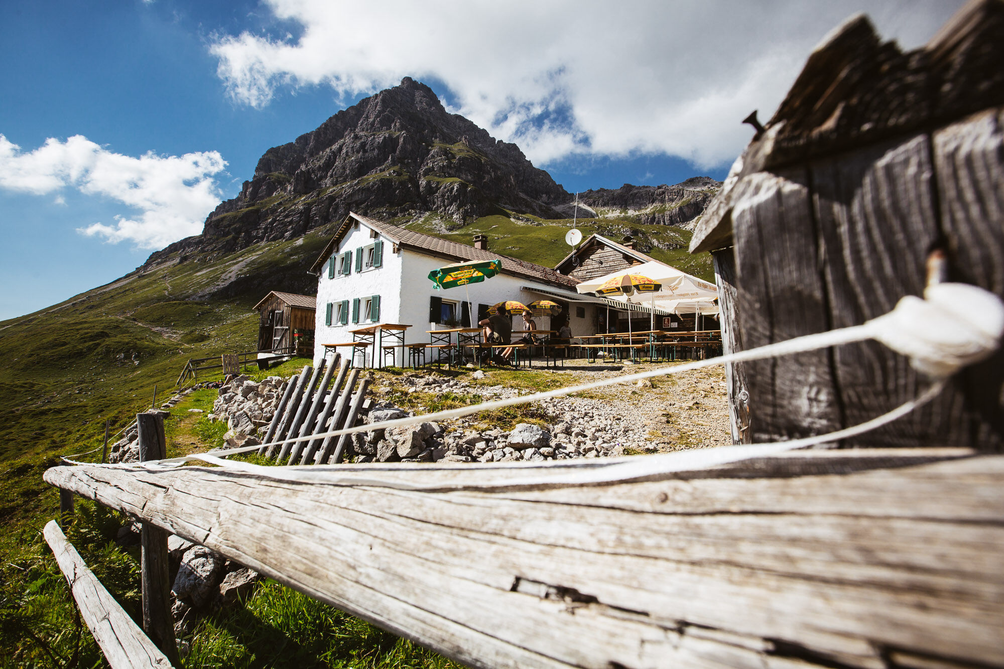
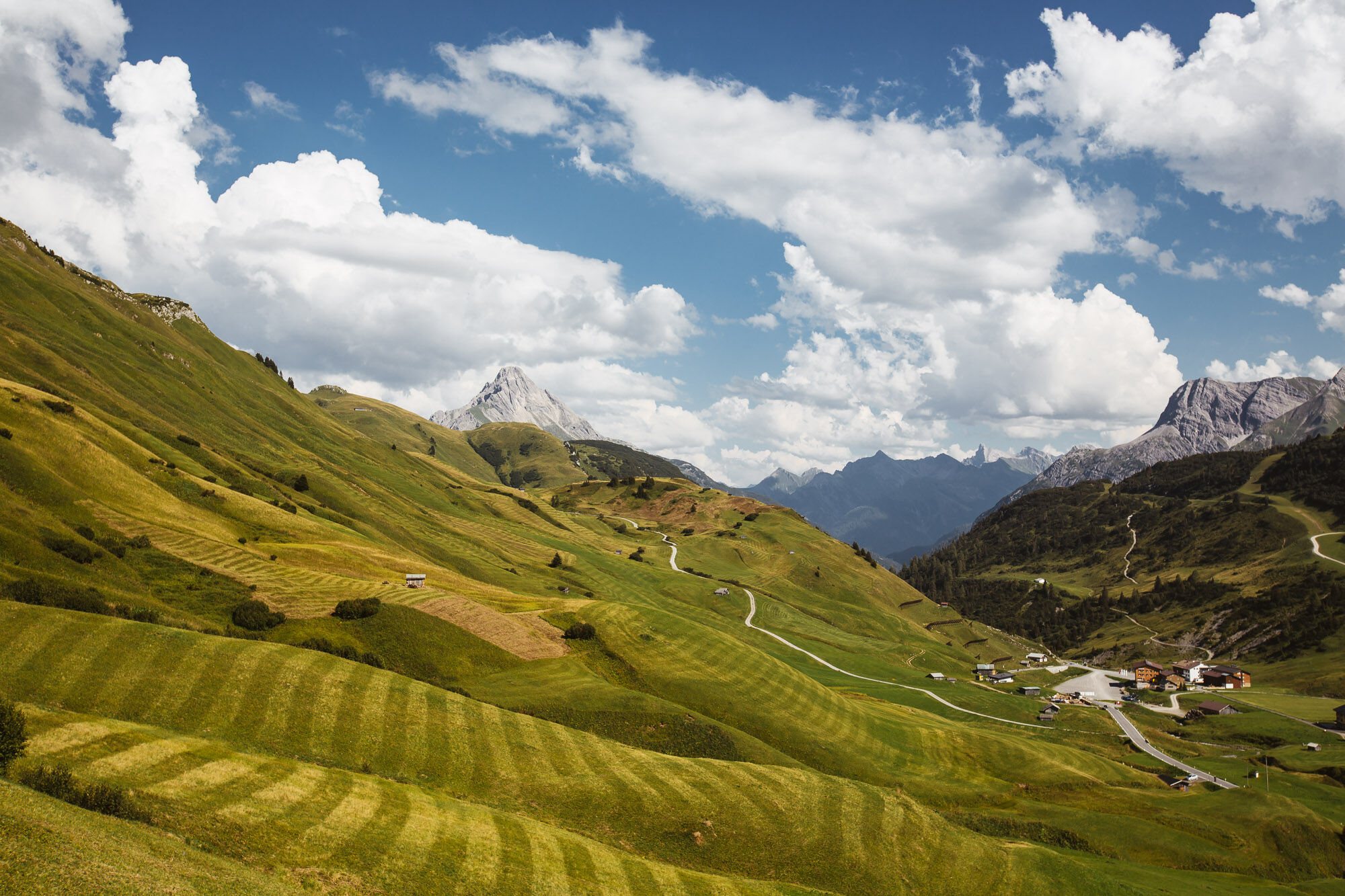
In Warth at the village square you start in the direction to the plot Wolfegg, from where you get on the way steeply up to the junction Alte Salzstraße. Via the Alte Salzstraße, a somewhat narrow path, you reach the Jägeralpe. Now the path leads you past the Jägeralpe to the Hochtannbergpass. On foot, the trail leads between wild flowers and fresh alpine herbs in the direction of Widdersteinhütte. Breathe in and enjoy the fresh, invigorating mountain air before the return journey is imminent. The descent follows the same route. Once you have arrived at the Hochtannberg Pass, you cycle towards Salobersattel. At the saddle, the wide gravel path leads you down through the picturesque Auenfeld over lush green mountain meadows. Continue on the wide path past the Alpe Batzen to the Alpmuseum Uf'm Tannberg. A short stop in the museum is really worthwhile, because there you can see the old craftsmanship of the mountain farmers. This path leads you further to the village of Schröcken.
The tour can of course also be started in Schröcken.
- Difficulté
-
moyen
- Évaluation
-
- Parcours
-
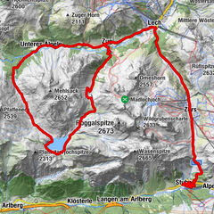
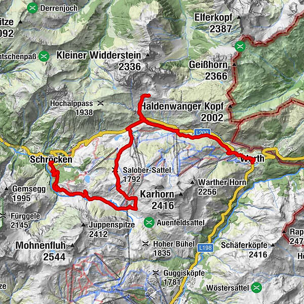
Warth (1.495 m)0,0 kmPfarrkirche St. Sebastian0,4 kmKitzeliftle0,6 kmWolfegg1,4 kmHolzbodenalpe2,8 kmJägeralpe3,6 kmSennkuchl3,6 kmHochkrumbach3,9 kmWiddersteinhütte6,2 kmAlpekörb8,5 kmSB-Restaurant Salober8,6 kmS18,8 kmSalober-Sattel (1.792 m)10,1 kmAuenfelder Hütte11,1 kmObere Auenfeld Alpe (1.732 m)11,6 kmMaterialseilbahn Körbersee17,4 kmTannberg17,6 kmSchröcken (1.269 m)17,6 km
- Meilleure saison
-
janv.févr.marsavrilmaijuinjuil.aoûtsept.oct.nov.déc.
- Hauteur maximale
- 1.993 m
- Point de mire
-
Village square Warth/Village square Schröcken
- Profil en hauteur
-


-

-
AuteurLa randonnée Bike & Hike Widderstein hut est utilisé par outdooractive.com fourni par.
GPS Downloads


Informations générales
Point de rassemblement
Secret
Prometteur
Autres parcours dans les régions


 Lech Zuers Tourismus by Hanno Mackowitz")