Lake Constance long-distance cycle track

Piste cyclable longue distance

© Tourist-Information Nonnenhorn - Sonja Gierer
")
- Brève description
-
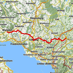
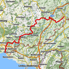
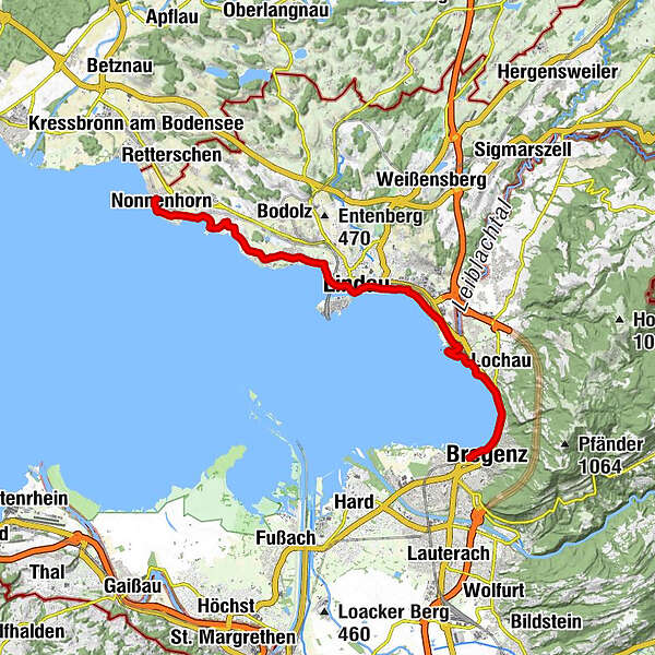
The Lake Constance cycle path with its 216 kilometres in total is one of the most popular long-distance cycle tracks in Europe - and deservedly so. Along the idyllic shores of Lake Constance we drive clockwise through the cultural landscape of the picturesque four-country-region. Always keeping an eye on the wonderful Alpine foreland.
- Difficulté
-
moyen
- Évaluation
-
- Parcours
-
Nonnenhorn0,6 kmWasserburg - Bodensee3,1 kmJakobus-Kapelle4,5 kmWilhelmshöhe4,6 kmReutenen4,6 kmSchwand5,1 kmEbnet5,5 kmBad Schachen5,8 kmSt. Leonhard6,0 kmLindau (Bodensee) (401 m)8,4 kmReutin9,5 kmZech11,6 kmUnterhochsteg12,0 kmKlausmühle16,1 kmTannenbach16,4 kmBrégence (427 m)17,2 kmBregenz17,8 km
- Meilleure saison
-
janv.févr.marsavrilmaijuinjuil.aoûtsept.oct.nov.déc.
- Hauteur maximale
- 415 m
- Point de mire
-
Bregenz
- Profil en hauteur
-
 © outdooractive.com
- Auteur
-
La randonnée Lake Constance long-distance cycle track est utilisé par outdooractive.com fourni par.
GPS Downloads


Informations générales
Point de rassemblement
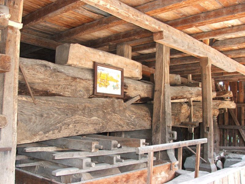
Culturel/Historiquement
Autres parcours dans les régions