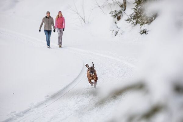
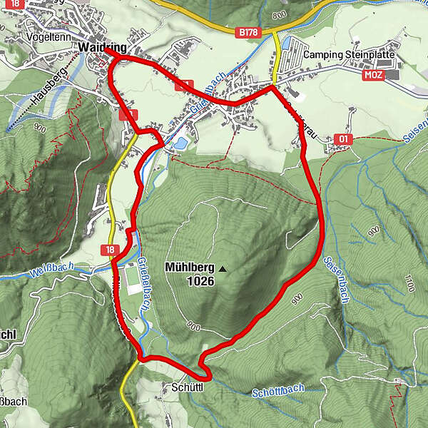
Winterwanderung Waidring Rund um den Mühlberg

Randonnée d'hiver

Dates des itinéraires
6,04km
766
- 878m
104hm
72hm
02:30h
- Difficulté
-
facile
- Évaluation
-
- Point de départ
-
centre of Waidring
- Parcours
-
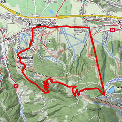
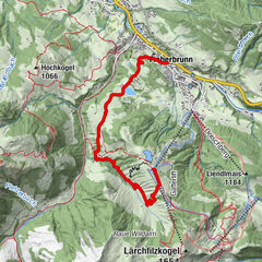
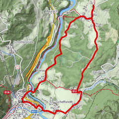
Waidring0,0 kmGasthof zur Post0,0 kmSchefferaukapelle1,8 kmHeiliger Vitus und Nikolaus5,5 kmSchneidermann5,6 kmGasthof zur Post6,0 kmWaidring6,0 km
- Meilleure saison
-
aoûtsept.oct.nov.déc.janv.févr.marsavrilmaijuinjuil.
- Hauteur maximale
- 878 m
- Point de mire
-
centre of Waidring
- Repos/Rassembler
-
Am Endpunkt im Dorfzentrum
- Cartes
-
Hiking map are available in all touristoffice´s of the PillerseeTal
- Informations par téléphone
-
0043.5354.56304
- Link
- https://maps.pillerseetal.at/v2/de/gdi_summer/2...
- Source
- TVB PillerseeTal
GPS Downloads


Autres parcours dans les régions
-
Pillerseetal
184
-
Waidring
37