
- Brève description
-
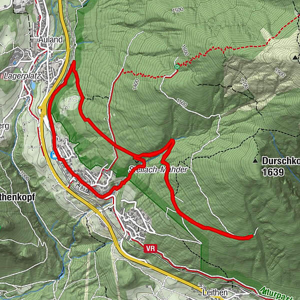
Genießen Sie eine leichte Rundwanderung auf dem aussichtsreichen Panoramaweg.
- Parcours
-
Reith bei Seefeld (1.120 m)0,0 kmLus-Mähder1,7 kmHölltal2,3 kmKaiserstand3,7 kmHölltal5,1 kmFrau Häusl Kapelle5,6 kmHotel Reitherhof6,2 kmPfarrkirche Hl. Nikolaus6,3 kmReith bei Seefeld (1.130 m)6,4 kmReith bei Seefeld (1.120 m)6,7 km
- Hauteur maximale
- 1.311 m
- Point de mire
-
Reith Bahnhof
- Profil en hauteur
-

- Auteur
-
La randonnée Rundwanderung Panoramaweg est utilisé par outdooractive.com fourni par.
GPS Downloads


Autres parcours dans les régions