Dates des itinéraires
9,83km
841
- 959m
193hm
194hm
02:00h
- Brève description
-
sehr leichte Wanderung
- Difficulté
-
moyen
- Évaluation
-
- Point de départ
-
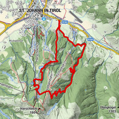
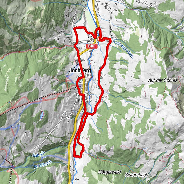
Jochberg Ortszentrum
- Parcours
-
Jochberg0,0 kmTaxerkapelle3,9 kmDorfstub'n Jochberg8,7 kmAlpenland8,8 kmPfarrkirche Heiliger Wolfgang9,6 kmJochberg9,7 km
- Meilleure saison
-
janv.févr.marsavrilmaijuinjuil.aoûtsept.oct.nov.déc.
- Hauteur maximale
- 959 m
- Cartes

GPS Downloads


Nature du chemin
Asphalte
Gravier
Pelouse
Forêt
Rocher
Exposé