Dates des itinéraires
11,9km
748
- 1.245m
503hm
03:30h
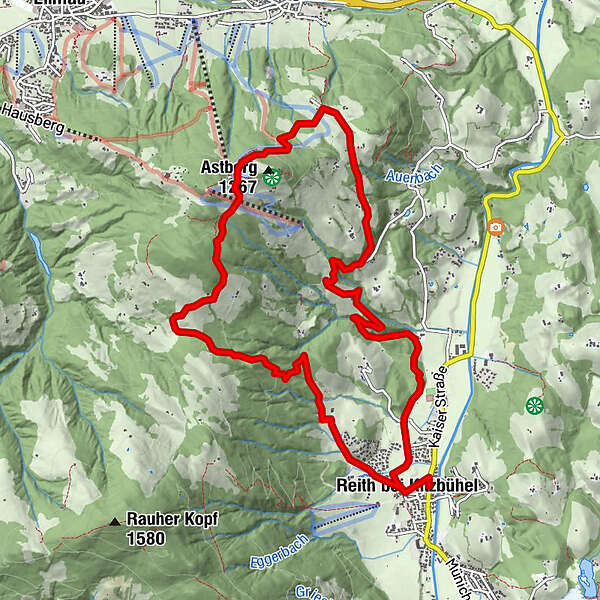
- Brève description
-
leicht bis mittel
- Évaluation
-
- Point de départ
-
Kulturhaus Reith
- Parcours
-
Reith bei Kitzbühel0,3 kmBlattlalm5,0 kmAstberg (1.267 m)5,3 kmReith bei Kitzbühel11,5 km
- Hauteur maximale
- 1.245 m
- Repos/Rassembler
-
Hollenauer Kreuz
- Cartes
GPS Downloads


Nature du chemin
Asphalte
Gravier
Pelouse
Forêt
Rocher
Exposé
Autres parcours dans les régions
-
Wilder Kaiser
1945
-
Reith bei Kitzbühel
602