Dates des itinéraires
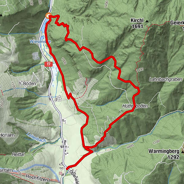
7,1km
945
- 1.310m
581hm
581hm
03:00h
- Brève description
-
wunderschöne Rundwanderung
- Difficulté
-
moyen
- Évaluation
-
- Point de départ
-
Warming
- Hauteur maximale
- 1.310 m
- Repos/Rassembler
-
Warminger Hof, Gasthof Wiesenseehof
- Cartes
-
in allen Tourimusverbänden im Pillerseetal


- Informations par téléphone
-
+43 (0)5354 / 56304
- Link
- https://maps.pillerseetal.at/#resourceDetail,62...
GPS Downloads


Nature du chemin
Asphalte
Gravier
Pelouse
Forêt
Rocher
Exposé
Autres parcours dans les régions
-
Pillerseetal
1787
-
Hochfilzen
410