Braunschweiger hut 2758 m

Logo Braunschweiger hut 2758 m
Dates des itinéraires
4,52km
1.750 - 2.732m
Distance
996hm
Montée
03:30h
 
Durée
Brève description

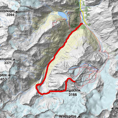
A trip through a wonderful glacier countryside. Big rocks, glacier, alpine-roses-fields and a great dversity of alp flovers accompany the trip. You get near the glacier tangue of the Mittelbergferners.

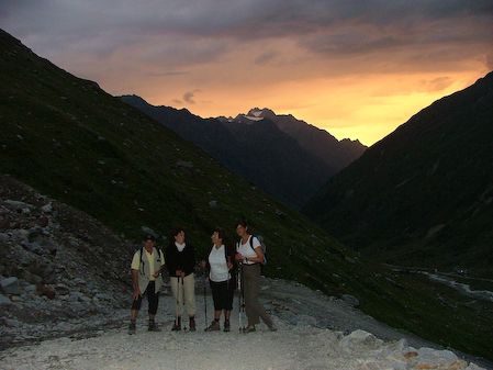
Sonja's favorit tour.

Parcours
Gletscherstube (1.891 m)
1,7 km
Marienkapelle
4,5 km
Braunschweiger Hütte
4,5 km

Hauteur maximale
2.732 m
Profil en hauteur

Auteur
La randonnée Braunschweiger hut 2758 m est utilisé par outdooractive.com fourni par.

Évaluation globale

5

0

%

4

0

%

3

0

%

2

0

%

1

0

%

Erreur
Une erreur est survenue. Veuillez réessayer.
Merci pour votre évaluation

L'évaluation a été supprimée

GPS Downloads
  • GPX GPS Exchange Format (XML)
  • KML Google Earth, Google Maps
Codes de téléchargement QR pour les téléphones portables
Autres parcours dans les régions

Randonnées populaires dans la région

Gletschersteig Pitztaler Gletscher - Taschachhaus - Mandarfen

difficile Randonnée
13,41km | 24hm | 04:30h

Nissalm

facile Randonnée
5,17km | 424hm | 01:50h

Winnebachseehütte - Längenfeld/Gries

moyen Randonnée
4,74km | 756hm | 02:00h

Amberger Hut

moyen Randonnée
5,6km | 495hm | 02:15h