© Alpstein

- Brève description
-
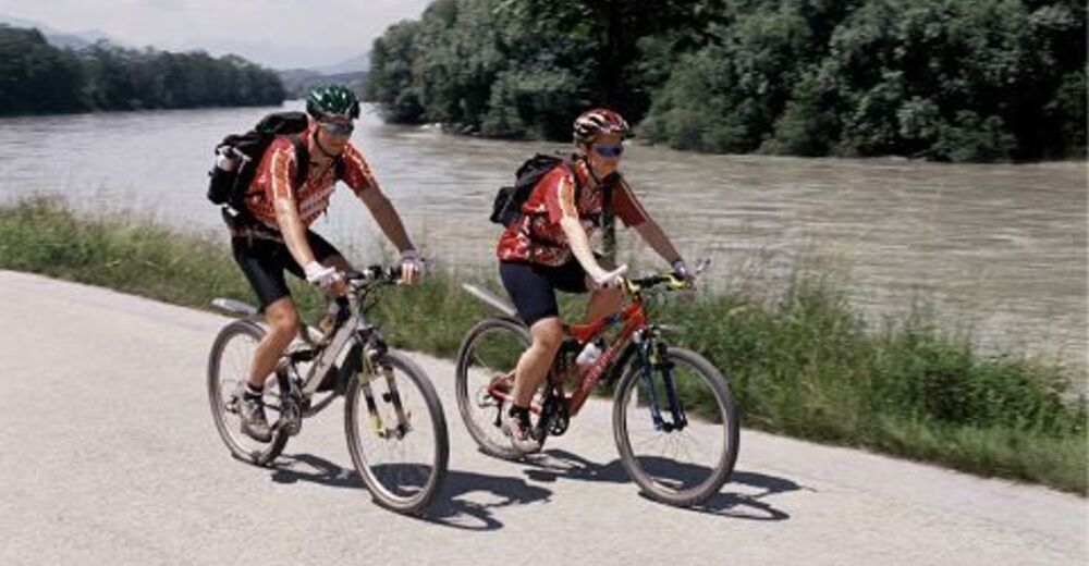
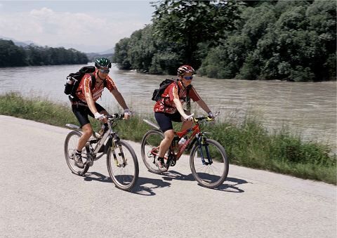
Inn Cycle Path - Tyrolean Unterland
The Inn Cycle Path covers 96 km in the Tyrolean Unterland along the banks of its namesake, the Inn River. The easy, family-friendly route with no significant climbs leads through the historic towns of Innsbruck, Hall, Schwaz, Rattenberg and Kufstein, as well as numerous picturesque villages in between along the Inn River.
Along the entire course of the Inn Cycle Path there are many connecting or extending tours that reach from the bottom of the valley to the top of the mountains!
- Difficulté
-
facile
- Évaluation
-
- Parcours
-
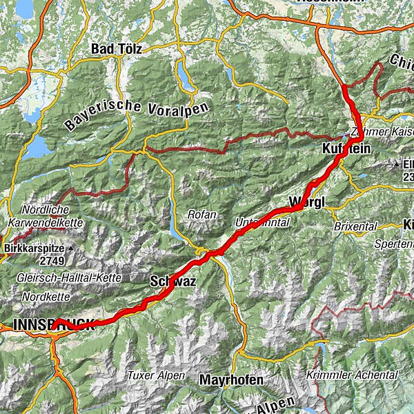
Innsbruck (574 m)Altstadt0,0 kmCongress (569 m)0,3 kmSt. Nikolaus0,3 kmOtto Neururer Kapelle4,6 kmOlympisches Dorf4,6 kmHall in Tirol (574 m)10,2 kmVolders (558 m)14,8 kmWattens (564 m)17,2 kmNeuterfens23,3 kmTerfens23,9 kmPill (556 m)26,6 kmSpielplatz Altmahd27,1 kmAltmahd27,2 kmSchwaz30,2 kmSpitalskirche Hl. Geist und Johannes der Täufer30,2 kmBuch in Tirol35,3 kmJenbach (563 m)37,4 kmMaurach38,4 kmSankt Gertraudi (527 m)45,4 kmWeng (526 m)47,8 kmBrixlegg48,6 kmKlosterkirche hl. Augustinus50,4 kmRattenberg50,4 kmBadl50,5 kmRadfeld51,8 kmKapelle St. Leonhard in der Au52,7 kmBreitenbach am Inn58,9 kmWörgl (513 m)67,7 kmAngath69,7 kmJausenstation zum Ferchl72,9 kmOberlangkampfen (494 m)73,2 kmKufstein82,5 kmFährstelle Ebbs86,6 kmOberndorf88,6 kmMühlgraben95,1 kmJohanneskapelle97,1 km
- Meilleure saison
-
janv.févr.marsavrilmaijuinjuil.aoûtsept.oct.nov.déc.
- Hauteur maximale
- 583 m
- Point de mire
-
Erl
- Profil en hauteur
-

- Auteur
-
La randonnée Inn Cycle Path - Tyrolean Unterland - cycling route 2 est utilisé par outdooractive.com fourni par.
GPS Downloads


Informations générales
Culturel/Historiquement
Autres parcours dans les régions
-
Alpbachtal
301
-
Brixlegg
124