Tschigat (3,000 m) from the Leiter Alm mountain hut

Randonnée

Dates des itinéraires
17,74km
1.478
- 2.959m
1.454hm
1.434hm
09:00h

- Brève description
-
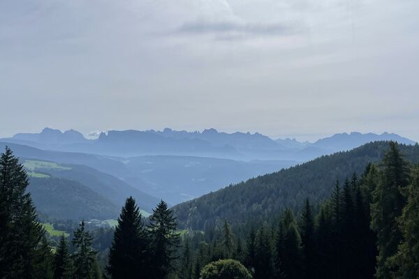
The Tschigat is a striking peak in the Texel Group. The pyramid formed from gneiss offers a magnificent view of many mountain peaks. The tour to the Tschigat is not just a hike, but a real mountain tour with easy climbing passages (grade 2) in exposed terrain. Experience, a good physical condition, sure-footedness, a head for heights and stable mountain weather are prerequisites (dangerous with ice and snow).
- Difficulté
-
difficile
- Évaluation
-
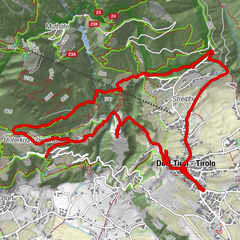
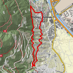
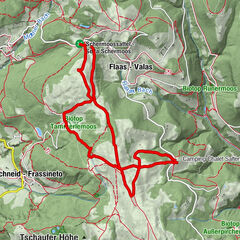
- Parcours
-
Leiteralm (1.550 m)0,2 kmKleiner Tschigat8,3 kmTschigat (2.999 m)8,4 kmSchutzhaus Hochgang (1.839 m)14,3 kmLeiteralm (1.550 m)17,4 km
- Meilleure saison
-
janv.févr.marsavrilmaijuinjuil.aoûtsept.oct.nov.déc.
- Hauteur maximale
- Leiteralm (2.959 m)
- Repos/Rassembler
-
Restaurant Leiter Alm, Schutzhütte Hochgang, Haus Tschigat

GPS Downloads


Nature du chemin
Asphalte
Gravier
Pelouse
Forêt
Rocher
Exposé
Autres parcours dans les régions
-
Meraner Land
1736
-
Meran und Umgebung
757
-
Partschins - Rabland - Töll
248