From the Klinkehütte to the Admonter Kalbling, Sparafeld and Riffel

Randonnée

© TV Gesäuse - Stefan Leitner

© TV Gesäuse - Stefan Leitner

© TV Gesäuse - Stefan Leitner

© TV Gesäuse - Christoph Lukas

© TV Gesäuse - Stefan Leitner

© Tourismusverband Gesäuse

© TV Gesäuse - Christoph Lukas

- Brève description
-
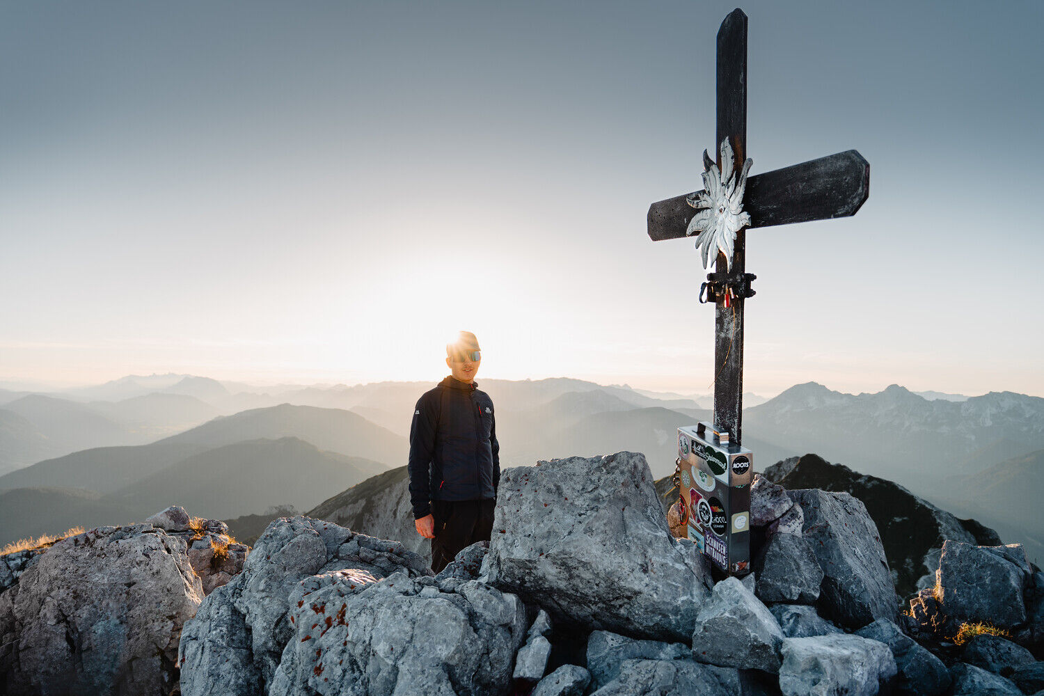
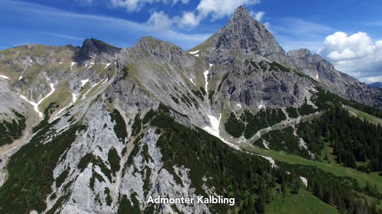
A panoramic mountain tour with no less than 3 peaks (!) starts at the Klinkehütte and leads first up to the Admonter Kaibling (2196 m). The ascent of the other two (Sparafeld 2248 m and Riffel 2106 m) is possible on the same day because it is a summit plateau and therefore you will not lose much altitude gain.
- Difficulté
-
moyen
- Évaluation
-
- Parcours
-
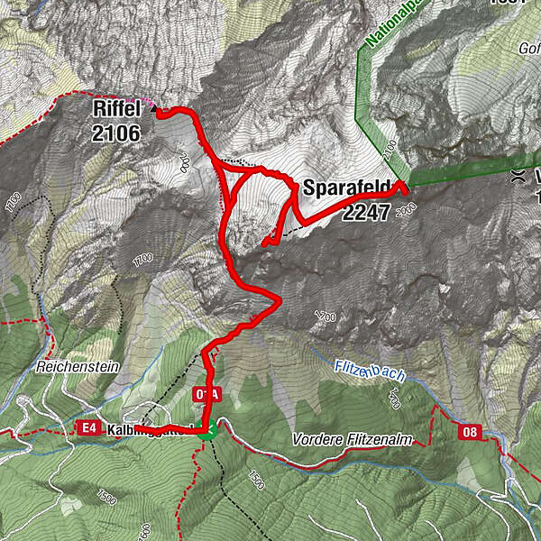
Oberst Klinke Hütte0,1 kmKalblinggatterl (1.542 m)0,3 kmAdmonter Kalbling (2.196 m)2,7 kmSparafeld (2.247 m)3,7 kmRiffel (2.106 m)5,6 kmKalblinggatterl (1.542 m)7,8 km
- Meilleure saison
-
janv.févr.marsavrilmaijuinjuil.aoûtsept.oct.nov.déc.
- Hauteur maximale
- 2.224 m
- Point de mire
-
Parking lot Klinkehütte
- Profil en hauteur
-


-

-
AuteurLa randonnée From the Klinkehütte to the Admonter Kalbling, Sparafeld and Riffel est utilisé par outdooractive.com fourni par.
GPS Downloads


Informations générales
Point de rassemblement
Prometteur
Autres parcours dans les régions
-
Gesäuse
2223
-
Urlaubsregion Pyhrn - Priel
1440
-
Kaiserau
293


