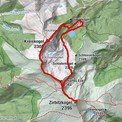
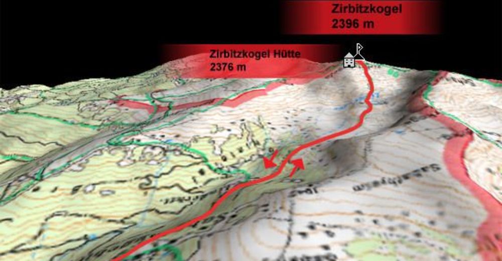
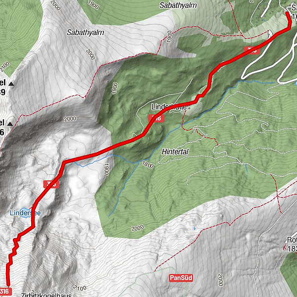
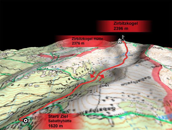
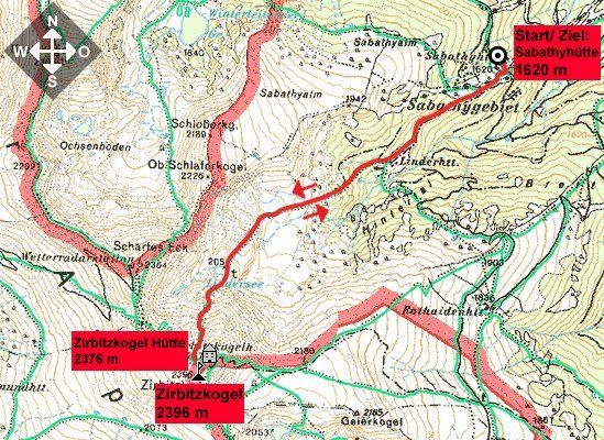
Vom Almidyll Sabathy (Sabathyhütte) auf den Zirbitzkogel

Randonnée
Dates des itinéraires
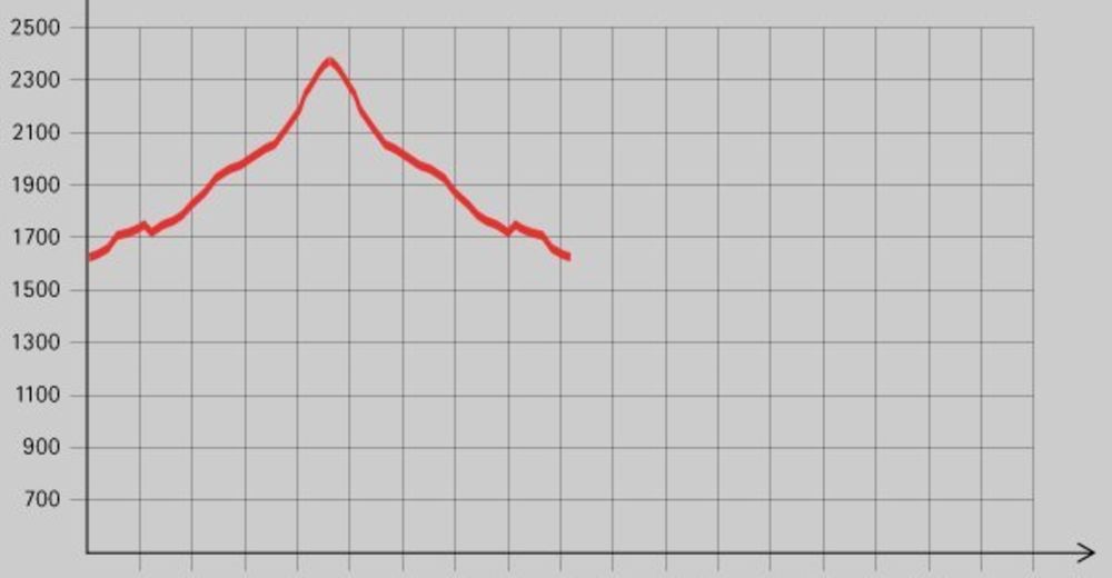
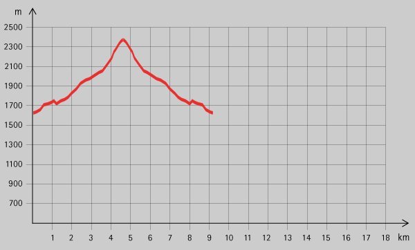
7,7km
1.615
- 2.298m
656hm
03:30h
- Brève description
-
Schöne Tour auf den wohl bekanntesten Gipfel der Region. Zirbitzkogel Hütte als Versorgungspunkt direkt beim Gipfel.
- Difficulté
-
moyen
- Évaluation
-
- Point de départ
-
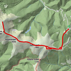
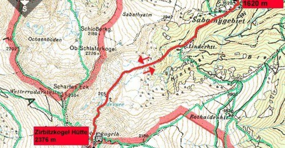
Almidyll Sabathy (Sabathyhütte) 1620 m
- Parcours
-
Alpengasthof Sabathy0,0 km
- Meilleure saison
-
janv.févr.marsavrilmaijuinjuil.aoûtsept.oct.nov.déc.
- Hauteur maximale
- 2.298 m
- Repos/Rassembler
-
Almidyll Sabathy (Sabathyhütte), Zirbitzkogel Hütte;
- Cartes
GPS Downloads


Nature du chemin
Asphalte
Gravier
Pelouse
Forêt
Rocher
Exposé
Autres parcours dans les régions
-
Erlebnisregion Murtal
1782
-
Steirisches Zirbenland
711
-
Mühlen
222