© Oststeiermark Tourismus - Walter Schneider

© Oststeiermark Tourismus - Tourismusverband Oststeiermark

© Oststeiermark Tourismus - Ewald Neffe

© Oststeiermark Tourismus - XErlebnisregion Oststeiermark Geschäftsstelle ApfelLand-Stubenbergsee

© Oststeiermark Tourismus - Rene Strasser

© Outdooractive – 3D Videos
- Brève description
-
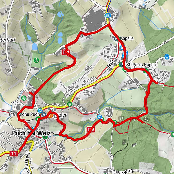
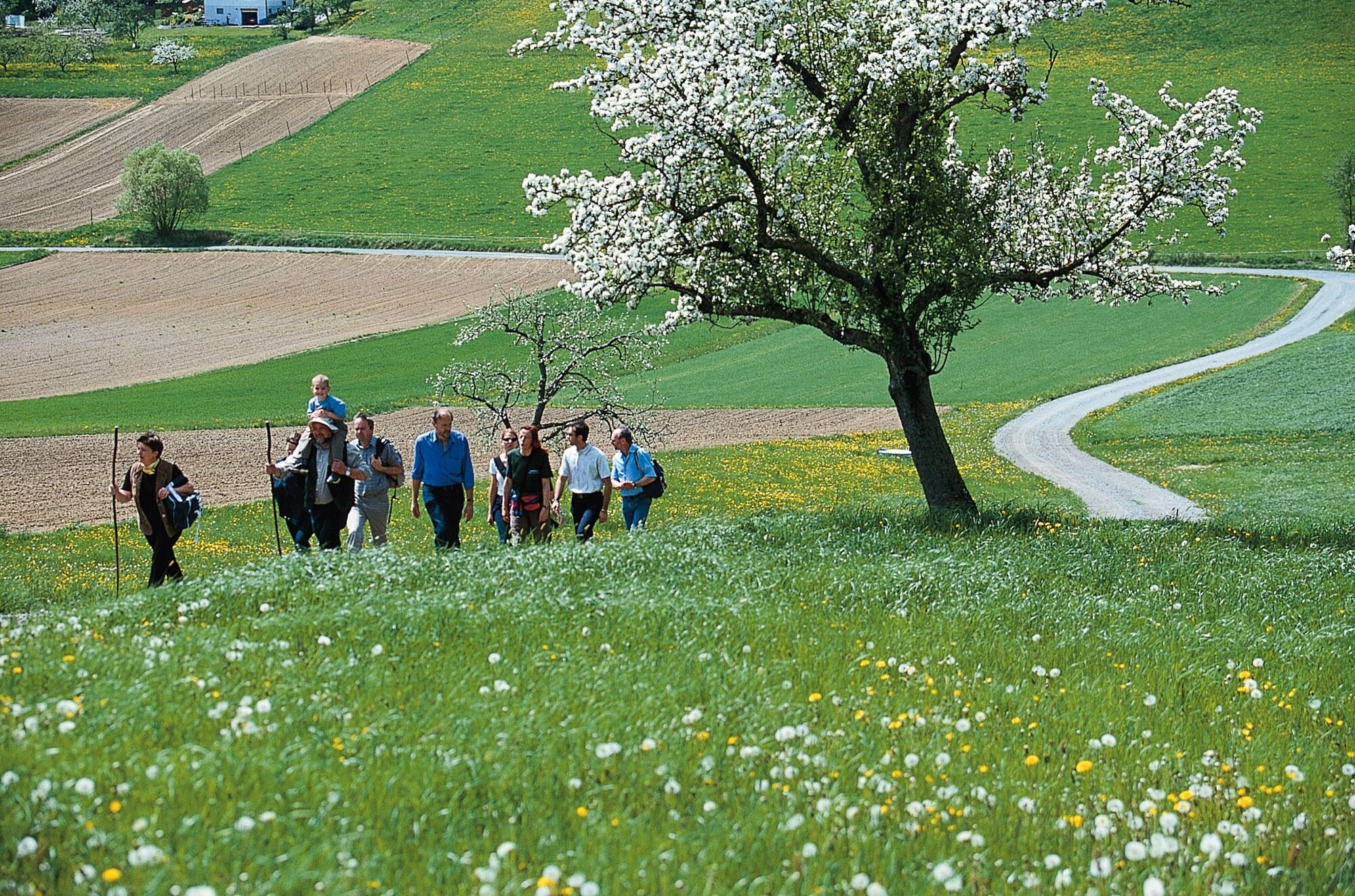
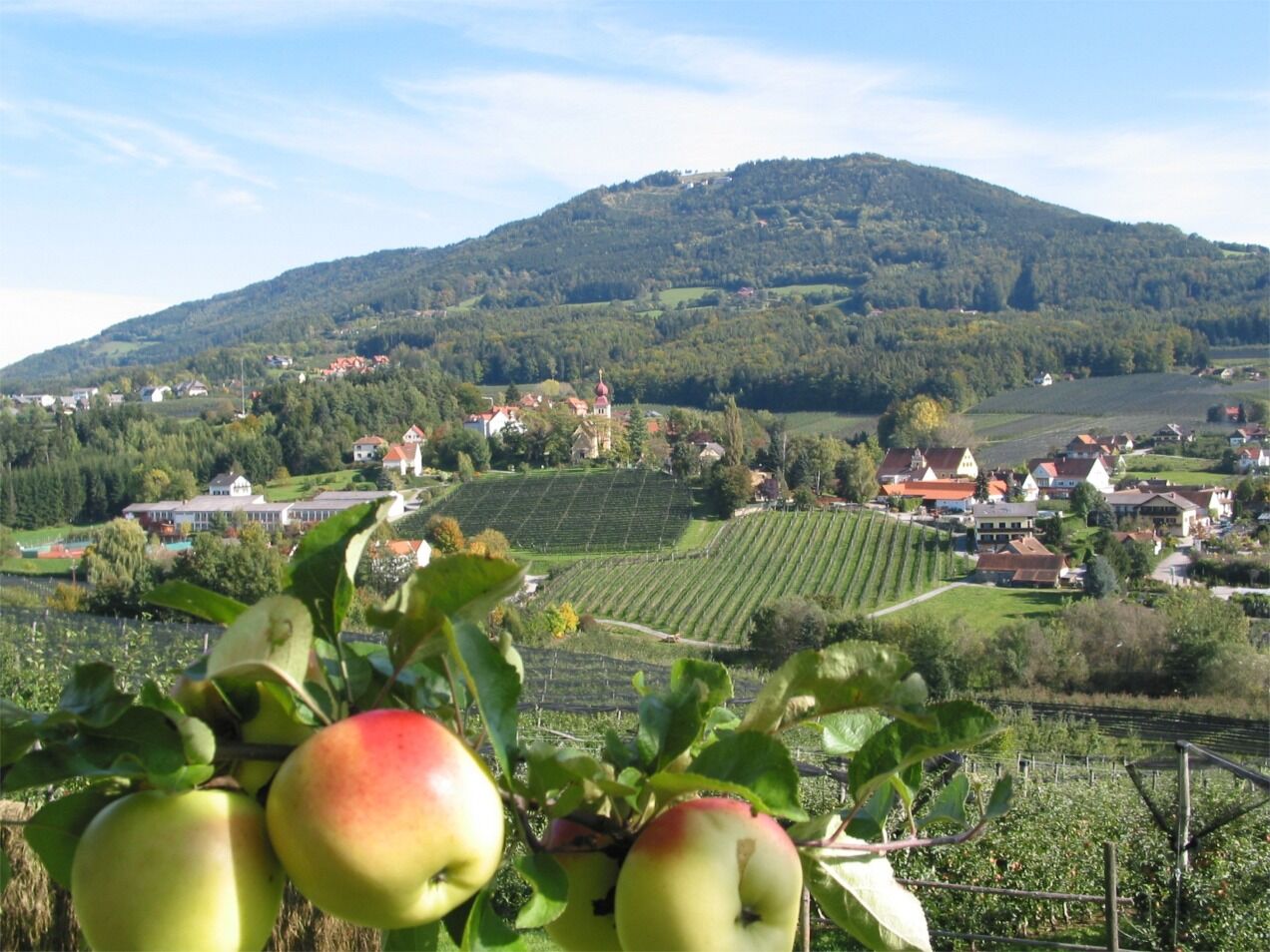
A pleasant and varied circular route around the apple village of Puch, which is located in the center of the Styrian Apple Road in the largest fruit-growing area in Austria.
- Difficulté
-
facile
- Évaluation
-
- Parcours
-
Eiteljörg0,0 kmPfarrkirche Puch0,1 kmHofer0,2 kmSt. Pauls Kapelle2,1 kmKapelle2,3 kmPuch bei Weiz3,9 kmMeißel4,1 km
- Meilleure saison
-
janv.févr.marsavrilmaijuinjuil.aoûtsept.oct.nov.déc.
- Hauteur maximale
- 514 m
- Point de mire
-
Municipal office Puch
- Profil en hauteur
-


-

-
AuteurLa randonnée Tramway, Puch near Weiz est utilisé par outdooractive.com fourni par.
GPS Downloads


Informations générales
Point de rassemblement
Autres parcours dans les régions
-
Oststeiermark
2126
-
ApfelLand - Stubenbergsee
1140
-
Puch bei Weiz
335