

© Erlebnisregion Murtal - 50plus Campingpark Fisching

© Erlebnisregion Murtal - 50plus Campingpark Fisching

© Erlebnisregion Murtal - 50plus Campingpark Fisching

© Erlebnisregion Murtal - 50plus Campingpark Fisching

© Erlebnisregion Murtal - 50plus Campingpark Fisching

© Erlebnisregion Murtal - 50plus Campingpark Fisching

© Erlebnisregion Murtal - 50plus Campingpark Fisching

© Erlebnisregion Murtal - 50plus Campingpark Fisching

© Erlebnisregion Murtal - 50plus Campingpark Fisching

© Erlebnisregion Murtal - 50plus Campingpark Fisching

- Brève description
- Difficulté
-
facile
- Évaluation
-
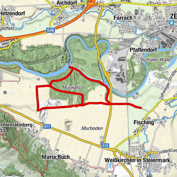
- Parcours
-
Fisching
- Meilleure saison
-
janv.févr.marsavrilmaijuinjuil.aoûtsept.oct.nov.déc.
- Hauteur maximale
- 706 m
- Point de mire
-
Parking lot Fisching
- Profil en hauteur
-


-

-
AuteurLa randonnée Murwaldrunde est utilisé par outdooractive.com fourni par.
GPS Downloads


Informations générales
Flore
Faune
Prometteur
Autres parcours dans les régions


