HWW-Hiking route: Rohrbach/Lafnitz - Lebing - Eichberg/Aussichtsturm - Eichberg - Lafnitz (circular trail)

Chemin thématique

© Oststeiermark Tourismus - XKarin Hofer

- Brève description
-
This HWW hiking route is part of the Wechselland Historical Long-Distance Hiking Trail (HWW), which tells the story of Wechselland along more than 100 HWW stations. More information can be found at www.wechsel-wandern.at.
- Difficulté
-
moyen
- Évaluation
-
- Parcours
-
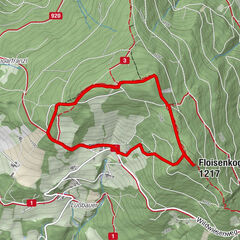
Pfarrkirche Rohrbach an der Lafnitz0,6 kmThomas0,7 kmRohrbach an der Lafnitz0,7 kmRohrbach-Vorau1,5 kmSpörk1,5 kmTempelleitenkapelle2,7 kmTempelbauern3,1 kmLebing5,0 kmLebingkapelle5,1 kmKrautgartner Höhe6,9 kmHöller "Pferschywirt"7,3 kmSippen Kogel7,9 kmHubertuskapelle8,3 kmKleinschlag9,9 kmEichberg12,1 kmPfarrkirche Eichberg12,4 kmWeiße Kreuz17,7 kmLafnitz19,7 kmRohrbachschlag21,8 kmDorfheuriger Fam. Fuchs22,4 kmRohrbach an der Lafnitz22,8 km
- Meilleure saison
-
janv.févr.marsavrilmaijuinjuil.aoûtsept.oct.nov.déc.
- Hauteur maximale
- 735 m
- Point de mire
-
Rohrbach an der Lafnitz
- Profil en hauteur
-


-

-
AuteurLa randonnée HWW-Hiking route: Rohrbach/Lafnitz - Lebing - Eichberg/Aussichtsturm - Eichberg - Lafnitz (circular trail) est utilisé par outdooractive.com fourni par.
GPS Downloads


Informations générales
Culturel/Historiquement
Autres parcours dans les régions
-
Thermen- & Vulkanland
1324
-
Hartbergerland
830
-
Rohrbach an der Lafnitz
223