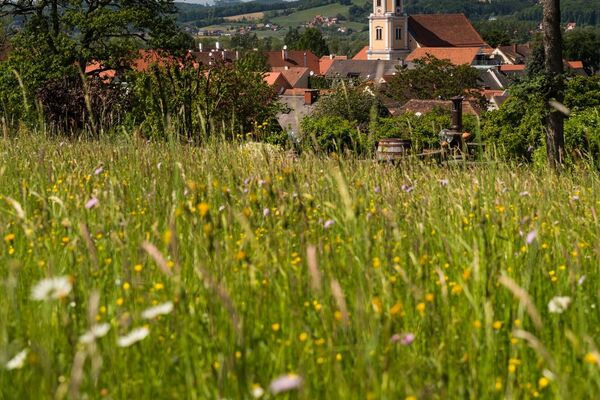
© Erlebnisregion Thermen- & Vulkanland - Jörg Liemandt

© Erlebnisregion Thermen- & Vulkanland - Johann Gollowitsch

© Erlebnisregion Thermen- & Vulkanland - Jörg Liemandt

© Erlebnisregion Thermen- & Vulkanland - Jörg Liemandt

- Brève description
-
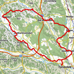
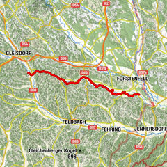
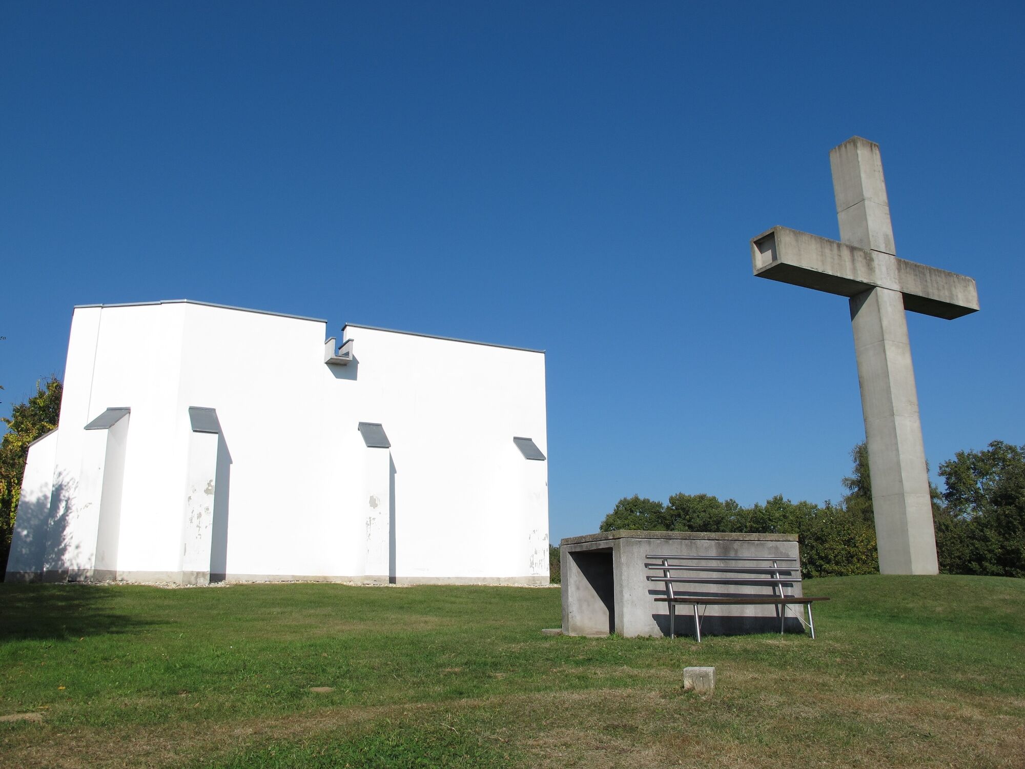
To the connection point, follow the first km of the mill tour (FF14). Medium-difficulty route, very wooded. Leads to the Schlösslberg in Mogersdorf. In addition to the wonderful panoramic view to Hungary and Slovenia, the exhibition about the Battle of the Turks in Mogersdorf is also worth seeing.
- Difficulté
-
moyen
- Évaluation
-
- Parcours
-
Hirczy-Kapelle1,0 kmOberhenndorf2,3 kmBücsek-Kapelle2,9 kmMitterhenndorf4,1 kmUnterhenndorf5,0 kmRosendorf9,7 kmOrtskapelle zur Hl. Dreifaltigkeit11,8 kmWallendorf11,9 kmDeutsch Minihof12,7 kmKreuzstadel am Schlösselberg14,6 kmSchlößlberg15,0 kmMogersdorf16,4 kmPfarrkirche hl. Josef16,7 kmGasthaus Josef Gottsnahm16,7 kmAnnakapelle17,2 kmMaria Bild21,8 kmLandRastHaus Maria Bild21,8 kmHobischberg23,3 kmRax-Bergen23,7 kmRax (240 m)26,6 kmJennersdorf28,8 kmGrieselstein31,0 kmGrieselgraben34,0 km
- Meilleure saison
-
janv.févr.marsavrilmaijuinjuil.aoûtsept.oct.nov.déc.
- Hauteur maximale
- 371 m
- Point de mire
-
Spa Loipersdorf
- Profil en hauteur
-

-

-
AuteurLa randonnée B71 Thermal spa bike path/Region Jennersdorf est utilisé par outdooractive.com fourni par.
GPS Downloads


Informations générales
Point de rassemblement
Culturel/Historiquement
Prometteur
Autres parcours dans les régions
-
Thermen- & Vulkanland
344
-
Südburgenland
127
-
Weichselbaum
25