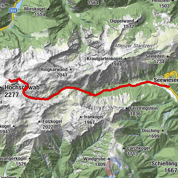
Etappe 03: BergZeitReise Schiestlhaus - Voisthalerhütte - Seewiesen


- Brève description
-
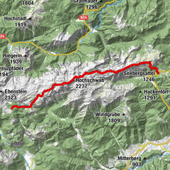
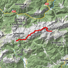
Stage 03: "On the way with Archduke Johann" - from Schiestlhaus to the rustic Voisthalerhütte and to Seewiesen
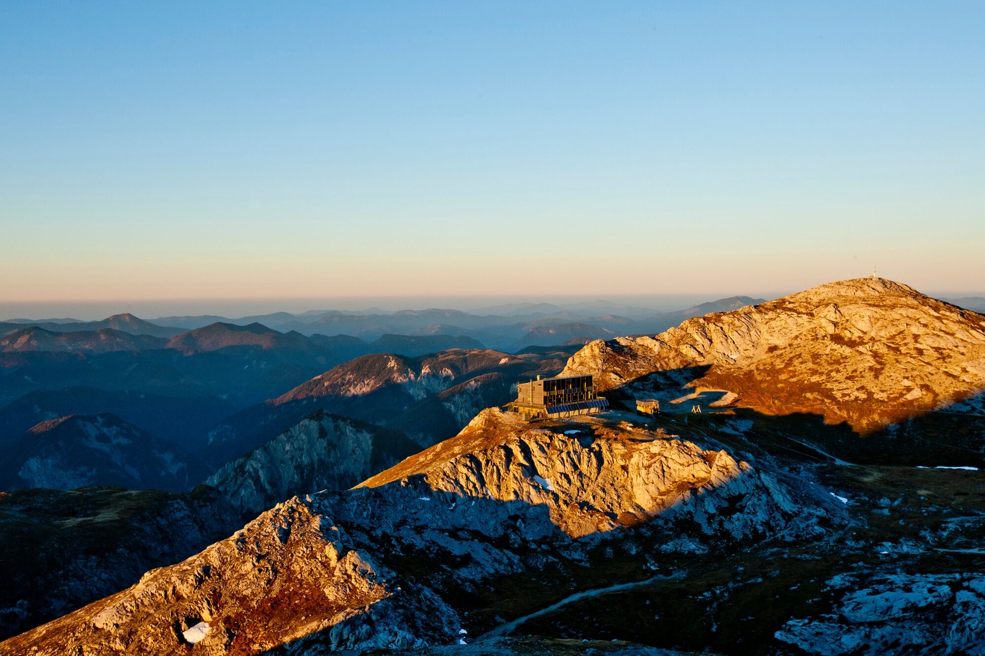
Start: Schiestlhaus on Hochschwab, Tel.: +43 699 108 121 99, www.schiestlhaus.at
GPS grid N 47° 37' 19,5" E 15° 8' 54,2"
Destination / overnight stop: Seewiesen, the "Styrian Heiligenblut", tourist information, overnight accommodations: Tel.: +43 664 3548485, www.turnau.gv.at/tourismus
Cab services: Taxi Steiner Tel.: +43 3862 51333 and Taxi Hochschwab Reisen Tel.: +43 3861 2400
GPS grid N 47° 37' 14,3" E 15° 16' 15,3"
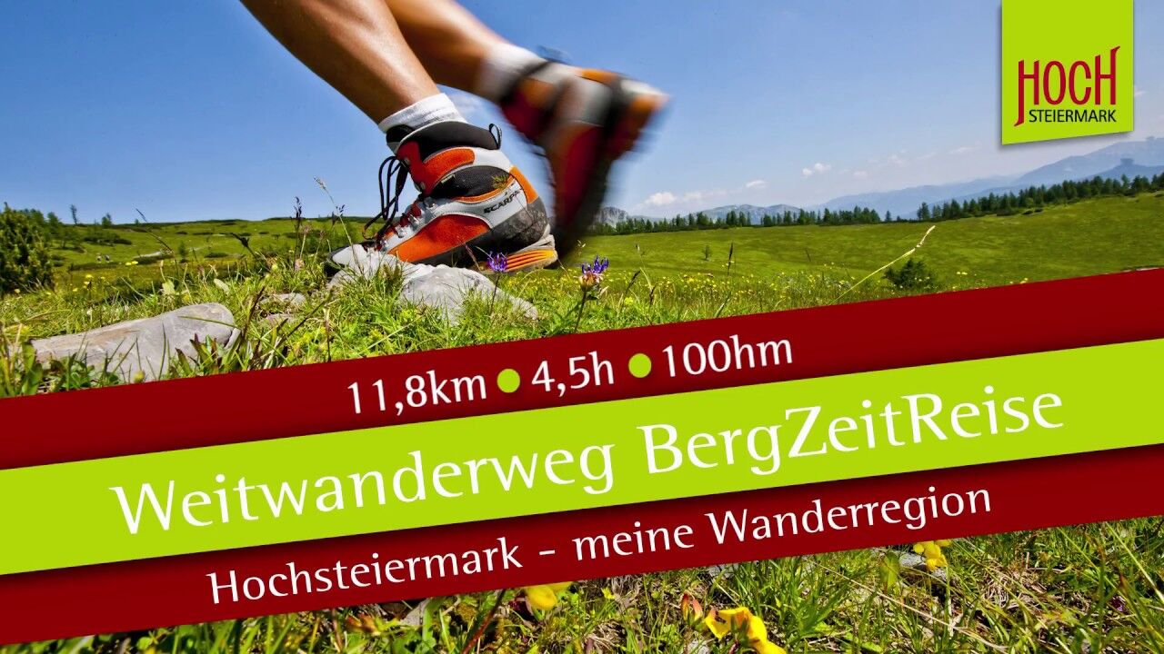
Stage length: 11.8 kilometers
Total walking time (without breaks): 4 ½ hours
Vertical meters ascent: 100 vertical meters
Meters in altitude descent: 1,310 meters in altitude
Difficulties: alpine trail without difficult parts, in bad weather / fog orientation not so easy!
This stage of the HOCHsteirische BergZeitReise corresponds to stage 15 of the overall Styrian long-distance hiking trail "from the glacier to the wine" - north trail.
- Difficulté
-
moyen
- Évaluation
-
- Parcours
-
Voisthalergasse4,2 kmHöllkampl (1.449 m)5,4 kmFlorlhütte (1.284 m)6,5 kmSeewiesen11,6 kmHotel Restaurant Seeberghof11,7 km
- Meilleure saison
-
janv.févr.marsavrilmaijuinjuil.aoûtsept.oct.nov.déc.
- Hauteur maximale
- 2.155 m
- Point de mire
-
Seewiesen, the "Styrian Heiligenblut", tourist information, overnight accommodations: Tel.: +43 664 3548485, www.turnau.gv.at/tourismus
- Profil en hauteur
-


- Auteur
-
La randonnée Etappe 03: BergZeitReise Schiestlhaus - Voisthalerhütte - Seewiesen est utilisé par outdooractive.com fourni par.