

- Brève description
-
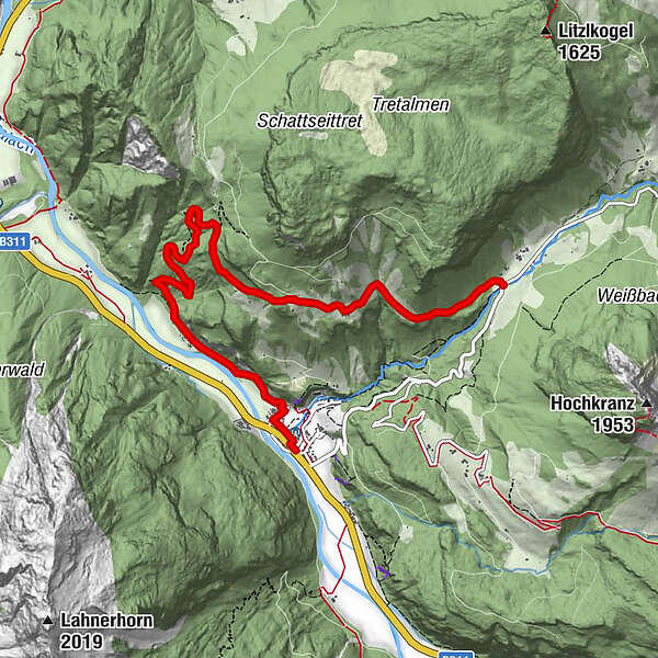
From Weißbach via the Grasenbergweg (trail no. 27) to the Wandbauern and along the Gerhardsteinstraße (33) to Hintertal/Gasthaus Lohfeyer.
- Difficulté
-
moyen
- Évaluation
-
- Parcours
-
OberweißbachUnterweißbach0,1 kmWeißbach bei Lofer0,2 kmLandgasthof Seisenbergklamm0,3 kmGasthof Lohfeyer6,8 km
- Meilleure saison
-
janv.févr.marsavrilmaijuinjuil.aoûtsept.oct.nov.déc.
- Hauteur maximale
- 1.090 m
- Point de mire
-
Weißbach near Lofer - Gasthof Lohfeyer
- Profil en hauteur
-


-

-
AuteurLa randonnée Grasenbergweg - Wandbauer - Lohfeyer est utilisé par outdooractive.com fourni par.
GPS Downloads


Informations générales
Point de rassemblement
Autres parcours dans les régions
-
Salzburger Saalachtal
1856
-
Weißbach bei Lofer
356


