From Heutal to the Dürnbachhorn (1776m)

Logo From Heutal to the Dürnbachhorn (1776m)
Dates des itinéraires
8,37km
960 - 1.763m
Distance
803hm
797hm
Montée
02:30h
 
Durée
Brève description

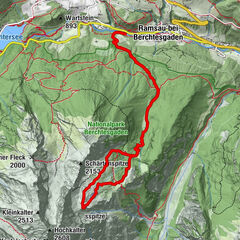
Fantastic ski tour to the Dürrnbachhorn in the Unken Heutal ski area (Natursport Heutal) in the Salzburger Saalachtal.

Difficulté
moyen
Évaluation
Technique
Endurance
Paysage
Résultat
Parcours
Wildalmlift
0,0 km
Wildalm
6,6 km
Wildalmlift
8,2 km

Meilleure saison
août
sept.
oct.
nov.
déc.
janv.
févr.
mars
avril
mai
juin
juil.
Hauteur maximale
1.763 m
Point de mire

Heutal

Exposition
Profil en hauteur

Auteur
La randonnée From Heutal to the Dürnbachhorn (1776m) est utilisé par outdooractive.com fourni par.

Évaluation globale

5

0

%

4

0

%

3

0

%

2

0

%

1

0

%

Erreur
Une erreur est survenue. Veuillez réessayer.
Merci pour votre évaluation

L'évaluation a été supprimée

GPS Downloads
  • GPX GPS Exchange Format (XML)
  • KML Google Earth, Google Maps
Codes de téléchargement QR pour les téléphones portables

Informations générales

Point de rassemblement
Prometteur
Autres parcours dans les régions

Randonnées populaires dans la région

Skitour auf das Dürrnbachhorn (Unken)

moyen Ski de randonnée
7,96km | 731hm | 02:14h

From Lofer to the Kechtalm

facile Ski de randonnée
5,8km | 872hm | 02:30h

Skitour Hochalm

difficile Ski de randonnée
12,53km | 1282hm | 03:30h

Over the Sodervocken to the Schwarzeck in the Almenwelt Lofer

moyen Ski de randonnée
6,65km | 817hm | 02:45h