Mozart Cycle Path – Stage 05: Köstendorf - Laufen

Piste cyclable longue distance
© Euregio Radgruppe - SalzburgerLand, Chiemgau, Chiemsee-Alpenland, Berchtesgadener Land - ©SalzburgerLand Tourismus/Markus Greber
© Euregio Radgruppe - SalzburgerLand, Chiemgau, Chiemsee-Alpenland, Berchtesgadener Land - ©SalzburgerLand/norbert-eisele-heim.com

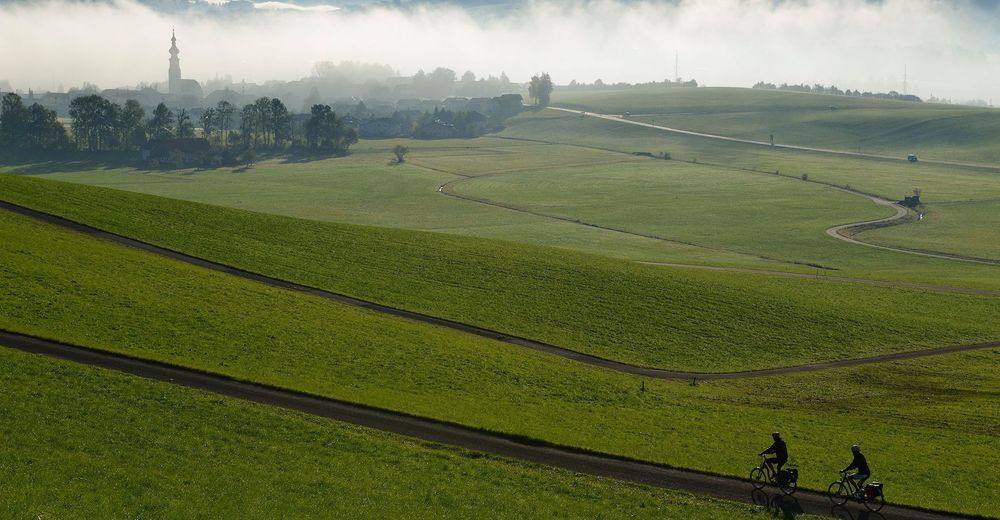
© Euregio Radgruppe - SalzburgerLand, Chiemgau, Chiemsee-Alpenland, Berchtesgadener Land - ©Salzburger Seenland/norbert-eisele-heim.com
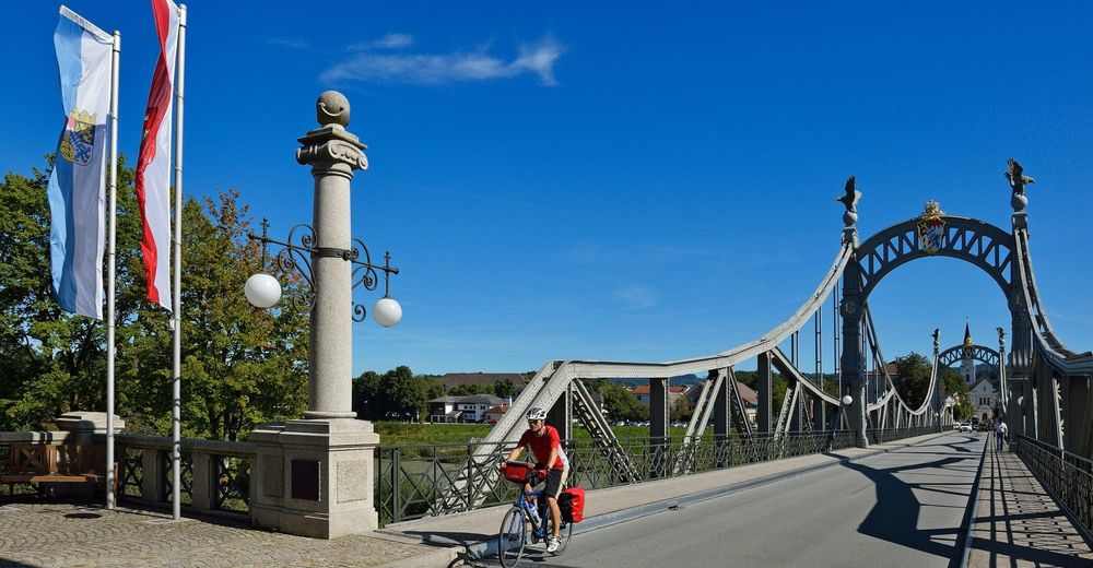
© Euregio Radgruppe - SalzburgerLand, Chiemgau, Chiemsee-Alpenland, Berchtesgadener Land - ©SalzburgerLand/norbert-eisele-heim.com

Dates des itinéraires
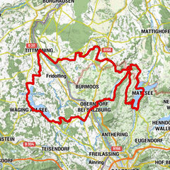
40,39km
394
- 614m
252hm
374hm
02:44h

- Brève description
-
On the way to the Austrian-Bavarian Salzach river bridge between Oberndorf and Laufen, you will find Mattsee, Seeham and Obertrum am See. The lakes here boast the best water quality! When at your destination in Oberndorf, you will not want to miss taking a detour to the Stille Nacht Kapelle (Silent-Night-Chapel)!
- Difficulté
-
moyen
- Évaluation
-
- Parcours
-
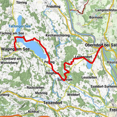
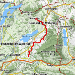
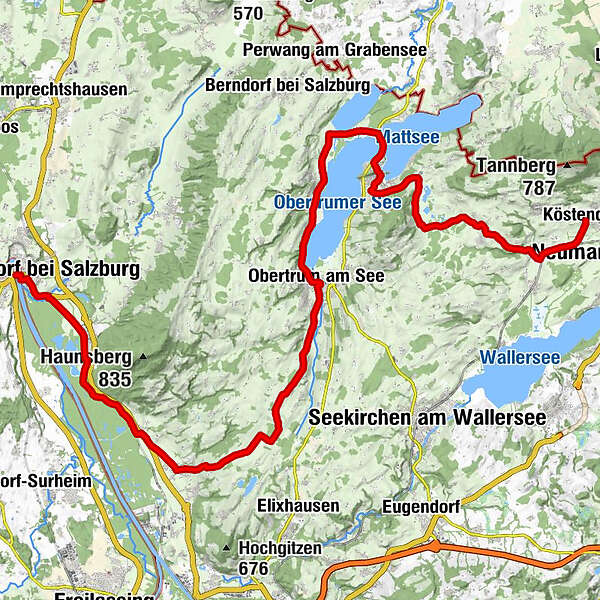
KöstendorfRestaurant D'AmiciHilgertsheim1,4 kmFischachmühle2,8 kmMauern4,4 kmPfarrkirche Schleedorf zum heiligen Stephan4,6 kmSchleedorf4,6 kmHofwirt4,7 kmMoos5,1 kmPaltingmoos7,4 kmGuglmoos8,0 kmLehen8,7 kmBlick über Mattsee9,8 kmOchsenharing10,5 kmStockwiese10,9 kmMattsee11,3 kmÜberfuhr12,7 kmZellhof13,6 kmFraham14,9 kmGasthaus Grabensee15,0 kmEisenmühle15,5 kmSeeham16,6 kmGröm17,2 kmMatzing17,6 kmSeeleiten18,8 kmStaffl19,4 kmObertrum am See20,4 kmPfarrkirche Obertrum20,6 kmGuten Hirten Kapelle22,0 kmLindenhof22,1 kmWindbichl22,2 kmGrabenmühl22,4 kmKatzelsberg22,4 kmBischelsroid22,9 kmHamberg23,5 kmMödlham24,6 kmHutzing27,0 kmKerbeslehen27,3 kmTrainting27,8 kmHupping28,6 kmBerg28,8 kmAnthering30,4 kmPfarrkirche Anthering30,5 kmGasthaus Voglwirt30,5 kmAcharting32,1 kmUnteracharting32,3 kmPabing36,0 kmOberndorf bei Salzburg39,5 kmLaufen (Salzach)40,3 km
- Meilleure saison
-
janv.févr.marsavrilmaijuinjuil.aoûtsept.oct.nov.déc.
- Hauteur maximale
- 614 m
- Point de mire
-
Laufen
- Profil en hauteur
-


- Auteur
-
La randonnée Mozart Cycle Path – Stage 05: Köstendorf - Laufen est utilisé par outdooractive.com fourni par.
GPS Downloads


Informations générales
Point de rassemblement
Flore
Prometteur
Autres parcours dans les régions