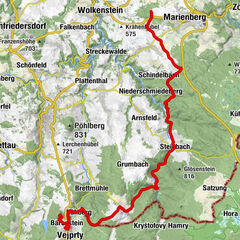
SMQR C-Edition Abschnitt 01 Oberwiesenthal-Bärenstein

Vélo de course

© Erlebnisheimat Erzgebirge - Ronny Schwarz

- Parcours
-
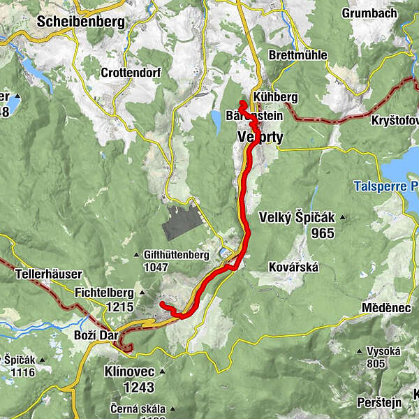
Kurort Oberwiesenthal0,9 kmBöhmisch Wiesenthal1,3 kmUnterwiesenthal2,6 kmBöhmisch Hammer5,1 kmsv. Alžběta5,1 kmLauxmühle5,5 kmHammerunterwiesenthal5,5 kmNeugeschrei8,1 kmNiederschlag8,2 kmWeipert (725 m)11,3 kmVšech svatých11,6 kmBärenstein12,2 kmBärenstein (898 m)14,2 kmBerghotel Bärenstein14,2 km
- Hauteur maximale
- 906 m
- Profil en hauteur
-
 © outdooractive.com
- Auteur
-
La randonnée SMQR C-Edition Abschnitt 01 Oberwiesenthal-Bärenstein est utilisé par outdooractive.com fourni par.
GPS Downloads


Autres parcours dans les régions
-
Erzgebirge
35
-
Erzgebirge
14
-
Oberwiesenthal
8